GPS Coordinates Locator Map
- 205.00
- 4.4
- Installs
- 10.00M
- Price
- Free

Screenshots
Analysis by Reviewed
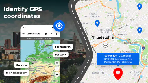
I reach for a coordinate-focused map app when a street address is not enough: a trail junction, a meeting point in a large park, or a spot I want to describe precisely. GPS Coordinates Locator Map is built around that practical need. Rather than treating it as a full turn-by-turn navigation service, I find it most useful as a straightforward way to see a position on a map and work with its coordinates.
A simple routine for checking a location
My basic routine is to open the map, give the position a moment to settle, and then check the displayed location before sharing or relying on it. That small pause matters: a phone’s GPS reading can shift while it is establishing a fix, particularly indoors, between tall buildings, or under dense cover. I would not treat a single reading as unquestionable when precision matters; stepping into a clearer open area and checking again is a sensible habit.
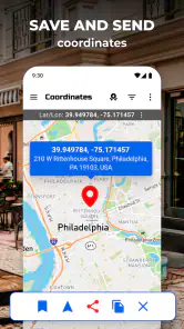
When I need to meet someone somewhere without a useful street address, coordinates can make the handoff clearer than a vague landmark. I can share the position and let the other person open it in a mapping app they already use. For a place I may want to return to, marking it on the map can be more helpful than trying to remember a turn or describe a path later. I still make sure the pin is on the actual entrance or meeting spot, not merely near the general area.
Where it fits among navigation apps
In the crowded Maps & Navigation category, I see this as a focused companion rather than a replacement for a comprehensive map service. A conventional navigation app is usually the better choice for route planning, live directions, traffic, or finding businesses by name. This one makes more sense when the question is “What are the coordinates here?” or “How do I pass this exact point to someone?” That narrower purpose is useful, but it also means I would not install it expecting every feature of a full navigation suite.
Who will get the most from it
I can see it helping hikers, campers, field workers, and anyone arranging a meetup in a place where addresses are unreliable. It is also a handy backup for people who occasionally need to communicate a precise point rather than send a general location. If you mostly travel between familiar addresses and depend on spoken, turn-by-turn directions, your usual maps app is likely enough. The value here is in having coordinates readily at hand, not in replacing all your other navigation tools.
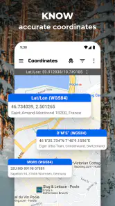
Settings and repeatable habits are worth treating as part of the workflow, not as an afterthought. I would check that location access is enabled when I first use the app and look over any available display or coordinate-format choices before sending details to someone else. Coordinate formats are easy to mix up when people use different tools, so confirming that both sides can read the shared location avoids an unnecessary back-and-forth. I also prefer to share a fresh reading rather than rely on an old screenshot if I have moved since saving it.
Intuitive Design Meets Functionality
Let’s chat about the app’s interface first. The GPS Coordinates Locator Map boasts a sleek and intuitive design that doesn’t overwhelm you with too many buttons or confusing options. The moment you fire up the app, you’re greeted with a clean map display, and getting your exact coordinates is just a tap away. It’s like the app knows exactly what you need, without the fuss.
One of the standout features for me is how incredibly accurate the location tracking is. I mean, we’ve all had those moments where the blue dot on our map seems to have a mind of its own, right? Well, not with this app. It’s impressively precise, and I found that even in areas with spotty service, the location accuracy was spot-on more often than not.
Sharing Made Simple
Another handy feature is the ability to easily share your location with others. Whether you’re coordinating a meetup or just letting your loved ones know where you are, the app makes it super easy. You can send your current coordinates via text, email, or even social media. Plus, the recipients can open the location in their preferred map application, which is a nice touch.
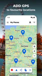
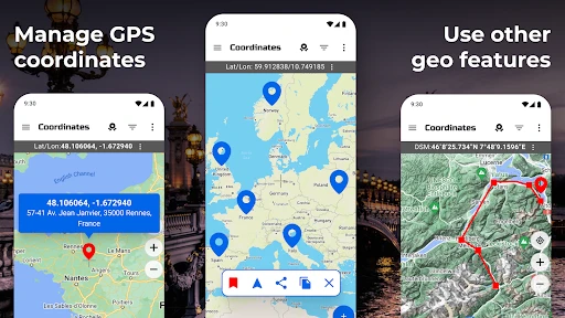
For those of you who love a bit of adventure, the app also allows you to drop pins on the map to mark specific locations. This feature can be a lifesaver when you’re exploring new areas and want to remember a particular spot, like a hidden waterfall or a quaint little bookstore.
Offline Capabilities
We all know that sometimes you’re in a place where data just isn’t available. That’s where the offline capabilities of this app shine. You can download maps for offline use, which means you’ll never be left stranded without a clue of where you are. It’s like having a digital compass that works anywhere, anytime.
Now, I know what you’re thinking – with all these features, it must be a battery drainer, right? Surprisingly, it’s not. The app is optimized to be efficient, so you can keep it running without worrying about your phone dying halfway through your adventure.
Settings, version and value
GPS Coordinates Locator Map is a free Android app from Firehawk, with optional in-app purchases ranging from under a dollar to just under a hundred dollars per item. It is rated for Everyone and runs on Android 5.0 or later; its current version is 3.1.0. The app has a 4.4 average from around 57,000 ratings and has passed 10 million installs. Those figures suggest a well-used tool, but I would still judge it by whether its coordinate-sharing workflow suits my own needs.
One useful habit is to treat a saved pin as a reference, not as proof that the approach is easy or safe. A coordinate can identify a point without explaining whether it is accessible, whether a path is open, or which side of a fence it lies on. For a weekend walk, I would save the destination, check the surrounding area in a fuller map app, and share the point with a short plain-language cue such as “meet at the north entrance.” That combination is more dependable than coordinates alone.
Where I would be cautious
Coordinate tools are only as helpful as the location fix and the person reading the result. Buildings, trees, and weak satellite reception can affect a phone’s position, while a copied number can be mistyped or interpreted in the wrong format. If I am giving directions to a driver or someone unfamiliar with coordinates, I pair them with a recognizable landmark. For turn-by-turn travel, route alternatives, or detailed offline navigation, I would use a dedicated mapping app instead.
For example, if friends are meeting me at a crowded lakeside park, I can check the map, choose a precise picnic area, and send the location before they set off. I would include a nearby entrance or visible landmark in the message, then confirm the pin is not on the water or on a restricted path. That is a small extra step, but it prevents the common problem of everyone reaching the park and still searching for one another.
A useful specialist, not an all-purpose navigator
GPS Coordinates Locator Map works best when I need a location expressed precisely and want a simple way to share or mark it. I would recommend it to people who regularly deal with trailheads, remote meeting points, or places without clear addresses. If you only need everyday directions between shops and home, it may add little to the maps app already on your phone. For me, its strongest role is as a practical specialist: keep the coordinate workflow simple, verify important points, and use a full navigation service when the journey itself needs planning.
Making the workflow more dependable
I get the most value from a coordinate app when I decide what I am trying to communicate before I open it. If I only need to tell someone where I am now, I use a fresh reading. If I am arranging a future meetup, I choose the destination on the map and check the approach separately. Those are different jobs: a live position describes where my phone is, while a selected point describes where I want another person to go. Mixing them up can send someone to the wrong place even when the coordinates themselves are copied correctly.
A practical habit is to send the coordinates with a short human description rather than as a bare string of numbers. I might say “the west gate beside the parking area” or “the trail junction after the footbridge,” then include the map point. The words help a person recognize the spot on arrival, while the coordinates narrow down the search. This is especially useful when the last stretch involves a footpath, a large building, or a park with several entrances that look similar on a screen.
I also avoid treating a saved pin as a long-term record unless I have a reason to keep it. A useful collection can become confusing if temporary stops, old meeting places, and important destinations all sit together without a clear naming habit. When I save a point, I give it a label I will understand later and remove or ignore places that no longer matter. That small bit of housekeeping is more useful than collecting coordinates indiscriminately, particularly if I return to the app after a long gap.
Small checks that prevent bad handoffs
Before I send a location, I look at the map around the marker rather than focusing only on the coordinate readout. The surrounding streets, paths, shoreline, or property boundary can reveal that a pin is close but not quite right. If the map is crowded or the destination is a broad area, I zoom in enough to distinguish the meeting point from the nearest road or entrance. This does not make the phone’s position more accurate; it helps me catch a selection mistake before someone acts on it.
Another useful check is to consider the recipient’s situation. A person who already uses coordinates may be comfortable opening them directly, while someone else may need a familiar landmark and a plain-language note. If the recipient is driving, I would send the point before they set off and let their normal navigation app handle the route. A coordinate tool answers a location question; it should not encourage someone to read numbers or adjust a map while moving.
For a field visit, I would use a repeatable sequence: confirm the point while I have a clear view of the sky, compare it with the visible surroundings, save or share it, and then make a separate note of access details if those matter. That last distinction matters because coordinates do not tell a colleague whether a gate is locked, where to park, or which side of a site is reachable. Keeping location and access instructions separate makes the message clearer and avoids asking a pin to communicate information it cannot carry.
What it can and cannot replace
People often ask whether an app like this can take the place of their everyday map. I would not use it that way. The strength of this tool is the precise point and the ability to pass it along; a full navigation service is generally more convenient when I need a route, traffic context, place search, or spoken guidance. The two can work together: use coordinates to agree on the destination, then use the navigation app that best handles the journey there.
It is also not a substitute for checking local conditions. A map marker does not establish that a footpath is open, a site is public, or a destination is safe to approach. For hiking or outdoor work, I would use reliable route information and follow local signs rather than assuming that a precisely marked point is reachable. This is a sensible boundary for any coordinate display, not a defect that can be fixed by zooming in further.
Offline use deserves the same careful distinction. The article’s stated offline map option is useful when connectivity is unavailable, but I would prepare before leaving coverage rather than assume that every surrounding detail will be available in every situation. I would check that the map area I need is usable, keep a separate backup for important navigation, and avoid relying on a phone as my only plan in remote terrain. A coordinate can still be valuable there, but it is only one part of being prepared.
Who should choose another tool
If your main need is getting from one address to another with minimal thought, a familiar route-planning app will likely serve you better day to day. The same goes for someone who wants rich place discovery, live traffic choices, or detailed journey guidance as the central feature. Installing a focused coordinate app makes sense when you encounter locations that ordinary address search handles poorly; otherwise, it may become an extra icon you rarely open.
On the other hand, I would keep it in mind if I regularly share trailheads, outdoor work sites, informal entrances, or gathering spots spread across a large area. It can be especially useful as a companion for a group where people prefer different map apps: one person can provide a specific point, and others can use their own preferred navigation tool to reach it. The key is agreeing on the same point and adding enough context to make the final approach understandable.
Final Thoughts
All in all, the GPS Coordinates Locator Map is a solid choice for anyone who needs reliable location tracking and sharing. It’s user-friendly and packed with features that make navigation a breeze. Whether you’re an avid hiker, an urban explorer, or just someone who loves to be prepared, this app is worth checking out. So go ahead, download it, and see how it transforms your navigation experience. You won’t be disappointed!
GPS Coordinates Locator Map Frequently Asked Questions
What permissions should I expect GPS Coordinates Locator Map to need?
Because GPS Coordinates Locator Map displays your position, location access is central to its purpose. You can review and manage that permission through your Android device’s settings, including whether the app can use location while you are using it. Think about how you plan to use the app before granting access, and remember that coordinates can reveal where you are if you choose to share them.
Which Android versions can run GPS Coordinates Locator Map?
GPS Coordinates Locator Map requires Android 5.0 or later, so check your device’s operating system before downloading. It is an Android app in the Maps & Navigation category, developed by Firehawk, and its age rating is Everyone. If your phone or tablet meets the Android requirement, the app is intended for displaying a GPS location on a map.
Does GPS Coordinates Locator Map work on both Android and iOS?
GPS Coordinates Locator Map is an Android app in the Maps & Navigation category, developed by Firehawk. It is designed to display a GPS location on a map, so check that your device runs Android 5.0 or later before downloading. Its age rating is Everyone, making it suitable for a broad audience, although location access is central to its purpose.
Is GPS Coordinates Locator Map free to download, and are there in-app purchases?
The app is free to download, but it also offers in-app purchases ranging from $0.99 to $99.99 per item. That means you can install it without an upfront price, while some optional content or features may involve a charge. If you prefer not to make purchases, review the purchase settings on your device before using the app, especially if someone else can access it.
What is the primary function of the GPS Coordinates Locator Map app?
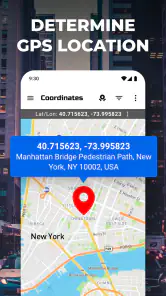
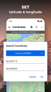
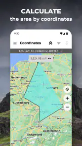
The GPS Coordinates Locator Map app is designed to provide users with precise geographical coordinates based on their location. It allows users to find and share their exact latitude and longitude, making it ideal for navigation, geocaching, or any activity that requires accurate location information. Users can also search for coordinates of any place globally. It has a 4.4 average from around 57,000 ratings, and its simple focus is displaying GPS coordinates on a map.
Pros
- Accurate location tracking capabilities.
- User-friendly interface for easy navigation.
- Supports offline maps for remote areas.
- Provides real-time traffic updates.
- Customizable map views and settings.
Cons
- Requires a strong internet connection.
- Consumes battery quickly during use.
- Ads can be intrusive in free version.
- Limited features without premium.
- Occasional bugs in map rendering.

- Category
- Maps & Navigation
- Version
- 3.1.0













