Satellite View
- 407.00
- 4.0
- Installs
- 5.00M
- Price
- Free

Screenshots
Analysis by Reviewed
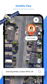
When a map app feels confusing, I usually want to know whether I missed a setup step or whether the tool simply isn’t suited to the job. Satellite View is best approached as a way to inspect places from above and support travel planning, rather than as a guaranteed replacement for turn-by-turn navigation. That distinction makes it easier to get useful results without expecting every map view to answer every practical question.
Where the first snags can happen
A satellite image can look detailed while still leaving you unsure what to do next. A broad view helps orient you, but it may not make a small entrance, a usable footpath, or a current road condition obvious. I’d use the overhead perspective to build familiarity with an area, then check a conventional navigation tool when the next turn or live route guidance matters.
Another common point of confusion is treating imagery as live video. Satellite imagery is a view of a place, not proof that the scene is unfolding right now. If a building site or landscape seems different from what you expect, I wouldn’t use one image alone to judge what is happening on the ground. For a trip, the safer approach is to combine a visual preview with current directions and local information.
Simple checks before planning a trip
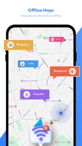
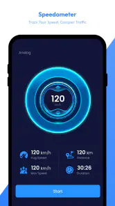
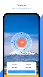
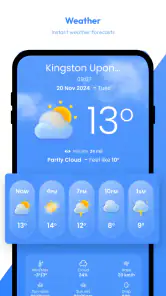
Mortys Games’ free Maps & Navigation app is called Satellite View, and its travel-planning focus brings together map viewing, weather, offline maps, and tools. I’d check the basics before relying on it away from home: open the area you need while you have a connection, look for the offline-map option, and make sure the view you intend to use is available before you set off. Offline access is most useful when prepared in advance, not when you are already struggling to get a signal.
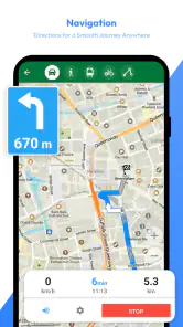
If you are comparing the app with a familiar navigation service, think about the task rather than looking for one universal winner. A standard route planner is usually the better first stop when you need a direct journey and clear turn-by-turn guidance. Satellite View is more appealing when you want to understand the shape of a destination, inspect its surroundings, or add a visual check to your planning. I see those as complementary jobs, not a reason to discard the tool you already trust for directions.
Recovering when a view is not useful
If an area does not look clear, I’d first zoom out and orient myself using nearby roads or recognizable landmarks, then zoom back in gradually. This is a practical way to avoid getting lost in an overly tight view. If the map itself is not loading as expected, check your connection and try again when it is stable; if you expect to be offline, prepare the relevant map beforehand instead of assuming a view will appear on demand.
For a realistic example, imagine choosing a place to meet in an unfamiliar town. I’d use the overhead view to see how the destination sits among nearby streets, then switch to a regular route planner for the drive or walk and check the weather before leaving. That small sequence uses each kind of information for what it can do well. It also avoids the mistake of treating a satellite picture as a live report of traffic, weather, or access.
You May Like

Clash of Clans Is Won Between the Battles

Android Auto Makes the Case for Quieter Car Software

MobiOffice: Transforming Mobile Productivity with Seamless Integration

EA SPORTS FC™ Mobile Soccer: Redefining Mobile Sports Gaming

How Microsoft OneDrive Became a Mobile Productivity Giant

How Google Translate Breaks Language Barriers Effortlessly
When the app may not be the cause
Sometimes the problem is the expectation, not the map. Aerial views can be harder to interpret in dense areas, and image detail does not guarantee that every useful feature on the ground will be easy to identify. If you need dependable spoken directions, an exact arrival plan, or immediate local conditions, a dedicated navigation service or an up-to-date local source may be a better fit. I’d keep Satellite View as a visual planning aid rather than the sole source for time-sensitive decisions.
Getting Started with Satellite View
First things first, downloading Satellite View is a breeze. Available on both Android and iOS, this app is ready to transform your phone into a window to the world. Once installed, you’re greeted with a user-friendly interface that even your grandma could navigate. The app opens up to a world map, allowing you to zoom in and out effortlessly, giving you the freedom to explore any corner of the globe.
Features That Stand Out
One of the standout features of Satellite View is its high-resolution imagery. The clarity and detail of the images are astonishing, making it feel like you’re actually hovering over the landscape. Whether you’re checking out the pyramids of Egypt or the bustling streets of Tokyo, the app provides an immersive experience that’s hard to beat.
Another cool feature is the real-time updates. Satellite View ensures you’re always looking at the most recent images, which is perfect if you’re tracking changes in certain areas or just satisfying your curiosity about a specific location. Plus, the app allows you to save your favorite views, so you can revisit them anytime without starting from scratch.
Why You’ll Love It
Now, why should you get Satellite View? For starters, it’s an excellent tool for trip planning. Imagine plotting out your travel routes while getting a sneak peek of your destinations. It’s also a fantastic educational tool for kids and adults alike, sparking curiosity about our planet and its diverse landscapes.
Moreover, if you’re a geography buff or just someone who loves discovering new places, this app is a goldmine. You can spend hours exploring different countries, learning about their topography, and seeing places you’ve only read about in books.
Before you know it, you’ll find yourself saying things like, “I never knew there was a desert like this in Australia!” or “Wow, the Amazon really is as vast as they say!” The app makes you feel like a global explorer without ever leaving your couch.
Final Thoughts
In a world where travel might be restricted or just not feasible at the moment, Satellite View offers a fantastic alternative. It’s like having the whole world at your fingertips, ready to be explored whenever you feel like it. So, if you’re looking for a way to satisfy your wanderlust or just want to have a handy tool for geographical exploration, this app is definitely worth checking out.
So, what are you waiting for? Grab your smartphone, download Satellite View, and embark on a journey around the world without ever leaving your home. Trust me, you won’t regret it!
Who it suits, and what to expect
I’d recommend it most to curious travelers, people comparing possible destinations, and anyone who enjoys exploring geography without needing a complete route-planning suite. It has an Everyone content rating, a 4.0 average from around 10,000 ratings, and more than 5 million installs. Those figures suggest a well-used app, though they don’t tell me whether its imagery will answer a particular local question.
The app is free to install, with optional in-app purchases ranging from $4.99 to $49.99 per item. It runs on Android 6.0 or later, and version 3.1.0 is the current release. I’d treat the purchase options as a reason to check what is included before paying, rather than assuming every useful tool requires an upgrade. If you only want occasional visual browsing, start with the free experience and decide from your own use whether anything more is worthwhile.
A few useful ways to work with the map
One practical trick is to begin with a broad view and identify a landmark before zooming in on the exact destination. That gives you context and can make an unfamiliar layout easier to read. I’d also save a view when I find an area I expect to revisit, rather than relying on memory or repeating the same search later. For a family trip, that can help everyone discuss where a hotel or meeting point sits in relation to the surrounding area before the day gets busy.
Offline maps are especially worth thinking through as a workflow, not just a feature label. Before a journey, prepare the relevant area while connected and check that you can access what you need; don’t wait until you are in a dead zone to discover your plan was incomplete. Weather is another useful planning input, but it should be considered separately from the map image: an overhead view can help you understand the place, while a forecast helps you decide what conditions to expect.
Making a useful plan from a visual preview
I find the map most helpful when I use it to answer one specific question at a time. Before a day trip, that might be whether a destination appears close to a main road or whether several possible meeting places are clustered together. It is less helpful to zoom around without a purpose and then assume I have learned how the area works. A quick note of a recognizable junction or landmark can make the later transition to ordinary directions much smoother.
For someone traveling with children or other people who prefer to agree on a plan beforehand, the visual view can also make a destination easier to talk about. You can compare the general layout together and choose a place to aim for, then rely on a route planner for the actual journey. That division is useful because a map image supports orientation, while a route service is designed to guide movement. Neither has to do both jobs perfectly for the combination to be worthwhile.
There is a trade-off when browsing far from home: an appealing overhead view can encourage confidence before you have checked the details that matter on arrival. A place that looks close on screen may still involve an awkward approach, and a visible path is not automatically an appropriate route for every traveler. I’d use the image to form questions, then confirm practical details with current directions or local information rather than treating visual appearance as a promise.
Choosing it alongside other map tools
Compared with the usual map apps, Satellite View’s strongest role is the extra visual context it offers for exploration and preparation. A familiar navigation app is often faster for entering a destination and following a route; a dedicated weather source may be clearer when the forecast is the main concern. Here, the appeal is having map viewing alongside travel-oriented tools in one place, especially if you like to inspect a destination before deciding how to get there.
I wouldn’t switch away from a route planner that already gives you dependable guidance just because this app offers a different perspective. Instead, I’d keep both available and use each at the right stage: browse and orient first, then navigate with the service you trust. If you mainly want spoken guidance, traffic-aware routing, or a streamlined commute, the standard alternative is likely the better everyday choice. If curiosity and pre-trip place checking matter as much as the route itself, Satellite View has a clearer reason to be on your phone.
It is also worth separating exploration from verification. A broad view can suggest where to look, but it cannot settle questions such as whether a venue is open, whether a route is accessible today, or whether conditions have changed. For those decisions, I’d check an appropriate current source. This is not a weakness unique to one app; it is a sensible limit to keep in mind whenever a visual map is used to make real-world plans.
Practical verdict
Satellite View’s appeal is the combination of visual exploration and travel-oriented tools, but I wouldn’t make it my only navigation option for an unfamiliar route. The app is most worthwhile when you want a better sense of a destination before arriving, or simply enjoy scanning the world from above. If precise live guidance is your priority, keep using a dedicated route planner; if your aim is to explore, prepare, and build a mental picture of a place, this is a more engaging companion. My advice is to try it on a low-stakes outing first, learn how its map and offline workflow suit you, and then decide whether it earns a regular place in your travel routine.
Satellite View Frequently Asked Questions
Can I use Satellite View to plan a trip before I leave?
Satellite View is a Maps & Navigation app for travel planning, with navigation, weather, offline maps, and tools intended to help users plan trips more thoughtfully. It may be useful for reviewing a route and checking travel conditions before setting out. The app is free to download, though some features may involve in-app purchases.
What is Satellite View and how does it work?
Satellite View is an advanced mapping application that provides users with real-time satellite imagery and detailed maps of various locations around the world. It uses satellite data to give a bird's-eye view of specific areas, making it easier for users to explore places remotely. The app leverages high-resolution images and integrates with GPS technology to allow users to navigate and discover new locations with precision.
Is Satellite View available for both Android and iOS?
Yes, Satellite View is available for download on both Android and iOS platforms. Users can find the app on Google Play Store for Android devices and the Apple App Store for iOS devices. It is designed to be compatible with a wide range of smartphones and tablets, ensuring that users on either operating system can enjoy its features without any hassle.
Does Satellite View require an internet connection to function?
Satellite View requires an active internet connection to access real-time satellite imagery and maps. The application relies on online data to provide the most up-to-date and accurate information. However, some features like saved maps or offline mode (if available) may allow users to view previously downloaded data without an internet connection, although the experience might be limited.
Are there any subscription fees or in-app purchases in Satellite View?
Satellite View is generally free to download and use, but it may offer premium features or additional content through in-app purchases or subscriptions. These could include advanced navigation tools, ad-free experience, or access to exclusive satellite imagery. Users can choose to use the free version or upgrade to a paid plan if they wish to enhance their experience with extra features.
Pros
- High-resolution imagery available.
- Real-time satellite tracking.
- User-friendly interface.
- Offline viewing capabilities.
- Frequent updates with new data.
Cons
- High battery consumption.
- Requires a stable internet connection.
- Limited features in free version.
- Large app size.
- May have occasional lags.

- Category
- Maps & Navigation
- Version
- 3.1.0













