Offline Maps & AI Trip Planner
- 8.00
- 4.6
- Installs
- 100.00K
- Price
- Free
Screenshots




Analysis by Reviewed
I would approach Offline Maps & AI Trip Planner as a practical backup for journeys where I want more than a live map on my phone. Its appeal is the combination of offline map downloads, trip planning, place discovery and car tracking, all within a Maps & Navigation app. That mix can be handy when a route takes me beyond reliable service, but it also means the first useful experience depends on setting things up before I leave.
My recommendation is to start with a simple trip rather than expecting the app to replace every navigation tool immediately. Pick a destination you know, prepare the map while you have internet access, then use that route as a low-pressure way to learn how the app handles planning and offline use. The most important habit is downloading what you need before connectivity becomes an issue.
What to expect from this navigation app
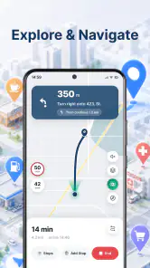
The central idea is straightforward: prepare maps for offline access, think through a trip with AI assistance, look up places and keep track of your car. Those functions address different moments in a journey. An offline map is useful when the network is weak; place discovery helps when deciding where to stop; trip planning is for shaping the journey; and car tracking can help you remember where you parked.
That breadth is attractive, but I would not treat the app as a guaranteed all-in-one replacement for familiar navigation services. The store summary describes its main tools, not every detail of how they behave in a particular region or under poor signal. A sensible first-time approach is to test the feature you care about most before relying on it for a long or time-sensitive drive.
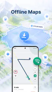
In everyday terms, offline maps are the feature with the clearest preparation payoff. They can make a map available when mobile data is unavailable, but an offline map should not be confused with a promise that every online convenience will work without a connection. I would download the area I need while connected and check that it is ready before setting out, rather than assuming a route search or every place detail will remain available offline.
The app is developed by Aykonu and is free to install. It is listed with a 4.6 average from around 590 ratings, and has passed 100,000 installs. Those figures suggest that it has found an audience, though they cannot tell me whether a particular map area suits my journey. The app is rated for Everyone, so its intended audience is broad.
There are in-app purchases, with items ranging from about five to thirty dollars. I would explore the free experience first and decide whether any paid option matters to my own travel habits before spending. The current version is 1.0.3, and the stated minimum operating system is version 7.0. For a traveler, the useful takeaway is that the app is positioned as an accessible starting point, while some purchases may add costs depending on what is offered in the app.
Who is likely to get the most from it
I can see it suiting people who occasionally travel through rural areas, take road trips across unfamiliar places, or want a map available as a backup rather than depending entirely on mobile coverage. It may also suit someone who likes to plan a route and possible stops before departure instead of making every decision from the driver’s seat.
It is less compelling if all your travel happens in a familiar city with dependable data and you already have a navigation app that reliably meets your needs. A dedicated navigation service may be a better fit if you depend on highly detailed live traffic guidance or established habits built around one particular map provider. I would compare the actual route and place results for my area before moving my daily navigation routine over.
Set it up before the journey, not at the roadside
For a first outing, I would install the app at home, open it while connected, and choose a nearby destination or a small trip I already understand. Then I would find the offline map option and prepare the relevant area. This reduces the chance of discovering, at the worst moment, that I need a connection to fetch the map I meant to use offline.
Think about the shape of your trip when choosing what to download. A destination map may not cover every stretch of a long drive, so I would consider the route and any likely detours rather than saving only the final town. If I expect to stop somewhere along the way, I would include that area too. This is a practical planning habit, not a guarantee about the map’s exact coverage boundaries; check the area shown in the app before relying on it.
A useful first test is to prepare the map, then briefly check the app without relying on mobile data. The point is not to simulate a dramatic emergency; it is to learn what remains available when connectivity is absent. If the map opens but a detail you wanted does not, you will know to look it up in advance next time. That distinction matters because offline map access and online place information are not necessarily the same thing.
For a commuter, this can be a modest but worthwhile routine before an occasional trip outside the usual coverage area. For a vacation, I would prepare maps before leaving home or a hotel with reliable internet, then open them once more before starting the drive. The extra check is more useful than downloading in a hurry after signal has already dropped.
Make the first trip-planning attempt small
The AI planning element is best approached as a starting point for organizing a trip, not as an authority that should make every decision for you. I would enter a realistic destination and inspect the proposed plan with common sense: does it fit the time I have, are the suggested stops plausible for my route, and is the destination actually where I intend to go? A generated idea can save some brainstorming, but I would verify the details that affect a real drive.
A good first use is planning a day trip with one destination and one or two possible stops. That gives you a chance to see whether the suggestions are relevant without having to untangle a complicated itinerary. If the plan misses your preferences, refine the request or use the result as inspiration and make the final choices yourself. The value is in helping you get moving, not in surrendering your judgement.
One small but important workflow is to separate planning from driving. Decide on stops before you set off, then avoid fiddling with trip ideas while behind the wheel. Even if an app makes planning feel quick, navigation decisions deserve attention; a passenger can handle changes, or you can pull over safely before adjusting the route.
Finding places and keeping track of the car
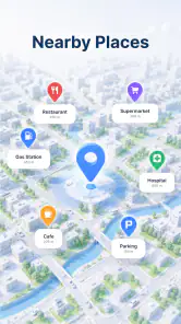
Place discovery can be useful when a route needs a practical break: perhaps I want to locate somewhere to stop, or I am visiting an area I do not know. I would search and inspect options before departure when possible, especially if the destination is in a place where coverage may be inconsistent. That gives me a chance to decide on a backup stop rather than depending on a last-minute search.
Car tracking is another potentially useful part of the package, but its best everyday role is simple: helping me find where I left the vehicle. In a large parking area or an unfamiliar neighborhood, I would use the feature when I park and make sure I understand how to return to the saved location. I would not assume it functions as theft protection or a live vehicle-security system; the stated purpose is tracking your car, and that is the sensible scope in which to evaluate it.
There is a helpful trade-off here. Combining maps, planning and parking assistance may reduce the need to switch between several apps for a straightforward outing. On the other hand, a broad toolset can take a little exploration, and a feature that sounds useful is only valuable if it fits your habits. I would test car tracking during an ordinary parking trip before depending on it in a sprawling venue or an unfamiliar city.
Where first-time users can get confused
The most likely misunderstanding is expecting “offline” to mean that every function works exactly as it does online. I would think of the downloaded map as preparation for viewing the relevant map area, then treat live information, fresh searches and other connected tasks as things to check before losing service. This expectation prevents a common disappointment: having a map available but not the particular up-to-date detail you hoped to retrieve.
Another point to check is map coverage. If a trip crosses several areas, a download for one destination may not be enough. Before leaving, inspect the saved region and consider the route, return journey and any likely diversions. A map that covers only the planned endpoint is not much help if the uncertain part of the trip is the road leading there.
AI suggestions also need a human review. A plan can be a useful prompt, but I would verify addresses, timing and stop choices instead of treating generated text as confirmed local knowledge. This is especially important if a trip has an appointment, accessibility needs or a narrow arrival window. For those situations, use the app to help organize the journey and cross-check critical details with a source you trust.
Finally, consider what you want from navigation before making this your default. If your priority is a pre-downloaded map and some help shaping a trip, the combination is appealing. If you need a particular live-navigation feature every day, compare it directly with your current app in the places you drive most. A short trial on a familiar route is a safer test than switching during an important journey.
A sensible next step after the first success
Once a small test works for you, build a repeatable pre-trip routine: download the areas you expect to need, check that the destination and stops make sense, and save or note the car’s location when you park. For a weekend drive, I would also identify a backup stopping place before departure. These steps turn the app’s different tools into a practical workflow rather than a collection of features you only remember when something goes wrong.
My overall view is that Offline Maps & AI Trip Planner is most persuasive as a prepared traveler’s companion. Its combination of offline map access, AI-assisted planning, place finding and car tracking can be convenient for road trips and unfamiliar destinations, especially when I want a backup plan for patchy connectivity. It is not a reason to skip checking coverage, validating a suggested itinerary or keeping attention on the road.
I would recommend giving it a low-stakes try if offline access is the feature you have been missing, then judging the other tools by how they fit your own trips. Someone who only needs familiar, always-connected city navigation may prefer to stay with a simpler routine. But if you like preparing before you go and want several travel tasks together, this app offers a credible place to start—provided you download ahead, verify important details and use its suggestions as assistance rather than certainty.
Offline Maps & AI Trip Planner Frequently Asked Questions
What is Offline Maps & AI Trip Planner, and what can it do?
Offline Maps & AI Trip Planner combines downloadable maps for navigation without an internet connection with AI-assisted trip-planning features. Depending on the version and available services, it may help you organize destinations, build an itinerary, and find useful places along your route. Check the app listing for the exact features included, since tools, map coverage, and AI capabilities can vary by platform or region.
Can I use Offline Maps & AI Trip Planner without an internet connection?
Offline navigation generally works only after you download the relevant map area while connected to the internet. Once saved, that map can help you view routes and navigate in places with weak or no service, although live traffic, current business details, online search, and AI-generated recommendations may still require a connection. Download maps before departure and confirm the app supports offline routing in your chosen area.
How does the AI trip planner create an itinerary?
An AI trip planner typically uses details you provide—such as destinations, travel dates, interests, or available time—to suggest an itinerary. Treat its recommendations as a starting point rather than guaranteed or up-to-date travel advice: opening hours, road conditions, prices, and local restrictions can change. Review the proposed stops and directions yourself, and verify important information with reliable local sources before setting out.
Is Offline Maps & AI Trip Planner free to download and use?
The download price and included features depend on the app’s current listing and the version available for your device. Some navigation or planning tools may be free, while premium features, subscriptions, or in-app purchases may apply; access to map downloads and AI services can also have limits. Check the store page and the app’s purchase terms before subscribing, and review renewal details if a trial is offered.
What should I check before downloading the app?
Confirm that your phone meets the app’s operating-system requirements and that offline maps cover the countries or regions you plan to visit. Also check the latest store listing for permissions, available languages, subscription terms, storage needs, and whether the features you want work offline. Downloading maps can use substantial storage, so make room on your device and connect to Wi-Fi before saving large areas.
Pros
- Download maps in advance for navigation without mobile data.
- AI trip planning can help turn travel ideas into suggested itineraries.
- Useful for keeping route guidance available in areas with weak coverage.
- Can make it easier to plan journeys before setting off.
- Offline access may help avoid roaming data charges.
Cons
- Downloaded maps take up storage space on your device.
- Offline maps may not include the latest road or place changes.
- AI-generated itineraries may need checking for accuracy and opening hours.
- Some features may require an internet connection or paid access.
- GPS navigation can drain battery quickly during longer trips.
- Category
- Maps & Navigation
- Version
- 1.0.3













