GPS Route Planner: Radar Map
- 295.00
- 4.7
- Installs
- 1.00M
- Price
- Free

Screenshots
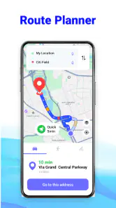
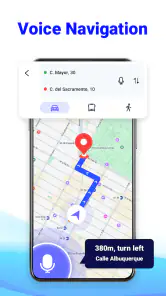
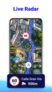
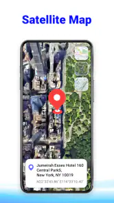


Analysis by Reviewed
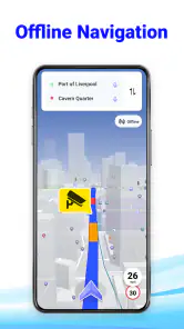
I judge a navigation app less by how many features it can name than by what happens when I am already running late, miss a turn, or lose a reliable connection. GPS Route Planner: Radar Map is aimed at that practical side of getting around: planning a route and following it with GPS guidance, including voice directions and offline navigation. It is a free Maps & Navigation app from MobApp - Phone Locator GPS Location, and its focus makes sense for drivers who want route guidance rather than a broad travel or mapping toolbox.
In everyday use, I would treat GPS Route Planner: Radar Map as a route-following companion, not as a substitute for thinking ahead. Its appeal is that spoken prompts can keep attention on the road, while offline GPS navigation offers a fallback for journeys where mobile data is unreliable. The balance is useful, but the app is most dependable when I prepare the route and check the relevant settings before setting off.
A practical routine for getting from plan to turn
Start with the route, then let guidance do its job
My baseline workflow would be simple: enter the destination while parked, review the proposed route, and begin navigation only once I am ready to move. That small pause matters. A route planner can help me get oriented, but it cannot make a last-second destination change safe or decide whether a turn is sensible for the vehicle I am driving. Keeping route setup separate from driving is the most useful habit I can bring to this app.
Once guidance is underway, voice directions are valuable because they reduce the need to glance repeatedly at the map. I still keep the visual route available for context: a spoken instruction tells me what is coming, while the map helps me understand where the turn sits in relation to nearby streets. I find that combination more reassuring than relying entirely on either audio or the screen.
Offline navigation is especially relevant when a trip passes through areas with patchy service. It is worth distinguishing that from a guarantee that every part of a journey will behave identically without a connection: GPS can establish location, but route preparation and other app functions may depend on what has already been made available. Before a long drive, I would check that the route is ready while connected rather than wait until coverage has disappeared.
A realistic example is a weekend drive to a rural address. I would set the destination at home, confirm the route, and start guidance before leaving town. If the signal fades later, having planned ahead is more useful than discovering the offline option only after the map stops updating. That is not a special trick; it is a repeatable routine that makes the app’s offline focus count in a real situation.
Settings that deserve a glance before departure
Voice guidance is one setting I would check early, especially if I share the car or alternate between quiet and noisy routes. Directions that are easy to hear in a calm cabin can become hard to follow with passengers talking or traffic noise. I would test the audio before driving and make sure the phone’s own sound level is appropriate. The goal is clear prompts without having to handle the device once moving.
The app also highlights speed camera radar. I see that as an awareness aid, not permission to stop watching the road or to treat an alert as a complete account of local rules. Camera information can be useful when it helps me stay attentive, but responsible driving still depends on posted signs, current conditions, and legal speed limits. I would avoid letting an alert dictate my attention at the expense of the road.
It is also worth deciding how much of the map I need to inspect while following a familiar route. If I know the general direction, I can listen for prompts and reserve glances for junctions or confusing approaches. On an unfamiliar trip, I would pay more attention to the visual route before departure, then use the voice instructions to reduce screen-checking once moving. This is a better workflow than trying to study every map detail in real time.
The app’s current version is 1.4.8, and it supports Android 6.0 or later. That makes the stated minimum operating-system requirement relatively approachable for people using older compatible phones, though a supported version alone does not tell me how well a particular device will perform. If navigation is essential, I would test it on the phone and mount I actually use before relying on it for an important trip.
Repeatable habits that make navigation smoother
Experienced users usually gain more from a consistent routine than from tapping around during a drive. I would save time by choosing the destination and checking the route before starting the engine, then leaving the phone mounted in a position that does not block the view. If I need to change plans, I would pull over first. That workflow is particularly helpful for short city trips, where a missed turn can quickly create pressure to make an unsafe correction.
A second useful habit is to treat familiar and unfamiliar journeys differently. For a regular commute, I would use voice prompts as reminders and keep my attention on traffic rather than repeatedly inspecting the map. For a first visit to a building or a less obvious address, I would review the final approach while parked. Navigation can bring me near a destination, but the last stretch may still require ordinary observation, such as looking for the correct entrance or legal parking.
For offline use, I would make preparation part of the departure checklist: choose the destination while connected, allow the route to settle, and confirm that guidance is active before entering a low-signal area. This is a practical safeguard rather than a claim that the app has a particular download workflow. It prevents a common mistake—assuming that an offline-oriented feature will automatically solve every connectivity problem without advance planning.
There is also a useful trade-off in how I respond to route changes. If a turn is missed, I would let navigation recalculate rather than make a hurried maneuver to recover the original route. A route planner is most helpful when I use it to regain orientation calmly, not when I obey it mechanically. Road closures, temporary restrictions, and local conditions can make any suggested path less suitable than it first appears.
Where it fits among familiar navigation choices
Compared with the usual map apps, GPS Route Planner: Radar Map is most appealing to someone who prioritizes driving guidance, voice prompts, offline navigation, and camera awareness in one navigation-focused experience. A broad mapping service may be a better everyday choice for someone who depends heavily on exploring places, checking business details, or coordinating a journey with other people. I would choose based on the task rather than assume one app must replace every map tool on my phone.
It is also not the right fit for every driver. If I need highly specialized routing for a large vehicle, live collaborative trip planning, or extensive local business research, I would look for an option designed around those needs instead of assuming this route planner covers them. Likewise, anyone who prefers to navigate entirely by a paper map or a dedicated in-car system may find a phone-based workflow unnecessary.
For a driver who mainly wants to enter a destination and follow spoken directions, the focused approach is a strength. The offline angle gives it a clear role for trips beyond dependable coverage, while the radar element may suit people who value camera alerts as part of their awareness routine. The key limitation is that these features do not remove the need to check routes, road signs, and changing conditions for yourself.
What the audience and age details mean in practice
The app is free and rated Everyone, so there is no purchase price to weigh before trying it. It has a 4.7 average from around 25,000 ratings, and more than a million installs. Those figures suggest a sizeable audience and generally positive reception, but I would still judge it by whether its route guidance works for my own roads, device, and driving habits rather than treating popularity as a guarantee.
It was released on October 25, 2023, and the developer is listed as MobApp - Phone Locator GPS Location. The age rating is broad, but a navigation app is still best used by the person who can operate it safely; passengers can handle destination changes or adjustments while the driver concentrates on driving. That division is a simple way to get the convenience without adding avoidable distraction.
Before depending on it for a time-sensitive journey, I would test a short, familiar route. That lets me check whether the voice instructions are clear in my car, whether the map is comfortable to read from its mounted position, and whether the route choices suit my expectations. A low-stakes test also gives me time to learn the basic flow without the pressure of being late or navigating an unfamiliar junction.
A capable choice for prepared, practical drivers
My verdict is that GPS Route Planner: Radar Map is worth considering if I want a straightforward driving companion with voice guidance, offline navigation, and speed camera radar in its feature mix. I would recommend it most to people who prepare routes before departure and prefer spoken prompts over constant screen-checking. Its value comes from a steady routine, not from treating the phone as an unquestionable authority.
I would skip it if my main need is something broader than getting from one place to another, or if I expect any navigation app to handle every route complication without my judgment. For everyday drives, its free price and focused feature set make trying it an easy decision; for important trips, a quick test and a backup plan remain sensible. Used with those habits, it can make route-following calmer while leaving the driver in charge.
GPS Route Planner: Radar Map Frequently Asked Questions
What is GPS Route Planner: Radar Map used for?
GPS Route Planner: Radar Map is designed to help users plan journeys and view routes with map-based navigation tools. Depending on the features available in your version, it may also show radar-style map views or information related to speed cameras and traffic. Check the app’s description and settings before relying on any specific feature, since available map data and tools can vary by region and app version.
Does GPS Route Planner: Radar Map provide turn-by-turn navigation?
The app’s name suggests route-planning and map features, but you should confirm whether it offers spoken, turn-by-turn directions before using it as your primary navigation tool. Try planning a short route while stationary and review the route guidance, voice settings, and map coverage. For driving, always follow road signs and local laws, and never interact with your phone while the vehicle is moving.
Does GPS Route Planner: Radar Map work offline?
Offline availability depends on whether the app lets you download map data or save routes for use without an internet connection. Do not assume that a route, radar display, or map will remain available after you lose signal. Before traveling through areas with poor coverage, check the app’s offline options and test any downloaded maps; live traffic and updated camera information generally require a connection.
Is GPS Route Planner: Radar Map free, and does it include ads or in-app purchases?
Pricing and monetization can differ between the Android and iOS versions and may change over time. Review the store listing before downloading to see whether the app is free to install, includes advertisements, or offers subscriptions or in-app purchases. If you start a trial or subscription, check its renewal terms and cancellation instructions so you understand any future charges.
What permissions and privacy considerations should I check before installing it?
A route-planning app may request location access to determine your position and calculate directions; some features may also need an internet connection. Grant only permissions that make sense for the features you intend to use, and review the app’s privacy policy and store-page disclosures for details about location collection, sharing, and retention. You can usually adjust location access later in your device settings.
Articles Related to GPS Route Planner: Radar Map
Clash of Clans Is Won Between the Battles
Its raids are quick; its community is a long-term project of coordination, teaching, rivalry, and shared responsibility—with all the friction that entails.
Android Auto Makes the Case for Quieter Car Software
The car interface is no longer judged by how much it can do, but by how quietly it helps. Android Auto shows what drivers now expect—and what still gets in the way.
MobiOffice: Transforming Mobile Productivity with Seamless Integration
MobiOffice: Word, Sheets, PDF is redefining mobile productivity with a surprising blend of functionality and innovation.
EA SPORTS FC™ Mobile Soccer: Redefining Mobile Sports Gaming
Dive into EA SPORTS FC™ Mobile Soccer, where immersive gameplay and strategic depth transform mobile sports gaming.
Pros
- Combines route planning with a radar-style map in one app.
- Can help drivers visualize nearby roads and plan trips more confidently.
- Useful for checking route options before setting off.
- Map-based interface makes route information easy to scan.
- Handy for users who want navigation tools in a single app.
Cons
- Radar-style visuals may be confusing if you expect a conventional map.
- Route accuracy can depend on GPS reception and map data.
- Using navigation continuously can drain your phone battery.
- Location access is needed for many core features.
- May be less useful in areas with limited coverage or outdated maps.

- Category
- Maps & Navigation
- Version
- 1.4.8












