Garmin ActiveCaptain®
- 762.00
- 4.1
- Installs
- 1.00M
- Price
- Free
Screenshots
Analysis by Reviewed
I think Garmin ActiveCaptain® makes the most sense when your boating routine already involves a Garmin chartplotter. It is a free navigation companion from Garmin, rather than a general-purpose map app, and that distinction shapes both its appeal and its limits. It has an average rating of 4.1 from around 6,500 ratings, with more than a million installs, so it is clearly reaching boaters beyond a small circle of dedicated users. I would consider it if I wanted to plan and manage parts of a trip from my phone while staying connected to compatible Garmin equipment.
Choosing it for the right kind of trip
The key question I would ask before installing it is not simply whether I boat often, but whether my existing routine includes Garmin marine equipment. ActiveCaptain is most useful when there is a compatible chartplotter to connect to; the phone app then has a clear job in the larger setup. If I were starting with only a phone and wanted a self-contained navigation tool, I would compare standalone boating apps first instead of assuming this one could take the same role.
That distinction matters for occasional boaters, too. If I use a Garmin plotter only on some trips, I would still find it worthwhile when the app helps prepare those outings, but I would not expect it to replace learning the equipment onboard. For someone who borrows boats, rents different models, or changes between navigation systems, the benefit may be less consistent because the experience is tied to the Garmin setup rather than to a phone alone.
What speed means on the water
I would not judge this app by how quickly it opens alone. Its useful speed is the time it saves when preparing a route, checking chart information, or moving information between a phone and a plotter. That convenience depends on having the relevant Garmin equipment available and connected; without that, the app’s central role is less compelling than a navigation app designed to work on its own.
For a short outing, I would do the planning before leaving rather than rely on a phone as the only tool once underway. Charts and route preparation are easier to check calmly at the dock, where there is time to resolve a connection issue or make sense of a setting. That small habit also avoids turning a simple departure into a last-minute troubleshooting session.
Navigating the Features
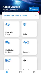
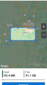
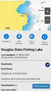
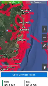
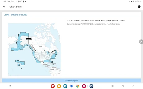
First things first, this app is all about integrating your boating life into one smooth digital experience. With Garmin ActiveCaptain®, you get to transform your mobile device into a nifty remote control for your Garmin chartplotter. How cool is that? This means you can access your charts, plan your next trip, and even update your maps all from the palm of your hand.
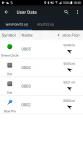
Now, one of my favorite features has to be the ability to connect with the ActiveCaptain Community. It’s like Facebook for boaters. You can share your experiences, learn from fellow seafarers, and even get advice on the best local spots to drop anchor. Plus, the waypoints and routes feature lets you save your favorite spots and plan future voyages with ease.
You May Like

Clash of Clans Is Won Between the Battles

Android Auto Makes the Case for Quieter Car Software

MobiOffice: Transforming Mobile Productivity with Seamless Integration

EA SPORTS FC™ Mobile Soccer: Redefining Mobile Sports Gaming

How Microsoft OneDrive Became a Mobile Productivity Giant

How Google Translate Breaks Language Barriers Effortlessly
Busy days, practical workflows
A useful way to put the route tools to work is to plan a familiar trip once, then save the waypoints that matter to you: a meeting point, a destination, or a place you may want to revisit. On a later outing, that preparation can save time and help keep the plan organized. I would still check the route against the chartplotter and the conditions on the day rather than treating a saved route as an automatic guarantee that every leg is suitable.
The community has a different job from the chart itself. Other boaters can offer local context and ideas, but I would treat shared recommendations as prompts to investigate, not as a substitute for checking navigation information. That distinction is especially useful when someone suggests an anchoring spot: local experience can help you decide what to look into, while the chart and your own judgment should guide the final choice.
Making preparation useful, not fussy
One practical approach is to keep the phone work focused. I would use it to get a trip organized, save the locations I expect to need, and review the connected setup, rather than trying to make every small decision on a screen while handling other tasks. A short checklist before departure can be more valuable than repeatedly reopening the app: confirm the route and relevant chart information, check that the plotter is communicating as expected, and then give your attention to the water and the equipment in front of you.
That workflow also helps separate planning from navigation judgment. A saved waypoint is a convenient reference, not a promise that a location remains appropriate for every visit. If conditions or plans change, I would reassess rather than follow a previous route automatically. This is one of the most important trade-offs of digital convenience: it makes preparation easier, but it can also make an old plan feel more authoritative than it really is.
Connectivity That Counts
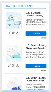
Connectivity is the name of the game here, and Garmin doesn’t disappoint. With built-in Wi-Fi, your chartplotter stays up-to-date with the latest maps and software, ensuring you’re always navigating with the best information available. And for those who are particular about safety (aren’t we all?), the app syncs seamlessly with Garmin’s Navionics charts, providing detailed bathymetric data to keep you clear of any underwater surprises.
And, oh, let’s not forget the smart notifications. Imagine getting a text or call while out at sea without having to fumble for your phone. The app gently nudges you with notifications right on your chartplotter screen. It’s like having your cake and eating it too!
When the connection gets complicated
Connectivity is also where I would set expectations carefully. A phone app and a chartplotter are two devices that need to work together, so it is sensible to check the connection and any planned updates before departure. If you are troubleshooting, I would start with the basics: confirm the devices are connected, make sure the intended chart or route is available on the device you plan to use, and avoid leaving an update until the last moment.
For a realistic weekend example, imagine heading to a familiar launch point after work and planning a new stop for the next morning. I would use the evening to review the route, save the relevant waypoints, and check for map or software updates while there is time to deal with any interruption. At the dock, I would verify that the plotter and phone are communicating before setting off. This is not extra ceremony; it is a practical way to make the app’s connected workflow useful rather than stressful.
Heavy-use moments and sensible checks
The app’s value is easiest to judge on a busy day when a trip involves more than one destination. I might be coordinating a meeting point, checking a planned stop, and keeping an eye on whether the phone and plotter are still working together. In that situation, saved routes and waypoints can reduce the small bits of repeated setup. I would still avoid doing a long sequence of phone tasks while underway; the best time for careful route editing is before departure, when a mistake is easier to notice and correct.
If something does not appear where I expect it, I would avoid assuming that the information has transferred just because I entered it on one device. I would check the receiving device directly and confirm that the intended chart or route is available there before relying on it. That simple habit is a useful safeguard for any phone-to-plotter workflow, especially when several pieces of information are being prepared close to departure.
Reliability, setup, and device limits
Because the experience depends on a Garmin chartplotter, ActiveCaptain is not the obvious pick for someone who wants a standalone boating map on any phone. I would also be cautious about assuming that every chart, device, or workflow behaves identically: compatibility and connectivity matter, so check that your particular equipment is supported before building a routine around the app. It is a companion, not a replacement for knowing how to use the plotter itself.
My view of reliability is therefore tied to preparation. The app can help organize information and connect devices, but I would not make a phone notification or a community suggestion the sole basis for a safety decision. Keep your normal navigation checks in the routine, and do not assume that an interrupted connection means the app can recover or synchronize everything without a check. In boating, a little verification is more valuable than trusting a screen because it looked right earlier.
It is free to download, though in-app purchases are listed from under a dollar to several hundred dollars per item, so I would review any purchase carefully before committing. It is rated for everyone, and the current version is 41.0.3219; those details may help when checking whether it suits your device and expectations. The minimum operating-system requirement is version 10, which is worth checking before installing, particularly on an older phone or tablet.
What to expect from your phone and plotter
Before making the app part of a regular routine, I would check both ends of the setup: the phone needs to meet the operating-system requirement, and the marine equipment needs to be compatible with the workflow I intend to use. This is more useful than judging the app from the phone alone. A phone that runs it comfortably does not, by itself, answer whether a particular chartplotter can work with the features I want.
I would also leave room for the practical realities of using a phone around boating equipment. Battery, visibility, and the convenience of handling a device are everyday considerations, not reasons to treat the phone as the primary navigation display. ActiveCaptain is most persuasive as a planning and connection companion; the plotter remains the central piece of equipment for the setup described here. If I am choosing between buying into an ecosystem and using a phone-only option, that difference should be part of the decision from the start.
Who should choose it—and who should not
I would recommend it most to boaters who already use a compatible Garmin plotter and want a more convenient way to prepare routes, manage charts, or keep selected information coordinated. It may also suit a careful weekend sailor who values saved waypoints and community knowledge, provided they understand that local tips are not a replacement for checking conditions and navigation details.
If you do not own Garmin equipment, or you mainly want a simple map that works independently, a standalone navigation option may be a better fit. General map apps are also more natural for finding road directions or everyday destinations; ActiveCaptain is built around boating and Garmin’s ecosystem, so it is not trying to serve those broader needs. Likewise, anyone who finds device pairing and setup frustrating should weigh that initial effort against how often they will use the connected features.
How it compares with phone-first alternatives
Compared with a general map app, ActiveCaptain is specialized: its appeal is the relationship between a phone, boating information, and a Garmin chartplotter, rather than road directions or everyday place-finding. Compared with a standalone boating app, its main advantage is that it belongs in a Garmin-based routine; its drawback is the same dependency. If I wanted one navigation app that remained useful across different boats and equipment, I would look for a phone-first alternative instead.
That does not make one approach universally better. A Garmin owner who regularly prepares routes and uses a plotter may prefer the connected companion, while a casual boater without that equipment may find a standalone option easier to understand and more immediately useful. I would choose based on the equipment I actually use and the jobs I need the phone to do, not on the assumption that a longer feature list automatically makes a better fit.
Set Sail with Ease
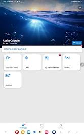
Setting up the Garmin ActiveCaptain® app is a breeze. Whether you’re a seasoned captain or a weekend warrior, the user interface is intuitive and straightforward. Within minutes, I had my phone connected, and everything was ready to go. The app holds your hand through the setup process with easy-to-follow instructions and prompts.
And for those who love a personal touch, the app offers customization options galore. From organizing your home screen to setting your preferred map layers, Garmin lets you make the app truly yours. It’s this attention to detail that sets it apart from other nautical apps out there.
But, hey, no app is perfect, right? While Garmin ActiveCaptain® does an exceptional job, it’s worth mentioning that the initial setup can feel a tad overwhelming for folks who aren’t tech-savvy. A little patience goes a long way, and once you’re past that, it’s smooth sailing!
So, whether you’re setting out for a leisurely day on the water or planning a long-haul voyage, Garmin ActiveCaptain® is the trusty sidekick you didn’t know you needed. With its robust features and user-friendly design, it’s no wonder this app is a favorite among boating enthusiasts. Give it a whirl and see for yourself – you might just wonder how you ever boated without it!
My performance verdict
For me, the strongest reason to install ActiveCaptain is not raw speed but the smoother routine it can create around a Garmin chartplotter: prepare at home, check the setup before departure, and use the phone as a practical companion rather than the only source of navigation. Its strengths are tied to that focused role, while the setup and equipment requirements are real trade-offs. If you already rely on Garmin marine gear, it is worth trying; if you need an independent navigation app, I would look elsewhere.
Garmin ActiveCaptain® Frequently Asked Questions
Is Garmin ActiveCaptain® free to download, and what should I know about its costs?
Garmin ActiveCaptain® is free to download, and its core app can be useful for connecting with your Garmin marine equipment. Some optional content or features may involve in-app purchases, so check the purchase details shown in the app before buying anything. The app is rated for Everyone, making it suitable for a broad audience, though its boating tools are intended for people using Garmin marine products.
What should I check before downloading Garmin ActiveCaptain®?
Before installing Garmin ActiveCaptain®, check that your phone or tablet meets its operating-system requirements and consider whether you have compatible Garmin marine equipment to connect. The app is designed around a connection to a GPS plotter, so its usefulness depends on your boating setup. It is a Maps & Navigation app from Garmin, intended to help users access marine information and work with supported devices.
What is Garmin ActiveCaptain® and how does it enhance my boating experience?
Garmin ActiveCaptain® is a comprehensive app designed to enhance your boating experience by providing seamless access to charts, maps, and other essential marine data. The app allows users to plan their trips, update their Garmin chartplotter software, and receive smart notifications directly on their device. With features like community-based feedback and integration with other Garmin devices, it ensures a more informed and enjoyable experience on the water.
Is Garmin ActiveCaptain® compatible with my device and how do I set it up?
Garmin ActiveCaptain® is compatible with both Android and iOS devices. To set it up, simply download the app from the Google Play Store or Apple App Store. Once installed, you need to create an account or log in using your Garmin credentials. Connect the app to your compatible Garmin device via Wi-Fi to sync your data and start exploring its features.
Does Garmin ActiveCaptain® require a subscription or any additional fees?
Garmin ActiveCaptain® itself is a free app with no subscription fees for basic features. However, certain advanced functionalities may require in-app purchases or subscriptions, especially if you need access to premium maps or specific content. Always check within the app for any additional costs associated with the features you wish to use.
Pros
- Seamless integration with Garmin devices
- User-friendly interface for easy navigation
- Real-time data synchronization
- Extensive database of nautical charts
- Customizable alerts for safety
Cons
- Limited offline functionality
- Requires Garmin account for full features
- Occasional syncing issues reported
- Some features locked behind paywall
- High battery consumption during use
- Category
- Maps & Navigation
- Version
- 41.0.3219













