Live Earth Map HD - Live Cam
- 1.01K
- 3.7
- Installs
- 10.00M
- Price
- Free

Screenshots
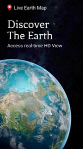
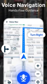
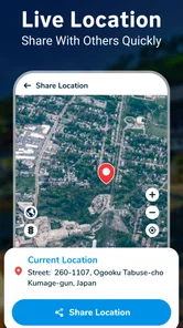
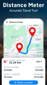
Analysis by Reviewed
I’m most drawn to the idea of opening a map and using it to look outward at places I may never visit that day. Live Earth Map HD - Live Cam is a free Maps & Navigation app from Appify Store, built around viewing the world through map imagery and camera streams. Its central appeal is not getting me from one address to another; it is making distant places easy to browse when curiosity, trip planning, or a quiet moment calls for a change of scenery.
A visual map, rather than a route planner
The distinction I would keep in mind before installing it is that this app is intended for looking at places, not for managing a journey from door to door. That changes how I use it: I open it with a destination or a question in mind, explore the visual information, and turn to a dedicated map app if I need reliable directions. The two kinds of tools can complement each other, but they do not solve the same problem.
That makes it useful in small, specific moments. I might want to see where a landmark sits in relation to the rest of a city, get a visual sense of a coastline, or satisfy a sudden curiosity about a place a friend mentioned. These are lightweight tasks, and the app’s combination of map imagery and camera viewing gives me a reason to explore rather than simply read a description or scan a list of search results.
It is also a different kind of screen time from browsing travel photos. A photo is usually selected to show a particular scene; a map invites me to move around and understand where that scene belongs. A camera feed, when one is available, adds a view that feels more immediate, though it remains limited to what that camera can see. I find that combination most valuable as a prompt for further research, not as a substitute for it.
Exploring the World from Your Screen
So, what's the big deal about Live Earth Map HD - Live Cam? Imagine having access to real-time satellite images and live video streams from some of the most iconic places around the world. Whether you're planning your next vacation or just want to check out the traffic in Times Square, this app has got you covered. It's like Google Earth on steroids, providing a more immersive and interactive experience.
Features That Make You Go "Wow!"
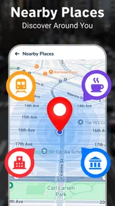
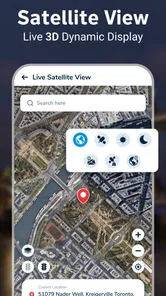
First off, the high-definition satellite imagery is absolutely breathtaking. You can zoom in and out with ease, getting up close and personal with landmarks, cities, and landscapes. The app also offers a street view feature that lets you walk virtually through streets and avenues, making it feel like you're actually there.
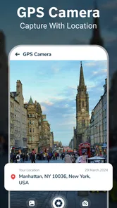
Another cool feature is the live cam feeds. From the bustling streets of New York City to the serene beaches of the Maldives, you can watch live streams from all over the world. It's perfect for those moments when you just want to escape and watch the world go by.
More From Our News Desk

 Weather - By Xiaomi
Weather by Xiaomi Review: Clear at a Glance, Less Clear Up Close
Xiaomi’s weather app makes everyday forecasts quick to scan, but its calm surface can leave useful details and recovery paths harder to find than they should be.

 X
X Under Pressure: Can It Recover When Posting Goes Wrong?
A resilience-focused review of X, examining setup, mistaken posts, interruptions, weak connections, and the gaps that matter when recovery needs to be dependable.

 Clash of Clans
 Is Won Between the Battles
Its raids are quick; its community is a long-term project of coordination, teaching, rivalry, and shared responsibility—with all the friction that entails.

 Android Auto
 Makes the Case for Quieter Car Software
The car interface is no longer judged by how much it can do, but by how quietly it helps. Android Auto shows what drivers now expect—and what still gets in the way.

 MobiOffice: Word, Sheets, PDF
MobiOffice: Transforming Mobile Productivity with Seamless Integration
MobiOffice: Word, Sheets, PDF is redefining mobile productivity with a surprising blend of functionality and innovation.

 EA SPORTS FC Soccer Mobile 26
EA SPORTS FC™ Mobile Soccer: Redefining Mobile Sports Gaming
Dive into EA SPORTS FC™ Mobile Soccer, where immersive gameplay and strategic depth transform mobile sports gaming.
Latest News

Using the Map with a Purpose
I get the most from the map when I choose a destination before opening it, rather than zooming around without a plan. For a future trip, I might look at the surrounding area and use a camera view as a rough visual preview, then rely on a dedicated navigation app for routes, opening hours, and current travel decisions. That division matters: this is an exploratory companion, not the tool I would trust to guide a time-sensitive journey.
For a realistic everyday use, imagine having ten minutes before meeting a friend and wanting to compare a few possible weekend destinations. I can browse a landmark or city, then switch to a live camera when one is available to get a more immediate sense of the place. I would treat that feed as a glimpse, not a guarantee of current weather, crowd levels, or what I will encounter later. A camera shows one viewpoint at one moment; it cannot stand in for a full, on-the-ground picture.
Making a quick destination check more useful
For that kind of short comparison, I would pick just a few places and ask the same question of each: does the surrounding area look like the sort of setting I want to explore? Keeping the question consistent makes the browsing more useful than simply jumping between famous views. I would note the neighborhood or nearby landmark that catches my attention, then look up practical details separately. That small habit turns a casual visual tour into a starting point for a real plan.
I would also avoid making a decision from one camera angle alone. A stream can make a busy destination look quiet if its lens points away from the main foot traffic, while a crowded view may represent only one popular corner. If I am choosing where to spend a day, I use the imagery to generate questions—what is nearby, what might be worth researching—not to settle questions about access, safety, or conditions on the ground.
User-Friendly and Intuitive
One thing I really appreciate about this app is its user-friendly interface. Navigating through the app is a breeze, and even if you're not tech-savvy, you'll find it easy to use. The menus are clearly laid out, and the search function lets you find specific locations in no time. Plus, the app runs smoothly without any annoying lags or crashes, which is a huge plus.
And here's a little tip: make sure you have a good internet connection to enjoy the app to its fullest. The high-quality images and live streams can be a bit data-heavy, but trust me, it's worth it!
What to Expect from a Visual Explorer
In practice, image browsing and video streaming ask for different things from your connection. If I am just checking a location, I keep the session focused instead of leaving a stream running while I do something else. That is a sensible way to avoid using more mobile data than intended, especially when I am away from Wi-Fi. I also separate “looks interesting on the map” from “is practical to visit”: a visual overview helps me orient myself, but it does not replace checking transport, access, or local conditions elsewhere.
A useful way to browse on a limited connection is to decide in advance whether I need the map view or a camera view, instead of repeatedly switching between them without a purpose. I would save longer explorations for a Wi-Fi connection and use mobile data for a quick check. I would not assume that a view already opened will remain available offline, so I would treat the app as an online browsing tool rather than something to depend on when connectivity is poor.
Compared with conventional navigation apps, the emphasis here is on seeing and exploring rather than turn-by-turn directions. Compared with a desktop globe or a general web search, the appeal is having map imagery and camera viewing together in one mobile experience. The trade-off is that someone who mainly needs dependable routing, transit choices, or offline guidance will be better served by a navigation-focused alternative. I would keep this app for visual discovery and use a specialist map when the route itself is the job.
Where it fits beside other map tools
For a trip, I would use a standard navigation app to work out how to get somewhere and this one to explore the destination visually. A general search is often quicker for a direct fact, such as a venue’s address or opening hours, while a desktop globe can be more comfortable for longer, detailed browsing on a large screen. This app’s strongest case is the in-between moment: I am on my phone, curious about a place, and want to move from a map view to a camera view without changing the nature of the task.
That convenience does not make it the best choice for every map question. If my plans depend on the fastest route, transit options, a dependable arrival time, or information I can use without a connection, I would choose a navigation service designed for those needs. If I want to study a destination carefully, I may prefer a larger display and more research sources. Here, the visual pairing is the point, and I would judge it by whether that makes exploration enjoyable and informative for me.
Who Will Get the Most from It
I can see this working especially well for curious travellers, students who enjoy geography, and anyone who likes taking a quick virtual detour during a break. It also suits people who want to preview the feel of a place before researching it more carefully. It is less suitable for someone who expects every location to have a useful camera view, or who needs a live feed to answer a precise question; availability and viewpoint can shape what a stream tells you. The best approach is to treat camera views as an extra perspective, not as a complete report about a destination.
It may also appeal to someone helping a friend choose between destinations. Rather than sending a stream of travel photos, I could look at a few areas together and use the map to keep the conversation grounded in where each place is. For a student, the same approach could make a geography assignment more engaging: start with a location, inspect its surroundings, and use the visual exploration to guide further reading. In both cases, the app is a doorway into a topic, not a source that answers every question on its own.
I would steer away from it if I were downloading a map tool mainly for daily commuting, route planning, or checking whether a particular street is passable right now. The visual format can encourage confidence, but a picture is not a complete local update, and a camera’s field of view is inherently narrow. People who need practical, time-sensitive answers will be happier starting with a specialist navigation or local information service, then opening this app only if a visual preview would add something.
Practical expectations before installing
The app is free to install, rated for Everyone, and its current version is 2.8.36, with Android 6.0 or later required. It has an average rating of 3.6 from around 55,000 ratings, and has been installed over 10 million times. Optional in-app purchases range from $0.49 to $29.99 per item, so I would check what is offered before buying anything rather than assuming the core experience requires a payment.
For me, the most useful question before spending anything is whether I already enjoy this kind of visual browsing. I would first try the free experience for the destinations I actually care about and see whether the available views answer my questions. An optional purchase only makes sense if I understand what it adds and expect to use that addition; I would not pay simply because a feature sounds appealing in the abstract. The app’s broad audience rating also suggests that it is worth approaching with realistic expectations rather than assuming every user will find the same value in it.
Wrapping It Up
In a world where travel is becoming more accessible, apps like Live Earth Map HD - Live Cam are bridging the gap between reality and virtual exploration. Whether you're a geography buff, a travel enthusiast, or just someone who loves discovering new places, this app is a fantastic addition to your digital toolkit. It's a fun, interactive way to see the world, and who knows? It might even inspire your next adventure!
My recommendation comes with a clear distinction: use it when the goal is to look around, satisfy a passing curiosity, or add a visual layer to early trip research. For precise directions or decisions that depend on complete, current local information, I would switch to a dedicated navigation or travel resource. Appify Store released it on January 2, 2020, and its 3.6 average suggests a mixed reception rather than universal approval. I would approach it as an appealing window onto places, with the sensible expectation that a visual tour is not the same as being there.
The decision I would make
If I wanted an everyday route planner, I would choose something else; if I wanted a visual way to spend a few minutes exploring places from my phone, I would give this a try. The strongest use is not replacing a journey but helping me imagine one, or turning a spare moment into a small virtual detour. I would keep its imagery in the role of a useful first impression, verify practical plans elsewhere, and decide whether any optional purchase is worthwhile only after seeing how I use the free app.
Live Earth Map HD - Live Cam Frequently Asked Questions
What does “live tour” mean in Live Earth Map HD - Live Cam?
The app is presented as a way to tour world-famous places in 3D and 360°, so “live tour” describes its visual exploration focus. It may be useful if you want to look around notable locations from your device. Keep in mind that a live-style viewing experience is not necessarily the same as a continuously updated view of every place.
Does Live Earth Map HD - Live Cam provide navigation directions for driving or walking?
Live Earth Map HD - Live Cam belongs to the Maps & Navigation category, but its stated focus is touring world-famous places in 3D and 360°. That makes it worth distinguishing visual exploration from turn-by-turn navigation before downloading. If your main need is directions for a trip, check that the functions you need are available in the app rather than assuming the category alone guarantees them.
Who develops Live Earth Map HD - Live Cam, and what is it designed for?
Live Earth Map HD - Live Cam is a Maps & Navigation app developed by Appify Store. Its short description is “Live Earth Map,” and it is presented as a way to take a live tour of world-famous places in 3D and 360°. That focus may appeal to people who want to explore notable locations visually before deciding whether to download it.
What features does Live Earth Map HD - Live Cam offer?
Live Earth Map HD - Live Cam offers a variety of features including real-time satellite imagery, live street views, and access to global webcams. Users can explore different parts of the world from the comfort of their own device. The app provides detailed maps and allows users to interact with the visuals to get a better understanding of different locations.
Is Live Earth Map HD - Live Cam free to use?
Live Earth Map HD - Live Cam is available as a free download. However, it may contain in-app purchases or ads to unlock additional features or to enhance user experience. Users should check the app store page for more details on any potential costs associated with the app. In-app purchases are listed from $0.49 to $29.99 per item, so review purchase options before buying anything.
Pros
- High-quality satellite imagery
- Real-time location tracking
- Street view mode available
- Interactive 3D maps
- Regular updates and enhancements
Cons
- Requires stable internet connection
- Can drain battery quickly
- Some features need subscription
- May have privacy concerns
- Occasional lag in live feed