Live Earth Map & GPS Map
- 435.00
- 4.1
- Installs
- 10.00M
- Price
- Free

Screenshots
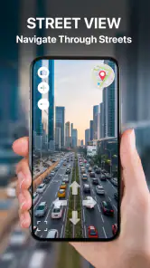
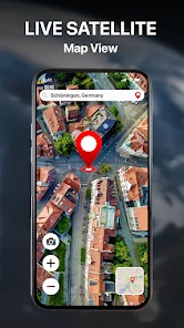
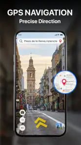
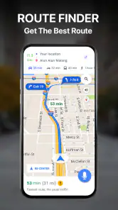
Analysis by Reviewed
I judge a map app by what happens when I need it in a hurry, not just by how attractive the globe looks on a quiet evening. Live Earth Map & GPS Map is aimed at people who want to browse satellite views as well as look for routes, and that mix can be appealing when a destination is unfamiliar. Its usefulness, though, depends on the task: exploring a place on screen is different from relying on turn-by-turn directions in a busy junction.
When the connection is doing the work
Maps are especially convenient when the phone can load the area and route information as needed. That makes a connected session useful for checking the shape of a neighborhood before setting out, then switching attention to the route while travelling. I would treat satellite imagery as a planning aid rather than a substitute for local signs: a broad aerial view can help me understand how streets and landmarks sit together, but it cannot tell me whether a turn is easy to make from the lane I am in.
One practical habit is to inspect the destination before leaving, while I have time to compare the route with the surrounding streets. I also like to keep the address or place name handy outside the map screen. If the connection becomes unreliable, that small bit of preparation can save the awkward moment of trying to remember where I was headed.
Useful in everyday mobile situations
On foot, I would use the map to get my bearings around a station, shopping area, or unfamiliar campus. In a car, I would set up the route before moving and let the phone stay where it is easy to see without distracting me. A passenger can do the browsing and route adjustments; the driver should not be tapping around while the vehicle is moving.
A realistic example is arriving in a new town for an appointment. I can check the destination’s surroundings before leaving, start the route when ready, and use the satellite view to recognize nearby blocks if the street layout feels confusing. That workflow is more useful than zooming around randomly after I have already missed a turn. It also helps me decide whether I need extra time to walk from a drop-off point or find the right entrance.
What to expect when something goes wrong
Route guidance is only as reassuring as the phone’s location signal, the map information on screen, and the connection available at the time. If directions pause or the map takes a while to refresh, I would avoid making a sudden turn based on a guess. Pull over safely, check the street name and the route again, or use a familiar landmark to regain context. This is a sensible backup routine for any phone-based navigation, not a special guarantee about this app.
For a trip where losing access to directions would be a serious problem, I would prepare a second option: note the key turns, keep the destination details available, or use another navigation source as a backup. People who regularly travel through weak-signal areas should choose a tool with offline navigation they have personally tested. A map that looks useful while connected is not automatically a dependable plan when the network disappears.
You May Like

Clash of Clans Is Won Between the Battles

Android Auto Makes the Case for Quieter Car Software

MobiOffice: Transforming Mobile Productivity with Seamless Integration

EA SPORTS FC™ Mobile Soccer: Redefining Mobile Sports Gaming

How Microsoft OneDrive Became a Mobile Productivity Giant

How Google Translate Breaks Language Barriers Effortlessly
Getting Started with Live Earth Map & GPS Map
First things first, let’s talk about how easy it is to get started. Downloading and installing the app is a breeze. Once you've got it, the user-friendly interface makes it a delight to navigate. It’s like having a virtual globe in your pocket, ready to spin and zoom into any place your heart desires. The interface is intuitive, and the navigation is smooth, making it accessible for users of all ages.
Features that Make a Difference
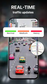
The Live Earth Map & GPS Map is not just about maps; it's about an experience. You can switch between different views, from a classic map view to a satellite view that’s so detailed, you might just spot your own house. The real-time traffic updates are particularly handy for those of us who dread sitting in jams. And if you’re someone who loves a bit of exploration, the app’s 3D street view is a total game-changer. It’s like going on a virtual city tour without leaving your couch.
Another cool feature is the GPS navigation. It’s precise and reliable, guiding you with voice directions and keeping you updated on your ETA. No more getting lost or taking wrong turns. Plus, for the adventurers, there’s the offline maps feature ensuring that you stay on track even when your data is playing hide and seek.
Choosing it for the right reasons
The app is free to download, and Gitola Tech Studios develops it. It sits in the maps and navigation category, with an average rating of 4.1 from around 12,000 ratings and more than 10 million installs. It is rated for everyone, and version 2.0.9 requires Android 7.0 or later. Optional in-app purchases range from $0.49 to $16.99 per item, so I would check the purchase prompts before tapping through if I want to keep the experience free.
That scale makes it easy to try, but it does not settle whether it suits my own routine. I would choose it when I want satellite-style browsing alongside route finding, or when I am curious about a place before visiting. If my priority is a familiar daily commute, a navigation app I already trust may be simpler; if I need dependable guidance where reception is poor, I would favor a solution whose offline behavior I have checked in advance. The best choice depends less on the number of map views than on where and how I travel.
Planning without wasting mobile data
Satellite imagery can be more demanding to load than a simple street map, so I would use the view deliberately rather than leave it open while casually browsing for a long time on mobile data. First locate the area in a standard map view, then switch to the aerial perspective only when it answers a real question—such as which side of a block a building sits on. That keeps the useful visual context while avoiding unnecessary image loading.
If I am comparing several possible destinations, I would check them one at a time and settle on the route before setting off, rather than repeatedly changing map layers on the move. This is a small workflow choice, but it reduces screen fiddling and makes the app feel more like a planning tool than a distraction. On a limited data plan, I would also pay attention to how much browsing I do away from Wi-Fi; the experience is still worth trying, but satellite exploration is best used with intention.
Where it fits among map apps
Compared with a conventional navigation app used mainly for commuting, this one’s appeal is the combination of route-finding and a more visual, exploratory way to inspect places. That can help when I am unfamiliar with the layout around a destination or simply want to understand an area before visiting. A dedicated navigation alternative may be the better pick if my needs are narrowly focused on routine driving, or if I have already built a dependable habit around its directions and saved places.
I would also separate “live-looking” imagery from a live view of events on the ground. A satellite layer is useful for seeing geographic context, but it should not be treated as a camera feed or as proof that a road is clear right now. For immediate decisions, I would rely on current route guidance and road signs, and use the aerial view to orient myself rather than to judge changing conditions.
Exploration, with sensible expectations
What really sets this app apart is how it blends functionality with fun. Imagine planning your road trip with detailed weather forecasts along your route or bookmarking your favorite spots for future visits. It’s not just about getting from point A to point B; it’s about the journey, and Live Earth Map & GPS Map is here to enhance it.
And hey, for those moments when you’re just daydreaming about travel, the app’s exploration feature lets you wander the world virtually. It’s like a mini-vacation right at your fingertips.
For casual exploration, I would pick a place I already know and see whether the map view helps me recognize its layout; that gives me a practical sense of how useful the imagery is before I depend on it somewhere new. A traveler who enjoys browsing destinations may get more from that visual side than someone who only wants the fastest route to work. By contrast, if I need accessibility details, precise entrance information, or a carefully verified route for a time-critical trip, I would check those specifics with another trusted source rather than assume a broad map view answers them.
Who should keep looking
I would recommend giving it a try if satellite exploration is part of how you plan trips, or if you want route finding and visual browsing in one place. It may be less suitable for someone who wants a strictly no-fuss commute tool, needs navigation that has been tested without a connection, or is uncomfortable checking purchase prompts in a free app. The useful question is not whether it has a long feature list, but whether its mix of visual discovery and routing matches the way you actually travel.
Before a longer journey, I would test the route on a short, familiar trip. That lets me see whether the directions, map presentation, and phone setup work for me without making an unfamiliar road the first trial. I would also keep the phone charged and mount it safely; a map is only helpful if I can consult it without taking attention away from the road.
Final Thoughts
In a world where being on the move is the norm, having a reliable map app is essential. Live Earth Map & GPS Map isn’t just reliable; it’s innovative and engaging. It brings the world to your screen, making every journey and exploration exciting. Whether you’re navigating through your daily routine or venturing into the unknown, this app is your perfect companion. So why not give it a try and see the world from a whole new perspective?
My connectivity verdict is straightforward: I see the strongest case for using it when I can plan with a steady connection and want a visual feel for the destination as well as a route. For a routine trip, it can be a handy option to try; for remote travel or a journey where a missed instruction would cause real trouble, I would not make any map app my only plan. Keep a backup, use satellite imagery for orientation rather than live road judgment, and this app’s blend of browsing and navigation makes more sense.
Live Earth Map & GPS Map Frequently Asked Questions
What devices and operating systems can run Live Earth Map & GPS Map?
Live Earth Map & GPS Map is a Maps & Navigation app for Android, with Android 7.0 or later required. It is listed as suitable for everyone, and the app is free to download. Before installing, check your device’s Android version and available storage so you can make sure it is ready for the app.
What features does the Live Earth Map & GPS Map app offer?
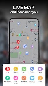
The Live Earth Map & GPS Map app provides a comprehensive suite of features including real-time satellite imagery, street view, 3D maps, and GPS navigation. Users can explore various locations worldwide, get accurate driving directions, and check traffic updates. Additionally, the app supports offline maps, making it convenient for users to navigate without an internet connection.
Is Live Earth Map & GPS Map app user-friendly for beginners?
Yes, the Live Earth Map & GPS Map app is designed with a user-friendly interface that makes it accessible even for beginners. It provides step-by-step guidance for navigation and easy-to-use search functions. The app includes tutorials and tips to help new users get acquainted with its features quickly, ensuring a smooth experience for all.
Does the app require an internet connection to function?
While the Live Earth Map & GPS Map app offers offline map capabilities for certain features, an internet connection is required for real-time satellite imagery and traffic updates. Users can pre-download maps of specific areas to access them offline. However, for the most accurate and up-to-date information, a stable internet connection is recommended.
Is the app available for both Android and iOS platforms?
Yes, the Live Earth Map & GPS Map app is available for download on both Android and iOS platforms. Users can easily find it on the Google Play Store for Android devices and the Apple App Store for iOS devices. It offers a consistent experience across both platforms, ensuring all users have access to its comprehensive mapping and navigation features.
Pros
- Real-time location updates.
- High-resolution satellite imagery.
- User-friendly interface.
- Customizable map views.
- Offline map availability.
Cons
- High data usage.
- Battery drain issues.
- Ads can be intrusive.
- Premium features are expensive.
- Limited offline features.

- Category
- Maps & Navigation
- Version
- 2.0.9











