Jakdojade: public transport
- 258.00
- 3.9
- Installs
- 10.00M
- Price
- Free

Screenshots


Analysis by Reviewed
I find Jakdojade most useful when a journey has several moving parts: a bus to a station, a tram across town, or a connection in an unfamiliar city. It brings route planning, public-transport timings and ticket buying into one place, which can save the small but stressful effort of switching between a map, a timetable and a ticket app. It is a free navigation app from CITY-NAV sp. z o.o., and its focus is specifically on getting around by public transport rather than guiding every kind of trip.
Where a journey can get frustrating
Public transport plans are only as useful as the information and connection behind them. A route may look straightforward on screen, yet a late vehicle, a missed transfer or a crowded stop can change the practical choice. I treat the suggested journey as a plan to check, not a promise that every leg will happen exactly on time. When timing matters, I look at the next departure and the connection together instead of focusing only on the total journey.
Ticket buying can also add a moment of friction. If I am already on a tram and only then remember I need a ticket, using an app is convenient, but it still depends on having a working phone and being able to complete the purchase. I would not wait until the doors are closing to work out the process for the first time. Getting familiar with the ticket flow before a hurried trip is a simple way to avoid that avoidable scramble.
Useful setup checks before leaving
Before relying on a route, I enter the actual starting point and destination rather than assuming the app has chosen the stop I have in mind. In a large city, similarly named stops or opposite sides of a road can make a noticeable difference. I also check that the proposed departure time matches when I can really leave; a route based on the wrong time can be less helpful than a slower option that fits my plans.
The app is rated for Everyone, has an average score of 3.9 from around 154,000 ratings, and has been installed over 10 million times. Those figures suggest a widely used service, but they do not guarantee that every route or ticket flow will feel effortless for every person. The current version is 7.0.9, and it requires Android 9 or later. The app is free to install, with optional in-app purchases listed from $0.49 to $3.99 per item.
How I recover when a plan stops working
If a connection no longer makes sense, I start by checking the route again with my present location and intended destination, rather than trying to rescue an outdated plan. I compare the next available departure with the transfer it leads to, then decide whether waiting or choosing another route is more sensible. This small reset is often clearer than repeatedly refreshing the same itinerary while standing at a busy stop.
If a screen or purchase seems stuck, I avoid assuming immediately that the route itself is wrong. I check whether the phone has a usable connection, whether the app is responsive, and whether I have selected the right stop or journey. If the issue remains, I can use another reliable source for the immediate departure and return to the app once I can check it calmly. For a time-critical trip, keeping a fallback in mind is practical, not pessimistic.
You May Like

Clash of Clans Is Won Between the Battles

Android Auto Makes the Case for Quieter Car Software

MobiOffice: Transforming Mobile Productivity with Seamless Integration

EA SPORTS FC™ Mobile Soccer: Redefining Mobile Sports Gaming

How Microsoft OneDrive Became a Mobile Productivity Giant

How Google Translate Breaks Language Barriers Effortlessly
Getting Around with Ease
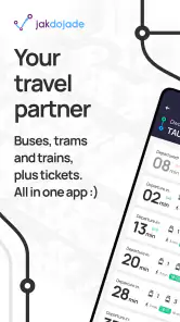
One of the first things I noticed after downloading Jakdojade was its intuitive interface. It's like the developers knew exactly what we needed—simplicity and functionality. You can easily search for routes, check schedules, and even see departure times in real-time. It's like having a magic wand that makes public transport a breeze!
Features That Make a Difference
Let’s dive into some of the features that make Jakdojade stand out. Firstly, the real-time updates are a game-changer. I mean, who wouldn’t want to know exactly when their bus is going to show up? No more waiting in the cold or rushing only to find out you've got plenty of time. The app’s live timings ensure you’re always in the know.
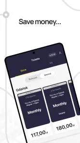
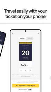
Another cool feature is the ability to buy tickets directly from the app. Imagine this: You're running late, you hop onto the tram, and bam! You realize you forgot to buy a ticket. No worries, just whip out your phone and sort it out in seconds. It’s super convenient and a real time-saver.
Choosing it for the right kind of trip
A typical use for me would be leaving home for an appointment across town: I check the route before I go, note the transfer, and then use the departure information to decide whether I can walk to a different stop or should head straight to the nearest one. That is where a transit-focused planner can be more useful than a general map, especially when comparing bus and tram options as part of one city journey.
Compared with checking printed timetables or searching each operator separately, having routes and ticket purchasing together is less fiddly. A general-purpose map may be a better fit if I am driving, walking most of the way, or planning a trip beyond the public transport networks the app covers. I also would not make it my only tool when a missed connection would have serious consequences: live estimates help with decisions, but I still allow extra time for an important appointment.
Making a transfer less stressful
One useful habit is to think about the transfer as its own decision point, not just a line between two vehicles. Before setting off, I check where the change happens and whether the proposed connection gives me enough time to move between stops. If I am unfamiliar with the area, I avoid planning around a transfer that leaves no room to orient myself. That can mean choosing a slightly longer itinerary in exchange for a calmer changeover.
For a journey with several legs, I also keep the destination of the next vehicle in mind rather than relying on route numbers alone. Numbers and directions can be easy to mix up when two services use the same stop. Reading the direction before boarding is a small check that can prevent a much longer detour. It is particularly useful when I am tired, travelling with bags, or trying to keep up with someone else’s pace.
Tickets and the moments they matter
Being able to buy a ticket in the same app as planning a route is convenient, but I treat those as two separate tasks. A route being ready does not mean I have completed the ticket purchase, so I make a point of checking the ticket screen before I board. If I am new to the app, I would try the purchase flow when I am not rushing; learning the steps at a quiet moment is better than discovering a confusing prompt while a vehicle is waiting.
That convenience also has a practical trade-off: the phone becomes part of the journey. A low battery, a stalled screen, or a connection problem can turn an easy purchase into a distraction. For a day of heavy travel, I make sure I can keep the phone usable and know what I will do if the app is unavailable at the stop. I would not assume that digital ticketing removes the need to check local travel requirements or keep a sensible backup plan.
Who benefits most from a transit-first planner
I would recommend this approach to people who regularly combine city buses and trams, visitors who need help comparing unfamiliar routes, and anyone who would rather plan a trip around departures than estimate it from a street map. It is especially handy when the best route is not obvious from the starting point: the shortest walk to a stop may not lead to the most convenient overall journey.
It is less compelling if most of your travel is by car, on foot, or through places where the public-transport information you need is not available. Someone who already knows a single regular commute by heart may only open it when service changes make the familiar option less useful. I see it as a practical companion rather than a reason to abandon every other navigation tool.
When the app may not be the cause
If a departure looks wrong or a route will not load, the cause may be outside the app: a weak connection, a change in local service, or simply selecting the wrong stop. I check the stop name and direction first, then compare the plan with what is displayed at the stop when that information is available. This is more useful than repeatedly asking the app for the same journey without changing anything.
For visitors, I would plan the first trip while I still have time to read the route carefully, rather than learning the interface during a rush. For regular commuters, the bigger benefit is having a quick way to reconsider a journey when the usual route is inconvenient. Either way, I keep enough battery and connectivity for the trip, since a phone-based ticket or timetable is only helpful when the phone is ready to use.
Why It’s a Must-Have
Now, you might be wondering, "Is this app really for me?" Well, if you rely on public transport and live in Poland, the answer is a resounding yes! Whether you're a local or just visiting, Jakdojade is your go-to companion for getting around the city efficiently.
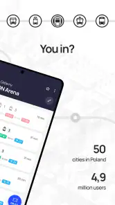
What really makes it a must-have is its coverage. It’s not limited to just one city; it spans across multiple major cities in Poland. So, whether you’re in Warsaw, Krakow, or Gdansk, you can count on Jakdojade to guide you smoothly from point A to point B.
How it fits alongside other travel tools
In practice, I would use a public-transport planner for the question “Which combination of services gets me there?” and a general map for broader orientation, such as judging the walk from a stop to a building or comparing a driving route. Those tools overlap, but they do not have to compete. Jakdojade’s value is the transit-specific view; it is not a universal answer for every leg of a day out.
For an unfamiliar city, I find it useful to plan the outward trip and think through the return before I leave, especially if I will finish somewhere other than the central area. That does not mean trusting an itinerary blindly. I use the route to understand likely options, then stay attentive to signs, stop displays and local changes. The app is most helpful when it reduces guesswork without replacing common sense.
What the rating can and cannot tell you
Its 3.9 average from roughly 154,000 ratings gives a prospective user a broad sense that the app has a substantial audience, but ratings are not a guarantee of a smooth experience on a particular device or route. I would weigh that alongside what the app is designed to do: bring city public-transport planning, timings and ticket purchase together. My own decision would depend more on whether those are the tasks I need than on expecting every live estimate to be perfect.
It has been available since August 3, 2011, and its current release is version 7.0.9. That history makes it a long-running option rather than a brand-new experiment, while the Android requirement is version 9 or later. It is free to download, rated for Everyone, and optional in-app purchases range from $0.49 to $3.99 per item. I would still check that the version suits my phone before relying on it for a trip.
Wrapping It Up
In conclusion, Jakdojade is more than just a public transport app; it’s a tool that brings peace of mind to your daily commute. It’s packed with features that make traveling by public transport a seamless experience. So, if you haven't already, give it a try. Trust me, once you do, you'll wonder how you ever managed without it.
Remember, next time you're stuck trying to figure out which tram to catch, just open Jakdojade and let it do the hard work for you. Happy traveling!
Jakdojade: public transport Frequently Asked Questions
Can Jakdojade help me plan a journey before I leave home?
Yes. Jakdojade is built around public transport journey planning, so you can enter a starting point and destination to explore possible routes before setting off. It brings route information together with timetables and navigation, which can make it easier to compare options and understand how a trip fits together. Check the suggested journey in the app before travelling, especially if your plans change.
Does Jakdojade cover walking directions as well as public transport?
Jakdojade’s journey planning can include walking directions alongside public transport options, helping you understand how to get between stops and your destination. This is useful when a trip involves a transfer or a walk at either end. Review the route shown in the app and make sure the walking portions suit your needs before you begin, particularly when travelling somewhere unfamiliar.
Which cities and transport networks can I use Jakdojade in?
Jakdojade is aimed at planning journeys on public transport, including buses, trams, and trains. Before relying on it for a trip, check that your intended city and route are available in the app, then enter your starting point and destination to see the options it can suggest. Coverage is especially important when travelling beyond familiar areas.
Can I use Jakdojade to buy public transport tickets?
Tickets are part of Jakdojade’s public transport essentials, alongside timetables and navigation, so the app can be useful for more than simply finding a route. Ticket availability and the options shown can depend on the journey and local transport services. Review the ticket details presented in the app before travelling, and check that the ticket suits your route and travel requirements.
What is Jakdojade and how does it work?
Jakdojade is a public transport application designed to help users navigate and plan their journeys across cities using various modes of public transport. It provides real-time schedules, route planning, and information on buses, trams, and trains. The app allows users to input their starting point and destination to find the most efficient routes, including transfers and walking directions.
Pros
- Accurate real-time updates.
- User-friendly interface.
- Wide coverage in major cities.
- Customizable trip planning.
- Offline maps available.
Cons
- Sometimes slow to load.
- Occasional GPS inaccuracies.
- Limited rural area data.
- Ads in free version.
- No ride-sharing options.

- Category
- Maps & Navigation
- Version
- 7.0.9











