FishWeather: Marine Forecasts
- 181.00
- 4.8
- Installs
- 100.00K
- Price
- Free

Screenshots

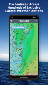
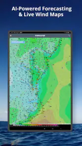
Analysis by Reviewed
When I need weather information for a day near the water, ordinary weather apps often feel too general. They may tell me whether rain is likely, but they do not always help me judge whether a trip is comfortable, practical, or sensible once wind, waves, and tides become part of the decision. FishWeather: Marine Forecasts takes a more focused approach. It is a free weather app from WeatherFlow built around marine conditions, and in my experience its value comes from putting the details that matter to boaters, anglers, sailors, and coastal visitors closer to the center of the screen.
My overall view is straightforward: FishWeather is most useful when a normal forecast is not detailed enough for your plans. I would not install it as my only weather tool for every situation, especially if I mainly want a quick rain forecast for a city commute. But if my day depends on wind direction, tide timing, wave behavior, or marine alerts, this app gives me a more relevant way to prepare.
What makes FishWeather different from a standard weather app
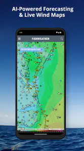
The first thing I noticed is that the app is organized around decisions made near water rather than around general daily weather. Its focus includes marine forecasts, tides, waves, wind conditions, alerts, and radar. That combination matters because marine planning is rarely about temperature alone. A mild, sunny day can still be unpleasant or unsafe if the wind strengthens, waves build, or the tide works against the route I have in mind.
WeatherFlow, the developer, has kept the app’s purpose clear instead of trying to turn it into an all-purpose lifestyle dashboard. I can approach a forecast by asking practical questions: Is the wind suitable for a small boat? Will the water be calm enough for a fishing trip? Does the tide line up with the time I want to launch? Is rain moving toward the coast? That is a more useful starting point than simply checking a large temperature number.
The app has earned a 4.8 average from around 1.7 thousand ratings, and that strong response makes sense when the user’s needs match its design. It has also passed 100 thousand installs, which suggests it serves a recognizable niche rather than being a curiosity with no regular audience. Its content rating is Everyone, so the interface is aimed at general users rather than a specialist professional audience.
I also appreciate that it is free to install. That makes it easy to test alongside the weather app already on a phone, rather than forcing an immediate commitment. There are in-app purchases ranging from about six dollars to around 180 dollars per item, so I would still examine any paid option carefully before buying. The free starting point is useful, but it should not be confused with every possible capability being included at no cost.
Wind and waves are more useful together than separately
A common mistake when checking marine weather is to look at wind speed as if it tells the whole story. FishWeather encourages a broader reading by bringing wind and wave information into the same planning process. I can use the wind forecast to think about exposure and direction, then compare that with wave conditions instead of assuming that a low wind number automatically means easy water.
More From Our News Desk

Clash of Clans Is Won Between the Battles

Android Auto Makes the Case for Quieter Car Software

MobiOffice: Transforming Mobile Productivity with Seamless Integration

EA SPORTS FC™ Mobile Soccer: Redefining Mobile Sports Gaming

How Microsoft OneDrive Became a Mobile Productivity Giant

How Google Translate Breaks Language Barriers Effortlessly
This is particularly helpful for someone using a small craft, kayak, paddleboard, or open fishing boat. I would not treat the app as a substitute for local knowledge or proper safety judgment, but it helps me notice combinations that a basic weather screen can hide. Wind from an awkward direction may matter more than a comfortable temperature, and waves can remain relevant even when the sky looks inviting from shore.
One practical habit I developed is to check the forecast at the time I expect to be on the water, rather than only looking at the day’s overall summary. A morning trip and an afternoon trip can feel like completely different outings. Reading the conditions as a timeline also makes it easier to decide whether to shorten a route, move the launch time, or leave the plan for another day.
Tides turn the forecast into a schedule
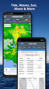
The tide information is another reason I would choose this app over a generic weather service. Tides are not just background facts for me; they affect access, shoreline conditions, fishing plans, launching, anchoring, and the amount of water available around shallow areas. Having tide information alongside the rest of the forecast reduces the need to jump between unrelated tools.
A useful workflow is to begin with the activity rather than the weather. I first think about when I need to arrive, how long I expect to stay, and whether the tide should be rising or falling for that plan. Then I compare the tide timing with wind and wave conditions. That sequence is more realistic than choosing a convenient tide and only afterward discovering that the wind makes the same window uncomfortable.
This is also where the app can help people who are not serious boaters. Someone planning a beach walk, shoreline photography session, or a visit to a tidal area may care more about water level and access than about the day’s high temperature. FishWeather gives those users a more appropriate planning lens, although they still need to understand the local shoreline and avoid treating a forecast as a guarantee.
Radar and alerts add value before leaving home
Radar is useful because marine plans are often ruined by timing rather than by the existence of bad weather. A forecast may describe a generally acceptable day, while a narrow band of rain moves across the route at the exact time I intend to launch. Checking radar before I leave gives me a better chance of spotting that problem and adjusting the schedule.
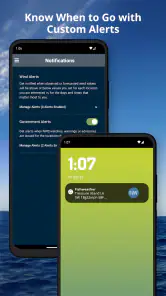
Alerts are helpful for the same reason. I prefer an app that can draw attention to changing conditions instead of requiring me to remember to open it repeatedly. Still, I see alerts as a prompt to reassess, not as permission to continue automatically. On the water, an alert can arrive after conditions have already changed locally, and no phone forecast replaces observation, equipment, or a sensible exit plan.
One non-obvious advantage is the way these pieces work as a sequence: radar helps me judge immediate precipitation, the forecast gives broader timing, wind and waves describe the water, and tides shape access. None of those elements is revolutionary on its own. The strength is having them connected to one marine-focused decision instead of scattered across several unrelated apps.
Where the experience can become frustrating
The same specialization that makes FishWeather valuable can make it feel excessive for casual users. If I only want to know whether I need an umbrella or jacket, the marine details may slow me down rather than help. A general weather app is usually faster for a quick glance at local temperature, precipitation, and broad daily conditions. I would not recommend replacing a simple everyday forecast solely because this app includes more information.
There is also a learning curve in interpreting marine information responsibly. Wind direction, wave conditions, and tides are not decorative numbers; they need context. A new user may see a promising forecast without understanding how a particular shoreline, inlet, boat type, or route changes the risk. FishWeather can organize the information, but it cannot make the judgment for me. I had to resist the temptation to reduce a complicated outing to one “good” or “bad” label.
Another limitation is the possibility of decision overload. When I open a marine forecast with several condition types in mind, I can spend too long comparing details and forget the original question: should I go, and what is my backup plan? The app works best when I already know what I am checking. I recommend deciding in advance which factors matter most for the activity, then using the forecast to answer those questions rather than browsing endlessly.
The in-app purchase range also deserves attention. The app is free to start, but the presence of purchases from roughly six dollars to nearly 180 dollars means some users may encounter paid options that are far beyond what a casual coastal visitor needs. That does not make the app poor value, but it does mean I would avoid buying anything simply because it appears while exploring. A recreational user should first establish whether the free experience already covers the planning routine they actually use.
Compatibility is reasonably broad for older devices, with the current version listed as 5.0 and support beginning at Android 5.0. That is convenient if I am using an older phone on a boat or keeping a spare device for outdoor trips. At the same time, an older operating system can bring its own limitations, so I would keep the app updated where possible and avoid relying on a single device for important safety information.
How it compares with the usual alternatives
Compared with the default weather app on a phone, FishWeather is less convenient for a quick general forecast but more relevant for marine planning. The default app usually wins when I am leaving for work, checking the temperature, or deciding whether to carry a coat. FishWeather wins when the question involves water movement, wind exposure, waves, or tide timing.
Compared with a general radar app, it offers a more specialized context. A radar-only tool can show me where precipitation is moving, but it does not by itself help me connect that movement with tides, waves, and wind. I still value radar, but I prefer having it as one part of a marine planning workflow rather than treating it as the complete answer.
Compared with relying on a tide-only service, FishWeather is more convenient for a mixed outing. A tide table may be excellent for one narrow question, yet I would still need another source for wind, waves, and approaching rain. FishWeather reduces that switching. The trade-off is that a dedicated specialist tide source may feel simpler if tides are the only thing I care about.
For demanding offshore or professional decisions, I would be cautious about making any single consumer app my sole authority. Local reports, official warnings, onboard instruments, and direct observation still matter. FishWeather is strongest as a practical planning companion: it helps me assemble the conditions before I go, but it should sit inside a wider safety routine for serious trips.
Who will get the most from it
I think this app is a particularly good fit for recreational anglers who want more than a temperature forecast. Fishing plans can depend on tide movement, wind direction, wave behavior, and whether rain is likely during the useful part of the day. Instead of checking several services, I can begin with one marine-oriented view and then decide whether the conditions justify the trip.
It also suits small-boat owners and sailors who regularly plan around changing water conditions. The app does not remove the need for experience, but it encourages a better habit: checking several connected factors before leaving the dock. That is more valuable than simply glancing at the sky or trusting yesterday’s conditions to continue.
Coastal families and outdoor visitors may find it useful too, especially when planning beach activities, shoreline walks, or tide-dependent exploration. In that case, I would use it selectively. There is no need to study every marine detail for a short walk, but tide timing and radar can make the difference between a relaxed visit and an inconvenient one.
I would suggest skipping it if your weather needs are almost entirely urban and land-based. If you mainly check commuting rain, pollen, temperature, or a simple weekly outlook, a conventional weather app will probably be clearer and quicker. FishWeather makes the most sense when water conditions are part of the decision often enough to justify learning its information.
A realistic planning example
Imagine I am considering a morning fishing trip. The first step is not to look for the warmest hour; it is to check the tide window that matches when I can launch. Next, I compare wind direction and wave conditions for the route rather than only reading the daily summary. I then use radar to see whether a rain band is likely to cross the area during the return trip, not just at departure.
If the tide works but waves and wind look uncomfortable, I might move to a more sheltered location or cancel. If the water looks manageable but radar shows poor timing, I might leave earlier or shorten the outing. That is the kind of practical value I get from the app: it does not decide for me, but it makes the trade-offs visible before I am already committed.
For a beach visit, the process is simpler. I would check the tide for access and shoreline conditions, glance at wind and waves for comfort, and use radar shortly before leaving. The app becomes a compact preparation tool rather than something I need to monitor constantly. That distinction matters because good weather planning should reduce uncertainty without turning a leisure activity into a full-time research project.
My final recommendation
FishWeather: Marine Forecasts is a focused weather app with a clear purpose, and I think it succeeds because it treats marine conditions as a connected planning problem. Its combination of tides, waves, wind, alerts, and radar is more useful for coastal and boating decisions than the simplified forecast found in many standard apps. WeatherFlow has built something that feels aimed at people who actually need to understand what the water may do, not merely what the sky may look like.
My recommendation is strongest for anglers, sailors, small-boat users, and anyone whose coastal plans depend on timing. I would start with the free version, learn which parts of the forecast genuinely influence my outings, and consider paid options only if they solve a specific need. I would also keep another trusted source available for official warnings and use sensible safety practices rather than treating the app as an authority.
For occasional city weather checks, this is probably more detail than necessary. For marine planning, however, the app earns its place by helping me connect conditions that are easy to overlook when using ordinary weather tools. That makes it a worthwhile download for the right audience, with the important qualification that its usefulness depends on reading the information thoughtfully rather than searching for one reassuring number.
FishWeather: Marine Forecasts Frequently Asked Questions
Can I view tides and radar in FishWeather: Marine Forecasts?
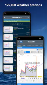
FishWeather is built around marine conditions, with information on tides, waves, wind, alerts, and radar. These tools can help you assess what is happening around a planned fishing or boating location and keep an eye on changing weather. Available details may vary by place, so check the relevant map and forecast before heading out.
Who develops FishWeather, and what devices can install it?
FishWeather is developed by WeatherFlow and is a weather app for people interested in marine conditions. It is suitable for a general audience, and the current version requires Android 5.0 or later. Before downloading, check that your device meets this requirement and that you are choosing the version offered for your platform.
What is FishWeather: Marine Forecasts used for?
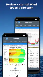
FishWeather: Marine Forecasts is designed for anglers, boaters, sailors, and anyone who needs marine weather information. It provides access to wind speed, wind direction, wave conditions, weather forecasts, and observation data for coastal and offshore locations. The app can help users choose safer times to go on the water and plan activities around changing marine conditions.
Does FishWeather provide accurate wind and wave forecasts?
The app gathers marine weather information from forecasting services, weather stations, buoys, and other available data sources. Accuracy can vary depending on the location, forecast model, distance from observation stations, and how quickly conditions change. It should be treated as a useful planning tool rather than a replacement for official marine warnings, local knowledge, or professional navigation equipment.
Can I use FishWeather without an internet connection?
FishWeather generally requires an internet connection to load updated forecasts, weather observations, maps, and station information. Some previously viewed information may remain temporarily available through device caching, but users should not depend on this for an extended trip. Before leaving shore, it is recommended to check the latest conditions and download or record essential information when possible.
Pros
- Detailed marine forecasts tailored to specific locations.
- Useful wind
- wave
- and weather data for trip planning.
- Interactive maps make conditions easy to compare.
- Supports saved spots for quick access to favorite areas.
- Helpful for sailors
- anglers
- surfers
- and boat owners.
Cons
- Some advanced forecast features may require a subscription.
- Coverage and accuracy can vary by region.
- The interface may feel busy for first-time users.
- Frequent data updates can increase mobile data usage.
- Forecast terminology may be difficult for casual users.
- Category
- Weather
- Version
- 5.0