Radar GO-X: HUD, GPS, Maps
- 950.00
- 4.2
- Installs
- 10.00M
- Price
- Free
Screenshots
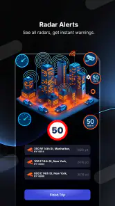
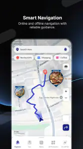
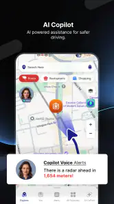
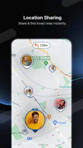
Analysis by Reviewed
The first few times I tried Radar GO-X: HUD, GPS, Maps, its appeal was easy to understand: it brings several driving-oriented tools together in one place, so I could explore more than a standard turn-by-turn map. That mix can feel especially handy when I’m heading somewhere unfamiliar and want navigation, speed information, or a radar-related view close at hand. The real question, though, is whether it becomes part of a useful routine after the novelty of switching between modes wears off.
What the first week feels like
As a free Maps & Navigation app from duff hl studio, it has a low barrier to trying it. The store details show a 4.2 average from around 58,000 ratings and more than 10 million installs, which suggests many people have given it a look, though popularity alone doesn’t tell me whether its particular mix suits my driving habits. It’s rated for Everyone, and the current version is 5.31.0, with Android support starting at version 6.0. I’d treat the first session as an orientation rather than assuming every tool will be useful on every trip.
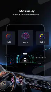
My practical tip is to set up and inspect the screen before setting off, then leave the phone alone while moving. A HUD can be appealing, but its usefulness depends on the car, the phone’s placement, glare, and whether the projected image is readable. I would test it while parked, not try to adjust it in traffic. And even if the app offers a speedometer, I’d use the vehicle’s own speed display as the reference rather than relying on a phone as a safety-critical instrument.
Getting Started with Radar GO-X
The first thing you'll notice when you fire up Radar GO-X: HUD, GPS, Maps is its sleek, user-friendly interface. It's like the app is giving you a big, warm welcome to the world of seamless navigation. Setting it up is a breeze—just a few taps and you're set to go. It’s perfect for those of us who aren’t exactly tech wizards but still want to feel like one.
The Features That Make It Stand Out
So, what makes this app a must-have on your device? Well, let's dive into some of its standout features. The app provides real-time GPS navigation, which is a lifesaver for anyone prone to getting lost. But it doesn’t stop there! The HUD (Heads-Up Display) mode is nothing short of magical. Picture this: your navigation details projected right on your windshield. It’s like having a slice of the future today.
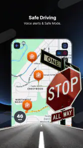
Another feature that I absolutely love is the detailed map view. It’s comprehensive yet easy to read, making sure you’re never caught off guard by sudden turns or exits. Plus, the voice-guided navigation is super precise, ensuring you keep your eyes on the road while still being informed about the next move.
Performance and Usability
Now, let’s talk performance. The app runs smoothly, even on older devices, which is a huge plus. I’ve tested it on both Android and iOS, and it was like a charm on both platforms, consistently delivering accurate directions without any hiccups. The developers clearly put a lot of thought into optimizing it for all users.
You May Like

Clash of Clans Is Won Between the Battles

Android Auto Makes the Case for Quieter Car Software

MobiOffice: Transforming Mobile Productivity with Seamless Integration

EA SPORTS FC™ Mobile Soccer: Redefining Mobile Sports Gaming

How Microsoft OneDrive Became a Mobile Productivity Giant

How Google Translate Breaks Language Barriers Effortlessly
The usability is top-notch, thanks to its intuitive design. Whether you’re planning a long trip or just a quick drive across town, setting your destination and preferences is straightforward. And let's not forget, it adapts quickly to changes in route, so you’re never left scrambling for an alternative path.
Making it useful beyond the novelty
To get recurring value from the combination of navigation, HUD, speedometer, location tracking, radar information, and flight tracking, I’d choose only the tools relevant to the day. For an unfamiliar drive, I’d keep the route guidance central and treat the other views as occasional checks, not a dashboard to monitor constantly. For someone who regularly follows flights as well as drives, having both interests represented in one app may be convenient; for a driver who only wants reliable directions, it may be more than they need.
There’s also a sensible trade-off in using a feature-rich navigation app: more options can mean more setup and more chances to be distracted. I’d decide on a preferred view before leaving, mount the phone securely, and let spoken prompts do the work. If a route change comes up, I’d pull over somewhere safe before interacting with the screen. For a commute on familiar roads, a simpler map app may be easier to glance at and maintain as a daily habit.
When another navigation choice fits better
I see Radar GO-X as an extra set of driving tools rather than an automatic replacement for every map app. A conventional navigation app is often the better choice if I mainly need a familiar route-planning workflow and want to keep the screen uncluttered. A dedicated vehicle display is preferable for speed checks, while a separate flight-tracking tool may make more sense for someone whose main interest is aviation. The advantage here is the breadth of the toolkit; the compromise is that not every part will earn a place in everyone’s routine.
One realistic use is a weekend drive to a venue I’ve never visited: I can set the destination before leaving, follow voice directions, and use the map to prepare for turns rather than repeatedly handling the phone. On the return trip, I might skip the HUD if reflections make it difficult to read. That flexibility matters more than trying to use every feature at once. If the display is hard to see or the interface feels busy, switching back to a plain map view—or to another navigation app—is a reasonable choice, not a failure to use this one properly.
Month-to-month value and upkeep
The app is free to download, with in-app purchases listed from $4.99 to $29.99 per item. I’d spend time with the free experience before considering any purchase, and only pay if a specific option solves a recurring problem for me. That makes the decision practical: occasional travelers may not need to invest, while someone who uses its added tools regularly can judge whether they justify the cost. Its 2021 release gives it a longer history than a brand-new utility, but I’d still make a habit of checking that the app is current and that its directions suit the journey I’m taking.
Maintenance is mostly about keeping the experience ready before a drive: check the route, choose a readable view, and avoid changing settings while moving. Location-based tools are only useful when the phone can determine where it is, so I’d confirm that location access and the device itself are working before relying on guidance. I would also keep a familiar backup route or map option in mind for trips where a missed turn would be costly. That small bit of preparation is more valuable than assuming any navigation app will handle every situation perfectly.
What makes it tiring over time
The same variety that makes the app interesting at first can become its main source of friction. If I have to decide between several views every time I start the car, or keep checking whether the HUD is readable in changing light, the extra choice can feel like work rather than help. I’d simplify the routine to one default navigation view and change modes only when a trip gives me a clear reason. That way the unusual tools stay available without demanding attention on every ordinary drive.
There is also a difference between an impressive feature and a dependable daily habit. A HUD may be useful on a route where a quick glance helps, yet unnecessary in a familiar neighborhood where I already know the turns. Flight tracking has a different rhythm altogether: it may be valuable when I’m watching a particular journey, but it won’t add much to a regular commute. I’d judge each part by whether I return to it naturally, not by how many options the app can put on the screen.
A practical routine for mixed trips
For a normal weekday, I’d set the destination before pulling away, check that the selected view is legible, and use voice guidance rather than attempting to watch the map continuously. On a longer drive, I’d review the route while parked before entering unfamiliar roads, then let the map help me anticipate complex turns. This small workflow makes the app’s range more useful: I’m using the map for orientation, the spoken prompts for timing, and the HUD only if it remains clear in my car.
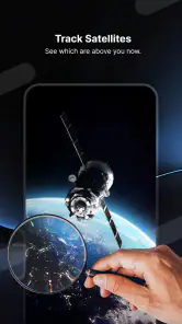
For an airport pickup, the combination of driving tools and flight tracking could be more relevant than it is on an ordinary errand. I could use the navigation side for the drive and consult the flight-related view when I need to follow an arrival, rather than juggling separate interests across several apps. I would still keep those tasks separate while the car is moving: check flight information before setting off or once safely parked. The convenience is having the tools in one place, not a reason to multitask behind the wheel.
Who is likely to keep it installed?
I’d keep it around if I genuinely use more than one of its driving or tracking tools, or if the HUD makes routine routes easier to follow in my particular car. I’d skip it if I only need basic directions, dislike configuring a phone for driving, or already have a vehicle display that covers the same needs. The useful test is simple: after a few trips, do I reach for a feature because it solves a real task, or am I opening the app just to revisit the novelty?
My long-term verdict
What earns this app a lasting place is not the number of modes but the fit between those modes and my routine. If I drive unfamiliar routes often, appreciate having speed and location tools nearby, or follow flights as part of the same day, its range can justify keeping it installed. If my needs are limited to dependable point-to-point directions, a streamlined navigation app will probably feel calmer and require less attention. That is a genuine distinction, not a flaw that every user should try to overcome.
I’d give the free version time to prove its usefulness before spending on an in-app option, and I’d keep the vehicle’s own instruments and safe driving habits ahead of any phone display. For me, the strongest case is occasional variety that solves a recurring task, rather than using every feature on every trip. Radar GO-X: HUD, GPS, Maps is worth trying if that blend matches the way you travel; it is not one I’d insist every driver needs.
So, if you’re on the hunt for a navigation app that combines functionality with a touch of futuristic charm, give this one a spin. Trust me, you won’t hit the road without it again!
Radar GO-X: HUD, GPS, Maps Frequently Asked Questions
Is Radar GO-X easy to set up for a first-time user?
Radar GO-X is a Maps & Navigation app from duff hl studio, with a focus on radar finding, speed-camera information, flight tracking, HUD, location tracking, and speedometer tools. If you are new to navigation apps, start by exploring the available screens and settings before using them on a trip. That gives you a chance to understand the controls and choose the functions that are most useful to you.
Can I use Radar GO-X while driving, and what should I keep in mind?
Radar GO-X includes navigation-related tools such as a HUD and speedometer, so it is intended to support a driving routine. Set up the app before you set off, and avoid handling your phone while driving. If you use the HUD, position the phone securely and make sure the display is easy to see without distracting you from the road. Safe driving should remain your priority.
Is Radar GO-X free to download, and what might require payment?
Radar GO-X is free to download, so you can try its maps and navigation tools without paying upfront. The app also offers in-app purchases, with items priced from $4.99 to $29.99. Check the purchase details shown in the app before confirming anything, especially if you are considering paid features. Its content rating is Everyone.
What is Radar GO-X: HUD, GPS, Maps?
Radar GO-X: HUD, GPS, Maps is a comprehensive navigation app designed to enhance your driving experience. It offers features such as HUD (Heads-Up Display), GPS navigation, and detailed maps, making it easier for users to find their way, avoid traffic, and reach their destinations efficiently. This app integrates advanced technology to provide real-time updates and accurate routing information.
How does the HUD feature work in Radar GO-X?
The HUD (Heads-Up Display) in Radar GO-X projects essential driving information onto your windshield, allowing you to keep your eyes on the road while accessing navigation details. It displays speed, directions, and other critical data directly in your line of sight, enhancing safety and convenience during your drive. This feature requires your smartphone to be correctly positioned to reflect the information.
Pros
- Intuitive user interface for easy navigation.
- Accurate GPS tracking for precise location.
- Customizable HUD display settings.
- Offline maps available for remote areas.
- Real-time traffic updates included.
Cons
- Battery drain due to constant GPS use.
- Limited features in free version.
- Occasional map lag in dense areas.
- Requires internet for live traffic updates.
- Ads present in the free version.
- Category
- Maps & Navigation
- Version
- 5.31.0













