onX Offroad: Trail Maps & GPS
- 2.62K
- 3.3
- Installs
- 1.00M
- Price
- Free

Screenshots
Analysis by Reviewed
When I choose a navigation app for a remote drive, I care about more than finding a line on a map: I want to know what the map can help me decide, what I should check for myself, and whether it suits the way I travel. onX Offroad: Trail Maps & GPS is an off-road-focused option from onXmaps, rather than a general turn-by-turn navigator. It is free to download, has an average rating of 3.3 from around 5,600 ratings, and has been installed over a million times. Those figures suggest a sizable audience but mixed reactions, so I would treat it as a planning aid to test on familiar ground before relying on it far from home.
Deciding what to trust before a trip
For me, trust in a navigation tool is practical rather than abstract: can I check the map before leaving, understand what a displayed boundary means, and make choices about what I save or share? This app is designed for off-road planning, where a mistaken turn can have more serious consequences than taking the wrong city street. I would use its maps to inform a plan, not to make the app the sole authority on access, current conditions, or safety.
That distinction matters most when a route passes through remote or mixed-ownership land. A digital map can make a trip easier to prepare, but it cannot replace posted signs, local rules, or judgment at the trailhead. My preferred approach is to treat the screen as one source of context, then stop and reassess if the real-world situation conflicts with what I expected.
Useful controls are the ones you choose to use
Waypoints, saved routes, and offline downloads give me practical choices about how to prepare. I can decide which points deserve a place on the map, which area I need available without service, and whether a route is worth keeping for another outing. Those are useful forms of control because they support a deliberate plan instead of leaving me to depend on memory at every junction.
I would also make a quick settings and sharing check before using any app for a trip that involves a private meeting place or a recurring route. The important habit is to share only what the group needs and to think carefully before making sensitive locations visible. I avoid assuming that a particular privacy control exists or works in a particular way unless I can see it in the app myself.
Planning routes, not just following a line
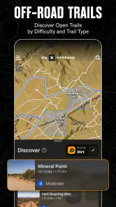
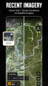
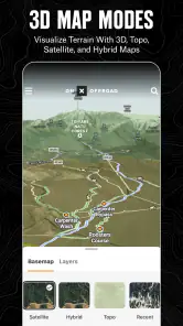
First off, the sheer amount of trail maps available on this app blew my mind. Whether you’re a seasoned off-roader or a newbie looking to dip your toes into this exciting world, onX Offroad has something for everyone. With over 550,000 miles of trails, you’ll never run out of new paths to explore. I personally love how detailed these maps are, providing information on trail difficulty, open and close dates, and even weather conditions. It’s like having a knowledgeable local guiding you every step of the way!
GPS That Works Even When You’re Off the Grid
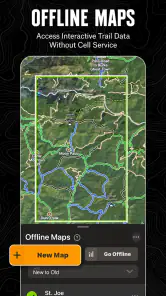
One of my biggest concerns when venturing into the wild is losing signal and getting lost. But with onX Offroad, that’s a worry of the past. The app’s offline maps feature is a lifesaver, allowing you to download maps and access them without cell service. It’s incredibly reassuring to know that no matter how deep into the wilderness I go, I’ve got reliable GPS guiding me back home.
You May Like

Clash of Clans Is Won Between the Battles

Android Auto Makes the Case for Quieter Car Software

MobiOffice: Transforming Mobile Productivity with Seamless Integration

EA SPORTS FC™ Mobile Soccer: Redefining Mobile Sports Gaming

How Microsoft OneDrive Became a Mobile Productivity Giant

How Google Translate Breaks Language Barriers Effortlessly
Making the map useful before departure
I get the most value from an off-road map before the tires leave pavement. I would save a likely route and mark the turnoffs or meeting points I might need to find again, then download the area while I still have a connection. That order matters: offline access is only useful if the right map is already on the phone. A quick check of the downloaded area before setting out can prevent the frustrating discovery that the map stops short of the route you planned.
A realistic use is a weekend drive where a familiar forest road leads to several branches. I’d use the map to compare options, note a sensible turnaround point, and keep the group’s meeting spot easy to identify. If plans change, the saved markers can make it easier to regroup without relying on everyone remembering the same junction. I would still tell someone outside the vehicle where I’m going and when I expect to return; a navigation app is not a substitute for a trip plan or sound judgment.
Customizable Experience
Another feature that’s worth mentioning is the app’s customization options. You can save your favorite trails, create waypoints, and even share your adventures with friends. It’s like your own personal trail diary where you can track your progress and revisit those epic off-road moments. Plus, the app’s user interface is super intuitive, making it easy for anyone to customize their off-roading experience.
One useful habit is to give waypoints names that describe their purpose, not just their location: a junction, a planned stop, or the point where the group should turn around. That small bit of organization is more helpful than collecting a long list of unnamed pins. I’d also review saved routes before a trip rather than assuming an old plan still fits; access conditions and personal plans can change, and a map cannot make those decisions for you.
Property information calls for care
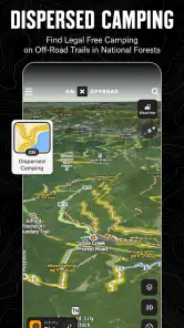
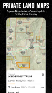
Public-land and private-property context can be especially valuable when a route crosses a patchwork of ownership. I see that layer as a prompt to check boundaries and permitted access carefully, not as permission to cross a gate or drive wherever a line appears. When the map raises a question, I would pause and verify the route through appropriate local sources instead of treating the display as a final ruling. That cautious approach is important for respecting landowners and avoiding an unpleasant surprise on the trail.
On privacy and trust, I prefer to judge an app by the controls I can actually see and use, rather than guess at its data practices. Before saving or sharing a route, I would look through the app’s current settings and review what information I am choosing to make visible. The practical point is simple: a waypoint can reveal a meeting place or a routine, so I would share only what friends need for that trip and avoid posting sensitive locations casually.
Community and Safety First
What really sets onX Offroad apart is its focus on community and safety. The app connects you with fellow off-road enthusiasts, offering a platform to share tips, reviews, and even trail conditions. Safety is also a top priority, with features like emergency location sharing and updates on trail closures ensuring that you’re always in the know. It’s reassuring to be part of a community that’s not only passionate about off-roading but also committed to keeping each other safe.
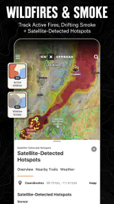
Community reports can help me spot issues worth investigating, but I would not treat a user update as a guarantee that a trail is open or passable today. Conditions can shift, and a vehicle that handles one obstacle may not be right for another. I’d use reports as one input, then check signs, closures, and conditions on the ground. For a group outing, agreeing in advance who is navigating and how the group will respond if vehicles get separated is more useful than assuming an app alone will keep everyone together.
Making a group plan work
When several vehicles are travelling together, I would make sure everyone knows the planned route and rendezvous point before setting off, rather than assuming that one person’s phone will solve every separation. A waypoint is most useful when it represents a decision the group has agreed on: where to wait, where to turn back, or where to regroup if the route divides. This also helps passengers follow the plan without having to interpret every map detail while the driver is concentrating on the trail.
For a first outing, I would keep the route modest and use the app on roads I can reasonably assess, then note where the downloaded map, route display, and actual junctions match or differ. That trial run is a better way to learn the interface than discovering its limits on a long remote trip. It also gives me a chance to make sure the phone is charged and the map area covers the full route, including the way back.
Who will get the most from it
This is a better fit for people who regularly plan trips on unpaved routes, explore unfamiliar trail networks, or want land context alongside navigation. It is less compelling if you mainly need city directions, public-transit guidance, or a simple road-trip navigator; a conventional maps app is usually more convenient for those jobs. Likewise, anyone who prefers not to prepare routes or manage offline downloads may find a dedicated off-road map takes more effort than they need.
The app is free to start, but it also offers in-app purchases ranging from about ten dollars to about a hundred dollars per item. I would check which functions matter to my own trips before paying, rather than assume every off-roader needs an upgrade. It is rated for Everyone, runs on Android 8.0 or later, and its current version is 25.44.0. With around 2,600 written reviews alongside its rating, there is a substantial set of user feedback to consult, though individual experiences will naturally vary by device, location, and expectations.
What to compare before choosing
Against a general-purpose maps app, the difference is the kind of question each tool answers well. A familiar road navigator is usually quicker for ordinary errands and paved routes; this app is more relevant when I need to think about trails and land context. If I already use another specialist map, I would compare the areas and planning details that matter to my own outings instead of assuming that one app will be best everywhere. For a trip with poor reception, I would also check the offline workflow in advance rather than treating a download button as proof that every part of a route is ready.
There is a real learning cost in that preparation. Someone who wants to open a map and immediately follow spoken directions may find this less straightforward than a mainstream navigation app. On the other hand, a careful planner may value being able to examine the route, save relevant points, and prepare for stretches without service. My choice would depend less on how often I drive and more on whether I regularly leave paved roads and am willing to plan before departure.
A measured recommendation
Compared with a general navigation app, onX Offroad is more relevant when the question is where a trail goes and what land context surrounds it; a regular road map is still the simpler choice for everyday driving. The trade-off is that specialized planning asks you to prepare: download the area, organize useful markers, and use good judgment when map details and real-world conditions do not line up. Offline GPS can help you orient yourself without cell service, but it should not be mistaken for a promise that every route is safe, accessible, or current.
If you are wondering whether you need a paid option, I would first identify the specific capability you expect to use and check what is available in the app before spending. The purchase range is broad enough that the right decision is personal rather than automatic. If you only take an occasional local drive, the free starting point may be enough to test whether the mapping style suits you; if you plan more involved trips, judge any upgrade by the concrete tools it adds to your own routine.
For Android users, the minimum system requirement is Android 8.0, and the app is also available for iOS. I would install it before a trip, take time to learn the map and download process, and test it somewhere familiar. That answers the most practical questions—whether it fits your phone, whether you can prepare the area you need, and whether its interface feels comfortable—without turning a remote outing into a first-use experiment.
In a nutshell, onX Offroad: Trail Maps & GPS is more than just an app; it’s your ultimate off-roading companion. Whether you’re looking to explore new trails, ensure your safety, or connect with a community of like-minded adventurers, this app has got you covered. So, gear up, download the app, and hit the trails with confidence. Happy off-roading!
onX Offroad: Trail Maps & GPS Frequently Asked Questions
Is onX Offroad easy to use for someone new to off-roading?
The app is built around maps and navigation, so it can be useful even if you are just starting to explore off-road routes. You can use it to look for trails, follow your position with GPS, and prepare before setting out. Taking time to review a route and its details before driving can help you feel more confident and choose a trip that suits your experience.
What is onX Offroad: Trail Maps & GPS used for?
onX Offroad: Trail Maps & GPS is an app designed for outdoor enthusiasts who enjoy off-roading. It provides detailed trail maps, GPS navigation, and various off-road features. Users can explore new routes, track their progress, and discover off-road trails with real-time updates and offline maps. This makes it an essential tool for adventurers seeking to explore and navigate the outdoors safely.
Can onX Offroad be used offline?
Yes, onX Offroad allows users to download maps for offline use. This feature is particularly useful in remote areas where cellular service may be unavailable. By downloading the maps in advance, users can access trail information, GPS tracking, and navigation without needing an internet connection. This ensures a seamless off-road experience even in the most remote locations.
Is onX Offroad suitable for all types of vehicles?
onX Offroad is designed to accommodate a wide range of off-road vehicles, including SUVs, trucks, ATVs, dirt bikes, and more. The app provides information on trail difficulty, vehicle type recommendations, and trail conditions, helping users choose routes that are suitable for their specific vehicle. This versatility makes it a great tool for all off-road enthusiasts, regardless of their vehicle type.
How does onX Offroad help with trip planning?
onX Offroad offers comprehensive trip planning features, allowing users to plan routes, mark waypoints, and track their progress. Users can save favorite trails, share routes with friends, and receive updates on trail conditions. The app's detailed maps and real-time information help users plan their off-road adventures efficiently, ensuring they are well-prepared for their trips.
Pros
- Extensive trail database for off-road adventures.
- Offline maps available for remote areas.
- Real-time GPS tracking with precise accuracy.
- User-friendly interface and easy navigation.
- Regular updates with new trails and features.
Cons
- Subscription required for premium features.
- Limited free trial period.
- Occasional GPS signal loss in dense forests.
- Some trails may lack detailed information.
- App size can be large
- using significant storage.

- Category
- Maps & Navigation
- Version
- 25.44.0













