Washington D.C. Map and Walks
- 11.00
- 3.8
- Installs
- 10.00K
- Price
- Free

Screenshots


Analysis by Reviewed
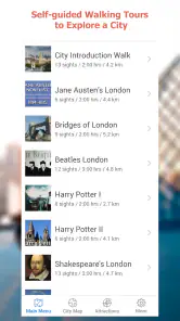
Washington D.C. Map and Walks is the kind of travel app I would use when I want a simple plan for seeing the capital on foot without building an itinerary from scratch. It belongs to the Travel & Local category, comes from GPSmyCity.com, Inc., and focuses on self-guided walks around Washington, D.C. Rather than trying to be a complete city guide, it gives the trip a more defined shape: choose a walk, follow the route, and explore at your own pace.
That focused approach is useful for a first visit, a short stop between appointments, or an afternoon when I want to see several landmarks without constantly deciding where to go next. It is also a free app, which makes it easy to try before committing to a more elaborate travel-planning service. In my experience, its value depends less on entertainment and more on whether a structured walking route matches the way you like to travel.
How clearly the app supports different ways of exploring Washington
Readable planning for a short city visit
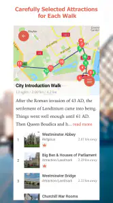
The strongest idea here is the self-guided walk. I do not have to begin with a blank map and search for attractions one by one. A route-based format turns a large city into a manageable sequence, which is especially helpful when I am unfamiliar with Washington, D.C. or have only a limited amount of time.
The app’s short store description calls it a Washington D.C. map, but I find that description slightly undersells the practical difference between a general map and a walk-centered guide. A normal map is excellent when I already know where I am going. This app is more useful when I want help choosing a direction and connecting places into an outing.
For readability, the main benefit is reduced decision-making. I can select a walk instead of comparing dozens of unrelated points of interest. That is a meaningful advantage for travelers who find busy planning screens tiring or who prefer a clear beginning, middle, and end to a sightseeing session.
At the same time, I would not treat it as a replacement for every other navigation tool. A dedicated map service is usually better when I need live traffic, public-transit changes, detailed accessibility information, or a quick route to a specific address. Washington D.C. Map and Walks makes more sense as the sightseeing layer of a trip, not necessarily as the only navigation app on my phone.
Following a route without rushing
A self-guided format gives me control over pace. I can stop for photographs, take a break, spend longer at a landmark, or abandon the walk when the weather changes. That flexibility is more comfortable than a tightly scheduled tour, particularly for travelers who need regular pauses or who prefer not to keep up with a group.
More From Our News Desk

Clash of Clans Is Won Between the Battles

Android Auto Makes the Case for Quieter Car Software

MobiOffice: Transforming Mobile Productivity with Seamless Integration

EA SPORTS FC™ Mobile Soccer: Redefining Mobile Sports Gaming

How Microsoft OneDrive Became a Mobile Productivity Giant

How Google Translate Breaks Language Barriers Effortlessly
There is also a useful psychological benefit. When I have a route in front of me, I am less likely to waste energy wondering whether I am missing an important nearby sight. I can concentrate on the surroundings instead of repeatedly reopening a search screen. For someone visiting Washington for the first time, that sense of direction can make a busy day feel calmer.
My practical suggestion is to review the chosen route before leaving the hotel or starting point. I would check how long I realistically want to walk, identify a place where I could pause, and keep a general map available as a backup. That small preparation matters because a sightseeing route may be interesting without matching my energy level, mobility needs, or schedule on a particular day.
Useful in a realistic everyday travel scenario
Imagine arriving in Washington after a morning meeting with three free hours before dinner. I would not want to spend the entire break researching monuments, comparing blogs, and manually arranging stops. I could open this app, choose a suitable self-guided walk, and use it as a ready-made outline for the afternoon.
If I became tired halfway through, I could stop treating the route as a checklist and simply use the nearby sights as a natural endpoint. That is one of the better ways to use the app: as a flexible suggestion rather than a promise that every stop must be completed. The route gives structure, while I still decide how much of it fits the day.
This also works for a local who has visitors. Instead of improvising an entire tour, I could use a walk as a starting framework and add a favorite café, museum, or quieter street along the way. The app does not need to control the whole outing to be useful; it can remove the hardest part, which is deciding how to connect the first few places.
Motor considerations and the realities of walking
From a motor-access perspective, the self-guided design has an important strength: there is no group pace to match. I can move slowly, pause frequently, or divide a walk into smaller sections. That is a better fit for people who need to manage stamina than a fixed tour with a departure time and a guide waiting for everyone.
However, a route being walkable in a general sense does not automatically mean it is suitable for every mobility situation. Streets, crossings, slopes, crowds, construction, and the distance between rest opportunities can change the experience considerably. I would not rely on this app alone to determine whether a particular walk works for a wheelchair, walker, cane, or limited standing tolerance.
My advice is to use the app for orientation and combine it with current local information before setting out. If step-free travel or a specific surface condition is essential, I would verify those details separately and keep an alternative stop nearby. This is not a criticism of the walking concept; it is a reminder that a route guide and an accessibility planner answer different questions.
There is a second motor-related issue that is easy to overlook. Holding a phone while walking can be awkward, especially when I need both hands for balance, a mobility aid, or carrying belongings. I would preview the route, reduce the need to interact with the screen while moving, and stop in a safe place whenever I need to check the next section. That workflow is safer and less tiring than trying to navigate continuously while crossing streets.
Sensory comfort and attention while sightseeing
Washington can be visually and audibly intense: traffic, crowds, large open spaces, sudden weather changes, and busy tourist areas all compete for attention. A route-based guide can help by limiting the number of decisions I make at once. Instead of searching for the next destination in a crowded environment, I can follow a prepared sequence and focus on one area at a time.
That said, a phone-based guide still requires visual attention. Travelers with low vision, light sensitivity, hearing differences, or difficulty processing crowded information should consider how they prefer to receive directions before starting. I would enlarge the phone’s text if needed, use a high-contrast system setting where available, and read the route while stationary rather than trying to interpret a screen in motion.
I also recommend planning a quieter fallback. A walk that looks manageable on paper may pass through a particularly crowded area at the wrong time of day. If noise or visual density becomes overwhelming, the best use of the app is to pause, step away from the busiest section, and resume only if the route still feels comfortable. The app provides structure, but it cannot remove the sensory character of the city itself.
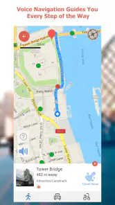
For users who depend on audio instructions, I would be cautious about assuming that a written walking guide offers the same experience as a turn-by-turn voice-navigation tool. A conventional navigation app may be the better companion when spoken directions are central to the trip. I see this product as more suitable for people who are comfortable checking a visual route and making ordinary on-the-ground judgments.
Situational access for different travel contexts
The app is particularly appealing for independent travelers, couples, families with older children, and visitors who dislike scheduled tours. It can also help someone who has already seen the famous headline attractions and wants a more intentional way to connect parts of the city. Because the walks are self-guided, I can adapt the day instead of committing to a guide, a group, or a rigid timetable.
Families should still decide in advance how much walking is realistic. Children may enjoy the freedom to explore, but a long sequence of stops can become tiring quickly. I would choose one walk as the main activity, identify a natural stopping point, and avoid presenting completion as the goal. The app works best when it supports curiosity rather than turning sightseeing into an endurance test.
For solo travelers, the route format can provide reassurance because I have a defined plan rather than wandering without context. I would still use normal city awareness: keep the phone secure, avoid staring at the screen while crossing, and make sure someone knows the general area I plan to visit. A travel guide can organize an outing, but it does not replace sensible personal safety habits.
For visitors using public transportation, I would treat the app as one part of the journey. A walk may begin some distance from my hotel or end far from the next appointment, so I would check the connection before leaving. This is a key trade-off compared with a broader city app: the walking experience may be more focused, while the surrounding logistics may require another tool.
What the free model means in practice
There is no purchase required to install the app, so I can test whether its walking style suits me without paying upfront. Optional in-app purchases are listed at $4.99 per item, which is worth keeping in mind if I want to unlock additional material or expand what is available inside the app.
I would approach the purchase decision practically. First, I would use the free portion to see whether the route presentation is comfortable to read, whether the available walks match my interests, and whether the app fits my pace. Paying for more content makes sense only if I already know that the format helps me explore.
This is also where the app compares favorably with a guided excursion for budget-conscious travelers. A paid tour may provide a person who answers questions and manages the group, while this app offers independence and a lower initial commitment. The trade-off is that I am responsible for interpreting the route, handling changes, and deciding when conditions make a detour sensible.
Remaining barriers and points of friction
The biggest limitation is scope. A collection of self-guided walks is not the same as a complete travel assistant. I would not choose it as my only tool for live transit decisions, detailed venue planning, emergency information, or highly specific accessibility research. Those needs call for specialized services or direct confirmation from the places I plan to visit.
Another barrier is the difference between a planned route and the city as it exists today. Streets can be crowded, weather can shift, and temporary closures can affect the most convenient way through an area. I would keep enough flexibility to leave the suggested path when necessary. Following the line on a screen too literally can create more stress than simply taking a sensible detour.
Phone dependence is another consideration. A long day outside can mean a low battery, glare, rain, or difficulty handling the device with gloves. I would start with a charged phone, review the route before walking, and keep a simple backup plan in mind. These are ordinary travel precautions, but they matter more when the app is guiding the shape of the outing.
The app’s history also tells me that it is an established product rather than a brand-new experiment: it was released in June 2013 and is currently at version 59. Its average rating is 3.8 from 49 ratings, with 11 written reviews, and it has reached over 10K installs. I read those figures as a sign of a modest, specialized tool with some real-world use, not as proof that it will satisfy every traveler.
It is available for users aged Everyone and requires iOS 11 or later. That makes the age classification broad, but parents should still judge each walk according to distance, weather, traffic, and their child’s needs. The operating-system requirement is simple enough to check before a trip, especially if I am using an older device that I keep as a travel backup.
Who should use it, and who should choose something else
I would recommend Washington D.C. Map and Walks to someone who wants a ready-made walking idea, prefers independent exploration, and is comfortable combining a sightseeing guide with ordinary map and transit tools. It is a good match for a first visit when I want direction without surrendering control, and for repeat visitors who want a reason to explore beyond their usual route.
I would be less enthusiastic about it for someone who needs detailed step-free routing, live spoken navigation, constantly updated transit information, or extensive venue-by-venue planning. In those cases, a mainstream navigation app, a dedicated accessibility resource, or an official local service may be more useful. The right choice depends on whether the main problem is finding interesting walks or solving complex movement logistics.
I would also skip it if I strongly prefer spontaneous wandering with no suggested sequence. The app’s central value is its structure, so a traveler who enjoys making every decision on the spot may find a general map less restrictive and more satisfying. Likewise, anyone expecting a virtual tour, a comprehensive historical encyclopedia, or a personal guide should set expectations accordingly.
My inclusive verdict on the walking experience
After looking at it as both a travel tool and an access-conscious companion, I see a useful but deliberately narrow product. Its best quality is the freedom to explore Washington at my own speed while starting from a route that someone has already organized. That can reduce planning fatigue, support flexible pacing, and make a short visit feel more purposeful.
Its limitations are equally important. It does not remove the physical, sensory, or logistical demands of an urban walk, and I would not assume that a suggested route is automatically suitable for every ability. The most inclusive way to use it is to preview the walk, adapt the length, plan rest points, protect attention while moving, and keep another source available for current access and transport details.
My final recommendation is to treat it as a flexible sightseeing framework, not a complete accessibility solution. For independent visitors who want a low-pressure way to discover Washington, D.C., the free starting point is appealing, and the optional $4.99 purchases can be considered after testing the experience. I would pair it with a general navigation app and personal planning rather than expecting it to handle every part of the trip.
In short, this is a practical choice when the question is, “Which walk should I take?” It is not the strongest choice when the question is, “Can I reach this place right now under very specific mobility or sensory conditions?” Knowing that distinction is what makes Washington D.C. Map and Walks genuinely useful: it gives me a route to begin with, while leaving the final decisions in my hands.
Washington D.C. Map and Walks Frequently Asked Questions
What devices and operating systems can run Washington D.C. Map and Walks?
Before downloading, check that your phone or tablet meets the app’s operating-system requirements. Washington D.C. Map and Walks is available for devices running iOS 11 or later. Meeting that minimum helps with installation, though keeping your device’s software current can also make everyday use smoother. The app is a travel and local guide from GPSmyCity.com, Inc., built around exploring the city on foot.
What is Washington D.C. Map and Walks?
Washington D.C. Map and Walks is a sightseeing app designed to help visitors explore the capital on foot. It combines self-guided walking tours with maps, route information, and descriptions of notable landmarks, museums, monuments, and historic areas. It is useful for travelers who prefer discovering the city independently instead of joining a scheduled group tour. Its focus is practical, independent exploration rather than booking a guided outing.
Does Washington D.C. Map and Walks work without an internet connection?
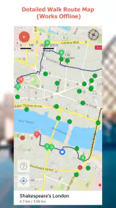
The app is intended to support independent sightseeing, and its offline features can be especially helpful when traveling without reliable mobile data or when trying to avoid roaming charges. Before starting a tour, users should open and download the required map or tour content while connected to Wi-Fi. Availability of every feature offline may depend on the app version and the content selected. Preparing before leaving your accommodation can make it easier to follow a route while out in the city.
Which Washington D.C. attractions and areas are included?
The app focuses on many of Washington, D.C.’s best-known sightseeing locations, such as monuments, memorials, museums, government buildings, and historic neighborhoods. The exact selection can vary according to the installed version and available tour packages. Travelers should review the tour list inside the app before downloading to confirm that it covers the landmarks and areas they most want to visit. This quick check can help you decide whether its walks fit your itinerary.
Is Washington D.C. Map and Walks suitable for first-time visitors?
Yes, the app can be a practical choice for first-time visitors who want structure without following a guide or fixed timetable. Walking routes help organize a day of sightseeing, while landmark descriptions provide useful context along the way. However, users should still check opening hours, security restrictions, weather, accessibility, and walking distances because the app cannot replace current information from official attraction websites. It works best as a companion to a little advance planning, especially when your day includes indoor attractions.
Pros
- Offline maps and routes are useful when mobile data is limited.
- Self-guided walks let you explore Washington at your own pace.
- GPS tracking makes it easier to follow routes and monitor progress.
- Covers major landmarks
- museums
- monuments
- and historic areas.
- Audio commentary adds context without requiring a live tour guide.
Cons
- Some walks or features may require an in-app purchase.
- Audio content can become repetitive on longer routes.
- GPS accuracy may drop near large buildings or crowded streets.
- Routes may not suit users with limited mobility or walking stamina.
- Content updates may not reflect every temporary closure or construction change.
- Category
- Travel & Local
- Version
- 59