GPSmyCity: Walks in 1K+ Cities
- 451.00
- 4.3
- Installs
- 500.00K
- Price
- Free

Screenshots
Analysis by Reviewed
Hey there, fellow wanderer! I recently stumbled upon this app called GPSmyCity, and let me tell you, it’s like having a travel buddy who knows all the cool spots in more than a thousand cities worldwide. If you're someone who loves to explore on foot and discover hidden gems, this app might just become your new best friend.
What to expect from a city walk
I’d think of this as a way to give a stroll some shape, rather than a replacement for every kind of travel tool. GPSmyCity is a free travel and local app from GPSmyCity.com, Inc., with a 4.3 average from around 2,800 ratings. It has been installed over 500,000 times, and its Everyone age rating makes it suitable for general audiences. The app offers self-guided walks across a broad range of cities, while optional in-app purchases range from $1.99 to $20.99 per item.
That mix is useful when I want a little context and direction but don’t want to join a scheduled group. I can imagine opening it on a free afternoon, choosing a walk that suits my time and interests, and leaving room to pause for lunch or a shop. The trade-off is that a prepared route has its own priorities: it may not match my pace, mobility needs, or idea of the perfect day. I’d treat the route as a starting point, not an obligation to keep moving.
Getting to Know GPSmyCity
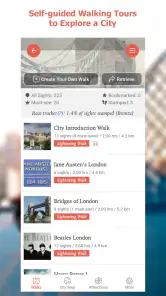
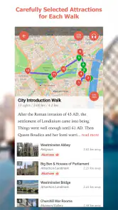
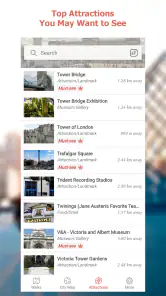
So, what’s the deal with GPSmyCity? Essentially, it's a navigation app designed to offer self-guided walking tours in over 1,000 cities. Imagine having access to curated city tours that guide you through historical landmarks, museums, art galleries, and more, all at your own pace. And the best part? No more fumbling with paper maps or trying to decipher foreign street signs. This app does it all for you!
First setup, without overplanning
For a first visit, I’d start by searching for the city I’m actually going to explore, then narrow the choice by the kind of walk I’d enjoy rather than picking the longest-sounding route. The app is free to install, but individual in-app purchases can apply, so I’d check what a particular walk requires before building a day around it. That small pause can prevent an awkward moment on the pavement when I discover that the next step isn’t included in what I’ve already accessed.
My practical tip is to make the route decision before leaving reliable Wi-Fi. The app’s offline access is a real advantage for travel, but downloading the relevant map and content ahead of time is what makes that advantage useful. I’d also open the walk once before setting out, confirm I can see the material I need, and bring a charged phone. Offline access helps with connectivity; it doesn’t remove the ordinary limits of a phone battery or guarantee that every detail of a changing street scene will match the guide.
Features That Make It Stand Out
Let’s dive into some of the cool features that make this app a must-have for any traveler:
More From Our News Desk

Clash of Clans Is Won Between the Battles

Android Auto Makes the Case for Quieter Car Software

MobiOffice: Transforming Mobile Productivity with Seamless Integration

EA SPORTS FC™ Mobile Soccer: Redefining Mobile Sports Gaming

How Microsoft OneDrive Became a Mobile Productivity Giant

How Google Translate Breaks Language Barriers Effortlessly
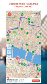
- Offline Accessibility: One of the biggest perks is that you can download maps and content to use offline. Perfect for when you’re in a place with spotty internet connection or trying to save on data.
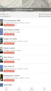
- Customizable Tours: You can either follow pre-set tours or create your own. Want to skip the museums and hit every coffee shop in town? Go for it!
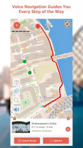
- Audio Guides: No need to read while you walk. Put on your headphones and listen to the stories and history of the places you visit.
- Regular Updates: The app is constantly updated with new destinations and tours, keeping your adventures fresh and exciting.
Your first satisfying walk
Now, let me share my personal experience with GPSmyCity. I decided to try it out during a weekend trip to San Francisco. I’m not exactly a tech whiz, but the app was super easy to navigate. After downloading the San Francisco map, I chose a walking tour that included Fisherman’s Wharf, Lombard Street, and Chinatown.
As I wandered through the city, the app guided me effortlessly from one spot to the next, with little tidbits of history and fun facts popping up along the way. I loved how it felt like having a personal tour guide without the hefty price tag.
Oh, and did I mention the app’s quirky audio guide? It was like having a local friend share insider stories—definitely made the experience more engaging. I only wish I had known about it sooner!
For a first-time user, success doesn’t have to mean completing every stop. I’d count it as a good first outing if I can follow the opening part of a route, learn something about one place, and still feel free to wander off for a break. A useful tactic is to glance at the next stop before leaving the current one: it gives me a chance to decide whether I want to continue, pause, or take a different street without constantly staring at my screen.
Making the route work for your day
One useful way to get more from a prepared walk is to treat its stops as anchors rather than a strict itinerary. Before starting, I’d look at the route’s general direction and pick a natural stopping point that leaves time for whatever comes next. That matters if I have a reservation, need to meet someone, or simply want to avoid turning a pleasant outing into a race. If I’m unsure how long I’ll want to walk, I’d begin with a shorter portion and decide later whether to continue.
I’d also use the route as a prompt to notice the spaces between its featured places. The named stops may provide the structure, but a street market, a quiet square, or an unexpected view can become the most memorable part of the outing. Pausing the walk for a spontaneous detour is a better fit for this kind of app than trying to follow every instruction while moving. It keeps the guide helpful without letting it take over my attention.
For a family or a group with mixed interests, I’d agree on a simple rule before setting out: choose the next stop together, then take breaks when someone needs them. A self-guided format removes the pressure of keeping up with a tour group, but it doesn’t automatically make a route suitable for every person. Checking the route’s character and length in advance, and being willing to leave it early, makes the experience more inclusive than assuming everyone wants the same pace.
Where it fits—and where it doesn’t
Compared with a general map app, GPSmyCity is more focused on giving a walk a narrative and a sequence of places, while a regular map is usually better when I need the quickest route to a specific address or want to compare transport options. Compared with a live, in-person tour, this app lets me pause and move at my own pace, but it can’t respond to questions or adjust its explanations to my interests. I’d choose it for independent sightseeing, not for urgent navigation or a deep, interactive history lesson.
It suits solo travelers, couples, and curious locals who enjoy walking and are happy to use a phone as a guide. It may be less comfortable for someone who wants a fully spontaneous day, dislikes checking a screen outdoors, or needs a route tailored to specific accessibility requirements. In a busy city, I’d stop somewhere safe to read rather than trying to follow directions while crossing streets. Headphones can make audio easier to hear, but I’d keep enough awareness of traffic and surroundings to walk safely.
A realistic use case is arriving in a city with a free morning before a booked activity. I’d choose a manageable walk, download its content in advance, and use the route to connect a few points of interest instead of spending the whole morning deciding where to go. If a café or a quieter side street catches my eye, I can pause and pick up again when ready. That balance—having a plan without surrendering the day to it—is where a self-guided walk makes the most sense.
There’s a different kind of value for people who live in a city they think they already know. I might use a walk on a weekend when I have no destination in mind, letting a themed route give familiar streets a fresh purpose. That is a better match than using the app for an errand, where the fastest practical route matters more than a sequence of sightseeing stops. It can also be a pleasant way to show a visitor around without needing to act as a full-time guide, as long as I’m comfortable adding my own local judgment.
Compared with browsing search results or social recommendations, a curated walk has the advantage of putting places into a route instead of leaving me to stitch together scattered suggestions. The trade-off is that a route’s selection may not reflect what I personally care about, and a general map remains more adaptable when plans change sharply. I’d use the walking guide to decide what to see, then keep a map app available for a quick detour or a return journey. Using both for different jobs is more sensible than expecting one tool to cover every travel need.
Common questions I’d settle before heading out
Do I need an internet connection throughout the walk? The offline maps and content are intended to help when the connection is poor or unavailable, so I’d prepare the material in advance rather than relying on a live connection. Is every walk included at no cost? The app is free, but in-app purchases are available, so I’d check the specific route’s access before setting off. Can I use it in my own city? Yes, its city-walk approach can be just as useful for seeing familiar streets with fresh attention as it is for a holiday.
One detail worth keeping in mind is that a guided route is still a route, not a promise that every stop will suit the moment I arrive. Weather, crowds, opening hours, and personal energy can change the day. I’d use the app for orientation and background, then make real-time choices based on what’s around me. That flexibility is more satisfying than treating the walk as a checklist.
If I’m planning to use the audio, I’d check that the relevant content is available before relying on it as my only way to follow along. A walk can still be useful when I prefer reading, but the best choice depends on how I like to take in information and what feels comfortable outdoors. I’d keep my phone accessible without holding it up constantly, and stop in a safe spot whenever I need to read or make a decision.
Another practical question is whether I should choose the app instead of a local guide. I wouldn’t frame it as an either-or choice for every trip. A self-guided route works well when I want control over timing, don’t need conversation, and am happy with prepared information. A person leading a tour is a better fit when I want questions answered, a local perspective shaped around the group, or a more social experience. The app’s strength is independence, not replacing those human qualities.
Why You Should Give It a Try
So, why should you download this app? Well, if you’re a travel enthusiast like me who loves to roam and discover, GPSmyCity is a game-changer. It’s convenient, informative, and adds an extra layer of adventure to your travels. Plus, the ability to use it offline is a huge bonus for those of us who are always battling with data limits.
The current version is 3.6.6, and the app’s walking-tour focus is its clearest strength: it helps me turn spare time into a more purposeful exploration without locking me into a guide’s timetable. I wouldn’t rely on it as my only travel resource, but I’d happily pair it with a general map for practical detours and use the walk for the stories and places along the way. If I wanted real-time transit help, highly customized accessibility planning, or a guide who could answer follow-up questions, I’d reach for another option instead.
For a cautious first try, I’d install it before the day of the walk, choose a route for a city I’m already visiting, and check what I can access before heading out. Starting with a short outing makes the decision low-pressure: I can see whether I enjoy having a route and commentary on my phone without committing my entire day to it. If that style suits me, I can make it part of a longer sightseeing plan; if not, a standard map still handles the practical basics.
If you’re planning a trip soon, or even if you just want to explore your own city in a new way, I highly recommend giving this app a shot. Who knows what treasures you’ll uncover?
So go ahead, download GPSmyCity, lace up those walking shoes, and let the adventure begin. Happy exploring!
GPSmyCity: Walks in 1K+ Cities Frequently Asked Questions
What is GPSmyCity and how does it work?
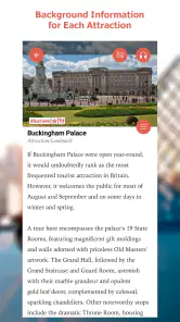
GPSmyCity is a travel app that offers self-guided walking tours in over 1,000 cities worldwide. It uses GPS navigation to guide you through various points of interest, offering detailed descriptions and historical information. The app functions offline, making it convenient for travelers without data access.
Can I choose a walk that matches my interests and travel plans?
The app is built around self-guided city walks, so it can suit travelers who want to explore at their own pace rather than join a scheduled group tour. Before downloading a walk, consider the places you hope to visit and how much time you have. The available tour content varies, so browse the city and walk options in the app to find a route that fits your plans.
Do I need an internet connection to use GPSmyCity?
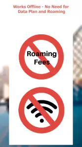
No, GPSmyCity allows you to download city maps and tour content for offline use. Once downloaded, you can access the guided tours without needing a Wi-Fi or data connection, which is perfect for international travelers looking to avoid roaming charges.
Are there any costs associated with using GPSmyCity?
GPSmyCity offers both free and premium content. While downloading the app and some basic features are free, access to detailed walking tours and additional content may require a purchase. Users can choose to buy individual tours or subscribe for full access to all content.
How does GPSmyCity ensure the accuracy of its information?
GPSmyCity updates its content regularly, drawing from contributions by local experts and travel writers. This ensures that the information is accurate and relevant. The app also encourages feedback from users to correct any discrepancies or outdated details.
Pros
- Offers offline maps for easy access.
- Includes detailed walking tours.
- Customizable routes for personal interests.
- Regularly updated with new cities.
- Integration with travel guides.
Cons
- Limited free features available.
- Some maps require in-app purchases.
- Occasional GPS inaccuracies.
- Not all cities have complete data.
- Interface can be overwhelming.
- Category
- Travel & Local
- Version
- 3.6.6