Google Earth
- 104.40K
- 3.8
- Installs
- 500.00M
- Version
- Varies with device
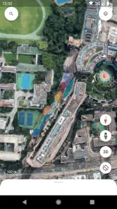
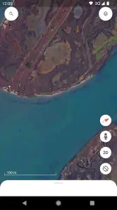
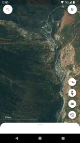
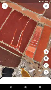
Screenshots

Ever wondered what it feels like to have the whole world at your fingertips? Well, with Google Earth, you can practically hold the globe in your hands without ever leaving your couch. This app is like having a passport to the entire planet, all packed into your smartphone or tablet. It's a powerful tool for those of us who love to explore, whether you're planning your next vacation or just curious about a place on the other side of the world.
Exploring the World Virtually
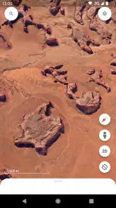
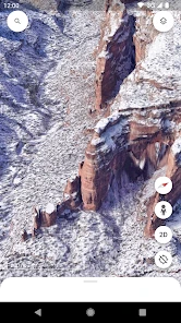
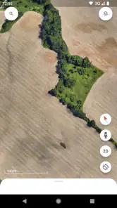
One of the coolest features in Google Earth is the ability to explore virtually any location on Earth. You can zoom in to see houses, streets, and even famous landmarks in stunning detail. It’s like having a bird’s eye view of anywhere you want. I remember the first time I used it, I spent hours just flying around different cities, checking out places I’d only dreamed of visiting. The 3D imagery is so crisp that you might find yourself zooming in and out just to catch every detail.
Street View and Beyond
And let’s not forget the Street View feature. Ever wanted to take a stroll down the Champs-Élysées or see the pyramids up close? Street View places you right on the ground, allowing you to explore streets and landmarks as if you’re actually there. It’s a bit surreal and totally fascinating. Plus, the app often updates its imagery, so you’re likely seeing locations as they are now, not years ago.
Voyager: A Curated Experience
If you’re someone who enjoys curated experiences, the Voyager section is a real treat. It’s like having a personalized tour guide. Voyager offers interactive stories and guided tours about nature, history, and culture. It’s educational and entertaining, perfect for those of us who love learning about the world around us. I personally got hooked on a series about the world’s biomes—it was like a documentary on steroids!
Latest News
Another standout is the ability to measure distances and areas directly on the map. Planning a hiking route or just curious about how far two places are from each other? This tool is super handy. Plus, if you’re someone like me who loves to geek out over geographic data, this is a dream come true.
Now, I’d be remiss not to mention that using Google Earth requires a decent internet connection. The app needs to stream a lot of data to deliver those beautiful images. So, if your connection is spotty, you might experience some lag. But hey, that’s a small price to pay for a trip around the world, right?
Conclusion: A Must-Have for Explorers
All in all, Google Earth is more than just an app; it’s an experience. Whether you’re a curious soul, a travel enthusiast, or just someone who loves learning new things, this app offers something for everyone. It’s like having the world at your beck and call, ready to be explored whenever the mood strikes. So, if you haven’t tried it yet, I’d say it’s high time you give it a go. Happy exploring!
Pros
- Stunning satellite imagery
- Interactive 3D maps
- Street View feature
- Historical imagery feature
- Educational tool
Cons
- Requires internet connection
- High data usage
- May drain battery quickly
- Complex interface for beginners
- Limited offline functionality