Offline Maps, GPS, Speedometer
- 138.00
- 3.8
- Installs
- 10.00M
- Price
- Free
Screenshots
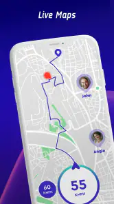
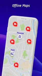
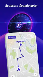

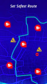
Analysis by Reviewed
I like to sort out navigation before I leave, not while I’m already trying to make a turn in a place I don’t know. That is where Offline Maps, GPS, Speedometer makes sense: it brings map use, GPS and speed information together for trips where signal may be patchy. It is a free Maps & Navigation app from Appcentric Team, rated for Everyone, and its current version is 1.3.19. Its average rating is 3.8 from around 15,000 ratings, with over 10 million installs. Those numbers suggest broad use, but I’d still judge it by how well it fits the way you actually travel.
Navigating Without Boundaries
First things first, the app's primary feature is its Offline Maps. I have to say, it's pretty impressive. No more buffering maps or waiting for your GPS to catch up while hiking through remote trails or driving through rural areas. The app lets you download maps for offline use, which means you’re not relying on data connectivity. It covers a wide range of locations, and the maps are surprisingly detailed, almost making you forget that you're not online. Thanks to its user-friendly interface, finding your way around has never been easier.
Where setup can trip you up
Offline navigation is only useful if the right area is saved before you lose service. I’d check the destination and the roads around it while still connected, rather than downloading a tiny patch that ends just before a turn or a junction. For a weekend drive, include the approach to your destination and a little room for a detour. That extra planning matters more than it sounds when a road closure or missed turn changes the route.
A useful habit is to open the saved map before setting off and confirm that it covers the whole leg you expect to travel. Offline maps and GPS solve different problems: a saved map can show the area, while the phone still needs a usable GPS signal to locate you. If the position is slow to settle indoors or among tall buildings, step into a clearer spot and give it a moment before assuming the map download failed.
More Than Just Maps
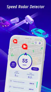
Besides navigation, the app also doubles as a Speedometer. If you're a road trip enthusiast like me, you'll love this feature. It gives real-time speed updates and alerts you if you’re going over the speed limit. It's like having a virtual co-pilot that keeps you in check. The app also logs your speed data, which is great if you’re curious about your driving habits or just want to keep track of your adventures.
I’d treat speed readings as a prompt to pay attention, not as permission to stop watching the road or the vehicle’s own instruments. GPS-based readings can take time to respond when speed changes quickly, and a phone display is not a substitute for safe driving. Set up your route and glance at information only when it is safe to do so; a passenger can handle checks on a busy trip.
The GPS That Works Everywhere
One of the standout features for me is the GPS functionality. It’s robust and reliable, which is exactly what you need when you’re somewhere new. Whether you're trekking through the mountains or navigating a foreign city, the GPS remains accurate and steady. No more getting lost or ending up in unexpected places, unless that's what you’re aiming for!
You May Like

Clash of Clans Is Won Between the Battles

Android Auto Makes the Case for Quieter Car Software

MobiOffice: Transforming Mobile Productivity with Seamless Integration

EA SPORTS FC™ Mobile Soccer: Redefining Mobile Sports Gaming

How Microsoft OneDrive Became a Mobile Productivity Giant

How Google Translate Breaks Language Barriers Effortlessly
If the location dot appears stuck, I’d first check the basics: whether location services are enabled, whether the phone has a clear view of the sky, and whether the app has been left open long enough to establish a position. Restarting the app or moving away from a covered area is a reasonable next step. On a long outing, save the destination details somewhere else too, so a drained battery or an unexpected phone issue does not leave you without a reference.
A practical trip, and the right expectations
Imagine driving from a town into a rural area for a day walk. Before leaving, I’d save the map around the trailhead and the route back, then check the location while still in town. Once parked, the GPS can help orient you, while the saved map remains available if mobile data drops. On the return drive, speed information can be a reminder to check your pace, but route decisions and road signs still come first.
Compared with relying only on a familiar online map app, this approach is useful when coverage is uncertain and you want offline access ready in advance. A dedicated navigation option may suit drivers who need deeper route planning, while a paper map is still a sensible backup for remote walks or a dead phone. I see this app as a handy extra layer, not a reason to skip preparation.
Who will get the most from it
I’d recommend this app most to people who travel beyond dependable mobile coverage but still want their phone to be useful for orientation. It can also suit someone who wants a speed display alongside map access without switching between separate tools. The strongest case is a trip planned in advance: save the relevant area at home or before departure, check it once, and then use the phone as a prepared navigation aid rather than expecting it to rescue an unplanned journey.
It is less compelling if you mostly commute on familiar roads with reliable data and already have a navigation app that meets your needs. It may also be the wrong primary tool for a driver who depends on detailed live traffic changes or specialized route choices. Offline access helps with connectivity, but it does not make every route decision current or remove the need to follow signs. For a demanding hike, I would still bring a route reference suited to the trail and tell someone where I’m going.
Making an offline plan more dependable
One practical trade-off is deciding how much map area to save. A narrow selection can be quicker to prepare, but it leaves little room if you miss a turn or decide to visit a nearby place. A broader area gives you more flexibility, though it is worth checking that the download is complete before you set off. I’d also think in route segments: save the town where the journey begins, the destination area, and the connecting roads rather than focusing only on the final pin.
If you are sharing the driving, agree on who will handle the phone before moving. The driver should not try to troubleshoot a map or interpret a speed alert while navigating traffic. If a route becomes confusing, pull over safely, check the saved map and surroundings, then continue. That simple workflow is more useful than repeatedly tapping at the screen while the car is moving.
Battery, reception, and other sources of friction
Offline maps reduce the need for a data connection, but they do not eliminate the phone’s dependence on power or location reception. A long drive with the screen active can still make battery planning important, so I’d start with a charged phone and take a charger or power bank when the trip warrants it. On a walk, keeping the screen on continuously is rarely necessary; checking your position at sensible pauses can help conserve power and keep attention on the route.
When the position is inaccurate, I’d separate the possible causes instead of immediately blaming the map. A saved area can be correct while the phone is still struggling to establish its location, especially under cover or between tall buildings. Moving to an open space and waiting briefly is a sensible first check. If the map itself does not show the expected roads, confirm that the correct area was saved and that the download finished while connected.
Where it sits beside familiar navigation tools
The app’s appeal is its combination of offline map access, GPS and speed information in one place. A mainstream online map may be more convenient when you want live information and do not expect to lose coverage; a dedicated car-navigation system may be a better fit for drivers who prioritize a vehicle-focused display and route guidance. This app makes most sense as a flexible phone-based option for trips where preloading the map is part of the routine.
I would not treat the word “offline” as a promise that every part of a journey works exactly like an always-connected service. The core advantage is having map coverage available without relying on mobile data, while the phone’s location function remains a separate dependency. If your plans change substantially, check whether the new area is covered before counting on it. That small check can prevent the frustrating discovery that your saved map ends before the new destination.
Perfect Companion for Travelers
Overall, the Offline Maps, GPS, Speedometer app is like a Swiss army knife for travelers. It’s packed with features that are incredibly useful for anyone on the move. From detailed offline maps and real-time speed tracking to a dependable GPS, it covers all the bases. It’s not just for the adventurous; even casual travelers will find this app a handy tool in their travel kit. Plus, it’s a battery saver, so you can use it without worrying about draining your phone.
For everyday commuting, the appeal is having map access and speed information close at hand; for a trip beyond familiar roads, the offline option is the bigger reason to prepare it. I’d be more cautious about using it as my sole guide on a complicated city drive or a demanding hike, where current road changes, detailed trail guidance or a backup device may matter more. Anyone who prefers a simple online navigator and rarely loses coverage may not need another app to manage.
When a problem may be elsewhere
Not every navigation hiccup points to the app. A phone with weak GPS reception, limited battery, or no saved coverage for the area can interrupt an otherwise sensible plan. Before leaving, charge the device, make sure the map includes the full route, and keep the screen use practical. If directions seem off, compare your position with visible road signs and surroundings instead of making a sudden maneuver to follow the display.
The app is free, and its Everyone age rating makes it broadly accessible; it was released on May 16, 2023, and requires Android 7.0 or later. I’d still check that the version available for your phone suits it before relying on the app for a trip. These details make it easy to try, but preparation remains part of using offline navigation well.
My practical verdict
Before a first trip, I’d test the workflow close to home: save a small area while connected, open it again, and check that the phone can establish your position outside. That low-stakes rehearsal answers the most useful questions in practice: whether the map is ready, whether your location appears, and whether the layout feels comfortable to use. It is a better way to build confidence than discovering the controls on an unfamiliar road.
For a simple weekend outing, I’d keep a second reference for the destination and avoid relying on one phone for every contingency. For a daily commute, I’d use it only if its combined tools are genuinely more convenient than the online navigator I already know. These are not reasons to avoid the app; they are sensible boundaries for a tool whose usefulness depends on preparation, signal and the kind of trip in front of you.
If you’re someone who loves to explore without boundaries, this app is a game-changer. It’s straightforward, reliable, and genuinely makes life easier. So, next time you’re planning a trip, make sure you’ve got this app downloaded. Trust me, you won’t regret it!
Offline Maps, GPS, Speedometer Frequently Asked Questions
Can I use Offline Maps, GPS, Speedometer without an internet connection?
The app is designed to assist with navigation without an internet connection, which can be useful when traveling through areas with limited coverage. Offline navigation depends on having the relevant map available on your device beforehand, so prepare for your route while you have access to a connection. GPS location tracking can still be useful offline, though your device’s reception and surroundings can affect its performance.
Does the app include a speedometer for activities other than driving?
The speedometer is described as a way to monitor your speed while driving, cycling, or walking, so the app may suit people who want speed information beyond a car journey. Its Maps & Navigation focus makes it most relevant when paired with route guidance. As with any speed-reading tool, use it as an aid rather than letting it distract you from your surroundings or safe travel.
What should I know about the app before downloading it?
Offline Maps, GPS, Speedometer is a Maps & Navigation app from Appcentric Team for people who want navigation tools alongside speed information. It is free to download, rated for Everyone, and has an average rating of 3.8 from around 15,000 ratings. Its store summary highlights real-time speed camera radar, police, and traffic alerts, making it worth considering if those driving-focused features fit your needs.
What features does the Offline Maps, GPS, Speedometer app offer?
The Offline Maps, GPS, Speedometer app is designed to assist users in navigation without the need for an internet connection. It offers detailed offline maps, a reliable GPS system for real-time location tracking, and a speedometer to monitor your speed while driving, cycling, or walking. The app is perfect for travelers who venture into areas with limited or no internet access.
How accurate is the GPS functionality in the app?
The GPS functionality in the Offline Maps, GPS, Speedometer app is highly accurate, utilizing your device's built-in GPS receiver to provide precise location tracking. It works efficiently even in remote areas, ensuring you can navigate confidently without internet connectivity. However, the accuracy can vary depending on environmental factors like dense forests or urban canyons.
Pros
- Works without internet connection
- Accurate GPS tracking
- Includes speedometer feature
- User-friendly interface
- Wide range of maps available
Cons
- Consumes battery quickly
- Limited features in free version
- Occasional map updates needed
- Ads in the free version
- Some maps may lack detail
- Category
- Maps & Navigation
- Version
- 1.3.19











