Marine Ways
- 1.16K
- 4.6
- Installs
- 100.00K
- Price
- Free
Screenshots
Analysis by Reviewed
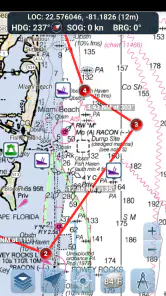
I approached Marine Ways as a practical boating companion rather than a general travel app. Its focus is clear: marine charts, route planning, and GPS-guided navigation in one place. That combination makes it more relevant to someone preparing a trip on the water than to a person who simply wants a map for a road journey.
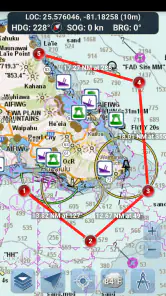
My first impression is that the app is built around a useful sequence. You begin with a destination or a boating idea, inspect the chart, shape a route, and then use GPS guidance while moving. That sounds straightforward, but on the water the quality of the handoff between those stages matters more than a long list of extra tools. A route that looks sensible on a screen still needs to be checked against the actual conditions around you.
Marine Ways is a free Travel & Local app from Kernalite, with optional in-app purchases priced at $1.99 per item. It is rated for Everyone, runs on operating systems from version 10 onward, and the current version is 1.99. The app has been available since August 27, 2015, and its presence on the platform is backed by over 100 thousand installs, a 4.6 average from around 2.3 thousand ratings, and roughly 1.2 thousand written reviews.
From a boating idea to a usable route
Starting with the right question
The most useful way to start with Marine Ways is not by immediately drawing a line. I first decide what I am actually trying to do: reach a marina, cross a familiar stretch, inspect a possible destination, or plan a route that can be followed with less guesswork. That small pause prevents the chart from becoming a decorative map instead of a planning tool.
For a short afternoon outing, I would use the app to establish the broad shape of the trip before leaving. I can look at the waterways, identify the likely destination, and consider whether the route makes sense for the boat and the people aboard. For a longer journey, the same screen becomes a planning workspace, but I would spend more time checking every important turn rather than trusting the first path that appears convenient.
This is where the app feels different from a normal road-navigation application. A road map usually assumes that the visible route is the main answer. A marine chart demands more attention from the user. Shorelines, channels, markers, restricted areas, and changing surroundings all affect whether a route is sensible. Marine Ways gives me a focused environment for that kind of thinking, but it does not remove the responsibility to interpret what I see.
Reading the chart before drawing
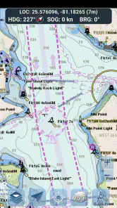
I find the chart stage most valuable when I treat it as a briefing. Before planning a route, I look at the surrounding water rather than only the endpoint. The wider view helps reveal whether the trip has a simple shape or whether it involves narrow passages, awkward turns, or a long exposed section. Zooming in too early can hide the relationship between the starting point and the final approach.
More From Our News Desk

Clash of Clans Is Won Between the Battles

Android Auto Makes the Case for Quieter Car Software

MobiOffice: Transforming Mobile Productivity with Seamless Integration

EA SPORTS FC™ Mobile Soccer: Redefining Mobile Sports Gaming

How Microsoft OneDrive Became a Mobile Productivity Giant

How Google Translate Breaks Language Barriers Effortlessly
A practical habit is to inspect the route twice. The first pass answers, “Can I get there?” The second asks, “What will the final approach actually require?” That second question is easy to skip, especially when the destination looks close. In real use, the last part of a trip can demand more attention than the open-water section because the shoreline, traffic, and available room become more important.
I would also avoid planning while already under way unless the adjustment is minor. A moving boat, changing visibility, and divided attention are poor conditions for careful chart reading. Marine Ways is more useful when the route is prepared calmly, then reviewed again before departure. The app supports that workflow; it should not encourage a skipper to replace observation with screen time.
Building the route in stages
Once I understand the area, I shape the route around recognizable points instead of thinking only about a start and finish. This gives the trip useful checkpoints. If the route needs to change, I can identify which part is affected rather than abandoning the entire plan. It also makes it easier to explain the intended journey to another person on board.
That staged approach is one of the less obvious strengths of a route-planning app. A single destination can conceal several decisions. A route with intermediate points exposes those decisions and makes the plan easier to discuss. It is particularly helpful when one person handles the phone and another person is responsible for steering or watching the surroundings.
I would keep the route as simple as the water allows. Adding points merely to make the line look precise can create unnecessary work and make later changes harder. The best plan is not always the one with the most points; it is the one that communicates the intended path clearly and leaves enough attention for what is happening outside the screen.
Handing navigation from the screen to the boat
The important handoff happens when planning ends and movement begins. At that moment, the route stops being an idea on a chart and becomes guidance for a real trip. I would review the route once more while stationary, confirm the destination, and make sure everyone who needs to know the plan has seen it.
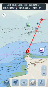
GPS guidance is helpful because it connects the planned route with the boat’s current position. That reduces the need to repeatedly estimate where I am on the chart. It is especially useful when landmarks are distant or when several similar-looking waterways make visual orientation difficult.
Still, I would treat the GPS position as one input, not as an automatic steering instruction. A phone can show where the boat is without understanding every practical decision a skipper must make. The person on board remains responsible for watching the water, reading signs and markers, accounting for other vessels, and responding to conditions that a route line cannot represent.
A good onboard arrangement is to let one person handle the app while another keeps attention on navigation. If I am alone, I would prepare as much as possible before departure and avoid making detailed changes during a demanding section. This division of attention is a genuine trade-off: the app can improve orientation, but interacting with it at the wrong moment can create a new distraction.
Using the result in an everyday scenario
Imagine planning a morning trip to a waterfront destination that I know generally but have not approached from the chosen launch point. Before leaving, I open the chart, identify the destination, inspect the surrounding water, and create a route with a few meaningful checkpoints. I then show the plan to the person coming with me so we agree on the intended direction.
After departure, GPS guidance helps me relate the boat’s position to that prepared route. If the shoreline looks different from expected or another vessel changes the situation, I can slow down, reassess, and decide whether the route still makes sense. The value is not that Marine Ways magically solves the trip. Its value is that the original plan gives me a reference point when the journey becomes less obvious.
On arrival, the route can also help with the return trip. Rather than starting from memory, I have a visual record of the general path I intended to follow. That is useful when the outward journey was interrupted or when the return begins under different light and visibility. I would still review the route instead of assuming that retracing it is always appropriate.
Where Marine Ways fits among alternatives
The usual alternative is a general-purpose map application. Those apps are excellent for roads, addresses, nearby businesses, and land-based directions, but they are not designed around the questions that arise on a boat. Marine Ways is more focused because its central experience is tied to nautical charts and marine movement rather than driving or walking.
A second alternative is a dedicated chartplotter or other onboard navigation equipment. Hardware can be preferable for serious, frequent boating because it is designed to remain part of the helm setup and may be easier to view in that environment. Marine Ways is more approachable for someone who wants planning and GPS guidance on a device already in hand, especially for occasional trips or as a secondary reference.
The trade-off is confidence and context. A phone app is convenient and inexpensive to begin using, while dedicated equipment may fit a demanding boating routine better. I would choose Marine Ways for preparation, familiar-water outings, and an additional navigation reference. I would not make it my only safeguard for a complicated passage simply because it is easy to carry.
What the free entry point means
The free price makes it easy to test whether the workflow suits me before committing money. I can judge the chart presentation, route planning process, and GPS-guided experience in the situations that matter to my own boating. The optional purchases, at $1.99 per item, create a relatively low-cost way to add paid elements when needed, but I would still check what an item unlocks before buying it.
That matters because a free app can be useful without being the complete answer for every user. Someone who only needs occasional route planning may find the basic experience sufficient. A frequent boater should evaluate the available paid options against the equipment and charts already used, rather than assuming that a small purchase automatically turns a phone into a full marine navigation system.
Friction during preparation
The main friction is not the idea of planning; it is the attention required to plan responsibly. A chart can make a route appear tidy even when the real trip involves uncertainty. I need to zoom, inspect approaches, and think through alternatives. That is valuable work, but it means Marine Ways rewards a careful user more than someone looking for instant, turn-by-turn simplicity.
Another limitation is the dependence on the phone as the center of the workflow. Screen visibility, battery condition, mounting position, and the general suitability of the device all affect the experience. I would prepare the phone before leaving, keep the display readable, and avoid treating the app as a substitute for ordinary boating preparation.
The app is also not the right choice for someone who wants a land-navigation tool. Its nautical focus would be unnecessary for commuting, walking around a city, or finding restaurants. Likewise, a professional or highly experienced skipper with established onboard systems may prefer equipment that is more deeply integrated into the helm routine.
Small habits that improve the handoff
One useful habit is to name the purpose of each route before using it. A route intended for a relaxed outing should not be treated like a fixed operational plan, while a route prepared for a time-sensitive arrival deserves more careful review. This simple distinction keeps the app’s guidance in proportion to the trip.
A second habit is to brief the passenger who is most likely to help. I would explain the destination, the general direction, and what to do if I need to focus elsewhere. That turns the phone from a private screen into a shared reference and reduces the chance that the person steering and the person holding the device have different assumptions.
A third is to make the route readable at a glance. I would avoid filling it with unnecessary points and would inspect the final approach separately. During the trip, the most useful information is often not the entire journey but the next meaningful decision. A clean route supports that kind of quick check better than a complicated drawing.
Who should use it, and who should skip it?
I think Marine Ways is a good fit for recreational boaters who want a dedicated marine planning experience without immediately investing in specialized equipment. It also suits people who already understand basic chart reading and want GPS guidance to support, rather than replace, their judgment. The free entry point makes experimentation easy, and the focused category is more appropriate than a standard road map for water-based trips.
I would recommend caution for complete newcomers who expect the app to teach them safe navigation from the beginning. The chart and route can support learning, but they do not remove the need to understand local rules, markers, weather, vessel handling, and the limits of electronic positioning. A beginner should use it alongside proper instruction and preparation.
I would also suggest skipping it as a primary solution if the trip is unusually demanding, the phone is unreliable, or the boat already has a navigation setup that is easier to read and operate at the helm. In those cases, Marine Ways may still be useful during preparation, but another system could be better for the live navigation stage.
My final assessment of the complete workflow
Marine Ways succeeds because its pieces form a sensible chain: inspect the water, plan a route, hand that plan to GPS guidance, and use the result as a reference during the journey. I appreciate that this workflow starts before departure instead of pretending navigation begins only when the boat moves.
Its strongest use is as a practical planning and orientation tool for recreational marine travel. The app helps turn an unfamiliar waterway into a route I can discuss, review, and follow with greater awareness. The free price lowers the barrier to trying it, while the optional purchases leave room for users who need more from the experience.
My reservation is equally clear: Marine Ways should support a skipper’s decisions, not make those decisions for them. It cannot replace observation, local knowledge, sensible preparation, or suitable backup arrangements. When I use it within those limits, it becomes a useful companion rather than a false promise of automatic safety.
For someone choosing between a normal map app and a marine-focused option, I would choose Marine Ways for chart-based planning and GPS-supported boating trips. For demanding navigation or a fully integrated helm setup, I would look beyond a phone app. For everyone in between, it is a worthwhile free starting point, provided the route is prepared carefully and the screen remains only one part of the navigation picture.
Marine Ways Frequently Asked Questions
Is Marine Ways free to download, and are there in-app purchases?
Marine Ways is free to download, so you can install it without paying an upfront price. The app also offers in-app purchases, with items priced at $1.99 each. Before making a purchase, check the purchase details shown in the app and consider which features you need. You can use the app’s free offering to decide whether it suits your boating routine.
What devices can run Marine Ways?
Marine Ways is available for devices running operating system version 10 or later. Before downloading, check your device’s system version and available storage, and make sure you are using the appropriate app store for your platform. Keeping your operating system updated can also help with compatibility. If your device does not meet the minimum requirement, you may need to use a compatible device to access the app.
What is Marine Ways, and what can I use it for?
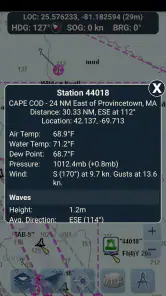
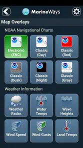
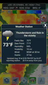
Marine Ways is a boating and marine-weather app designed to help users prepare for time on the water. It can provide access to weather information, forecasts, marine conditions, and location-based details that are useful before leaving the dock. It is suitable for boaters, anglers, sailors, and anyone who wants a quick overview of conditions that may affect a trip.
Does Marine Ways provide accurate real-time marine weather information?
Marine Ways is useful for checking current and forecast marine conditions, but its information should be treated as guidance rather than a guarantee. Weather can change quickly, especially offshore, so users should compare the app’s forecasts with official marine warnings, local authorities, and onboard instruments. Always check wind, waves, visibility, storms, and advisories before departing.
Can I use Marine Ways to plan a boating or fishing trip?
Yes, Marine Ways can be helpful during the planning stage of a boating or fishing trip. You can review forecast conditions and use available location information to decide whether the timing and route appear suitable. However, it should not replace proper nautical charts, navigation equipment, safety gear, or experience. Conditions should be checked again immediately before and during your trip.
Pros
- Provides marine weather forecasts useful for planning trips.
- Includes tide information for coastal navigation.
- Offers access to nautical charts and waterway details.
- Covers many U.S. waterways and popular boating destinations.
- Simple interface makes key information quick to find.
Cons
- Coverage may be limited outside the United States.
- Some advanced information may require an internet connection.
- Chart detail can vary depending on the selected waterway.
- Forecast accuracy depends on available local data sources.
- The interface may feel dated compared with newer boating apps.
- Category
- Travel & Local
- Version
- 1.99