Land id®
- 431.00
- 4.1
- Installs
- 100.00K
- Price
- Free

Screenshots
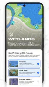
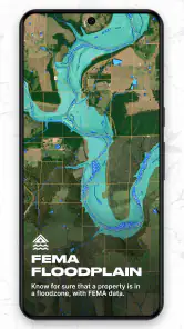
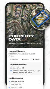
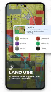
Analysis by Reviewed
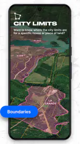
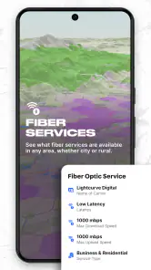
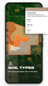
I approached Land id® as a practical productivity app rather than something you open casually. Its purpose is to help you look at land boundaries, ownership information, and parcel details in one place, which makes it most useful when a property question comes up and a normal map app feels too general. I found the idea especially appealing for comparing what I can see on the ground with the parcel information attached to a location.
The app is developed by Land id™ and is free to install, with a free trial period available before paid in-app options become relevant. It is rated for Everyone, so the presentation is intended for a broad audience. With an average rating of 4.1 from around 1.1 thousand ratings and more than 100 thousand installs, it has enough adoption to feel established without being one of those enormous, anonymous utility apps that tries to do everything.
How Land id® feels to read and navigate
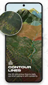
The first thing I would want from a parcel app is a map that does not make me fight for basic information. Land id® is built around that map-first experience. Instead of beginning with a long form or a complicated property database, I can start by looking at an area and then focus on the parcel that matters. That is a sensible choice for people who think spatially, because the location gives immediate context.
For readability, the most important factor is not just the size of labels. It is whether boundaries, roads, neighboring parcels, and information panels remain understandable when several things are visible at once. In my experience, this type of app is easiest to use when I zoom in gradually rather than trying to inspect a whole neighborhood at once. A wide view helps me understand the area, but a closer view is more useful when I need to distinguish one parcel from another.
That creates a small but important habit: I would not treat the first map view as the final answer. I would use the broad view to orient myself, then zoom and open the parcel details only after I have identified the correct property. This reduces the risk of reading information from a nearby lot, especially in dense areas where boundaries can sit close together.
The app suits users who prefer visual navigation over typing an exact address. That said, people who expect a simple search box followed by one definitive result may need a little patience. Parcel research is inherently more layered than searching for a restaurant. The location, the boundary, and the attached property information all need to agree before the result is useful.
I also appreciate that the product has a clear practical identity. It is not trying to replace a general navigation app, a real-estate marketplace, or a full professional geographic information system. That narrower focus makes the interface easier to understand conceptually. I know I am opening it to investigate land, not to plan a commute or browse listings.
More From Our News Desk

Clash of Clans Is Won Between the Battles

Android Auto Makes the Case for Quieter Car Software

MobiOffice: Transforming Mobile Productivity with Seamless Integration

EA SPORTS FC™ Mobile Soccer: Redefining Mobile Sports Gaming

How Microsoft OneDrive Became a Mobile Productivity Giant

How Google Translate Breaks Language Barriers Effortlessly
Useful reading habits for parcel information
When I use a map with ownership and parcel data, I separate three questions that are easy to blur together: “Where is the property?”, “What are the apparent boundaries?”, and “What information is associated with it?” Land id® is helpful because it brings those questions into the same workflow, but the user still has to interpret them carefully.
For example, if I were checking a rural property before visiting, I would first inspect the surrounding roads and neighboring parcels. Then I would select the target parcel and read the available ownership or property details. Finally, I would compare the map with visible landmarks such as fences, driveways, tree lines, or access roads. That last comparison is valuable because a line on a screen and a physical feature on the ground do not always tell the same story.
My strongest practical tip is to treat the map as a research aid, not as permission to cross land. Ownership information can help me understand a situation, but it does not replace local rules, official records, or direct permission. This is one of the most important distinctions for new users, particularly anyone exploring unfamiliar rural areas.
Motor, visual, and sensory considerations in everyday use
Land id® is naturally suited to touch interaction: panning, zooming, selecting a parcel, and moving between the map and its details. Those actions are familiar on a phone, but they can still be demanding for someone with limited fine-motor control. Pinch-to-zoom gestures require two fingers and a degree of precision, while selecting a narrow parcel can be difficult when several boundaries are close together.
A practical workaround is to do the detailed investigation while stationary, using deliberate gestures and a larger screen when possible. A tablet can make the map easier to inspect because there is more room for boundaries and labels, although the experience will still depend on the device and operating system. I would avoid trying to select parcels while walking, driving, or balancing a phone outdoors. That is both harder to control and unsafe.
Users with tremors or reduced dexterity may find that repeated map movement becomes tiring. In that situation, I would search for the general area first, pause, and then make one controlled adjustment at a time. It is also worth turning the phone rather than constantly dragging the map if the target area is near the edge of the screen. Small changes in technique can reduce the number of precise gestures needed.
For people with low vision, map-based interfaces can be challenging because meaning depends on visual contrast, line separation, and changing scale. A boundary that is easy to distinguish when the map is quiet may become harder to follow when roads, imagery, and neighboring parcels overlap. I would recommend increasing the device’s text size where the operating system allows it, using a brighter screen in outdoor conditions, and zooming in before attempting to read property details.
Those adjustments may help, but they do not turn the app into a dedicated accessibility tool. Anyone who depends on a screen reader, magnification, voice control, or highly consistent focus order should test the current version carefully on their own device before relying on it for important work. The app is currently version 5.44.0, and interface behavior can change as mobile software develops.
Color perception is another consideration. Parcel maps often communicate differences through lines, fills, and highlights, so someone who has difficulty distinguishing certain colors may need to rely more heavily on the selected parcel, surrounding geography, and written details. I would not make a legal or financial decision from a color distinction alone. If two adjacent parcels look confusing, I would zoom further, select each one separately, and compare the displayed information.
For users who are sensitive to visual clutter, the best approach is a staged workflow. Start with the map at a comfortable scale, identify one property, and avoid opening multiple information panels at once. The app becomes more manageable when I use it as a sequence of small questions rather than as a screen to absorb all at once.
Using it from different places and situations
The app’s usefulness changes depending on where I am. At home, I can sit down, use a stable internet connection, and investigate a parcel without time pressure. This is the most comfortable setting for comparing neighboring properties, reading ownership information, and making notes elsewhere. It is also the best place to prepare before a site visit.
In a car, Land id® should only be used by a passenger or while parked. A parcel map can be absorbing because it invites repeated zooming and checking, and that is exactly the kind of task that should not compete with driving. For a passenger, it can be useful during a property tour to confirm which lot is being discussed, but I would still wait until the vehicle is safely stopped before making careful selections.
Outdoors, sunlight, glare, gloves, poor reception, and cold weather can all make a touch map harder to operate. These are not unusual problems for mobile mapping, but they matter more when the difference between two parcels is subtle. I would prepare the area before leaving, save any important notes outside the app, and avoid assuming that a screen view will remain equally convenient in a remote location.
This preparation also answers a common question: can the app replace planning before a visit? I do not think it should. It is better used as one part of a process. Before going out, I would identify the property, inspect nearby access routes, and record the details I expect to need. On site, I would use the app for orientation and checking rather than for making every decision from scratch.
For people working in teams, the app can serve as a shared reference point during a conversation, but it is not automatically a substitute for formal documentation. If a contractor, family member, or buyer is involved, I would communicate the parcel location clearly and verify that everyone is discussing the same property. A screenshot or written address may be easier for another person to understand than a verbal description of a map position.
Land id® is also potentially useful for landowners who want a quick way to understand neighboring parcels, outdoor enthusiasts researching an area, and people beginning a property search. It is less suitable for someone who only needs turn-by-turn directions, because a conventional navigation app will be faster for that job. It is also not the first tool I would choose for a professional survey, title decision, or boundary dispute.
Where the experience still creates barriers
The biggest barrier is the nature of parcel information itself. Even a clear interface cannot remove ambiguity from real property boundaries. A user may see a line and assume it represents a fence, a legal boundary, or an accessible route, when those are different things. The app can make research more convenient, but it cannot make a complicated property situation simple in every case.
There is also a learning curve for people unfamiliar with parcel maps. General map apps teach us to look for streets, businesses, and directions. Land id® asks us to understand lots, neighboring ownership, and property records. A first-time user may need to experiment with zoom levels and selection behavior before the map feels natural.
The free entry point is attractive, but the trial and paid options deserve attention before a user commits to a long-term workflow. In-app purchases range from $14.99 to $799.99 per item, which is a very broad span. I would begin by deciding what I actually need from the app and checking the purchase screen carefully rather than assuming that every useful function will remain free.
That pricing structure may be reasonable for users who gain significant value from land research, but it can feel excessive for someone who only wants to inspect one parcel once. A casual user should compare the cost with local public records, a real-estate professional’s assistance, or a standard map combined with official sources. The cheapest option is not always the most convenient, but the most feature-rich option is not automatically the best value either.
Another limitation is that mobile convenience can encourage overconfidence. Because the information appears neatly on a phone, it can feel more authoritative than it should. I would use the app to form questions, check locations, and organize research. For a purchase, boundary disagreement, access concern, or ownership issue with real consequences, I would verify the important point through appropriate official channels.
People who need highly specialized geographic analysis may also outgrow it. A professional GIS platform can offer more control over layers, measurement, data handling, and technical workflows. That extra power comes with a steeper learning curve, so I would not recommend switching unless those capabilities are genuinely necessary. For many everyday property questions, a focused parcel app is easier to approach.
Device compatibility is another practical checkpoint. The minimum operating system is iOS 9, so users on very old Apple devices may find the baseline requirement manageable, while current users should still keep the app and system updated when possible. Regardless of platform, screen size, battery condition, and connectivity will affect how comfortable the map feels in real use.
The Everyone content rating makes the app approachable for households and general audiences, but that rating does not mean every task is equally easy for every person. Children may understand the map quickly yet lack the context to interpret ownership information responsibly. Older adults may benefit from a larger display and a slower, prepared workflow. Users with disabilities may need to test gestures and assistive settings before deciding whether the app fits their routine.
Who should use it and who should choose something else
I would recommend Land id® to a property owner checking nearby parcels, a buyer researching an area before contacting an agent, or anyone who regularly needs land context rather than ordinary road directions. It is particularly appealing when the question begins with a map: Which lot is this? Where does it sit among neighboring parcels? What ownership or property information is attached to that location?
I would be more cautious about recommending it to someone who wants a single definitive answer with no interpretation. If the purpose is to settle a legal boundary, confirm title, establish access rights, or support a high-stakes transaction, this app should be a starting point, not the final authority. A surveyor, title professional, local office, or official record may be the better choice.
I would also steer occasional users toward trying the free experience first and thinking carefully about the value of paid features. The app is free to install, but the presence of substantial in-app purchase options means the financial decision should be deliberate. A person researching one address may not receive enough ongoing benefit to justify a larger purchase.
Compared with a normal map app, Land id® is more focused on parcels and ownership context, but less useful for navigation and everyday place discovery. Compared with professional mapping software, it is easier to approach but less appropriate for technical analysis. That middle position is its real strength: it gives ordinary users a more land-specific view without asking them to learn an entire professional mapping system.
One workflow I found especially sensible is to combine it with ordinary notes. I would open a parcel, write down the address or identifying details I need, record the question that remains unresolved, and then close the map rather than repeatedly reopening it. This prevents the app from becoming a source of scattered impressions. It also makes it easier to explain the research to someone else.
Another useful trade-off is screen size versus portability. A phone is convenient for a quick check at a property tour, while a tablet or larger display is more comfortable for comparing several neighboring parcels. If visual strain or precise tapping is a concern, I would prioritize the larger screen for planning and reserve the phone for orientation.
My inclusive verdict after using the app
Land id® is a focused productivity app with a clear purpose: making land boundaries, ownership information, and parcel data easier to investigate from a mobile device. I like that it addresses a gap left by ordinary map apps, especially for people who need property context rather than directions. The map-centered design can be approachable, but it rewards patience, careful zooming, and a willingness to verify what the screen is showing.
From an inclusion perspective, its strongest quality is flexibility of context. I can use it at home for calm research, with a passenger during a property trip, or outdoors for orientation. Its weaker side is the dependence on touch precision and visual interpretation. Users with limited dexterity, low vision, sensory sensitivities, or reliance on assistive technology should test it personally instead of assuming that a general-audience rating guarantees a comfortable experience.
The developer, Land id™, has kept the product recognizable as a land research tool rather than turning it into a crowded all-purpose app. That focus helps the experience, although it also means the app cannot answer every legal, surveying, or navigation question. The average rating of 4.1 suggests a generally positive reception with room for individual frustrations, which matches my view: useful and distinctive, but not effortless in every situation.
My final recommendation is straightforward. Try the free version if you regularly investigate property, prepare for land visits, or need a clearer parcel view than a standard map provides. Before paying, make sure the workflow solves a recurring problem rather than a one-time curiosity. And whenever the information could affect money, access, safety, or a dispute, use the app to guide your next question, then confirm the answer through the appropriate official or professional source.
Land id® Frequently Asked Questions
Is Land id® free to download, and what does the trial include?
Land id® is free to download, and its store summary advertises a free 7-day trial. Some additional features are offered through in-app purchases, with prices ranging from $14.99 to $799.99 per item. Before starting a trial or confirming a purchase, review the current subscription terms in the app so you understand what access is included and what may cost extra.
Which devices can run Land id®?
Land id® is available for Android and iOS devices that meet the applicable operating-system requirements. The listed minimum OS version is 9, so check your device’s software version before downloading. Keeping your operating system and the app up to date can also help with compatibility. The app is rated Everyone, making its content suitable for a broad audience.
What is Land id® used for?
Land id® is a mapping and property research app designed to help users identify land parcels, view property boundaries, and access available ownership or location information. It can be useful for homeowners, buyers, agents, outdoor enthusiasts, and professionals who need a convenient way to explore land records and geographic details from a mobile device.
Does Land id® show accurate property boundaries and ownership information?
Land id® provides property data sourced from public records and other mapping databases, but the information should not be treated as a legal survey or guaranteed proof of ownership. Boundary lines, owner details, acreage, and tax information may vary by county or region and can become outdated. Always verify important findings with the relevant assessor, recorder, surveyor, or title professional.
Can I use Land id® without creating an account or paying for a subscription?
The app may allow users to browse certain maps and property details without immediately subscribing, but access to advanced records, expanded search tools, historical information, or other premium features can depend on the current plan. Availability and pricing may change, so it is worth reviewing the in-app subscription terms before starting a trial or confirming a purchase.
Pros
- Clear property boundary maps help users understand land details.
- Useful for viewing parcel information while visiting a property.
- Location tools make it easier to identify nearby land parcels.
- Supports sharing property maps with clients
- family
- or business partners.
- A practical tool for real estate
- land management
- and outdoor planning.
Cons
- Coverage and parcel data may vary by location or jurisdiction.
- Some advanced property details may require a paid subscription.
- Map accuracy can depend on government records and update schedules.
- The app may use significant battery during extended GPS sessions.
- Its features may feel excessive for users needing only basic map navigation.
- Category
- Productivity
- Version
- 5.44.0