Fishing Spots: Maps & Forecast
- 1.46K
- 4.6
- Installs
- 1.00M
- Price
- Free
Screenshots
Analysis by Reviewed
I tend to judge a fishing app less by how impressive it looks on the first outing and more by whether I still open it when planning an ordinary trip weeks later. Fishing Spots: Maps & Forecast makes a useful first impression because it brings locations, forecasts and catch logging into one place. It is a free sports app from FishAngler, LLC, rated 4.6 on average from around 6,800 ratings, with over one million installs. Those figures suggest an established audience, but the real test is whether its tools fit the way you actually fish.
Useful before the first cast
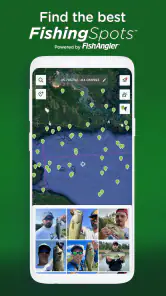
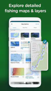
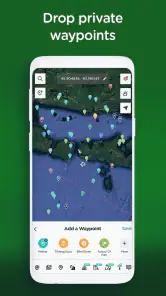
For someone new to an area, a map of fishing locations can turn vague plans into a shortlist worth checking. I would use it to compare possible stops before leaving home, then treat the map as a starting point rather than a promise that a particular bank or access point will suit me. User-generated locations can bring local knowledge into the picture, while curated spots offer another way to explore. That mix is helpful, though any shared location is still something to assess in person.
The forecast is most valuable as a planning aid, not a guarantee of bites. I’d check conditions before setting out, then keep a backup location in mind in case the weather or access makes the original plan unattractive. Solunar predictions can add another angle to timing, but I wouldn’t let them overrule practical considerations such as a safe route, changing conditions or the time I have available.
Making the first week count
During the first few days, I would resist the temptation to treat every map marker as a recommendation. Instead, I’d narrow the choices by distance and practicality, then use the forecast to help decide when to go. This makes the app useful even if the first suggested location turns out not to suit me: the map helps generate options, while the final call remains mine.
For a beginner, the most helpful early habit is to save a small number of promising places to revisit mentally or through the app’s own records, rather than browsing endlessly. A crowded map can make exploration feel productive even when it has not produced a realistic plan. I’d choose two or three plausible stops, check their conditions on the day, and leave room to change course.
Value that depends on your routine
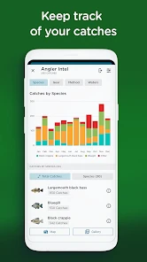
Catch logging gives the app a reason to stay installed after the novelty of browsing spots wears off. A quick note after a session can help me remember which location I visited and what I caught, instead of relying on a hazy memory when planning the next trip. Over time, that record is more useful if I log consistently; occasional entries are still pleasant, but they are less likely to reveal patterns in my own fishing.
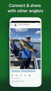
Sharing catches and tips adds a community layer, especially when I want ideas beyond my own regular waters. I’d browse those contributions with a little judgment: other anglers’ experiences can suggest where to look or what to consider, but they cannot ensure the same result on my next visit. For a private, low-tech logbook user, the social side may feel unnecessary rather than essential.
More From Our News Desk

Clash of Clans Is Won Between the Battles

Android Auto Makes the Case for Quieter Car Software

MobiOffice: Transforming Mobile Productivity with Seamless Integration

EA SPORTS FC™ Mobile Soccer: Redefining Mobile Sports Gaming

How Microsoft OneDrive Became a Mobile Productivity Giant

How Google Translate Breaks Language Barriers Effortlessly
How I’d use it on an ordinary fishing day
Imagine I have a free morning and only enough time for one nearby stop. I’d check the map for a few possibilities, look at the forecast and timing information, and choose a practical option rather than chasing a supposedly perfect prediction. After fishing, I could record the catch and keep a personal trail of outings. That simple loop—plan, go, log—is where the combination makes sense: it can reduce scattered searching without taking over the trip.
Compared with using a general map, a weather app and a notebook separately, this app is appealing because fishing-specific locations and catch records sit alongside planning tools. The trade-off is that a dedicated fishing app still depends on the usefulness of its local information and on your willingness to maintain a log. If you only need navigation, a regular map may be simpler; if you already have a trusted local source and prefer paper notes, switching may not add enough to justify a new habit.
Getting more from a catch log
I would make logging easier by choosing a consistent, brief routine: add the catch after I have finished fishing, while the location and trip are still fresh in my mind. The point is not to turn an outing into paperwork. A short record I keep up with is more valuable to me than a detailed one I only complete occasionally. If I had no catch to report, noting that I visited and what conditions I noticed could still help me remember the day.
There is a useful distinction between looking for a pattern and assuming one. A few entries might help me recall which places I have tried, but they would not prove that a particular forecast or timing prediction caused a catch. I’d use the history as a prompt for better questions on later trips, not as a personal fishing formula. That makes the record useful without giving it more authority than it deserves.
Discover the Best Fishing Locations
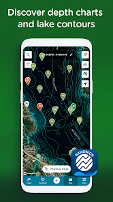
One of the standout features of Fishing Spots: Maps & Forecast is its ability to point you to the best fishing locations. The app offers a detailed map with thousands of fishing spots worldwide, so whether you're planning a local trip or a vacation far away, you're covered. I love how it shows user-generated spots as well as those curated by the app itself. It's like having an insider’s guide to fishing hotspots right in your pocket.
Weather and Solunar Forecasts
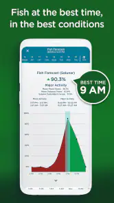
Another feature that deserves a mention is the weather and solunar forecasting tool. Before heading out, I always check the app for the latest weather updates and solunar predictions. It provides a comprehensive look at the best fishing times so you can maximize your chances of a good catch. I find this particularly useful because it saves me from those days when I’d end up staring at water without a single bite.
Community and Social Features
Fishing isn't just about the catch; it's also about the community. This app nails that aspect with its interactive social features. You can share your catches, tips, and even photos with other users. It’s like a social media platform designed exclusively for anglers. I've picked up quite a few tips from seasoned fishermen, and the community vibe is always welcoming and encouraging.
Personalized Experience
The app also allows you to customize your experience. You can track your fishing history, log your catches, and even set goals. I’ve found this feature super motivating, especially when I want to beat my previous records. The personalized dashboard gives a detailed overview of your fishing stats, which is perfect for those who take their fishing seriously.
Keeping the routine lightweight
In practice, the maintenance burden is modest only if I keep entries simple. I would record the details I know I’ll want later, rather than trying to document every part of a trip while packing up or watching the water. A short, repeatable note is more likely to become a habit than an elaborate record I postpone. The useful question is not whether I can build a perfect fishing archive, but whether I’ll remember to add enough to make the history meaningful.
There is also a privacy and comfort trade-off in sharing. Catch photos and tips can make the community more useful, but anglers who prefer to keep favorite places quiet may want to be selective about what they post. I’d use the social tools when I have something helpful to share, while keeping personal location notes for my own planning. That balance lets the app support community without making every outing feel like content creation.
When a different tool is the better fit
If I were planning a trip where navigation and road access mattered most, I would still rely on a general map for that job. Fishing locations can help me discover possibilities, but they are not a substitute for checking how I will reach a place or whether the route makes sense. The same applies to changing weather: a forecast is useful context, not a reason to ignore conditions I can see for myself.
For anglers who already have a dependable local network, the community may add less value than it would for someone exploring unfamiliar water. A paper notebook can also be a better choice for someone who wants to write freely without checking a phone. I see the app as strongest when discovery, planning and keeping a basic history are all appealing; if only one of those matters, a simpler tool may be easier to stick with.
Who will get the most from it
I’d recommend trying it if you explore unfamiliar waters, enjoy learning from other anglers, or want one place to plan outings and keep a catch history. It may be especially handy for someone who fishes irregularly: checking a forecast and browsing a map can make a spare morning easier to organize. Newer anglers can use the shared knowledge as inspiration, while experienced anglers may value having their own outings recorded over time.
It is less compelling if your fishing is already organized around a small number of familiar spots and you have no interest in logging catches or browsing a community. It is also not a substitute for sound judgment outdoors. A promising forecast does not make a location accessible or safe, and a mapped spot cannot tell me everything I need to know once I arrive. I’d still check local conditions and make decisions on the ground.
Questions that matter after installing
Will it still be useful if I do not post publicly? I think so, if the map, forecasts or private catch history are the parts I return to. The social layer is an option rather than the only reason to open it. Can a suggested place guarantee a productive session? No map marker or forecast can promise that; I would use them to make a more informed plan, then adapt to the actual conditions.
Does it suit someone who fishes only now and then? It can, because occasional use for checking a location and conditions is a reasonable way to start. The catch history becomes more valuable with regular entries, but a sporadic angler need not turn that into a chore. Should I replace my other weather or navigation tools? I would not do so automatically. I’d compare what I already trust with what this app adds, and keep using separate tools where they do a better job for my needs.
Costs, compatibility and lasting value
The app is free to start, with in-app purchases ranging from $6.99 to $49.99 per item. I’d begin with the free experience and see whether the map, forecasts and logging actually become part of my routine before considering any purchase. That is a sensible approach because the app’s long-term value comes from repeated use, not from installing it before a single big trip. It is rated Teen, and its current version is 4.6.6.210, with a minimum operating system of 9.
My main caution is that several useful tools can also create several reasons to check the phone: map browsing, forecasts, social posts and personal stats. On the water, I’d decide what I need before leaving and avoid turning a quiet session into constant screen time. The app works best as a planning companion and an after-trip record, with attention still on fishing itself.
For an ordinary routine, I’d check the map and forecast before leaving, then put the phone away unless I need it. Afterward, I’d add a short catch entry and stop there. That small boundary helps preserve the best part of the experience: being present at the water rather than repeatedly checking whether the app has something new to show. If the habit feels useful after several trips, it has earned its place; if I keep forgetting to log or never consult the map, I would not force it.
In conclusion, Fishing Spots: Maps & Forecast is more than just a tool; it’s a companion for every fishing adventure. With its extensive database, weather forecasting, and social features, it truly caters to every angler's needs. Whether you're a newbie or a seasoned pro, this app is worth a try. So next time you plan a fishing trip, make sure you’ve got this app installed. Trust me, it’s like having a fish-whisperer in your pocket!
Fishing Spots: Maps & Forecast Frequently Asked Questions
What devices and operating systems can run Fishing Spots: Maps & Forecast?
Fishing Spots: Maps & Forecast is available for Android and iOS, so anglers can use it across either major mobile platform. On Android, it requires version 9 or later. The app is free to download, though in-app purchases are available. Checking that your device meets the operating-system requirement before installing can help avoid compatibility surprises.
What features does Fishing Spots: Maps & Forecast offer to enhance my fishing experience?
Fishing Spots: Maps & Forecast provides a variety of features to enhance your fishing trips, including detailed maps with fishing hotspots, weather forecasts, and solunar calendars to predict the best times for fishing. Additionally, users can access community-shared fishing reports, track their catches, and plan trips more effectively using the app's comprehensive planning tools.
Is Fishing Spots: Maps & Forecast available for both Android and iOS devices?
Yes, Fishing Spots: Maps & Forecast is available for download on both Android and iOS platforms. Users can easily find the app on Google Play Store for Android devices and the Apple App Store for iOS devices, ensuring a wide range of users can benefit from its features regardless of their device preference.
How does Fishing Spots: Maps & Forecast help in planning a fishing trip?
The app aids in planning fishing trips by providing users with real-time weather updates, tide forecasts, and solunar predictions, which are crucial for determining the best fishing times. It also includes detailed maps and user-generated reports that can help identify promising fishing locations, making it easier to plan successful and enjoyable fishing outings.
Are there any costs associated with using Fishing Spots: Maps & Forecast?
Fishing Spots: Maps & Forecast is free to download, and in-app purchases are available for users who want to spend more within the app. This gives new anglers a chance to try it without an upfront download charge, while those considering purchases can review the available options before deciding whether they fit their needs.
Pros
- Comprehensive fishing locations database
- Real-time weather and tide updates
- User-friendly interface
- Community-driven tips and reviews
- Offline access to saved maps
Cons
- Limited free features
- Occasional app crashes
- Requires internet for full features
- In-app ads can be intrusive
- Not available in all regions
- Category
- Sports
- Version
- 4.6.6.210