TrailView
- 92.00
- 3.4
- Installs
- 50.00K
- Price
- Free

Screenshots
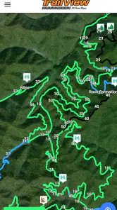
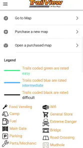
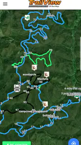
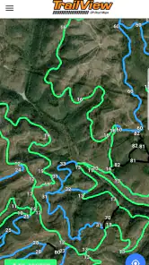
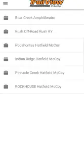
Analysis by Reviewed
Finding your way around an off-road route is a very different problem from navigating a city street. A normal map may get you close to a trailhead, but it is not always the tool I want when the road becomes rough, the signal becomes unreliable, or several dirt tracks look almost identical. TrailView is built for that narrower travel problem: it is a free Travel & Local app from TrailView aimed at helping drivers avoid losing their route while exploring trails.
I approached it as a practical companion rather than a complete replacement for every navigation app. That distinction matters. Its appeal is easy to understand if you spend weekends driving forest roads, exploring remote paths, or planning an off-road outing where a missed turn can cost far more time than it would on a normal commute. At the same time, the modest average score of 3.4 from roughly 130 ratings suggests that the experience is not universally smooth. My view is that it is worth examining as a focused tool, but not blindly trusting as your only preparation for unfamiliar terrain.
What TrailView is really for
The store presents TrailView as an app for avoiding missed trails and getting lost while offroading. In practical terms, that places it between a general map app and a dedicated outdoor-navigation system. I would not install it for everyday driving around town. Its reason to exist is the moment when a route becomes less obvious and the usual turn-by-turn experience stops feeling dependable.
That focus makes it easier to judge. If you regularly explore trail networks, the app may give you a more relevant view than a road-first navigation service. If your trips are limited to paved roads, its specialized purpose will probably not justify adding another app to your phone. I see the strongest fit for people who already think in terms of trail entrances, dirt-road junctions, and route awareness rather than simply following spoken directions.
The developer is TrailView, and the app has been available since April 9, 2019. It is currently listed as version 1.6.0 and supports devices running Android 7.0 or later. Those details make it accessible to many older Android phones, which is useful for outdoor users who may keep a spare handset in a vehicle instead of risking their newest phone on dusty or wet trips.
It is also rated for Everyone, so the age classification is not a barrier for families planning an outing together. The more important question is not age but responsibility: no navigation app should be treated as proof that a trail is open, legal, safe, or suitable for a particular vehicle. Trail conditions can change, and an app cannot replace local signs, preparation, or sensible judgment.
Free access changes the decision
TrailView is free to install, which makes testing it much easier than committing to a paid navigation package. I can see the value of downloading it before a trip, checking whether its approach suits my routes, and deciding from actual use rather than from a store description alone. That low entry cost is especially helpful for occasional off-road travelers who do not want a recurring expense for a tool they may use only a few times each season.
More From Our News Desk

Clash of Clans Is Won Between the Battles

Android Auto Makes the Case for Quieter Car Software

MobiOffice: Transforming Mobile Productivity with Seamless Integration

EA SPORTS FC™ Mobile Soccer: Redefining Mobile Sports Gaming

How Microsoft OneDrive Became a Mobile Productivity Giant

How Google Translate Breaks Language Barriers Effortlessly
There are in-app purchases listed from $0.99 to $29.99 per item. Because those purchases cover a wide range, I would inspect the purchase screen carefully before paying and confirm exactly what a selected item provides. The free installation and paid options should not be treated as the same value proposition: the app may be useful at no cost, while a paid addition needs to earn its place against other mapping tools and against the cost of preparing a trip properly.
For me, the sensible approach is to begin with the free experience, test it in a familiar area, and only consider spending money if the app solves a problem I actually encounter. Free access lowers the risk, but it does not remove the need to verify what an optional purchase unlocks. That is the most honest way to evaluate its value.
Where the app can help during a real outing
Imagine leaving a paved road on a Saturday morning and reaching a junction where two unmarked tracks continue in different directions. With a standard road-navigation app, the area may appear as a blank or simplified space. TrailView’s purpose is to help keep the route visible in an off-road context, so the useful habit is to consult it before the junction rather than waiting until you have already committed to the wrong branch.
I would use it as part of a simple workflow. Before leaving home, I would identify the general area and make a mental note of the planned trail sequence. At the trailhead, I would compare the app’s view with physical signs and the surroundings. During the drive, I would slow down at forks and check the route while stopped, not while handling the phone on a rough track. This turns the app from a last-second rescue device into a route-awareness tool.
A less obvious benefit is reducing decision fatigue. Off-road driving already demands attention to rocks, ruts, clearance, weather, and other vehicles. If TrailView helps me anticipate the next junction, I can spend less mental energy wondering whether I am still on the intended path. That is not the same as automatic guidance, and I would not assume it is. The practical gain is confidence in route position, not permission to drive without looking at the terrain.
Another useful scenario is group travel. When several vehicles are following one planned route, a shared understanding of the trail sequence can make regrouping easier. I would still establish meeting points and a fallback plan, because an app alone does not solve separation, battery problems, or changing conditions. Its value here is organizational: everyone can think about the same route instead of improvising at every fork.
How it compares with familiar alternatives
General map apps are usually better for addresses, paved-road directions, businesses, traffic, and ordinary urban travel. I would choose one of those for getting to the trailhead. TrailView makes more sense after the conventional journey ends and the route itself becomes the main concern. Using both can be more practical than asking one app to handle every part of the trip.
Dedicated outdoor-navigation products may offer a broader set of planning tools, route recording options, offline workflows, terrain detail, or community information, depending on the product. They can be a better choice for experienced hikers, expedition planners, or drivers who need a complete archive of trips. The trade-off is often greater complexity, a steeper learning curve, or more paid content. TrailView’s narrower identity may be preferable if I want something focused on staying oriented around off-road trails rather than managing an entire outdoor database.
Paper maps and downloaded reference material still have a place. A printed map does not run out of battery, and a second phone or compass can be more useful than expected when conditions are difficult. I would not make TrailView the only source of navigation in a remote area. Its best role is as one layer in a backup-minded setup, alongside a charged phone, a route plan, and enough knowledge to turn around when the route stops making sense.
Trade-offs that affect everyday use
The first limitation is the app’s relatively mixed reception. An average rating of 3.4 from about 130 ratings is not a reason to dismiss it, but it is a reason to test it before depending on it. Ratings at that level often indicate that the app works well for some situations while leaving other users dissatisfied. I would treat the score as a warning to verify the experience on my own phone and in an area I already understand.
The second trade-off is the gap between seeing a trail and knowing whether it is usable. A route can be visible yet blocked, washed out, private, seasonal, or unsuitable for a low-clearance vehicle. TrailView’s central purpose may help with orientation, but it cannot turn an uncertain track into a safe route. I would check local restrictions and conditions separately, especially after storms or when traveling far from help.
The third is phone dependence. Outdoor navigation can expose weaknesses that are invisible during a city test: a weak signal, a nearly empty battery, glare on the screen, cold weather, or a phone mounted where it is difficult to read safely. Before a longer trip, I would test the app in a controlled area, reduce unnecessary battery use, and keep a backup plan. I would also avoid making route decisions while moving.
There is a practical difference between occasional use and demanding use. Someone who drives a familiar trail network may only need a quick way to confirm a junction. Someone planning a multi-day remote trip may need detailed preparation, dependable offline access, route sharing, recording, and stronger backup options. I would not assume TrailView is the better choice simply because it is simpler or free. The right tool depends on how much failure would matter.
Three habits that make the app more useful
First, test it where the consequences are low. I would choose a familiar trail or a nearby route with an easy exit, compare what I see in the app with the physical landscape, and learn how quickly I can check the route. This reveals more than opening the app once at home, because the real challenge is using it calmly when several tracks look alike.
Second, use it before decision points. Checking after missing a turn is inefficient and can lead to unnecessary backtracking. I would pause at a safe location before a junction, orient myself, and then continue. That small change makes the app part of route planning rather than an emergency reaction.
Third, separate navigation confidence from vehicle confidence. Even if the app helps me stay on the intended trail, it does not tell me whether the surface is beyond my vehicle’s ability. I would still assess slope, mud, water, clearance, and weather independently. This is an important trade-off because a clear route line can create false reassurance if I let it replace visual judgment.
A fourth habit is to review the paid options only after identifying a specific need. If the free version already supports the way I travel, paying may add little value. If a purchase promises something important for my workflow, I would read its description carefully and decide whether that benefit is more useful than a broader outdoor-navigation alternative. The price range makes this comparison worthwhile rather than automatic.
Who should install it
I think TrailView is most appealing to Android users who explore off-road routes often enough to need more than a normal road map, but not so intensively that they require a full expedition-planning platform. It may also suit a beginner who wants to become more comfortable with trail navigation without paying upfront. The free starting point gives that audience room to experiment.
It is less convincing for someone who only wants reliable city directions, address search, traffic information, or a polished commuting experience. A general navigation app is likely the better fit there. I would also hesitate to recommend TrailView as the sole navigation solution for remote trips where losing the route could create a serious safety problem. In that situation, redundancy matters more than convenience.
The app’s 50K-plus installs show that it has reached a meaningful audience, but popularity alone does not prove that it matches every off-road workflow. I would focus on the kind of trips I actually take. A casual trail explorer can reasonably try it at no cost; a professional guide or highly experienced remote traveler should compare it with more specialized tools and test every important function before relying on it.
My final buying decision
I would recommend trying TrailView if off-road orientation is a recurring problem for you and you want a free way to explore a focused navigation app. Its strongest value is not that it replaces every map, but that it addresses the point where ordinary road navigation becomes less useful. I like the idea of using it alongside a conventional map for the drive to the trailhead and a physical or offline backup for the trail itself.
I would skip it if you need a complete outdoor-navigation system, if you rarely leave paved roads, or if you are unwilling to test a navigation tool before trusting it in a remote location. The mixed rating and the presence of optional purchases mean I would not pay immediately or build a complicated trip around it without first checking the free experience.
Overall, TrailView is a focused, low-risk experiment rather than an automatic must-have. TrailView earns its place when it helps you recognize and follow off-road routes more confidently, especially on familiar test trips and ordinary weekend outings. My verdict is to install it for free, evaluate it in a safe area, keep a backup, and spend only when a clearly identified purchase delivers value for the way you actually travel.
TrailView Frequently Asked Questions
Is TrailView free to download, and what might cost extra?
TrailView is free to download, so you can try the app without paying an upfront price. It also offers in-app purchases, with items ranging from $0.99 to $29.99. Before buying anything, review the purchase details shown in the app and decide whether the feature is useful for your trip. Keep in mind that the free download does not mean every available feature is free.
What phones and operating systems can run TrailView?
TrailView is a travel and local app from developer TrailView, and its current version is 1.6.0. On Android, it requires version 7.0 or later, so check your device’s software version before downloading. The app is rated for Everyone. If you use a different platform, check its store page for compatibility details before installing.
What is TrailView, and what can I use it for?
TrailView is designed to help users explore and understand outdoor trails through a convenient mobile interface. Depending on the available data in your area, it may provide trail maps, route details, points of interest, elevation information, and other useful navigation features. It can be helpful for hikers, walkers, cyclists, and anyone planning an outdoor adventure, although coverage and available information may vary by location.
Does TrailView work without an internet connection?
TrailView may offer offline support for certain maps or trail information, but users should check the app’s current features before relying on it in remote areas. Downloading maps or routes in advance is recommended because mobile coverage can be unreliable on mountains, in forests, or in rural locations. Even with offline access, keep your phone charged and carry a backup map for safety.
Is TrailView accurate enough for hiking and outdoor navigation?
TrailView can be a useful planning and navigation aid, but it should not be treated as the only source of guidance. Trail conditions, closures, private land boundaries, weather, and map data can change. GPS accuracy may also be affected by trees, terrain, or poor signal. Before starting a trip, compare the route with official local information and make sure it matches your experience level.
Pros
- Offline map access helps when hiking beyond reliable mobile coverage.
- Clear trail details make it easier to compare routes before starting.
- GPS tracking helps monitor your position and progress during a hike.
- Useful route information supports better planning for different skill levels.
- A focused design keeps essential hiking tools easy to find.
Cons
- Map and trail coverage may vary significantly by region.
- GPS use can drain your phone battery during longer hikes.
- Some features may require an internet connection or paid access.
- Trail information may not always reflect recent closures or conditions.
- Small screens can make detailed route planning less convenient.
- Category
- Travel & Local
- Version
- 1.6.0