RadSat HD Pro
- 140.00
- 4.2
- Installs
- 100.00K
- Price
- Free
Screenshots
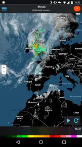
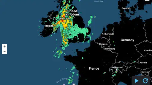
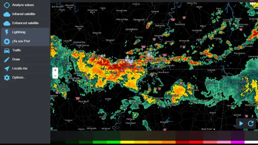
Analysis by Reviewed
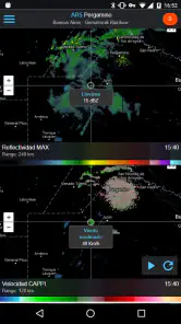
I usually open a weather app for a quick answer, but radar work is different. When I want to know whether rain is moving toward my neighborhood, whether a storm is intensifying nearby, or whether lightning is worth taking seriously before heading outside, a simple temperature forecast is not enough. That is where RadSat HD Pro makes sense: it puts weather radar, satellite imagery, and lightning information on an interactive map instead of making me read several separate forecast panels.
My view is that this is a focused tool rather than an all-purpose weather companion. It is most useful when the question is “what is happening around me right now?” rather than “what will the weather be like next week?” The distinction matters, because the best choice depends on whether you value visual storm tracking, a compact daily forecast, or a broad collection of alerts and planning features.
What I would consider before choosing it
The first decision is how you normally consume weather information. If you prefer a large temperature display, hourly icons, and a short written summary, a conventional forecast app may feel faster. If you think in terms of movement, coverage, and distance, this application has a more useful approach. Its map lets me examine weather as a changing picture, which is especially helpful when conditions are uneven across nearby towns.
The second decision is whether radar and satellite layers are genuinely relevant to your routine. They are valuable for outdoor work, driving, cycling, hiking, photography, travel, and anyone who wants to judge whether a shower is likely to pass or arrive. They are less important if you only need tomorrow’s high and low. Installing a specialized map-based tool for a question that a basic widget already answers would add friction without much benefit.
I would also think about screen size and attention. Interactive weather maps reward a few minutes of inspection, but they are not always the quickest option when I am already rushing out the door. On a phone, I need to zoom, move around, and interpret layers. That extra step is worthwhile when a storm is close, yet unnecessary for a casual glance at the morning temperature.
The app comes from SocialEx Aplicaciones and sits in the weather category. It is free to obtain, with in-app purchases listed at $7.99 per item. That makes the initial decision fairly easy: I can try the central experience before deciding whether any paid element is useful to me. The content rating is Everyone, so it is presented as suitable for a broad audience rather than a niche professional group.
Its long availability also gives it a more established feel than a brand-new experiment. It was released on March 20, 2017, and the current version is 4.0.17. The stated minimum operating system is Android 3.0, which is unusually broad compatibility for anyone using older hardware. In practical terms, that may help users who keep a spare phone in a car, workshop, or travel bag instead of upgrading frequently.
More From Our News Desk

Clash of Clans Is Won Between the Battles

Android Auto Makes the Case for Quieter Car Software

MobiOffice: Transforming Mobile Productivity with Seamless Integration

EA SPORTS FC™ Mobile Soccer: Redefining Mobile Sports Gaming

How Microsoft OneDrive Became a Mobile Productivity Giant

How Google Translate Breaks Language Barriers Effortlessly
How I use the map instead of guessing from an icon
My most useful habit with this kind of app is to start with the map, not the forecast label. I look at the radar pattern around the place I care about, then widen the view to understand the direction and shape of the weather. A small patch of color directly overhead can mean something different from a larger band approaching from a distance. The interactive format encourages that kind of context.
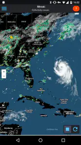
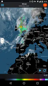
Satellite imagery adds another perspective. Radar helps me think about precipitation, while satellite views can make broad cloud cover easier to understand. I would not treat either layer as a promise about exactly what will happen at my front door, but together they provide more visual evidence than a single weather symbol. This is one of the app’s strongest reasons to exist.
Lightning information is particularly useful when I am deciding whether an outdoor plan should continue. I would use it as a reason to pause, move indoors, or check conditions again before leaving, not as a substitute for local safety guidance. The important advantage is that lightning is presented in the same map-oriented workflow, so I do not have to mentally combine a separate warning source with a different location view.
A practical tip is to avoid zooming in too quickly. I get a better reading by first seeing the wider weather system, then narrowing the map to my route or destination. That prevents a common mistake: focusing on a clear-looking spot while missing a larger area of activity moving toward it. This wider-to-narrower workflow is more valuable than simply having another colorful weather screen.
Where it works especially well
The clearest strength is situational awareness. Suppose I am preparing to drive across town for an appointment. The normal forecast says there may be rain, but that description does not tell me whether the rain is already nearby, moving away, or arriving after I plan to leave. With the map, I can inspect the surrounding pattern and make a more informed choice about timing. It does not remove uncertainty, but it gives me a better basis for it.
The same applies to a weekend walk. Instead of checking a forecast once and forgetting it, I can look at the radar shortly before leaving and again if the sky changes. That is a more realistic workflow for short outdoor activities than relying on a forecast made many hours earlier. The app becomes a quick decision tool rather than a passive information screen.
For people who live in areas where weather changes quickly, the visual approach can be more intuitive than a list of percentages. I find it easier to understand “this band is approaching from that direction” than to translate several isolated hourly values into a mental picture. Users who work outdoors may appreciate that difference even more, especially when a short delay can make a task more comfortable or safer.
Another non-obvious benefit is comparison across nearby locations. A city forecast can hide meaningful local variation, while a map lets me inspect the space between my current position and destination. That matters for commuting, school runs, deliveries, and trips to places just outside the usual forecast area. The map does not guarantee perfect local precision, but it helps me avoid treating one location’s forecast as if it describes an entire region.
I also like the possibility of using separate visual layers for different questions. If I am mainly concerned about rain, radar is the natural starting point. If the sky looks generally covered but the precipitation picture is unclear, satellite imagery can add context. If thunderstorm risk is the concern, lightning information deserves attention. The value comes from switching perspectives rather than expecting one layer to answer everything.
What may slow me down
The same map focus that makes the app useful can make it feel less convenient than a standard weather app. A map requires interpretation. Colors, movement, distance, and timing all matter, and a quick glance may not be enough for someone who is unfamiliar with radar imagery. I would not recommend it as the only weather tool for a person who wants plain-language explanations with almost no effort.
There is also a mental difference between observing current conditions and planning far ahead. RadSat HD Pro is naturally suited to immediate or near-term decisions. For holidays, appointments several days away, or long-range scheduling, I would still want a conventional forecast view. A radar map can show what is developing now, but it is not the same kind of information as a daily outlook.
Map-based apps can also feel busy. When several layers are available, the screen may become harder to read rather than more informative. My advice is to keep the display focused: use the layer that answers the question in front of you, then add another only when it contributes something specific. Turning on everything at once can create visual noise and make the weather pattern less obvious.
Another trade-off is attention during changing conditions. A static forecast can be checked quickly and forgotten, while a radar view invites repeated checking. That is helpful when a storm is close, but it can become unnecessary if I keep refreshing without making a decision. I get the most value when I define a question first: should I leave now, wait a little, change route, or cancel the outdoor activity?
The free entry point is welcome, but the presence of purchases means I would look carefully at which parts of the experience I actually need before spending anything. The listed price of $7.99 per item is clear enough to keep in mind, yet the right value depends on how often I use the app and whether the paid element improves my particular workflow. Occasional users may be perfectly satisfied with the free starting experience, while frequent radar users may judge the purchase differently.
How it compares with ordinary weather alternatives
A typical weather app is usually better for routine information. It may put the current temperature, a short outlook, and hourly conditions in front of me immediately. That is ideal when I am deciding what to wear or whether to carry an umbrella. RadSat HD Pro takes a different route: it asks me to explore the weather spatially. I would choose the ordinary app for convenience and this one for weather movement.
A forecast widget is even faster, but it is also narrower. It can tell me the conditions associated with one selected location, while a radar map helps me inspect what is happening around that point. If I only check the weather once each morning, the widget probably wins. If I need to reassess conditions during the day, the map has a stronger case.
General-purpose weather services may also be preferable for people who want many types of information in one place, such as longer forecasts, lifestyle guidance, or a highly simplified presentation. I would not switch away from those tools entirely just because this app has better visual storm context. The sensible arrangement may be to keep a familiar forecast app for daily planning and use this one when precipitation or lightning becomes the deciding issue.
On the other hand, a dedicated radar application can be less distracting than a broad weather service. Its purpose is immediately clear, and I do not need to search through unrelated panels to find the map. That specialization is valuable for users who already know they want radar, satellite, and lightning views rather than a general weather dashboard.
My advice is to compare workflows, not feature counts. Ask which app answers your most common question with fewer steps. If the question is “what is today’s forecast?”, a standard alternative is likely more comfortable. If it is “is that storm heading toward my route?”, this application’s map-centered design is the more natural fit.
The practical cost of switching
Moving from a basic forecast app to this one does not require changing how I interpret every weather detail, but it does require learning to read a map. I need to become comfortable with looking at patterns rather than isolated numbers. That learning curve is modest for curious users, yet it can be a real barrier for someone who wants an instant yes-or-no answer.
The easiest way to adopt it is to use it for one repeatable situation. I might check the radar before a morning commute, compare it with the route I plan to take, and then review the map again before returning home. After several uses, I would know whether the visual information genuinely changes my decisions. This trial is more meaningful than opening the app once during clear weather.
I would also avoid replacing a trusted emergency-information source with a map tool. For severe conditions, official local alerts and instructions should remain the authority. The app is useful for understanding the weather picture and making everyday timing decisions, but I would not rely on any single visual display for urgent safety decisions.
Older-device support may make switching easier for some households. Since the minimum operating system is Android 3.0, the application may be relevant to users with hardware that cannot run many newer apps. At the same time, an older phone may offer a less comfortable map experience because of its screen or performance. Compatibility helps, but usability still depends on the device in my hand.
The app has an average rating of 4.2 from around 2.5 thousand ratings, with around 140 written reviews, and it has passed 100 thousand installs. Those figures suggest that it has attracted a meaningful audience without making popularity the only reason to choose it. I would treat them as reassurance that the concept is established, then make the final decision based on whether map-based weather fits my habits.
Who should install it, and who should skip it
I would recommend trying it if you spend time outdoors, drive through changing weather, monitor storms near home, or prefer visual information to a row of forecast icons. It is also a good candidate for anyone who has repeatedly been surprised by rain that a single city forecast did not make easy to understand. The combination of radar, satellite, and lightning gives those users several useful ways to inspect the same situation.
I would be more cautious if you want a polished daily planner with minimal interaction. Someone who simply wants tomorrow’s temperature, a morning notification, and a quick weekly glance may find a conventional weather app more efficient. The same is true for users who dislike interpreting maps or who rarely need to distinguish weather conditions across nearby places.
For families, the Everyone content rating makes the app straightforward to consider, but I would still teach younger users not to treat a clear map as permission to ignore thunderstorm safety. The app can support a conversation about changing conditions; it should not replace adult judgement or official instructions.
For paid features, I would wait until the free experience has become part of my routine. If I only open the app a few times each season, purchasing anything may not be worthwhile. If I use it repeatedly for work, travel, or outdoor planning, a paid item priced at $7.99 could be easier to justify, provided it addresses a real limitation in my use rather than simply adding another option I rarely touch.
My recommendation after using it as a decision tool
I see RadSat HD Pro as a strong specialist companion, not a universal replacement for every weather app. Its best quality is the way it turns weather from a single-location summary into something I can inspect across an area. Radar, satellite, and lightning views are most helpful when timing and movement matter, and that makes the app more practical than a basic forecast screen in the situations it targets.
I would keep it installed if I regularly make outdoor decisions, travel through unsettled weather, or want to understand what is approaching rather than merely read what is predicted. I would skip it if my needs stop at a quick daily temperature check. In that case, the extra map interaction would feel like work.
The free starting point lowers the risk of trying it, while the broad operating-system requirement may help people using older Android phones. The paid items deserve a deliberate decision, and I would not buy them before testing the app during the kind of weather I actually care about. That approach keeps the cost connected to usefulness instead of assumptions.
Overall, I recommend it to readers who want a focused weather radar app and are willing to spend a little time reading visual information. It is not the simplest option, and it does not replace official warnings or a long-range forecast. But when I need to decide whether a rain band is moving toward a route, whether clouds are building around a destination, or whether lightning should change an outdoor plan, this map-first approach gives me information a standard weather widget usually cannot show as clearly.
RadSat HD Pro Frequently Asked Questions
What does the lightning layer add to RadSat HD Pro’s weather map?
RadSat HD Pro combines weather radar with satellite imagery and lightning information on an interactive map. These layers can give you a broader view of changing weather than a simple forecast screen, helping you follow precipitation and storm activity visually. If you are deciding whether to download it, consider whether map-based weather monitoring fits the way you prefer to check conditions.
Who develops RadSat HD Pro, and what kind of app is it?
RadSat HD Pro is a weather app developed by SocialEx Aplicaciones. Its focus is visual weather monitoring through an interactive map, with radar, satellite imagery, and lightning information. This makes it most relevant to people who want to inspect weather activity on a map rather than rely only on a brief text forecast or a basic temperature display.
What is RadSat HD Pro and what does it do?
RadSat HD Pro is a weather application focused on detailed radar information and storm monitoring. It is designed for users who want more than a basic temperature forecast, offering radar imagery, precipitation tracking, and weather data that can help identify approaching rain or severe conditions. Its usefulness depends on your location, available data coverage, and the freshness of the radar information.
Is RadSat HD Pro free to download and use?
RadSat HD Pro is free to download, and it offers in-app purchases priced at $7.99 per item. The app’s interactive weather map brings radar, satellite imagery, and lightning information together, so you can explore its core purpose after installing it. Review the purchase details shown in the app before buying anything, and check that the available features suit your needs.
Does RadSat HD Pro provide accurate and real-time weather radar data?
RadSat HD Pro is intended to display radar-based weather information, but no weather application can guarantee perfect accuracy in every situation. Radar updates may be delayed, coverage can vary by country or region, and local terrain may affect results. For serious storms, outdoor activities, or emergency decisions, compare the app with official meteorological alerts and local authorities.
Pros
- High-resolution radar imagery makes storm cells easy to identify.
- Smooth map navigation with useful zoom and pan controls.
- Color-coded weather layers are quick to understand.
- Helpful for tracking precipitation while traveling or outdoors.
- Supports detailed local weather monitoring beyond basic forecasts.
Cons
- Advanced radar features may be confusing for first-time users.
- Radar coverage and update frequency can vary by location.
- Continuous map use may consume significant battery power.
- Weather data may require an internet connection to stay current.
- The interface can feel dated compared with newer weather apps.
- Category
- Weather
- Version
- 4.0.17