OruxMaps GP
- 157.00
- 4.3
- Installs
- 100.00K
- Price
- $4.49

Screenshots
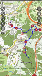
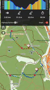
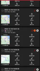
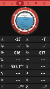
Analysis by Reviewed
Hey there, fellow adventurers! If you're anything like me and love the thrill of exploring the great outdoors, then you might want to check out OruxMaps GP. This nifty app is a fantastic tool for hikers, bikers, and all-around outdoor enthusiasts who want to keep track of their journeys without getting lost in the wilderness.
Who benefits most from a map-first approach?
I find this app most compelling for people who plan routes before they leave and want more control than a basic turn-by-turn navigation tool usually offers. A hiker can prepare a GPX route at home, load it, and follow it on a map; a cyclist can record a ride and look back at the track afterward. That planning-and-review loop is a practical reason to choose it, rather than simply expecting it to behave like a car navigation app.
For a familiar weekend walk, I would prepare the route and the map while I still had a reliable connection, then check that both are available before setting off. If the path forks or the trail is less obvious than expected, a mapped route and recorded track give me useful context without relying on a live signal. I would still carry the judgment to turn back when conditions call for it: a navigation app can help me stay oriented, but it cannot decide whether a trail is safe.
Readability and navigation in the field
The key trade-off is that OruxMaps GP gives you a map-based toolset rather than hiding every choice behind a single destination box. That flexibility can be valuable when I want to inspect terrain, follow a planned line, or compare my recorded path with the route. It also means I need to spend time learning the controls before a demanding outing. I would not want my first attempt at setting up a route to happen at a confusing junction with daylight fading.
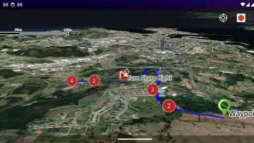
Maps are most useful when I choose the right view for the task. A detailed map can help me understand the route, while satellite imagery may offer a different visual perspective. I would avoid treating either view as a guarantee that a visible line is passable; conditions and access can change. Before heading out, I would zoom in on the tricky parts, check the route’s overall shape, and make sure I know how to return to the map view I rely on.
Getting Started with OruxMaps GP
Let me tell you, diving into the world of OruxMaps GP is like opening a treasure chest of maps and features. The app is available on both Android and iOS, making it super accessible no matter what device you're using. The installation process is straightforward – just a few taps, and you're ready to embark on your mapping adventure.
In the outdoor-navigation category, the usual alternatives often favor either quick, simple directions or a broader collection of travel information. OruxMaps GP makes more sense to me when the map and the track are the main event. If I only need the easiest route across town, a simpler navigation app may be less work. If I want to plan an outdoor route and keep a record of where I went, this style of tool is a better fit.
More From Our News Desk

Clash of Clans Is Won Between the Battles

Android Auto Makes the Case for Quieter Car Software

MobiOffice: Transforming Mobile Productivity with Seamless Integration

EA SPORTS FC™ Mobile Soccer: Redefining Mobile Sports Gaming

How Microsoft OneDrive Became a Mobile Productivity Giant

How Google Translate Breaks Language Barriers Effortlessly
Features Galore
One of the first things you'll notice about OruxMaps GP is its extensive range of features. It supports both online and offline maps, which is a godsend when you're venturing into areas with spotty cell service. You can download maps beforehand and access them anytime, anywhere. This feature alone makes it a must-have for anyone serious about their outdoor escapades.
Offline access is only useful if I prepare for it rather than assume it will take care of itself. My practical routine would be to select the area I expect to cover, save the map in advance, and open it before leaving home to confirm it is ready. I would also keep the intended route and an alternative way back in mind. This small check is especially worthwhile for a long outing, where a missed turn can mean more than a minor detour.
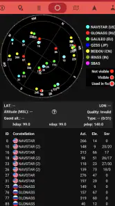
The app also boasts an impressive array of tracking options. Whether you're hiking up a mountain or cycling through rolling hills, OruxMaps GP lets you record your track, view statistics, and even share your adventures with friends. The real-time tracking feature is particularly useful for those who love to keep tabs on their progress as they conquer new terrains.
Track recording can also make a familiar place easier to revisit: after a walk, I can use the record as a personal reference rather than trying to remember every turn. For a group outing, sharing a track can help others understand the route I took, though I would not treat that as a substitute for agreeing on a meeting point or staying in contact. A useful trade-off is that recording adds value during the trip, but it asks me to pay attention to the app and my device instead of focusing solely on the scenery.
Navigation Made Easy
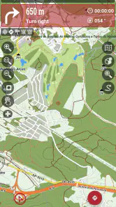
Navigating through OruxMaps GP is a breeze, thanks to its user-friendly interface. Even if you're not the most tech-savvy person out there, you'll find your way around the app with ease. The menu is intuitive, and the settings are customizable to suit your specific needs. Plus, the app's compatibility with various external sensors and devices adds an extra layer of functionality for those who want to take their navigation to the next level.
Motor and sensory considerations
Outdoor use creates its own accessibility challenges. A small screen can be harder to read in bright conditions, and adjusting a map while walking or riding is awkward and potentially unsafe. I would stop in a stable place before changing settings or checking a complicated junction. If fine touch gestures are difficult, the app’s many options may require patience during setup; simplifying the screen and preparing the route at home can reduce the number of interactions needed outside.
For anyone who relies on audio cues, a map-focused workflow may feel different from navigation that continually calls out turns. I would test the app in a familiar, low-pressure place before depending on it for a route where visual attention is limited. Likewise, people who find dense maps tiring should zoom to a useful level ahead of time and avoid making decisions while moving. Those are practical precautions, not a claim that one layout or method will work equally well for every person.
Making a route manageable before leaving
One small workflow change can make a big difference: I would separate route preparation from route following. At home, I can inspect the whole GPX line, note awkward crossings, and decide where I might turn back. Outdoors, I then need fewer fiddly decisions on the screen. This is especially useful for someone with limited hand dexterity, anyone sharing navigation duties, or a group that does not want to stop repeatedly while one person searches through controls.
For a practical example, imagine a short cycle ride that begins on familiar streets and ends on unfamiliar paths. I would check the route where it leaves the road, save the relevant map for offline use, and start recording only when I am ready to ride. At the first uncertain junction, I would stop safely, compare the planned line with the map, then continue. That routine is less spontaneous than opening a basic directions app, but it keeps the decisions visible and makes the recorded ride useful afterward.
My Personal Take
Now, I won't sugarcoat it – OruxMaps GP does have a bit of a learning curve. But once you get the hang of it, you'll wonder how you ever ventured outdoors without it. The app's ability to provide detailed topographic maps and satellite imagery is truly impressive. It’s like having a digital compass and map rolled into one handy package.
It is also worth thinking about the purchase before committing. OruxMaps GP costs $4.49, and it has in-app purchases priced from $0.99 to $8.99 per item. I would check which parts match my own needs instead of assuming that buying the app means every optional item is included. The app is rated for Everyone and has an average rating of 4.3 from around 6,900 ratings; it has over 100,000 installs. Those figures suggest a substantial audience, but they cannot tell me whether its interface will suit my habits.
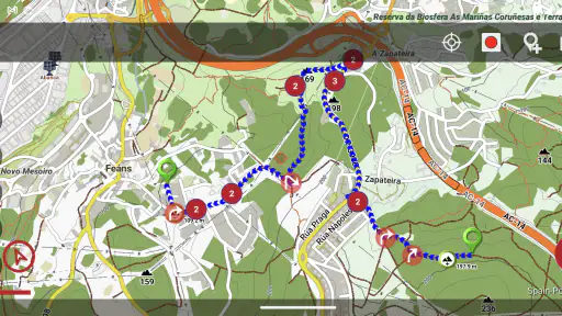
One thing I particularly love is the app's ability to create and import GPX routes. Planning your next hiking trip has never been easier. Just plot your course, load it into the app, and you're good to go. It's like having a personal guide in your pocket!
A useful GPX habit is to inspect the route before importing or setting off, especially where it crosses a road, branches, or approaches the end of a trail. I would keep a second route or a simple turnaround point in mind rather than treating a downloaded line as unquestionable. This makes the app’s route handling useful for preparation while keeping the actual decision-making with me.
When a different kind of navigation is better
I would not choose this app simply because I need to get somewhere quickly. For city errands, public transport changes, or a drive where I want spoken directions to lead each turn, a conventional navigation app is likely the less distracting choice. Those tools generally make the destination the center of the experience; here, I get more value from examining a map and managing a track. The distinction matters if I want guidance that asks little of me while moving.
It is also not an ideal first mapping app for someone who becomes anxious when presented with several route choices. A guided walk with a companion, a printed map, or a simpler route-following tool can be more reassuring in that situation. I would treat OruxMaps GP as an instrument for people willing to learn how their route is represented, not as a promise that every navigation decision will be made automatically.
Situational access and remaining barriers
OruxMaps GP was released on November 14, 2011, and is developed by jose vazquez. Its long-running focus on outdoor mapping is reflected in the kind of work it asks the user to do: prepare, read the map, and manage a route rather than expect a travel assistant to make every choice. That can be empowering for a confident navigator, but a beginner may prefer a simpler app for an occasional walk.
The app is not my first recommendation for someone who wants effortless directions, has no interest in learning map controls, or needs an interface that can be operated without looking at the screen. It is also not a replacement for a paper map, local knowledge, or sensible preparation in remote areas. For an unfamiliar outing, I would check the route beforehand and avoid relying on a phone as my only navigation plan.
There is a practical question many first-time users have: can I depend on it where reception is poor? Offline maps make that kind of trip more workable, but the safe answer depends on preparing the correct area and confirming the map is accessible before leaving. A downloaded route is not the same thing as a downloaded map, so I would check both. I would also make sure the phone itself is ready for the outing and keep a non-digital backup for a route where losing access would matter.
Another question is whether I need extra equipment. A phone alone is enough to explore the basic map-and-track approach, while compatibility with external sensors and devices gives experienced users room to build a more involved setup. I would not buy accessories before learning what information I actually need. A hiker who only wants to follow a route may have no reason to add hardware, whereas a cyclist who already uses sensors may value the option.
An inclusive verdict for outdoor planning
For accessibility, the strongest point is flexibility: I can prepare in advance, choose a useful map view, and reduce screen work once I am outside. The weakness is that this flexibility comes with choices and visual interaction. Someone who has difficulty reading a map, tapping small controls, or looking at a screen while moving may need a companion, a different navigation method, or a carefully tested setup. I would make that decision on a short outing rather than discovering the mismatch far from home.
Final Thoughts
So, is OruxMaps GP worth downloading? Absolutely! Whether you're a seasoned adventurer or just someone who enjoys a leisurely stroll through nature, this app has something for everyone. Its robust features, ease of use, and reliable performance make it a standout choice for outdoor navigation.
If you're ready to take your outdoor experiences to the next level, give OruxMaps GP a try. Who knows? It might just become your new favorite travel companion. Happy exploring!
My recommendation is more specific: choose it if you enjoy preparing routes, want offline maps, or value keeping a record of your outings. If your priority is the least complicated possible guidance, or if screen-based navigation is difficult in your usual conditions, another approach may serve you better. I like that OruxMaps GP gives outdoor-minded users room to work with maps and tracks, but I would begin with a short, familiar route and build confidence before relying on it farther from home.
OruxMaps GP Frequently Asked Questions
Who is OruxMaps GP designed for?
OruxMaps GP is aimed at people who want a dedicated navigation tool for outdoor activities, including hikers, cyclists, and geocachers. Its GPS tracking and route-planning features can help users follow a route or record a trip, while offline maps are useful when heading beyond reliable cellular coverage. It offers plenty of options to explore, so it may appeal most to users who want more control than a basic map app provides.
What is OruxMaps GP and what are its main features?
OruxMaps GP is a comprehensive navigation app designed for outdoor enthusiasts. It supports a wide range of map formats and offers offline maps, GPS tracking, and route planning features. Users can record their trails, share them, and even use custom maps. The app is highly customizable, making it suitable for various outdoor activities like hiking, cycling, and geocaching.
Is OruxMaps GP available for both Android and iOS devices?
OruxMaps GP is primarily developed for Android devices and is available for download on the Google Play Store. Unfortunately, there isn't an iOS version available. The app is highly appreciated by Android users for its extensive features and reliability in outdoor navigation. iOS users might need to look for alternative apps with similar functionalities.
Does OruxMaps GP require an internet connection to function?
OruxMaps GP can operate without an internet connection, which is one of its standout features. Users can download maps for offline use, ensuring they have access to navigation even in remote areas without cellular coverage. However, to download new maps or updates, an internet connection is necessary. Offline functionality makes it ideal for outdoor adventures.
How user-friendly is OruxMaps GP for beginners?
While OruxMaps GP is packed with features, it may have a steeper learning curve for beginners. The interface can seem overwhelming due to its extensive customization options and tools. However, with a bit of time and exploration, users can familiarize themselves with the app's functionalities. There are also online tutorials and community forums that can assist new users in getting started.
Pros
- Highly customizable settings.
- Supports offline maps.
- Wide range of map sources.
- Detailed GPS tracking features.
- Frequent updates and improvements.
Cons
- Steep learning curve.
- Limited user-friendly design.
- Some features require payment.
- Occasional GPS accuracy issues.
- Complex interface for beginners.
- Category
- Travel & Local
- Version
- Varies with device