Live Satellite View, 3D Map
- 77.00
- 3.9
- Installs
- 100.00K
- Price
- Free
Screenshots
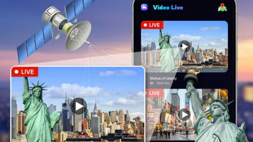
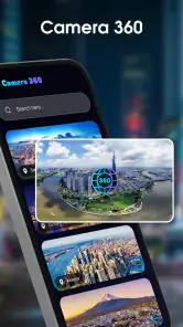
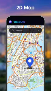
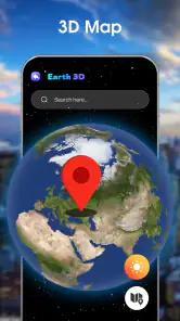
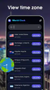
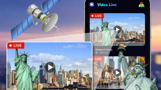
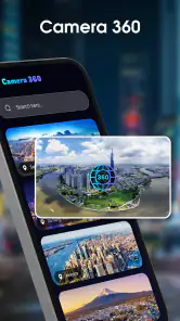
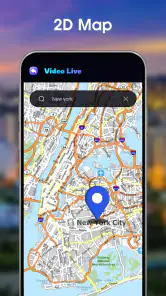
Analysis by Reviewed
Live Satellite View, 3D Map caught my attention because it turns a familiar map idea into something more visual: instead of looking only at roads and labels, I can use satellite imagery as a window onto places around the world. Developed by Banix Studio, this free Maps & Navigation app is aimed at curious explorers as much as practical map users. Its store summary presents it as a real-time window to the world, but my lasting impression is more measured: it is enjoyable when I want visual context, while its long-term usefulness depends on whether satellite imagery is something I naturally return to.
The app is available for Everyone and runs on Android devices using version 7.0 or later. Its current version is 3.6, and it has passed the 100K-install mark, with a 3.9 average from around 500 ratings. Those figures suggest a real audience, although not the same level of maturity or universal polish I would expect from the biggest navigation platforms. The download itself is free, while optional in-app purchases range from about two dollars to ten dollars per item. That makes it easy to try, but I would still spend time with the free experience before paying for anything.
What the first week feels like
During the first few sessions, the appeal is immediate. I can move from a familiar neighborhood to a coastline, mountain range, island, or large city and see how the area is arranged from above. This is different from ordinary turn-by-turn navigation, where the map is mainly a tool for reaching a destination. Here, the visual layer is the point. I find myself zooming out to understand the relationship between roads, buildings, parks, fields, and water, then zooming back in to inspect a smaller area.
That makes Live Satellite View, 3D Map especially pleasant for casual exploration. It works well when I am planning a trip and want a broad sense of the surroundings before opening a conventional navigation app. I can look at whether a hotel appears close to open land, whether a beach is surrounded by dense development, or whether a walking route might pass through a visually interesting area. I would not treat the imagery as a guarantee of what is happening at this exact moment, but it is useful for building a mental picture of a place.
The first-week experience also suits people who enjoy geography without needing a formal purpose. I used this kind of view to revisit places I had seen in photos and to compare them with their surrounding landscape. A normal street map tells me where a road is; satellite imagery helps me understand why the road is there. That distinction gives the app its character and prevents it from feeling like just another basic map viewer.
A practical everyday scenario
Imagine that I am visiting a new town for a weekend. Before leaving, I open the app and inspect the area around my accommodation. I look for nearby green spaces, the shape of the coastline, large parking areas, and the general density of buildings. Then I switch to my usual navigation service for live directions, traffic information, transit details, and precise arrival guidance. This two-app workflow is where Live Satellite View, 3D Map makes the most sense: it provides visual planning, while a dedicated navigation tool handles the trip itself.
That division of labor is important. People sometimes expect a satellite-focused app to replace a complete navigation suite, but I would not make that substitution. If I need reliable route recalculation, current traffic, public transport departures, business information, or detailed turn instructions, the usual mapping alternatives are stronger choices. Banix Studio’s app is better understood as a visual companion to those tools rather than an all-purpose replacement.
More From Our News Desk

Clash of Clans Is Won Between the Battles

Android Auto Makes the Case for Quieter Car Software

MobiOffice: Transforming Mobile Productivity with Seamless Integration

EA SPORTS FC™ Mobile Soccer: Redefining Mobile Sports Gaming

How Microsoft OneDrive Became a Mobile Productivity Giant

How Google Translate Breaks Language Barriers Effortlessly
Why the novelty is convincing at first
The strongest early feature is not a single button but the change in perspective. Satellite imagery rewards curiosity. A conventional map can make every location look like a collection of lines and symbols, while this app gives me a more recognizable sense of terrain and layout. That is useful for travelers, students, hikers doing preliminary planning, property viewers, and anyone who likes exploring places from home.
I also appreciate that the app’s purpose is easy to understand without a long learning period. The short description, “Live Satellite View,” sets a clear expectation, and the interface concept follows that promise. I do not need to build a complicated project or configure a long list of preferences before getting value. Open it, find a place, examine the view, and decide whether that perspective helps.
Still, the first-week excitement can be partly driven by discovery itself. I can spend a surprisingly long time browsing simply because the world is large and visually interesting. That is enjoyable, but it is not the same as having a reason to return every day. The important question is whether the app becomes part of a repeatable routine after I have explored the places that initially caught my attention.
Where the month-to-month value comes from
After the initial curiosity fades, I see three realistic reasons to keep the app installed. The first is trip preparation. Satellite context can help me compare neighborhoods, understand the shape of a destination, and identify broad environmental features before I commit to a route. The second is occasional location research, such as checking the surroundings of a venue, campsite, viewpoint, or accommodation. The third is personal exploration: returning to places I know and noticing their wider geography.
The app is most valuable when I use it before a decision, not when I need a decision made for me. For example, if I am choosing between two places to stay, I can inspect the surrounding development and open areas rather than relying only on a street address. If I am planning a photography outing, the overhead view may help me understand the relationship between a road, a field, a river, and a viewpoint. These are small advantages, but they are more durable than simply opening the app to watch the map move.
A useful habit is to pair it with notes. When I find a promising area, I can record the place externally with a short reminder about why it interested me: a visible trail network, a cluster of buildings, a shoreline, or a large open space. This prevents aimless browsing and turns the app into a lightweight research tool. It is a non-obvious improvement because the satellite view itself encourages wandering, while a simple note-taking step gives that wandering a purpose.
Another worthwhile workflow is to begin at a wide scale and narrow the view gradually. Jumping straight into maximum zoom can make me focus on individual structures without understanding the area. Starting with the regional shape, then checking roads and landmarks, gives better context. I find this particularly helpful when studying unfamiliar destinations, because it reduces the chance of mistaking a visually close feature for an easily accessible one.
Who is likely to keep using it
I think the strongest long-term audience includes travelers who research destinations visually, geography enthusiasts, students who want an accessible way to inspect landscapes, and people who regularly plan outdoor activities. It can also suit users who enjoy virtual exploration but do not want the social features or heavy planning systems found in other travel products.
Its value is less convincing for someone who only wants directions from one address to another. That person will probably get more from a mature navigation platform with live traffic, route alternatives, transit support, and a larger place-information ecosystem. The same is true for professional fieldwork that depends on current, authoritative mapping details. In those situations, the visual appeal here does not compensate for the need for specialized accuracy and workflow tools.
Families may find it approachable because the age rating is Everyone and the basic idea is easy to share. I can imagine using it with a child to compare coastlines, islands, cities, and rural areas. However, the app’s educational value comes from how the adult frames the exploration; it is not a substitute for a structured geography lesson. It is better as an interactive starting point for questions than as a complete learning environment.
Maintenance, friction, and the cost of returning
The maintenance burden is fairly light if I use the app occasionally, but it becomes more noticeable when I expect it to support regular travel planning. A map app has to earn trust every time I open it. I want the imagery to load smoothly, the search process to feel predictable, and the visual information to be clear enough that I can make a sensible preliminary judgment. Any delay, awkward zoom behavior, or unclear distinction between imagery and navigation data makes the experience feel less dependable.
I also have to maintain realistic expectations about the word “live.” Satellite imagery should not be treated as a live camera feed showing current conditions. A view from above can be extremely useful for geography and layout, but it may not reflect temporary changes, recent construction, weather, crowds, road closures, or seasonal conditions. This is the most important practical limitation to remember. I would never use the image alone to decide whether a trail is open today or whether a road is passable right now.
That limitation changes how I use the app. I treat the imagery as a planning layer, then verify time-sensitive details with official sources or a navigation service. This extra step is not a flaw unique to this app, but it does mean the product is rarely the only tool I need. If I forget that distinction, the visual confidence of the map could lead me to overestimate what I actually know about a location.
The free price lowers the cost of experimentation, though the optional purchases deserve attention before I spend money. Because individual items can cost from roughly two dollars to ten dollars, I would first identify the exact benefit of a purchase and ask whether it improves a repeated workflow or merely extends the initial novelty. For an occasional explorer, the free experience may be enough. For a frequent user, an optional purchase could make sense only if it removes a recurring annoyance or adds a capability I genuinely use.
Small habits that improve the experience
I recommend using the app with a clear question in mind. “What does this place look like from above?” is fine for casual exploration, but more focused questions produce more useful results: Is the accommodation surrounded by dense development? Does the park connect visually to the neighborhood? Is the beach backed by roads or open land? This approach makes the app feel less like a novelty viewer and more like a quick visual research instrument.
I also avoid treating a satellite image as a walking map. A building that looks close may be separated by a fence, private land, a steep slope, water, or an inconvenient road layout. The overhead view is excellent for orientation, but it does not automatically reveal access rights or safe passages. Checking the normal map and local information afterward is essential, especially for outdoor plans.
Finally, I use it before, rather than during, a journey. When I am already navigating through an unfamiliar place, switching between a visual exploration app and a live route tool can create unnecessary friction. Before the trip, however, I can explore without pressure, note the areas that matter, and then rely on the appropriate navigation service when movement and timing become important.
What causes fatigue after the novelty fades
The biggest source of fatigue is repetition. Once I have explored my favorite destinations and familiar neighborhoods, the basic action of zooming and panning can start to feel similar from session to session. There is no guarantee that every visit will reveal something new, so the app needs a purpose supplied by me. Users who prefer guided discovery, recommendations, saved itineraries, or constantly changing local information may find the experience too passive.
Another source of fatigue is the gap between visual richness and practical certainty. The image can look detailed enough to invite confident conclusions, yet it still requires interpretation. I may see a promising route or open area, but I cannot assume that the route is public, maintained, or currently usable. That extra mental caution is manageable for experienced map users, but it can make the app feel less straightforward for someone who wants a simple answer.
Comparison with familiar alternatives makes this clearer. Google Maps and Apple Maps are usually better for everyday navigation because they combine mapping with directions, local listings, traffic, and other trip-focused information. Dedicated outdoor mapping services can be better when I need trail-specific planning or activity data. A globe or geography app may offer a more educational presentation. Live Satellite View, 3D Map earns its place when I specifically want an overhead visual perspective without making the rest of the experience compete for attention.
The app can also feel less essential during routine weeks. If I am commuting, shopping, or meeting friends nearby, a standard map already solves the problem faster. The satellite view becomes relevant when the location is unfamiliar, when I am comparing areas, or when I am exploring for its own sake. That means its retention depends on lifestyle. Frequent travelers and visual planners have a natural reason to return; people with stable routines may open it only occasionally.
I would also be selective about recommending purchases. The free entry point is a strength because it lets me judge whether satellite exploration fits my habits. Paying before establishing that habit reverses the sensible order. My advice is to use it across several different situations—trip research, local orientation, and relaxed exploration—then decide whether the optional items provide lasting value rather than a short burst of extra curiosity.
My long-term verdict
Live Satellite View, 3D Map earns lasting space on my phone when I treat it as a visual planning companion, not as my primary navigation system. Its strongest quality is the way it changes how I understand a place. I can see the broader relationship between roads, buildings, terrain, and open land, which is often more informative than a standard line-based map when I am preparing for a trip or satisfying a geography question.
Its lasting value is therefore conditional. I would keep it installed if I traveled regularly, planned outdoor visits, researched unfamiliar neighborhoods, or enjoyed returning to maps simply to explore. I would probably remove it if I only needed turn-by-turn directions or if I found myself opening it without a clear purpose and closing it a minute later. The app does not need to be used daily to be worthwhile, but it does need to solve a recurring visual problem.
Banix Studio has made a focused free app with an accessible entry point, an Everyone rating, and a clear identity in the Maps & Navigation category. The 3.9 average indicates a generally positive but not flawless reception, which matches my view: the concept is appealing, yet the experience is bounded by the limits of satellite imagery and by the fact that it does not replace a complete navigation toolkit.
My recommendation is to try it as a companion, not a replacement. Use it before a journey, pair its overhead perspective with a conventional map, and verify anything involving current access or safety. If that workflow becomes part of how you plan places, the app can justify a permanent spot. If the first-week fascination never develops into a repeatable habit, the free download has still done its job without demanding that I force it into a role it was not designed to fill.
Live Satellite View, 3D Map Frequently Asked Questions
Can I search for a particular place or landmark in Live Satellite View, 3D Map?
The app is intended for exploring locations, and its map-based tools may help you look for places and get a visual sense of nearby landmarks or destinations. Search results and available details can depend on the region, connection, and current app version. Before a trip, check that the place is clearly identified and confirm important details with a dependable navigation source.
Is Live Satellite View, 3D Map suitable for exploring places before a trip?
It can be useful for getting a general visual impression of a destination, checking the layout of an area, and viewing terrain or landmarks before you visit. Treat the imagery as a planning aid rather than a guarantee of current conditions: roads, buildings, and other features may have changed since images were captured. For practical travel decisions, pair the map view with current local information.
What is Live Satellite View, 3D Map used for?
Live Satellite View, 3D Map is designed to help users explore locations through satellite-style imagery, map views, and three-dimensional visualizations. It can be useful for checking landmarks, viewing terrain, planning routes, discovering cities, and getting a general impression of an area before visiting. The available tools may vary depending on the device, region, and version of the application.
Does Live Satellite View, 3D Map show real-time satellite images?
Despite the word “Live” in its name, the application should not be understood as providing continuously updated, real-time satellite footage. Satellite and aerial imagery is normally collected at different times and may be updated irregularly. The map can still offer an attractive visual overview of places, but buildings, roads, construction sites, and natural features may not appear exactly as they do today.
Does the app require an internet connection to work?
Most of the application’s map, satellite, search, and 3D features generally require an active internet connection because imagery and location data are loaded online. Performance can also depend on connection speed and signal quality. Some basic information may remain available temporarily through cached data, but users should not assume that complete offline navigation or offline satellite browsing is supported.
Pros
- Offers realistic satellite imagery for exploring unfamiliar areas.
- 3D terrain makes mountains
- valleys
- and landmarks easier to understand.
- Useful for planning trips and checking surroundings before traveling.
- Simple interface makes map browsing accessible for casual users.
- Can provide a more immersive alternative to standard map views.
Cons
- Image quality and coverage may vary by location.
- Some 3D buildings or terrain details can be outdated.
- Requires a stable internet connection for smooth map loading.
- Frequent zooming and 3D rendering may drain the battery quickly.
- Advertising or locked features may limit the free experience.
- Category
- Maps & Navigation
- Version
- 3.6













