Live Earth Map: Street View 3D
- 1.45K
- 4.3
- Installs
- 10.00M
- Version
- 2.10.10
Screenshots
Hey there, fellow globe-trotter! Have you ever found yourself daydreaming about exploring the world but felt stuck at home? Well, let me introduce you to the Live Earth Map: Street View 3D app. This nifty little app is like having a magic carpet ride right in your pocket, allowing you to explore the nooks and crannies of our beautiful planet without even leaving your couch.
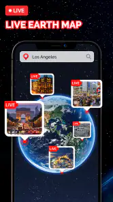
Explore the World with a Swipe
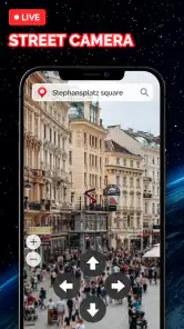
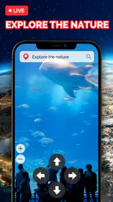
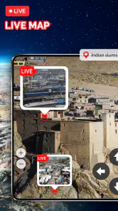
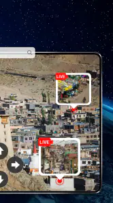
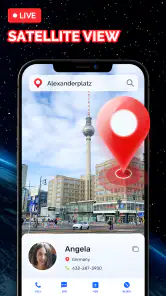
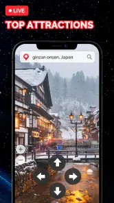
First off, let’s talk about the user interface. The Live Earth Map: Street View 3D app is as intuitive as it gets. You open it up, and bam! You’re greeted with a stunning globe that you can spin around with just a swipe. Fancy a trip to Paris? No problem, just zoom in and voila, you’re standing right next to the Eiffel Tower. The 3D street view is mind-blowing, making you feel as if you’re actually there. It’s so realistic that you might find yourself reaching out to touch the digital landscapes.
Features that Get You Hooked
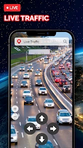
What really caught my eye are the features packed into this app. It’s not just about pretty pictures; you get real-time updates, live traffic conditions, and even weather forecasts. Planning a trip? This app doubles as a handy travel companion. You can bookmark locations, measure distances, and even find the best routes. It’s like Google Maps on steroids!
And let’s not forget the offline maps. Yep, you heard me right. You can download maps and access them without any internet. This is a total game-changer, especially when you're traveling to remote areas with spotty Wi-Fi.
Why You’ll Love It
Now, I’ve got to admit, I’m a bit of a tech geek. But even if you’re not, you’re going to love the simplicity and functionality of this app. It’s perfect for virtual tourists, geography students, or anyone with a bit of wanderlust. The app is constantly updated, so you’re always getting the latest and greatest in map technology. And the best part? It’s totally free! You can explore the world without burning a hole in your pocket.
However, like all great things, it’s not without its quirks. Sometimes, the street view can be a tad slow if you’re on a shaky internet connection. But hey, a little patience goes a long way, right?
Overall, the Live Earth Map: Street View 3D app is a must-have for anyone who loves exploring. Whether you’re planning your next vacation or simply satisfying your curiosity about the world, this app has got you covered. So, go ahead, download it, and let your adventures begin!
Pros
- High-quality 3D maps enhance navigation.
- Real-time traffic updates improve planning.
- Street view offers immersive exploration.
- User-friendly interface for easy access.
- Customizable map themes for personalization.
Cons
- Requires constant internet for real-time data.
- Heavy on battery usage during long sessions.
- Limited offline map capabilities.
- Ads may interrupt user experience.
- Some areas may lack detailed street view.