LA Metro - Official
- 76.00
- 4.5
- Installs
- 10.00K
- Price
- Free

Screenshots
Analysis by Reviewed
When I need to cross Los Angeles without relying on a car, the hardest part is rarely choosing a destination. The real challenge is turning that destination into a trip I can actually follow: finding the right Metro service, knowing when to leave, and adjusting when the vehicle is not moving exactly as expected. LA Metro - Official is built around that practical problem. It is a free travel and local app from TAP LA that combines trip planning with live ride information for Metro.
My first impression is that it feels more useful as a travel companion than as something I would browse casually. I open it because I have somewhere to be, not because I want to explore a map. That focus is a strength. The app sits in a crowded category where general map apps are often the default, yet its connection to Metro makes it a more direct choice for riders who already know they will use the system.
The app has an average rating of 4.5 from around 160 ratings, with more than 70 written reviews and over 10 thousand installs. Those figures suggest a modest but engaged audience rather than a huge general-purpose platform. It is rated for Everyone, costs nothing to use, and currently appears as version 5.194.1.1788. It runs on Android 7.0 and newer, which is helpful if an older phone is still doing dependable daily work.
From a vague destination to a workable Metro trip
Starting with the actual problem
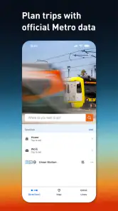
A realistic use case is leaving work in the afternoon with a meeting on the other side of Los Angeles. I may know the destination address but not the best station, transfer, or departure time. Instead of piecing together a route from separate browser searches, I use the planner as the first step. The useful mindset is to enter the trip as it exists in real life: where I am starting, where I need to finish, and when the arrival matters.
That distinction matters because a route that looks short on a map may involve an awkward walk or a transfer that leaves little room for delay. A Metro-focused planner encourages me to think in terms of the transit journey rather than simply the road distance. I can judge the proposed route against my own tolerance for walking, waiting, and changing services.
The best use of this app is not blind trust; it is turning a route suggestion into a plan I can verify. Before leaving, I check the suggested path, identify the first station or stop, and note where I will need to hand off from one part of the journey to another. That small preparation makes the live tracking tools more useful later because I know what information matters.
Reading the plan before walking out
I would not treat the first result as automatically perfect. A planner can give me a sensible Metro route while my personal starting point is inconvenient, a station entrance is farther away than expected, or the final walk is unsuitable with luggage. The app helps me organize the transit portion, but I still need to apply common sense to the parts that happen outside the vehicle.
This is one of the less obvious trade-offs compared with a broad map application. A general map service may be better when I am mixing Metro with a rideshare, a long walk, or several unrelated stops. LA Metro - Official is more appealing when the central question is, “How do I use Metro for this trip?” That narrower purpose can reduce distraction, but it also means I should not expect it to replace every navigation tool on my phone.
For a visitor, I would use the planner before reaching the station, ideally while I still have time to compare the suggested route with the appointment time. For a regular rider, the value is different: the app becomes a quick confirmation tool. I can check whether the familiar route still makes sense today instead of assuming that yesterday’s routine will fit the current trip.
Following the ride in real time
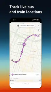
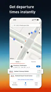
Once I have started the journey, the live information becomes the more important part. The store summary emphasizes real-time, accurate information for tracking a ride, and that is where the app can move beyond a static timetable. I can use the current status to decide whether to keep waiting, prepare for the arrival, or reconsider the next part of the trip.
The practical benefit is not simply seeing a moving marker or an updated estimate. It is reducing uncertainty at the moments when uncertainty is most expensive. If I am standing at a station before an appointment, knowing that the service is being tracked is more useful than repeatedly refreshing a general search result. If the ride is delayed, the information gives me a chance to change my expectations before I am already late.
I would still leave a buffer. “Real time” does not mean the app can eliminate traffic, platform crowding, boarding time, or the walk from the station to the final address. The information is most valuable as an early warning and decision aid, not as a promise that every handoff will happen at an exact minute.
A useful workflow for a time-sensitive trip
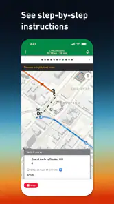
My preferred workflow is simple. I plan the complete route first, inspect the transfer points, begin the trip with the first service in mind, and then use the live view to reassess while I travel. When I approach a changeover, I check the next part rather than assuming the original plan is still the best one. This avoids a common mistake: planning carefully at home and then ignoring new information once the journey has begun.
Enter the starting point and destination with the arrival time in mind.
Look at the proposed Metro route and identify every transfer or substantial walk.
Check the ride information before leaving and again at the point where waiting matters.
Use the updated information to decide whether to continue, wait, or revise the next handoff.
Keep the final walk separate in your thinking so a transit arrival is not mistaken for arrival at the destination.
This process is especially helpful for people who know Los Angeles destinations better than they know Metro. It turns the app from a route generator into a sequence of decisions. That is a more realistic way to travel in a large city, where the best plan can change between the front door and the platform.
Where the handoffs create friction
Every public-transit trip contains handoffs. The first is from my phone to the street: I must leave the app, walk to the correct place, and recognize that I am at the right entrance or stop. The second is from one service to another. The third is from the final station to the destination itself. LA Metro - Official is strongest around the Metro portion, but these transitions still require attention from me.
A route can be technically correct and still feel difficult if I arrive at the wrong side of a large intersection, underestimate a walk, or have to make a rushed transfer. That is why I value the app more when I use it in stages. I do not just ask it for a route once; I use the information to prepare for the next handoff. This is a concrete advantage over treating a trip as one unbroken line on a map.
There is also a human handoff: sharing the plan with someone who is expecting me. If I tell a friend that I am “on the way,” the live ride information helps me make that statement more honestly. I can explain whether I am still waiting, already moving, or approaching the transfer. The app does not solve the communication itself, but it gives me a clearer basis for it.
For a family member, occasional visitor, or rider carrying bags, I would pay particular attention to the number of changes rather than choosing only the fastest-looking option. A slightly longer journey with fewer handoffs may be easier to complete. The app can support that judgment, but the final choice remains mine because comfort and confidence are not always represented by a single travel estimate.
What the result feels like in everyday use
The outcome I want is not an impressive map. I want to reach the destination with fewer moments of guessing. When the planner gives me a route and the live tracking helps me understand what is happening now, the trip feels more manageable. I know what I am waiting for, which change comes next, and when I need to stop looking at the transit portion and focus on the final walk.
That makes the app a good fit for a commuter whose routine includes Metro, a student traveling to a different part of the city, or a visitor who wants a transit-specific starting point. It is also useful for someone who dislikes standing at a stop without knowing whether the expected ride is close. The live element gives the journey a sense of progression rather than leaving me with a timetable that may already be outdated.
The free price removes an important barrier. I can recommend trying it without asking someone to commit to a subscription or purchase. The Everyone rating also makes it suitable for a broad household audience, although younger users may still need practical guidance about navigating stations and city streets.
Its current audience size is not a reason to dismiss it. In fact, a focused app can be preferable to a massive platform when I want Metro information without unrelated travel suggestions. The developer, TAP LA, has kept the product’s identity clear: it is for planning and monitoring Metro journeys, not for pretending to be an all-purpose replacement for every travel app.
Where I would choose an alternative
I would choose a general navigation app when the trip depends heavily on driving, cycling, walking through unfamiliar neighborhoods, or combining several transportation types. Those tools often provide a broader picture of the complete door-to-door journey. If I am comparing a Metro route with a car journey or coordinating a pickup at the destination, a wider service may be more convenient.
I would also hesitate to rely on this app alone for a trip where a missed arrival time has serious consequences. Live information can improve my decisions, but it cannot guarantee that the service will arrive, that a transfer will remain comfortable, or that the last walk will be easy. For an airport connection, an interview, or an event with strict entry timing, I would use the app alongside extra time and a backup plan.
Another limitation is psychological rather than technical: a transit app can make a route look more settled than it feels on the ground. I still need to watch station signs, listen for announcements, and confirm that I am boarding the service shown in my plan. The app should reduce mental load, not replace awareness.
Small habits that make the app more useful
I get better results when I check the route before I am already late. That gives me time to notice an inconvenient transfer and choose whether the added simplicity is worth more travel time. I also keep the final address visible separately in my mind, because a successful Metro arrival is only one stage of the trip.
For recurring journeys, I use the planner as a comparison tool rather than automatically repeating the same route. A familiar route may be fine most days, but a different transfer can sometimes make more sense for a particular appointment or starting point. Rechecking also prevents me from confusing what I remember with what the service information currently indicates.
When traveling with another person, I would agree on a meeting point before boarding. That avoids turning a transfer into a second problem if we become separated. The app helps each rider understand the Metro plan, but a clear physical meeting point handles the part technology cannot.
Finally, I treat the live view as something to consult at decision points: before departure, while waiting, and before a transfer. Constantly watching it is unnecessary and can make the trip more stressful. Used selectively, it gives me timely information without making my phone the center of the entire journey.
My recommendation after following the complete workflow
LA Metro - Official succeeds because it addresses the two questions that matter most to a Metro rider: how to organize the trip and what is happening with the ride now. I like that the route-planning and tracking roles belong together. The handoff from planning to traveling feels natural, and the app is most convincing when I use it as a live companion rather than a one-time search box.
It is not the right choice for every journey. People who need broad multimodal navigation, detailed door-to-door driving guidance, or a guaranteed schedule should keep another option available. Riders must still allow time for walking, transfers, and real-world disruption. Those limits are important, but they do not cancel out the app’s focused usefulness.
For anyone whose Los Angeles travel regularly involves Metro, I think it is worth installing because it is free, straightforward in purpose, and practical at the exact moments when uncertainty causes the most trouble. My recommendation is strongest for commuters and occasional riders who want to make better decisions before and during a trip. Use it to plan deliberately, check the live ride at handoff points, and keep a little human judgment in the loop. That combination gives the app its real value.
Pros
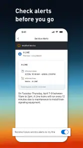
- Official service alerts help users plan around delays and disruptions.
- Station and stop information makes it easier to find nearby Metro access.
- Supports trip planning across rail and bus services in Los Angeles.
- Useful for checking route details before traveling in unfamiliar areas.
- Official information can be more reliable than third-party transit apps.
Cons
- Real-time arrival estimates may occasionally be inaccurate or delayed.
- Some features depend on a stable internet or mobile data connection.
- The interface can feel less intuitive for first-time users.
- Coverage is focused on Los Angeles Metro services
- not every local operator.
- Service information may be limited during unusual or rapidly changing disruptions.

- Category
- Travel & Local
- Version
- 5.194.1.1788