Helipaddy: Heli Landing Sites
- 4.00
- 2.4
- Installs
- 10.00K
- Price
- Free

Screenshots

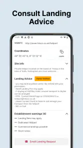
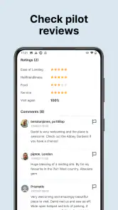
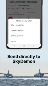
Analysis by Reviewed
Planning a helicopter trip is rarely just a matter of choosing a destination and following a road route. The difficult part is often finding a practical place to land, checking whether it suits the flight, and passing the right details to everyone involved. That is the problem Helipaddy: Heli Landing Sites tries to solve. I found it most useful as a specialist starting point for locating helicopter landing sites rather than as a complete flight-planning replacement.
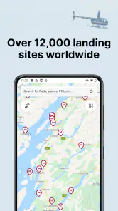
Developed by Helipaddy Ltd, this free Travel & Local app focuses on a very specific audience: helicopter pilots, operators, passengers who regularly arrange private flights, and people responsible for coordinating landing locations. Its central appeal is a large directory of sites, with more than twelve thousand locations presented as the service’s main resource. That makes it far more targeted than an ordinary maps app, but it also means the value depends heavily on how well a listed site fits the particular flight being planned.
I would not approach it like a normal navigation app. Google Maps or Apple Maps can help with roads, addresses, and nearby businesses, but they are not designed around helicopter landing points. Helipaddy sits in the gap between a general map and the practical search process behind a helicopter journey. Its real strength is reducing the time spent searching for possible landing locations.
From a vague destination to a workable landing plan
The starting condition matters more than the destination
A useful way to judge this app is to begin with a realistic situation. Imagine that I need to arrange a helicopter journey to a rural hotel, private home, event venue, or business site. I may know the final destination, but that does not automatically tell me where the aircraft can land. A nearby airport may be inconvenient, a field may not be suitable, and a location that looks close on a road map may still be impractical for the flight.
In that situation, I use Helipaddy to form a shortlist of possible landing sites. The app’s focus on helicopter pads and related landing locations is immediately more relevant than searching a conventional map for “helipad.” A general map may return a mixture of hospitals, airports, businesses, old references, and places that are not useful for my particular operation. A specialist directory gives me a better first filter.
The important word is “shortlist.” I would not treat the first result as an automatic answer. A directory can point me toward options, but the final choice still needs human checking. The site may be near the destination yet unsuitable for the aircraft, the weather, the timing, the local surroundings, or the permissions required. The app helps me begin the investigation; it does not remove the responsibility of completing it.
This distinction is especially important for occasional users. Someone arranging a one-off helicopter transfer may expect a pin to mean “approved and ready to use.” That would be the wrong assumption. I see each result as a lead that needs to be reviewed and handed to the pilot or operator for confirmation.
More From Our News Desk

Clash of Clans Is Won Between the Battles

Android Auto Makes the Case for Quieter Car Software

MobiOffice: Transforming Mobile Productivity with Seamless Integration

EA SPORTS FC™ Mobile Soccer: Redefining Mobile Sports Gaming

How Microsoft OneDrive Became a Mobile Productivity Giant

How Google Translate Breaks Language Barriers Effortlessly
Searching is most useful when I already know the mission
The app makes more sense when I approach it with a clear purpose. Before opening it, I would note the destination, the preferred arrival time, the aircraft or operator involved, and whether the landing is for a private property, a commercial venue, or a more established aviation location. Those details change which sites are worth considering.
For example, a landing location that works for a short passenger transfer may not be appropriate for a larger aircraft or a night operation. A site near a venue may be convenient for passengers but awkward for ground access. A remote location may look attractive on the map but create problems for a vehicle collecting the passengers. Helipaddy cannot make those decisions for me, but it helps expose the possible locations that I need to compare.
One practical habit is to search broadly first and narrow the list later. I would rather identify several nearby candidates than commit too early to one pin. That gives the pilot or operator alternatives if the first site is unavailable, unsuitable, or too difficult to coordinate. It also makes the conversation with the destination more productive because I can ask about specific places instead of making a vague request for “somewhere nearby.”
The step-by-step flow I would follow
My workflow begins by opening the directory and looking for landing sites around the destination rather than assuming the destination itself has a usable pad. I then compare the locations in relation to the actual passenger journey. The closest pin is not always the best one if it leaves passengers far from the venue or requires an awkward road transfer.
Next, I separate possible sites into three groups: the most convenient, the most operationally promising, and the best backup. This is a simple but useful distinction. A site can be geographically convenient while still needing more investigation. Another can be slightly farther away but easier to reach by car or easier for the operator to coordinate. Keeping those roles separate prevents me from confusing “nearest” with “best.”
After that, I pass the candidate details to the person who can make the operational decision. Depending on the trip, that may be a pilot, a charter company, a property owner, an event organizer, or a local contact. I would include the site name or location, its relationship to the destination, and any questions that still need answers. The app is most valuable here as a shared reference point in a larger process.
Finally, I keep a backup in view until the flight is confirmed. This is one of the less obvious ways to use a landing-site directory well. A backup is not just useful for emergencies; it can also reveal that the original location is not the only option. If the first choice depends on a private owner, a temporary event arrangement, or a particular access route, having another candidate ready can save time later.
What I would verify before treating a result as usable
I would check the site’s position against the real destination, then ask the operator to assess the aviation side. That includes whether the location suits the aircraft and the planned operation, whether permission is needed, and whether the site is currently available for the intended visit. A listing is a starting point, not a substitute for that conversation.
I would also verify the ground handoff. Passengers need to know how they will get from the landing point to the final destination. If a hotel, estate, or event site is involved, someone on the ground should know where the aircraft is expected and how passengers will be collected. This is where a seemingly excellent site can become inconvenient: the aircraft may land close to the destination, but the passenger transfer may still be unclear.
For rural or private locations, I would be particularly careful about relying on an old assumption. The practical situation around a landing site can change even when its map position does not. That is why I prefer to use the app to identify contacts and possibilities, then confirm the details through the operator or destination before making promises to passengers.
Handoffs are where the app becomes genuinely useful
The first handoff is from the person arranging the trip to the pilot or flight operator. I would send a small, clear shortlist rather than a long collection of unfiltered results. The goal is to make a professional decision easier, not to transfer the entire search burden to someone else.
The second handoff is between the operator and the landing-site contact. This is where practical questions are resolved: whether the site can be used, when the aircraft is expected, and what local arrangements are needed. Helipaddy can support the discovery stage, but the actual agreement belongs between the responsible people.
The third handoff is to the passengers or ground team. They need a simple outcome, not a directory search. They should know where to go, who is meeting them, and what happens after landing. I find this a useful test of whether the planning is complete. If I cannot explain the landing point and onward transfer clearly, I am not finished just because I found a pin.
This workflow also explains why the app may feel less satisfying to someone expecting a polished consumer travel experience. It is not necessarily designed to carry every participant from search to booking to transfer in one uninterrupted journey. Its role is narrower and more specialist: help identify landing locations so the people with operational responsibility can take the next steps.
What the result looks like in everyday use
In a realistic scenario, I might be arranging a helicopter arrival for a countryside wedding. The venue is outside a major town, and the couple wants to avoid a long road transfer. I search around the venue, identify several possible landing locations, and compare them by distance and practical access. I then send the shortlist to the operator and ask the venue team which ground transfer they can support.
The outcome is not simply “the app found a helipad.” The better outcome is a coordinated plan: one preferred site, one backup, a responsible contact for confirmation, and a clear route for passengers after landing. Helipaddy helps with the first part of that chain. Its value grows when I use it as a planning tool shared between people rather than as a final authority.
Another useful scenario is a business visit to a location that is poorly served by conventional transport. A company assistant may need to find a landing option near a factory or estate, then pass the information to a charter operator and the company’s driver. In that case, the directory can save the assistant from starting with scattered web searches. The time saved comes from having aviation-specific candidates in one place, even though the final coordination still happens outside the app.
Where the flow breaks down
The biggest limitation is the gap between discovering a site and knowing whether it is the right site today. A directory can contain valuable coverage, but a search result does not automatically answer every operational question. Users who need live availability, booking, detailed aircraft suitability, or a complete door-to-door itinerary may find themselves moving back and forth between the app, phone calls, messages, and other navigation tools.
That extra work is not necessarily a flaw for experienced pilots, who are used to verifying information. It is more frustrating for a passenger or administrator who wants a simple booking-style experience. If I were arranging a flight without support from a professional operator, I would be cautious about relying on the app alone.
The app’s average rating is 2.4 from roughly sixty ratings, with a smaller group of written reviews. I would treat that as a reason to test the current experience carefully rather than as a complete verdict. Specialist apps often serve a narrow audience, but a low overall score still suggests that usability or expectations may vary. I would make sure the app works comfortably on my device before depending on it for a time-sensitive trip.
There is also a commercial consideration. The app is free to install, while in-app purchases are listed at $59.99 per item. That makes it important to understand what I actually need before paying for anything. A casual user who only wants to investigate a possible landing location may not have the same needs as a frequent pilot or operator. I would avoid treating the free download as proof that every useful part of the workflow is cost-free.
Compatibility is another practical checkpoint. The current version is 5.5.7 and requires Android 6.0 or later. That covers many older devices, but I would still install and test it before a trip, especially if the phone is used for navigation or communication. A specialist directory is only helpful when it is available at the moment I need it.
How it compares with ordinary map apps and aviation research
For a normal road journey, I would choose a mainstream maps app. It is better suited to turn-by-turn driving, traffic, addresses, and finding the final ground destination. Helipaddy is not a replacement for those tools once passengers are on the road. I would use both when necessary: this app to identify helicopter landing possibilities, then a familiar map for the onward transfer.
Compared with a web search, the specialist directory gives me a more focused starting point. Searching the open web can produce useful local information, but it can also return outdated pages, irrelevant businesses, or vague references. Helipaddy’s aviation-specific purpose makes the initial discovery process more efficient, particularly when I am looking in an unfamiliar area.
Compared with direct contact with an operator, however, the app is not always the better first step. If I already have a trusted charter company handling the flight, that operator may know the region, suitable sites, and local contacts more effectively. In that case, Helipaddy is best used as a second opinion or a way to explore alternatives, not as a replacement for professional knowledge.
For frequent users, the trade-off is straightforward: a specialist directory can be worth the extra verification because it saves repeated searching, while occasional users may prefer to ask the operator to handle the location research. The right choice depends less on how often I fly and more on whether I am responsible for finding the landing site myself.
Who should use it, and who should skip it
I would recommend Helipaddy to pilots and aviation professionals who need a focused source of possible helicopter landing locations. It can also help travel coordinators, estate managers, event planners, and executive assistants who regularly arrange helicopter arrivals and need a practical way to begin local research.
It is also useful for a passenger who has already been asked to suggest landing options near a destination. In that role, I would use it to prepare informed possibilities before handing them to the operator for approval. That is a realistic benefit: it improves the quality of the conversation without pretending that the passenger is making the aviation decision.
I would skip it if I only need ordinary travel directions, a hotel search, or road navigation. I would also avoid making it my only tool if I expect instant booking, live operational confirmation, or a complete passenger-transfer plan. Those needs are better handled by a charter operator, local contact, or conventional navigation service alongside the directory.
My final take after following the full workflow
Helipaddy: Heli Landing Sites is a focused app with a clear job: help me discover helicopter landing possibilities when a normal map is too general. Its directory of over twelve thousand sites gives it a useful starting position for specialist research, and its free price makes it easy to try before deciding whether it fits my workflow. The Everyone age rating also makes it broadly accessible, although the subject matter naturally suits adults involved in travel or aviation planning more than casual tourists.
I like it most when I treat it as the first link in a chain: search, shortlist, verify, hand off, and arrange the ground transfer. That approach turns a collection of map results into a usable travel plan. The less obvious benefit is that it encourages me to think about alternatives and responsibilities early, rather than discovering at the last minute that the nearest landing point is not practical.
My reservation is that the app cannot remove the real-world friction surrounding helicopter operations. Permissions, suitability, availability, weather, operator judgement, and passenger transfers still require human coordination. Anyone expecting a one-tap answer may be disappointed, particularly given the modest average rating and the possibility of paid in-app items.
Overall, I see this as a specialist research companion rather than a complete travel service. Use it to find and organize possibilities, then let the pilot or operator confirm the decision. If that matches your role, it can save meaningful time. If you simply want directions from an airport to a hotel, a standard maps app will be the more comfortable choice.
Helipaddy: Heli Landing Sites Frequently Asked Questions
Is Helipaddy: Heli Landing Sites free to download, and are there in-app purchases?
Helipaddy is free to download, so you can install it without paying an upfront price. It also offers in-app purchases, listed at $59.99 per item, so check the purchase details in the app before committing to anything. The app is published by Helipaddy Ltd and is intended for pilots looking for helicopter landing-site information.
What devices can run Helipaddy: Heli Landing Sites?
The Android app requires Android 6.0 or later, which covers a range of older and newer devices. Before downloading, check your device’s operating-system version and available storage in the relevant app store. Helipaddy is a travel and local app, and its usefulness will depend on having a device that can display the site information clearly when you are preparing for a flight.
What is Helipaddy: Heli Landing Sites used for?
Helipaddy: Heli Landing Sites is designed to help helicopter pilots find, organize, and use information about helicopter landing locations. The app can be useful when planning a flight, checking possible landing options, and keeping landing-site details available in one place. It is primarily a planning and reference tool, rather than a replacement for official aviation charts, NOTAMs, local permissions, or professional flight judgment. Its stated directory covers over 12,000 sites, making it a broad starting point for researching possible locations.
Does Helipaddy provide accurate and up-to-date landing-site information?
The app may include useful details such as landing-site locations, descriptions, access information, and other pilot-oriented notes, but users should not assume that every listing is current or suitable for every operation. Landing conditions, permissions, obstacles, ownership, and availability can change. Before relying on a site, pilots should verify the information with official sources, the site owner, current aviation data, and local authorities.
Can I use Helipaddy for real flight planning and navigation?
Helipaddy can support flight preparation by helping pilots research and compare potential landing sites, but it should not be treated as the sole navigation or operational planning system. It may not replace certified navigation equipment, approved charts, weather briefings, NOTAM checks, aircraft performance calculations, or regulatory requirements. Pilots remain responsible for confirming that a selected site is legal, safe, accessible, and appropriate for the helicopter and conditions.
Pros
- Detailed database of helicopter landing sites worldwide.
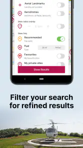
- Useful filters help pilots find suitable locations quickly.
- Includes site notes
- photos
- and important landing information.
- Allows users to contribute new sites and update existing data.
- Helpful planning companion for private and professional helicopter flights.
Cons
- Coverage and accuracy can vary significantly by country or region.
- Some site details may become outdated without recent user updates.
- Many useful features may require an account or paid access.
- Not a substitute for official aviation charts
- permissions
- or local advice.
- The interface may feel less intuitive for first-time users.
- Category
- Travel & Local
- Version
- 5.5.7