Street View Live 3D GPS Map
- 86.00
- 3.4
- Installs
- 1.00M
- Price
- Free

Screenshots

Analysis by Reviewed
I often find a map most useful before I set out, not just after I have taken a wrong turn. That is the appeal of Street View Live 3D GPS Map: it brings map browsing, street-level views and navigation together, so I can get a feel for a destination and then work out how to reach it. It is a free Maps & Navigation app from Game Soft Studio 3D, rated for Everyone, and it suits curious explorers as much as people who simply want help getting around.
A practical way to start a trip
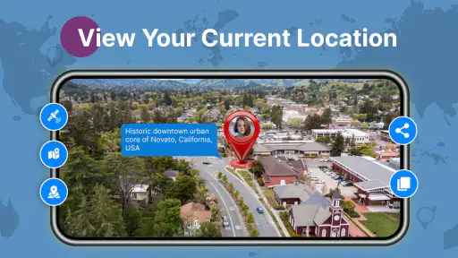
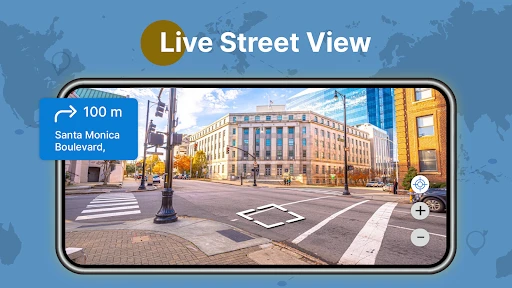
My most useful routine is to look up the destination before leaving, inspect the surrounding streets, then switch to directions when I am ready to travel. That small pause can answer practical questions a route line cannot, such as whether the entrance appears to face a main road or whether the destination sits in a dense cluster of streets. Street imagery is a visual aid, though, not a guarantee that the view reflects current conditions; I would still follow signs and check the place itself when I arrive.
For example, if I am meeting someone at an unfamiliar café, I can use the map view to understand the approach before setting off, then keep navigation focused on the journey. Saving a place is handy for a repeat visit, but I would use a clear mental system—such as saving only destinations I genuinely expect to revisit—rather than filling the map with every passing stop. A tidy set of saved places is faster to scan when I am in a hurry.
Making a destination easier to recognize
There is a useful distinction between finding an address and recognizing it. A route can take me to the right block without making the last few steps obvious, especially when several entrances, side streets, or similar-looking buildings are close together. I use the visual view as a pre-arrival check, then keep the written address handy so I am not relying on a picture alone. This is particularly helpful when I am being dropped off nearby or walking from a transit stop and need to choose the correct approach.
If I am planning to meet a friend, I would share a clear meeting point in ordinary terms rather than assume we will both interpret the same pin. A corner, a visible storefront, or the entrance facing a named street is easier to describe than “near the marker.” That small habit makes the app more useful without expecting it to solve the social part of coordinating a visit.
Exploring the World from Your Couch
Imagine being able to explore the bustling streets of Tokyo, the historic alleys of Rome, or the sun-kissed beaches of Hawaii, all from the comfort of your home. That’s exactly what Street View Live 3D GPS Map offers. With its immersive 3D street views, you can virtually walk around any corner of the globe. The app’s interface is super user-friendly, making it easy to jump from one location to another without missing a beat.
Settings and habits that make a difference
Before relying on any navigation app for a drive, I check that location access is available and that the destination is entered correctly. Those simple checks matter more than tapping through a route quickly: a misplaced pin can send you to the wrong side of a large building, while a poor GPS signal can make a moving position less dependable. I also set the route before driving and let voice guidance do its job, rather than handling the phone on the road.
More From Our News Desk

Clash of Clans Is Won Between the Battles

Android Auto Makes the Case for Quieter Car Software

MobiOffice: Transforming Mobile Productivity with Seamless Integration

EA SPORTS FC™ Mobile Soccer: Redefining Mobile Sports Gaming

How Microsoft OneDrive Became a Mobile Productivity Giant

How Google Translate Breaks Language Barriers Effortlessly
The app’s different map views are best treated as tools for different questions. Street-level imagery helps me recognize a place; a conventional map is easier for seeing the broader route; a 3D view can make nearby terrain or building shapes easier to interpret. I would not assume that a 3D appearance means every path is suitable for walking or that imagery is live. When timing matters, I use the directions as guidance and verify important details through signs or another trusted source.
Questions to settle before depending on it
Can it help me find an address I have never visited? Yes, as a planning aid: I can inspect the surroundings, compare the approach with the map, and start directions once I know what to look for. Should I trust the street view as a current picture? No. I treat it as a visual reference and expect the real scene to differ sometimes. That distinction is important when a road layout, entrance, or business frontage may have changed.
For a drive, I would also decide in advance whether I need ongoing route guidance or only a quick look at the destination. Starting with a clear destination and checking the route while parked avoids last-second searching. If the location dot seems off, I wait for it to settle and confirm the street name instead of making a sudden turn based on one moment of GPS positioning.
The Nitty-Gritty of Navigation
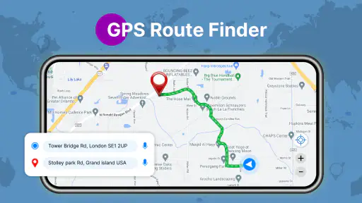
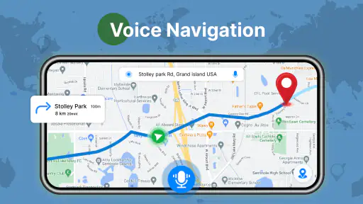
One of the standout features of this app is its precise GPS navigation. Whether you’re trying to find the quickest route to a coffee shop or planning a road trip, the app provides real-time updates on traffic conditions, helping you avoid those pesky jams. Plus, the voice-guided navigation is a lifesaver, especially when you’re driving and can’t keep your eyes glued to the screen.
The app also offers a unique feature where you can pin your favorite spots. So, the next time you’re planning a visit to your grandma’s or your favorite burger joint, you can save the locations for easy access. Pretty neat, right?
Quicker planning without overcomplicating it
For a familiar commute, I would go straight to the saved destination rather than browse street imagery again. For a new address, I reverse that order: inspect the area first, then start directions once I have a useful idea of where I am headed. This split workflow is a small but worthwhile time-saver, especially when a destination is in a busy district where the final approach can be confusing.
On a day trip, I might save the main destination and one likely stop, but avoid building an elaborate itinerary inside a navigation app. The benefit is quick access without turning route planning into a second task. If I am comparing several possible places, I check each one visually and then choose; I do not treat a striking map view as evidence that a venue is open or that its entrance is easy to reach.
A repeatable routine for busy days
When I have several errands, I find it more useful to group destinations by area than to save every address I might conceivably visit. I can check the first stop, note the next one, and keep the active route focused on where I am going now. This is a modest workflow, but it reduces clutter and makes saved places more meaningful. It also avoids the temptation to keep changing destinations while already on the move.
For an appointment, I would check the area before leaving and allow myself time to confirm the actual entrance on arrival. For a casual outing, I might browse first and decide whether the place looks easy to approach. Those are different jobs: one is about arriving predictably, the other about getting a better feel for a location. The app is more helpful when I choose which question I want the map to answer.
Visual Delight with 3D Maps
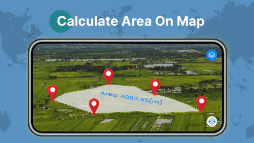
Now, let’s talk visuals. The 3D maps are not just a show-off; they’re genuinely useful. They give you a realistic view of the terrain, helping you understand the landscape better. This is particularly helpful when you’re hiking or trekking in unfamiliar areas. The detailed graphics make it feel like you’re actually there, turning your navigation experience into a visual treat.
Where I would choose another tool
Compared with a dedicated turn-by-turn navigation app, this one’s attraction is the combination of visual exploration and directions, rather than navigation alone. If my priority were dependable route guidance for a long drive, I would choose an option whose routing, traffic information and offline planning I already know well. For remote hiking, I would use a purpose-built trail map instead of relying on a general street-view experience; a 3D landscape can help me orient myself, but it is not a substitute for trail-specific information.
It is also worth keeping expectations grounded. Street imagery can be useful for orientation, but the scene may not match what is there today, and GPS accuracy depends on the device and surroundings. In dense streets or beside tall buildings, I would give the location dot a moment to settle before acting on it. These are practical limits of map-based navigation, not reasons to avoid the app, but they matter if a missed turn would cause a real problem.
Choosing between a visual map and a specialist navigator
The usual alternative is a navigation-first app that emphasizes driving routes, traffic, and familiar turn prompts. I would lean toward that kind of tool when the journey is long, timing is tight, or I already depend on a workflow that I know works for me. Here, the extra appeal is being able to inspect a destination visually as part of the same general trip-planning routine. That can save a switch between tools for a simple outing, but it does not automatically make this the stronger choice for every route.
For a neighborhood walk, I would use the map and street imagery to orient myself, but still pay attention to crossings, signs, and the actual pavement. For a rural route or a trip where connectivity is uncertain, I would plan with an option designed for offline use rather than assume any map view will be available when needed. The practical trade-off is clear: this app is most appealing when visual context matters, while specialized tools can be a better fit when a specific navigation capability is essential.
Who will get the most from it?
I would recommend it to someone who likes previewing places, wants a visual sense of an unfamiliar address, or needs a straightforward way to keep a few regular destinations close at hand. It can also be enjoyable for armchair exploring when the goal is to browse rather than travel. Someone who needs specialist outdoor navigation, extensive offline route planning, or a feature-rich driving tool may be better served by an app built specifically for that job.
The app has an average rating of 3.4 from around 2.9 thousand ratings, with 86 written reviews and over one million installs. It is currently at version 1.0.37 and supports Android 6.0 and later. Those figures suggest it has found an audience, while the modest average is a reminder to judge it by your own needs rather than assume it will replace every map tool. It is free to install, with in-app purchases listed at $6.99 per item.
What the rating and purchase model mean to me
I would approach it as a free app to try for visual browsing and everyday directions, not as a promise that every part of my preferred navigation routine will be covered. The average rating is a reason to keep expectations measured and test the basic workflow on a familiar trip before depending on it somewhere unfamiliar. In-app purchases are listed per item, so I would check what an optional purchase covers before paying rather than assume it is necessary for the functions I want.
Its Everyone rating makes the audience broad, but suitability still depends on how someone uses a map. A younger user can browse locations with an adult’s guidance, while a driver should set the route before moving and avoid interacting with the phone behind the wheel. A useful tool does not remove the need for ordinary care, especially when directions and real-world road conditions do not line up perfectly.
Why I Keep Coming Back
So, why do I keep coming back to this app? Well, it’s reliable, accurate, and incredibly easy to use. I’ve tried a bunch of navigation apps in the past, but this one takes the cake with its comprehensive features and seamless performance. Whether you’re a frequent traveler or just someone who loves exploring new places, this app is a must-have in your digital toolkit.
In a nutshell, Street View Live 3D GPS Map is more than just a navigation app; it’s your personal guide to exploring the world, near and far. So, go ahead, give it a whirl, and let it lead you to new adventures. Who knows, you might just discover your new favorite spot!
Street View Live 3D GPS Map Frequently Asked Questions
Is Street View Live 3D GPS Map suitable for first-time users of navigation apps?
It is presented as a Maps & Navigation app, with a short description focused on street view and a summary covering satellite maps, GPS navigation, and driving directions. Those familiar features make its purpose easy to understand before opening it. If you are new to navigation apps, you can start by exploring the map and directions options, then decide which features fit the way you travel.
Who develops Street View Live 3D GPS Map, and what is its general audience?
Street View Live 3D GPS Map is developed by Game Soft Studio 3D and is rated for Everyone. It is intended for people interested in exploring map views or getting driving directions, rather than for a specific age group. The app is free to download, while in-app purchases are available, so it is worth considering both the intended use and the purchase options before installing.
What features does the Street View Live 3D GPS Map app offer?
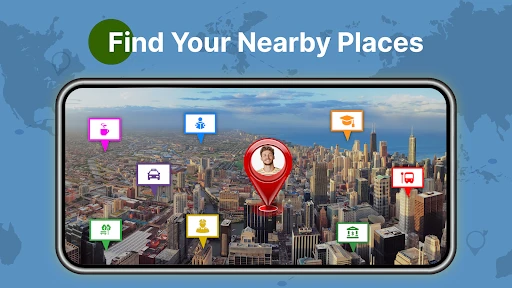
The Street View Live 3D GPS Map app provides a comprehensive suite of features for navigation and exploration. Users can experience live street views in 3D, access real-time GPS mapping, and utilize satellite imagery to explore any location worldwide. It also offers route planning, traffic updates, and nearby place suggestions to enhance travel experiences.
Is the Street View Live 3D GPS Map app free to use?
Yes, the Street View Live 3D GPS Map app is free to download and use. However, it may offer in-app purchases or premium features that require payment. Users should review the app's in-app purchase options and terms upon download to understand which features are included for free and which require additional payment. In-app purchases are listed at $6.99 per item.
How accurate is the GPS tracking in the Street View Live 3D GPS Map app?
The GPS tracking in the Street View Live 3D GPS Map app is highly accurate, utilizing advanced GPS technology to provide real-time location data. It ensures precise navigation by regularly updating position information and integrating with satellite data. Users can rely on it for accurate route planning and navigation, though occasional discrepancies may occur due to environmental factors.
Pros
- Provides real-time street views.
- Easy navigation and user-friendly UI.
- Accurate GPS tracking and updates.
- Supports 3D map visualization.
- Comprehensive global coverage.
Cons
- High data usage while streaming.
- Battery drains quickly during use.
- Limited offline functionality.
- Occasional map loading delays.
- Requires strong internet connection.

- Category
- Maps & Navigation
- Version
- 1.0.37