MBTA Go — Official
- 55.00
- 3.7
- Installs
- 50.00K
- Price
- Free

Screenshots
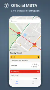
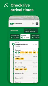
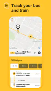
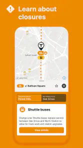

Analysis by Reviewed
When I need public transit information around Boston, I want an app that gets me to the useful part quickly: what is running, what is delayed, and which option makes sense for the trip in front of me. MBTA Go is built for that focused job. It is the official Maps & Navigation app from MBTA, and its purpose is straightforward: provide live public transit information for the Greater Boston area without trying to become a general travel platform.
That focus is its biggest advantage. I would not open it expecting a full replacement for every map, walking, cycling, or rideshare tool on my phone. I would open it when the MBTA itself is the subject of the question. Is my train approaching? Should I leave now for the station? Is the route I normally take behaving normally today? Those are the moments when an official transit app can be more useful than a broad mapping service that treats public transportation as only one layer among many.
MBTA Go is free and rated for Everyone, so it is easy to recommend as a low-risk addition for regular riders, occasional visitors, students, and anyone who wants a direct source for local service information. It was released on February 21, 2025, and the current version is 2.1.4, with a minimum operating-system requirement of 9. That makes the compatibility question fairly simple for most modern Android users, while older devices should be checked before installation.
How I use MBTA Go for an ordinary trip
My baseline workflow starts before I leave home, not when I am already standing on a platform. I open the app, check the transit information for the route I expect to use, and compare what I see with my actual departure time. That small habit matters because a live update is most useful when it changes a decision. If everything looks normal, I can continue getting ready. If the service picture is different, I have time to consider another departure or adjust the first part of my journey.
A realistic example is a weekday trip into the Greater Boston area. I already know the broad route, so I am not asking the app to teach me the city from scratch. Instead, I use it as a final check: are the services I depend on currently moving as expected, and is there a reason to leave earlier? This is where the official nature of the app helps. I am looking at information intended specifically for MBTA riders rather than trying to interpret a general-purpose map that may prioritize directions over the latest transit situation.
For a new visitor, the process is different. Someone unfamiliar with Boston may still need a broader mapping app to understand walking connections, landmarks, or a complete door-to-door itinerary. I would use MBTA Go alongside that tool rather than forcing one app to handle everything. The general map can explain the geography; MBTA Go can be the place I check the local transit condition before committing to the trip.
I also find it useful to separate planning from monitoring. Planning asks, “Which service should I take?” Monitoring asks, “Is that service still behaving as expected?” MBTA Go is most compelling for the second question. A route that looked fine earlier can become less convenient later, so checking again close to departure is a better habit than relying on a screenshot, an old search result, or memory from yesterday.
More From Our News Desk

Clash of Clans Is Won Between the Battles

Android Auto Makes the Case for Quieter Car Software

MobiOffice: Transforming Mobile Productivity with Seamless Integration

EA SPORTS FC™ Mobile Soccer: Redefining Mobile Sports Gaming

How Microsoft OneDrive Became a Mobile Productivity Giant

How Google Translate Breaks Language Barriers Effortlessly
The practical strength of MBTA Go is not that it eliminates every transit decision; it gives the decision a more relevant starting point. I still need to allow time for walking, transfers, and the unpredictability of a busy day. The app should support judgment, not encourage me to plan an arrival around an overly precise assumption.
What I check before leaving
I begin with the service I actually intend to use instead of browsing every possible option. That keeps the first check fast and prevents a common mistake: seeing a long list of information without identifying which detail affects my trip. Once I know the relevant line or service, I look for the current situation and then decide whether I need a backup plan.
A good backup plan is not always a completely different journey. It might mean leaving earlier, walking to a different stop, or choosing a later departure that gives me more breathing room. The app does not need to make that decision for me to be valuable. Its role is to reveal whether my normal routine deserves a second look.
I would also avoid checking only once in the morning if the trip is important. Conditions can change between the time I prepare breakfast and the time I reach the station. A quick second check shortly before leaving is a more dependable workflow than treating the first result as a promise.
Settings and phone habits worth checking
Experienced use begins with the phone, not with complicated tricks inside the app. I make sure the device is running a compatible operating system, keep the app updated, and avoid assuming that an old installation will behave exactly like the current release. Since the current version is 2.1.4, updating is a sensible first step if information seems stale or the interface does not match what I expect.
I also check the app’s notification and battery behavior on my own device. I do not assume that every phone handles background activity in the same way, and I do not build a critical commute around a notification arriving at precisely the right moment. If alerts are available and useful in my setup, they can add convenience, but I still open the app for a deliberate check before an important trip.
Location settings deserve a practical look as well. A transit app can be easier to use when the phone knows where I am, but I prefer to understand what access I am granting and whether I actually need it for the task at hand. When I already know my station, manually checking the relevant service may be simpler than waiting for the phone to determine my position. This is a small privacy and reliability trade-off: location can reduce friction, while a manual workflow gives me more control.
Another useful habit is keeping the app easy to reach. I place it where I can open it without searching through several screens, especially if I use transit daily. That is not an MBTA Go feature, but it changes the experience. The difference between checking live information and skipping the check is often only a few seconds of friction.
I would not fill the phone with several overlapping transit apps and expect that to create clarity. A general map, MBTA Go, and perhaps a favorite route-planning tool can each have a role, but too many sources can produce conflicting arrival expectations. I prefer one repeatable official check for MBTA information, followed by a broader map only when I need walking directions or a more complete itinerary.
Faster patterns for regular riders
Once the basic workflow feels familiar, the next improvement is reducing unnecessary decisions. I use a simple sequence: open the app, go directly to the service relevant to the trip, check the current information, and then choose whether to proceed or adjust. Repeating the same sequence is faster than exploring the interface differently every morning.
Shortcuts on the phone can support this routine. A home-screen placement, a frequently used app folder, or a device-level shortcut that opens the app quickly can make a meaningful difference. I am careful not to describe these as special MBTA Go functions; they are personal ways of reaching the app faster. The important point is that an official transit source is only useful when I remember to consult it before the decision is already made.
For a regular commute, I also separate “normal day” and “high-stakes day” checks. On a normal day, one look before leaving may be enough. On a day with an appointment, a connection, or a required arrival time, I check earlier and again before boarding. That is a better use of live information than constantly refreshing without a clear purpose.
Another non-obvious improvement is to record my own fallback choices mentally. If the usual service is disrupted, I want to know which nearby station, walking connection, or later departure I would consider. MBTA Go can inform that decision, but it cannot replace familiarity with the area. After a few trips, I build a small personal playbook: the normal route, the acceptable alternative, and the point at which I stop waiting and change plans.
This is also where the app compares well with ordinary web searches. Searching the web for a transit problem can return old pages, broad advice, or results unrelated to the exact service I need. Opening a dedicated MBTA app is less flexible for general research, but it is more direct when the question is specifically about current MBTA travel information. The trade-off is clear: broader tools offer more context, while MBTA Go offers a narrower and more relevant starting point.
Using it with other navigation tools
I would pair MBTA Go with a general map when the trip includes complicated walking. For example, if I am visiting an unfamiliar neighborhood, I may use a map to understand the walk from the station to the destination, then use MBTA Go to check the transit portion shortly before departure. This division of labor avoids expecting the official app to provide every kind of navigation detail.
For short, familiar journeys, I may not need the second app at all. If I know the station and destination, MBTA Go can be the quicker choice because it keeps my attention on transit rather than presenting driving, cycling, and walking options I do not need. That narrower view can be calming during a rushed morning.
For a visitor trying to compare public transit with a taxi, rideshare, or walking, a general travel app may be better for the initial comparison. MBTA Go becomes more useful after I have decided that MBTA service is the option I want to evaluate. In other words, it is strongest as a transit-specific companion, not as a universal trip marketplace.
Where the focused approach reaches its limits
The same focus that makes MBTA Go convenient also defines its boundaries. I would not choose it as my only navigation tool for a multi-stop sightseeing day, a trip that mixes several transportation types, or a destination where detailed walking guidance matters as much as the transit ride. A broader map can provide a more complete picture in those situations.
I also keep a buffer around live information. “Live” does not mean that every part of a journey is predictable, and an arrival estimate cannot account for every delay after I look at the screen. I use the information to make a better decision, not to remove all uncertainty. If I have an important appointment, I leave room for the walk to the stop, boarding time, transfers, and the possibility that conditions change after the check.
There is a second limitation in relying on any single official channel: I still need to pay attention to what is happening around me. Platform announcements, signs, staff instructions, and visible service changes can matter. If the information on my phone conflicts with an immediate instruction at the station, I do not blindly follow the earlier screen. The app is one input in a real environment.
The rating of 3.7 from around 116 ratings suggests that the experience has been useful for some riders but is not universally smooth. I read that as a reason to keep expectations practical. An official app can be valuable without being perfect, and a focused tool may still feel limited to someone expecting the polish or breadth of a major mapping platform. With around 50 thousand installs, it is established enough to attract a real user base, but I would still judge it by whether it fits my daily transit habits rather than by popularity alone.
Its free price removes the main barrier to trying it, though “free” does not mean it will suit every rider. Someone who rarely uses MBTA service may prefer the convenience of an existing map app. Someone who needs transit information outside the Greater Boston area will need another source for those journeys. And someone who wants detailed route comparison across driving, walking, cycling, and multiple transit agencies may find MBTA Go too specialized.
The Everyone content rating makes it appropriate for a wide range of users, including families and younger riders, but a simple age rating does not teach someone how to navigate an unfamiliar system. I would still help a child or first-time visitor understand the route, station, and backup plan rather than handing over the phone and assuming the app solves the whole problem.
Small frictions that affect trust
My biggest concern with a live transit app is not the number of screens; it is whether I know what the information means and when it was last checked. If the interface makes me work too hard to identify the relevant service, the official source loses some of its practical advantage. That is why I favor a repeatable route-first workflow instead of casual browsing.
Another friction is the temptation to refresh constantly. Repeated checking can create anxiety without improving the decision. I prefer to check at meaningful points: before leaving, near the station, and again when a delay or connection makes the trip important. This turns the app into a planning aid rather than a screen I stare at continuously.
Battery and connectivity are also real-world considerations. I would not let a low battery or unreliable connection leave me without any idea of where I am going. Before a long outing, I make sure I know the basic route and keep the phone charged. MBTA Go is most helpful when it supplements preparation, not when it is the only thing standing between me and an unfamiliar destination.
My verdict after making it part of the routine
I see MBTA Go as a practical specialist. It does not need to replace Google Maps, Apple Maps, or every other navigation option to earn a place on my phone. Its value comes from being the official MBTA-focused choice for live public transit information in the Greater Boston area. When I am riding regularly, that direct focus is more useful than a larger app that makes me sort through unrelated travel modes.
I recommend it most strongly to commuters, students, local residents, and visitors who already know that MBTA service will be central to their trip. The best results come from using it deliberately: check before leaving, check again when timing matters, keep a backup idea in mind, and use a broader map for walking or mixed-mode planning. Those habits make the app feel faster and more dependable without pretending it can control the transit system.
I would skip it as a primary tool if my travel is mostly outside Greater Boston, if I need comprehensive door-to-door planning, or if I rarely use public transportation and do not want another dedicated app. In those cases, a general navigation service may be simpler. I would also avoid treating any live update as a guarantee, particularly when a missed connection would have serious consequences.
For everyone else, the free download makes experimentation easy. MBTA Go is not a flashy all-purpose travel assistant, and that is exactly why I find it useful. It gives MBTA riders a focused place to begin, rewards consistent checking habits, and works best when combined with personal knowledge of stations and realistic time buffers. My final view is positive but measured: MBTA Go is worth keeping if Boston-area transit is part of your routine, especially when you use it as an informed check rather than your entire travel plan.
The app comes from MBTA, carries an Everyone rating, and is currently at version 2.1.4. Those details matter less than the everyday result: I can open one dedicated tool before a journey and make a more grounded choice about leaving, waiting, or changing course. For a specialized Maps & Navigation app, that is a clear and useful job—and one it is sensible to let it do well.
MBTA Go — Official Frequently Asked Questions
Who is MBTA Go — Official intended for?
MBTA Go — Official is intended for people traveling on public transit in the Greater Boston area, including regular commuters, occasional visitors, and anyone comparing routes before setting out. It focuses on MBTA travel information, so it may be a useful companion when checking subway, bus, commuter rail, or ferry details. The app is listed for everyone, making it suitable for a broad range of riders.
What is MBTA Go — Official, and what can I use it for?
MBTA Go — Official is a mobile companion for navigating Boston’s Massachusetts Bay Transportation Authority network. It is designed to help riders check subway, bus, commuter rail, and ferry information, plan journeys, view service updates, and access route or stop details. It is especially useful before and during a trip, although the exact tools and coverage can depend on the current app version and the MBTA data available at the time.
Does MBTA Go — Official provide real-time arrival and service information?
The app is intended to provide current transit information, including predicted arrivals, departures, alerts, and disruption notices for supported MBTA services. In practice, predictions can change because of traffic, equipment problems, weather, or incomplete vehicle data. For that reason, I recommend checking the information shortly before leaving and allowing extra time when traveling during busy periods or when the app displays a warning.
Can MBTA Go — Official plan trips across different MBTA services?
Yes, the app is designed to help users find routes involving multiple parts of the MBTA system, such as subway lines, buses, commuter rail, and ferries. It can be useful for comparing possible journeys and identifying transfers, stops, and estimated travel times. However, trip-planning results should be treated as guidance rather than a guarantee, since schedules, accessibility conditions, construction, and service changes may affect the actual journey.
Does MBTA Go — Official require an internet connection or location access?
An internet connection is generally needed to retrieve live arrivals, service alerts, updated schedules, maps, and trip-planning results. Location permission may also make it easier to find nearby stations or stops, but you can usually search for routes and locations manually if you prefer not to share your position. Mobile data usage should be modest, though frequent map viewing and live updates may consume more data and battery.
Pros
- Official real-time subway
- bus
- and commuter rail information
- Trip planning covers multiple MBTA services in one app
- Service alerts help users spot delays and disruptions
- Nearby stops make finding local stations and routes easier
- Mobile ticketing is convenient for eligible commuter rail trips
Cons
- Real-time predictions can occasionally be delayed or inaccurate
- Some features depend on a reliable internet connection
- The interface may feel crowded for first-time users
- Mobile ticket options vary by service and fare type
- Frequent alerts can become overwhelming during major disruptions
- Category
- Maps & Navigation
- Version
- 2.1.4












