MapXplorer: Navigation, Radar
- 272.00
- 3.7
- Installs
- 10.00M
- Price
- Free

Screenshots

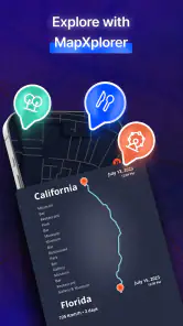
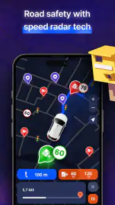

Analysis by Reviewed
I find navigation apps most useful when they help me make a decision before a trip becomes stressful. MapXplorer: Navigation, Radar brings together map viewing, offline preparation, and a radar-style display, which gives it a different feel from a basic turn-by-turn navigator. It is most interesting to me for journeys where mobile coverage may be unreliable or where I want to look beyond a single suggested route. It is not automatically a replacement for the app I already trust, though: the right choice depends on how you travel, what information you need at a glance, and whether its screen works comfortably for you.
Who benefits most from a map with an offline option?
I see the strongest case for this app when a journey may outlast a dependable connection: a day trip beyond town, a drive through patchy coverage, or exploring a new neighborhood while traveling. The useful move is to prepare before leaving, rather than assume offline access will solve everything on the spot. Downloading the area you expect to use gives you a better chance of keeping the map available when mobile data drops.
That preparation also makes the app a different kind of choice from the navigation tools many people already use. A familiar turn-by-turn map may be the simpler pick for a routine commute where signal is steady and traffic information is the priority. MapXplorer is more appealing when offline maps and a radar-style view are part of what you want to consult. I would not treat those strengths as a reason to abandon a trusted route-planning app without first checking how each one handles your regular journeys.
Getting Started with MapXplorer
First things first, let’s talk about the interface. MapXplorer: Navigation, Radar welcomes you with a clean, user-friendly design that doesn’t bombard you with unnecessary information. It’s straightforward, which I absolutely love, because who needs complicated menus when you’re trying to find your way?
Features that Stand Out
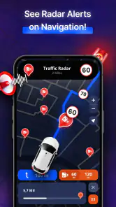
One of the coolest features is the real-time radar, which is perfect for those of us who love a bit of adventure. It gives you a bird’s eye view of your surroundings, ensuring you’re always aware of what’s around the corner. Whether you’re hiking in the wilderness or navigating a busy city, this feature is a game-changer.
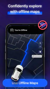
Another highlight is the offline maps feature. Gone are the days of getting lost because of a poor internet connection. With MapXplorer, you can download maps in advance and explore without worry. This is particularly handy when you’re traveling abroad or in areas with spotty coverage.
One practical habit I’d build into that workflow is checking the intended area before setting off, especially if your plans include a detour. Offline preparation is most useful when it matches the trip you actually take; an unfamiliar side road or an unplanned stop can put you outside the map area you prepared. I’d also compare the offline view with the live radar while connected, so you know which display feels easiest to read before needing it under pressure.
You May Like

Clash of Clans Is Won Between the Battles

Android Auto Makes the Case for Quieter Car Software

MobiOffice: Transforming Mobile Productivity with Seamless Integration

EA SPORTS FC™ Mobile Soccer: Redefining Mobile Sports Gaming

How Microsoft OneDrive Became a Mobile Productivity Giant

How Google Translate Breaks Language Barriers Effortlessly
For a weekend trip, I’d use that preparation as a small checklist rather than a last-minute download: identify the places I expect to visit, allow for a likely stop or route change, then open the map before leaving to make sure the area is available. This is a useful distinction from simply saving a destination. The journey itself may cross a boundary, and a map that covers only the endpoint may not be much help along the way. If the plan changes substantially, I’d pause somewhere safe and reassess instead of assuming the offline map automatically includes every alternative.
Making the screen work for you
Readable maps are not only about a tidy layout. In bright daylight, glare can make any phone map harder to interpret, while a quick glance at a busy junction leaves little time to study small details. I’d set up the route and look over the next step before moving, then use voice guidance where available rather than trying to read while driving. The simpler display described here may help reduce visual clutter, but it does not remove the need to stop safely when you need to inspect the map closely.
There is also a useful distinction between having navigation information and being able to act on it comfortably. Someone who finds small touch targets difficult may prefer to enter a destination and adjust the route while stationary, rather than making repeated changes on the move. If you rely on spoken directions, test the guidance at a low-stakes time and at a comfortable volume. In noisy surroundings or for someone who cannot use audio cues, a screen-based check may matter more, so it is worth seeing whether the available presentation suits your needs before depending on it for an unfamiliar trip.
I would also think about how the phone is held and mounted, not just what the map looks like. A pedestrian who needs frequent close inspection may find a large screen easier to read but harder to carry; a driver may prefer a secure mount and a route selected before starting. Those are ordinary trade-offs, but they affect whether a clean interface actually feels accessible in practice. If tapping or reading is tiring, keep the interaction to a minimum and avoid treating the app as something to operate continuously while moving.
Navigation Made Easy
Getting from point A to point B has never been easier. The app provides detailed directions with voice guidance, so you can keep your eyes on the road. Plus, the real-time traffic updates mean you can avoid those dreaded traffic jams. I’ve found this feature incredibly reliable, saving me countless hours on the road.
Additionally, the customization options are a nice touch. You can tailor the app to suit your preferences, whether it’s choosing the fastest route, avoiding tolls, or even selecting scenic paths for a more enjoyable drive.
A realistic weekday test would be a familiar drive at a busy time: compare the proposed route with the one you normally take, then see whether the traffic view gives you a useful reason to change course. For an unfamiliar destination, I’d choose the route before pulling away and avoid adjusting options while driving. This is where MapXplorer’s mix of route choices and live information can be convenient, but a commuter who mainly wants predictable navigation may prefer the app they already know.
I’d treat route customization as a way to express priorities, not as a promise that the suggested path will match every preference perfectly. Choosing a scenic option, for instance, is only useful if I have time to follow a less direct route; choosing to avoid tolls matters most when I have checked that the alternative is reasonable. On a trip with a fixed arrival time, I would compare the proposed route with my usual option before committing. That habit helps separate a genuinely useful choice from a setting that merely sounds appealing.
Using it in different situations
For a traveler, the practical question is not simply whether a map can work offline, but whether the destination and likely detours are covered before connectivity becomes unreliable. I’d prepare the map on a stable connection and keep a second plan for important journeys, such as noting the destination or major turns. That is not a criticism unique to this app; it is a sensible safeguard whenever a phone becomes the main wayfinding tool.
For a passenger, cyclist, or pedestrian, the value of the radar and map view depends on whether the screen is comfortable to consult and whether the chosen route makes sense for that way of traveling. I would not assume that driving-oriented route choices automatically suit every trip. Check the path before setting off, and use a more specialized navigation option if your journey depends on details tailored to a particular mode or terrain.
Picture arriving in an unfamiliar town by train, then walking to a café and a nearby meeting place. I’d prepare the area while connected, check the first leg before leaving the station, and use the map to orient myself when streets start to look alike. If I decide to stop somewhere along the way, I’d check whether the destination still fits the prepared area and reassess the route from a safe place. That is a more realistic use of offline mapping than expecting the app to make every decision without preparation.
For a driver, the same features serve a different purpose: prepare the route at home, check the traffic picture before departure, and let the guidance handle routine turns while attention stays on the road. For someone who travels through unfamiliar places often, the option to inspect a broader map may be more valuable than it is for a person who repeats the same commute daily. I would skip it as a primary tool if my essential need were highly specialized walking, cycling, or mobility routing and I could not confirm that the proposed route fits.
What to know before relying on it
MapXplorer is a free Maps & Navigation app from Goldlab Pro, with optional in-app purchases priced from $6.99 to $49.99 per item. It is rated for Everyone, has a 3.7 average from around 23,000 ratings, and has passed 10 million installs. It was released on September 23, 2023; version 103 requires Android 6.0 or later. Those figures give a useful sense of its reach, but they do not guarantee that every feature will suit every person or route.
If you are wondering whether you need to pay to try it, the app is free to start with, while in-app purchases are available. I’d first use the basic experience on a familiar route and decide whether its map presentation, guidance, and offline preparation fit your habits before considering any purchase. The age rating is Everyone, but that does not mean the interface will be equally comfortable for every ability, screen size, or sensory preference.
Another practical question is whether it should be your only navigation app. I would not make that decision based on one successful trip. Try it on a route where you already know the turns, then on a short unfamiliar journey, and compare what you actually need: a map that remains available, a route you can follow comfortably, or live information that helps you decide when to leave. Keeping a familiar alternative available during those trials is sensible, particularly when a missed turn or an unexpected closure would cause real trouble.
The comparison with mainstream navigation tools is less about declaring one universally better and more about choosing the right tool for the moment. A conventional navigator may be a stronger fit when your day revolves around turn-by-turn directions and familiar traffic habits. MapXplorer earns consideration when offline preparation and a radar-style view are central to how you want to explore. I would not assume those features replace a specialized outdoor map or a route planner designed around a particular travel mode.
Remaining barriers and a fair test
Even a visually simple map can demand a lot from someone who has low vision, limited dexterity, sensory sensitivity, or difficulty processing information quickly. Screen glare, small labels, noisy surroundings, and the pressure of changing a route at the wrong moment can all turn a convenient tool into a frustrating one. I would test the app in the actual context where I plan to use it rather than infer accessibility from a clean first screen.
A useful low-pressure trial is to set a familiar destination while seated, inspect the route, and check whether the map is legible at the phone’s usual brightness and text settings. Then try spoken directions in a quiet place and consider whether they remain understandable in a more typical environment. If the display is hard to read or the controls are awkward, that is a meaningful result, not a minor inconvenience to ignore before a long trip.
Offline access also has a trade-off: it can reduce dependence on a live connection, but it shifts some responsibility to the person using the app. I’d avoid setting out with the assumption that a saved area removes every source of uncertainty. Keeping a written destination or another way to orient yourself is especially useful when the route matters, and checking traffic or route changes before leaving helps avoid relying on information that may have changed after preparation.
For someone comparing it with an accessibility-focused navigation option, I’d make the decision around the specific need rather than the app’s general category. If you require routes that account for step-free access, dependable large controls, or a particular audio or visual presentation, choose a tool that clearly meets that requirement and test it in advance. MapXplorer may still be useful as a secondary map, but I would not make it the sole plan until those essentials feel comfortable.
Final Thoughts
In a world where navigation apps are a dime a dozen, MapXplorer: Navigation, Radar manages to stand out with its unique features and reliable performance. It’s not just an app; it’s a trusty sidekick for all your journeys. Whether you’re a frequent traveler or just someone who loves exploring new places, this app is worth checking out.
So, if you’re on the lookout for a navigation app that combines functionality with a touch of adventure, MapXplorer might just be your new best friend. Happy exploring!
My inclusive verdict is positive but measured: the cleaner layout and offline planning can make exploring feel less stressful, especially when a connection is uncertain. Yet map access alone does not guarantee easy use. People who need larger controls, highly legible displays, dependable audio alternatives, or routing tailored to a specific mobility need should test those essentials before relying on it. For others, trying it alongside their usual navigation app on a familiar trip is a low-pressure way to see whether its radar view and route choices genuinely help.
MapXplorer: Navigation, Radar Frequently Asked Questions
What kinds of maps and views can I use in MapXplorer?
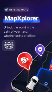
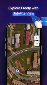
MapXplorer is a maps and navigation app whose headline features include offline maps, radar, satellite view, and real-time alerts. These options may suit travelers who want to explore an area visually as well as plan a route. The combination is useful to consider if you are choosing an app for both everyday navigation and trips where connectivity may vary.
Can I use MapXplorer for navigation when I have limited or no internet access?
The app’s summary highlights offline maps, making it relevant for journeys through areas with weak connectivity. Preparing maps before a trip can help you refer to them when mobile internet is unavailable. Offline access should not automatically be taken to mean that every feature works without a connection, so consider which tools you expect to use while planning your route.
Does MapXplorer include satellite imagery and real-time alerts?
Yes, MapXplorer’s feature summary includes satellite view and real-time alerts, alongside offline maps and radar. Satellite imagery can offer a different visual way to explore places than a standard map, while alerts are intended to provide timely information during a journey. If those features matter to your choice, check how they appear in the app and which options suit your needs.
Who develops MapXplorer, and what should I know about its age rating?
MapXplorer is developed by Goldlab Pro and is a maps and navigation app for people who want mapping tools in one place. Its content rating is Everyone, so it is presented as suitable for a general audience. Before downloading, you can also check that your device meets the app’s minimum operating-system requirement.
Is MapXplorer free to download, and are there in-app purchases?
MapXplorer is free to download, so you can install it without paying an upfront purchase price. It also offers in-app purchases, with listed items ranging from $6.99 to $49.99 each. Those purchases may be relevant if you want access to paid options, so it is worth reviewing the purchase prompts in the app and checking your device’s purchase settings before confirming anything.
Pros
- Intuitive user interface for easy navigation
- Accurate real-time traffic updates
- Offline maps available for remote areas
- Customizable route planning options
- Supports multiple languages for global use
Cons
- High battery consumption during use
- Occasional crashes on older devices
- Limited POI database compared to competitors
- Requires frequent updates for map accuracy
- Ads present in the free version

- Category
- Maps & Navigation
- Version
- 103












