Maps All in One, Speedometer
- 297.00
- 4.4
- Installs
- 10.00M
- Price
- Free

Screenshots
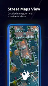
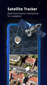
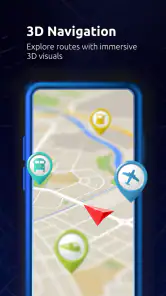
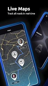
Analysis by Reviewed
I find this app most useful as a shared travel tool rather than a replacement for every navigation service in a household. On a family road trip, one person might check the route while another keeps an eye on speed or looks up a location. That can reduce the app-switching that makes a phone awkward to use in the car, though I’d still have the passenger handle searches and route changes whenever possible.
Sharing a phone without sharing every choice
On a device used by more than one person, it helps to agree on a simple routine: decide who is navigating, choose the map service that suits the trip, and avoid changing settings while the vehicle is moving. A combined map app can make that handoff easier, but it does not remove the need for each person to check that the selected map and route are appropriate. I would treat it as a convenient shared screen, not as a substitute for clear communication.
That distinction matters when people have different habits. One driver may prefer a familiar navigation service, while another may care more about checking coordinates, altitude, or an offline map before setting out. Having several travel tools in one app can make those checks less scattered. The trade-off is that a broad toolbox can feel less direct than opening a single-purpose app when all you need is turn-by-turn directions.
Plan for the journey, not just the map
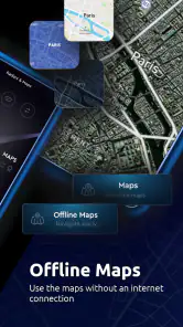
For a trip through an area with unreliable reception, I’d prepare before leaving: check the route while connected and make sure any offline map material needed for the journey is ready. Offline access can help with map reference when a connection drops, but it should not be treated as a guarantee that every online feature will work without internet. I’d also keep a familiar alternative available if precise live routing is essential.
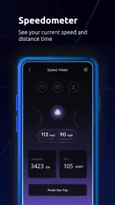
The same planning mindset helps with the speedometer. It can be useful as a quick reference on a long drive, but I would not let a phone display distract the driver or assume it replaces the vehicle’s own instruments. A passenger can monitor it, or the driver can check it only when safely stopped. For everyday commuting, a dedicated navigation app may be faster to open; for a trip that also calls for location details and speed awareness, putting several tools together has a clearer advantage.
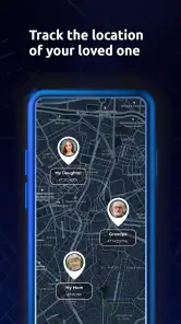
If you mainly want one established map service and never use the other travel tools, this may be more app than you need. It makes more sense for people who regularly switch between map sources, travel beyond their usual routes, or want location and altitude details alongside navigation. I would also think about who uses the device and keep personal accounts and settings separate where the phone allows it; the app itself should not be assumed to provide family profiles or parental controls.
For younger passengers, an Everyone age rating makes the app suitable for a broad audience, but that is not a promise that every journey or on-screen task is appropriate without adult judgement. I’d set expectations around safe phone use, especially in a moving car, and have an adult manage route choices. Those small boundaries are more useful than expecting a navigation app to coordinate a household by itself.
You May Like

Clash of Clans Is Won Between the Battles

Android Auto Makes the Case for Quieter Car Software

MobiOffice: Transforming Mobile Productivity with Seamless Integration

EA SPORTS FC™ Mobile Soccer: Redefining Mobile Sports Gaming

How Microsoft OneDrive Became a Mobile Productivity Giant

How Google Translate Breaks Language Barriers Effortlessly
In practical terms, this is a free app from duff hl studio, with optional in-app purchases priced from $4.99 to $35.99 per item. Its 4.4 average from around 34,000 ratings and more than 10 million installs suggest it has found a sizable audience, though popularity alone cannot tell me whether its mix of tools fits your routine. I’d try it for varied trips and shared-device use, while checking purchase choices before anyone else uses the phone.
The main question I’d ask before relying on it is whether it can do the specific job I need without extra setup. For a route, I’d compare the chosen map service with the one I normally trust; for weak-signal travel, I’d prepare offline access in advance; and for speed, I’d use the display as a supplementary reference. That approach keeps the app useful without expecting every component to behave like a dedicated specialist tool.
Its current version is 2.35.0 and it supports Android 6.0 and later, so it can suit some older Android devices as well as newer ones. I would still consider the phone’s screen size and how comfortable it is to switch between tools before making it the household’s default. On a small screen, fewer, simpler controls may be preferable when someone is navigating under pressure.
A practical handoff during an ordinary trip
Picture a weekend drive where the usual driver knows the main roads but a passenger is keeping track of a new destination. I’d have the passenger check the route and any useful location details before the car moves, then leave the driver focused on the road. If the destination changes, the passenger can make the adjustment while parked or when it is safe to do so. This is where having map choices and travel references close together can save time; it is not a reason to make the driver browse menus.
For a household that shares one phone in the car, I’d also agree on a simple handoff: who is holding the device, which map is being used, and whether the speed display is only a passenger reference. That prevents a common source of confusion—two people assuming the other has checked the route. The app can put tools within reach, but the household still needs a clear routine for using them.
Use the extra tools with a little preparation
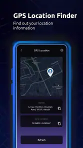
Coordinates and altitude are most useful when they answer a specific question, rather than when they are treated as decoration on a screen. Before leaving, I’d note the location information needed for a meeting point or remote stop, then avoid trying to interpret it while driving. A coordinate can be a more precise way to describe a place than “near the large building,” but it only helps if everyone knows how they will use it and can enter it carefully.
Offline maps also reward a small test before the trip. I’d prepare the area while connected and check that the relevant map material is available before relying on it. That is especially worthwhile for a rural drive, a trailhead approach, or a destination where mobile reception is uncertain. The trade-off is that offline reference is not the same thing as live traffic or every online navigation function, so I would not plan as though one automatically replaces the other.
The speedometer has a similarly specific role: it is a supplementary view, not a safety system or a replacement for the car’s own instruments. If a passenger is using it, the driver can stay focused on driving. If I were alone, I would set things up before departure and avoid interacting with the phone in motion. In a household, that distinction is worth spelling out rather than assuming everyone will use the feature the same way.
Choosing it over a single-purpose navigation app
The usual alternative is to keep one familiar navigation app ready and use separate tools only when a trip calls for them. That can be the better choice for someone who wants a predictable route interface and rarely needs coordinates, altitude, or alternate map sources. A specialist app may also feel more straightforward when the only task is getting turn-by-turn guidance across town.
Maps All in One is more appealing when a trip involves several kinds of checks: comparing map sources, preparing an offline reference, looking up a location, or keeping a speed display available. The convenience is in bringing those needs together, not necessarily in making every individual tool better than a dedicated alternative. I’d judge it by how often I actually use the combination; if I open only one map and ignore the rest, the broader setup adds little.
Another useful way to decide is to try it on a low-stakes journey first. Compare the route with your normal choice, explore the relevant tools while parked, and see whether switching between them feels comfortable on your device. That lets you learn the app’s layout before a time-sensitive drive. If it adds hesitation rather than reducing it, returning to a simpler navigation setup is a sensible choice.
Who is likely to get the most from it?
I’d recommend trying it if you travel across different kinds of areas, share a phone with another passenger, or have occasional reasons to check more than a basic route. It can also suit someone who wants a quick reference for location or altitude without keeping a separate app for each task. The strongest case is not “one app replaces everything”; it is “one place may cover several jobs I already do.”
I’d skip it as a primary choice if you need highly dependable live guidance for a demanding commute and already have a navigation app you know well. I would also avoid making it the default for a household member who finds menus distracting or has little need for the additional tools. Familiarity and simplicity matter more than a long feature list when someone needs to make a quick, safe decision.
Families should treat shared access as a device arrangement, not as an account or supervision feature. Keep purchases and personal settings in mind when handing a phone to someone else, and let an adult decide what is suitable for younger users. Since the age rating is Everyone, the app can be appropriate for a broad audience, but the way a phone is used during a trip still depends on household rules and adult judgement.
If you are deciding whether to pay for anything, I’d first use the free app to see which parts fit your routine, then review any purchase choice before confirming it. Optional items range from $4.99 to $35.99 each, so I would not assume every household member should buy the same thing or that a purchase is necessary to test the basic idea. On a shared device, being deliberate about purchase decisions is a practical boundary.
A household verdict based on the way you travel
What I like most is the possibility of keeping several kinds of travel information close at hand without making the phone the center of the journey. The best workflow is still simple: prepare before moving, assign navigation tasks to a passenger when possible, and use the vehicle’s instruments and a trusted specialist service where they are the better fit. The app is useful when its range saves effort, but that range should not encourage last-second switching.
Its 4.4 average across around 34,000 ratings and more than 10 million installs show that many people have tried it, but those figures are only background. My recommendation depends on your habits: try it if maps, coordinates, offline reference, altitude, and speed awareness are all relevant to your trips; stay with a simpler option if you want one familiar route and nothing else. It is free to start, rated Everyone, and comes from duff hl studio, with optional purchases to consider before sharing the device.
If you've ever found yourself juggling between multiple navigation apps while driving, then Maps All in One might just be the perfect solution you've been searching for. This app promises to be your ultimate travel companion by combining various map services under one roof. Let's dive into what makes this app a must-have for anyone who spends a lot of time on the road.
One App to Rule Them All
First off, I must say that Maps All in One delivers on its promise of convenience. The app integrates several popular map services, allowing users to seamlessly switch between them without the need to download multiple apps. Imagine having Google Maps, Waze, and MapQuest all in one place! This feature alone is a game-changer for those who rely heavily on GPS navigation.
Interface and Usability
Upon launching the app, I was greeted with a clean and intuitive interface. The developers have done an impressive job in ensuring that the app is user-friendly. Even if you're not tech-savvy, you’ll find navigating through the app a breeze. The menu is straightforward, and the transitions between different map services are smooth and lag-free.
Features That Stand Out
Aside from its multi-map integration, what really caught my attention was the real-time traffic updates. The app provides accurate traffic information, helping users avoid congested routes and save precious time. Moreover, the offline maps feature is a lifesaver when traveling in areas with poor internet connectivity. You can download maps beforehand and use them without worrying about losing your way.
Another noteworthy feature is the speedometer function, which allows you to monitor your speed directly from the app. This is particularly useful for those long drives where keeping track of your speed is crucial to avoid tickets.
Why You Should Consider Downloading It
In a world where convenience is key, having an app that consolidates your navigation needs is invaluable. Whether you're a daily commuter or an occasional traveler, Maps All in One offers a reliable, efficient, and user-friendly experience. Its comprehensive feature set not only enhances your navigation but also ensures a smoother and safer journey.
To wrap it up, if you're tired of switching between apps while driving or just want a more streamlined navigation experience, give Maps All in One a try. It’s a solid investment for anyone looking to simplify their travel routines. Happy traveling!
Maps All in One, Speedometer Frequently Asked Questions
Who developed Maps All in One, Speedometer, and what is it designed for?
Maps All in One, Speedometer is developed by duff hl studio and is a Maps & Navigation app for people who want travel and location tools together. Its short description is “Maps All in One,” while its features focus on map information, routes, GPS coordinates, altitude, and speed. It may suit travelers who prefer to check several kinds of trip information in one app.
Is Maps All in One, Speedometer available for iPhone and iPad?
Maps All in One, Speedometer is listed for Android devices, with support beginning at Android 6.0. Before downloading, check that your device meets this system requirement. If you are choosing an app for another platform, confirm its availability in the relevant app store before proceeding, as the version and features can vary between platforms.
What does the app’s Everyone age rating mean for families?
The app has an Everyone content rating, which indicates that it is broadly suitable for users of all ages. Its focus is on maps, location details, and travel routes rather than age-specific entertainment. Parents may still want to guide younger users when the app is used during a journey, particularly to ensure the device is handled safely and does not distract someone who is driving.
What information does Maps All in One, Speedometer provide about a destination before I travel?
The app is designed to bring together practical map and travel details, including location, route, GPS coordinates, and altitude. Its focus is useful for people planning a journey as well as those already on the move. You can explore map information and route options in one place, while the speedometer and navigation tools support the trip itself.
Which devices can run Maps All in One, Speedometer?
Maps All in One, Speedometer is available for Android devices running version 6.0 or later. That makes it worth checking your device’s operating system before installing, particularly if you use an older phone or tablet. The app is developed by duff hl studio and is categorized as a Maps & Navigation app, so its main purpose is travel and location use.
Pros
- Comprehensive navigation features
- Accurate speed tracking
- User-friendly interface
- Customizable map views
- Offline map availability
Cons
- Consumes a lot of battery
- Ads can be intrusive
- Limited language support
- Requires frequent updates
- Data-heavy on mobile networks

- Category
- Maps & Navigation
- Version
- 2.35.0













