Île-de-France Mobilités
- 206.00
- 3.6
- Installs
- 5.00M
- Price
- Free

Screenshots

Analysis by Reviewed
Île-de-France Mobilités app is your trusty companion for navigating the bustling streets and winding metro lines of Paris. Whether you’re a local or just visiting the City of Lights, this app promises to make your public transportation experience as smooth as a Seine River cruise.
When a route check is worth the pause
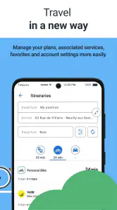
I find the biggest practical benefit of this public transport app is having journey planning, ticket buying, and traffic information together in one place. If I’m deciding whether to leave now or wait for a less hectic time, checking a route and current disruptions before heading out can help me avoid making a plan based on habit alone. It is especially useful when a trip involves more than one leg, because I can consider the journey as a whole rather than relying on a separate map for each step.
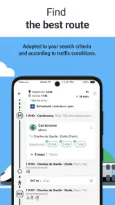
A realistic use is a visitor leaving a museum and heading across town: I would check the route before walking to a station, then look at traffic information again if service conditions seem to have changed. That small pause can prevent a wasted walk to a stop that is not serving the route as expected. For regular commuters, the same habit is useful when a familiar journey feels unusually slow. I would compare the suggested itinerary with the route I normally take instead of assuming the first option is automatically best.
For a less familiar trip, I would note the key transfer and destination before setting out, rather than trying to work through every detail while walking. This makes the app useful even when I do not want to keep my phone open for the whole journey. It also gives me a simple way to compare a familiar route with a suggested alternative: not just by the time shown, but by how many changes it asks me to make and how much room I have if one leg is delayed.
Speed expectations on the move
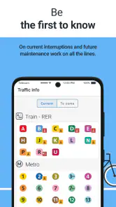
Speed matters most when I am standing on a crowded platform or trying to make a connection, but I would treat an itinerary as guidance rather than a guarantee. Traffic information can help me spot a problem, while the actual conditions around a station may still affect what feels like the quickest choice. My useful tip is to check before setting off, then leave enough flexibility to change plans if the journey becomes disrupted. Constantly reopening a route while moving can be less helpful than making a sensible plan at the start.
For a heavy-use day, such as several appointments across the region, I would use the app to plan each major leg and keep ticket needs in mind before reaching the station. This is a more dependable workflow than waiting until a train is due and then trying to sort out both directions and tickets at once. I would also avoid assuming that the fastest itinerary is always the most comfortable: a route with a tight change may save time on paper but leave little room if the first leg runs late.
In practical terms, I would use a quick route check as a decision aid, not expect it to remove every pause from a trip. A journey with a transfer involves walking, finding the right platform, and responding to what is happening around me; those parts of travel do not always feel as tidy as a route result. When timing is important, checking before leaving gives me more options than opening the app only after I am already late.
More From Our News Desk

Clash of Clans Is Won Between the Battles

Android Auto Makes the Case for Quieter Car Software

MobiOffice: Transforming Mobile Productivity with Seamless Integration

EA SPORTS FC™ Mobile Soccer: Redefining Mobile Sports Gaming

How Microsoft OneDrive Became a Mobile Productivity Giant

How Google Translate Breaks Language Barriers Effortlessly
Getting Started with Ease
First impressions matter, and the Île-de-France Mobilités app doesn’t disappoint. With its sleek design and intuitive user interface, you’ll find yourself booking your first trip in no time. The app is available for both Android and iOS, and downloading it is as easy as a Parisian Sunday morning. Once installed, you’re greeted with a friendly interface that’s both welcoming and functional. It’s like having a Parisian friend in your pocket, always ready to guide you through the city.
For a newcomer, I would begin with one straightforward journey rather than trying to learn every part of the service at once. Search the trip I actually need, look over its stages, and then decide whether using the app for tickets fits my habits. That approach keeps the first experience focused: the app is most useful when it helps me make a specific travel decision, not when I spend time exploring screens without a journey in mind.
Features that Make a Difference
One of the standout features of this app is its real-time tracking. Imagine knowing exactly when your next bus or train will arrive – no more guessing or stressing. This feature is particularly handy during rush hours when every minute counts. The app also offers detailed route options, which means you can choose the fastest, most scenic, or least crowded routes depending on your mood or schedule.
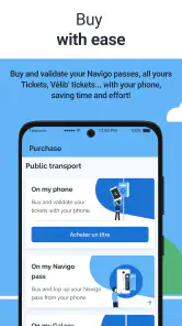
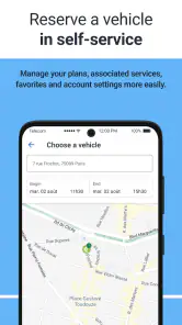
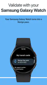
Another feature worth mentioning is the ticket purchasing option. Gone are the days of fumbling for change or dealing with paper tickets. With just a few taps, you can purchase and validate your tickets directly from your phone. It’s a digital age dream come true, making public transport not just convenient but also environmentally friendly.
The useful trade-off is that route planning and ticket handling belong to the same travel routine, so I can think about both before I reach the station. I would still take a moment to make sure the ticket choice suits the journey I intend to make; saving time at the point of travel is only helpful if I have prepared the right thing. For visitors who use public transport repeatedly, handling that task before a busy day can be less stressful than making it part of every departure.
User Experience
Using the app feels like a breeze. The developers have clearly put a lot of thought into the user experience, making it both straightforward and enjoyable. The app supports multiple languages, which is a blessing for tourists who might not be fluent in French. Plus, the customer support is top-notch. If you ever run into any issues, help is just a click away.
It is developed by Île-de-France Mobilités and sits in the Maps & Navigation category. It is free, rated for Everyone, and has been available since February 3, 2012. Its 3.6 average across around 91,000 ratings, alongside more than 5 million installs, suggests a widely used service that does not please every rider equally. I would read that as a reason to approach it as a practical regional tool, not as a promise that every journey will be effortless.
That broad mix of riders is worth keeping in mind when judging any transit app: a visitor planning a single outing and a commuter making the same trip each weekday have different expectations. I would judge it by whether it helps me plan the journey I need and manage the ticket step with less friction, rather than expecting the same experience to suit every trip. A long-running regional service can be a useful companion, but it still makes sense to check important details as travel conditions change.
Choosing it over a general map
A general-purpose map is often the better choice when I need walking directions, driving options, or a broad view of several kinds of travel. This app makes more sense when public transport in the Île-de-France region is the focus and I want journey information and ticket tasks close together. The trade-off is that a specialist transit app is not a universal travel planner: if my trip depends on comparing non-transit options or navigating somewhere beyond the region, I would turn to a broader map as well.
For a first-time visitor, I would use it alongside ordinary street signs and station displays, especially when a route includes a transfer. For someone who already knows the network, it can be more valuable as a way to check changing conditions than as a substitute for local knowledge. If a phone battery is low, or I prefer not to manage tickets digitally, I would plan ahead and keep a backup option rather than making the app the only thing I rely on.
The choice between this and a general map is not necessarily all-or-nothing. I would turn to a broad map for the walk from a hotel or for comparing travel beyond public transport, then use this regional app when I want to focus on a transit itinerary and its related ticket task. That division of jobs is especially sensible for visitors: one tool can help with the wider geography, while the specialist one keeps the regional public-transport part in view.
Reliability and practical limits
In daily use, the app’s usefulness depends on having a working connection and on the information being relevant to the moment I travel. I would check an important journey before leaving, and verify unexpected changes against information at the station when available. That is not a special flaw of this app so much as a sensible habit for any live transit service. Buying through a phone can reduce last-minute friction, but it also means I need to be comfortable using the device as part of my travel routine.
It is best suited to residents, commuters, and visitors who expect to use regional public transport more than once and want route planning and tickets in the same place. Someone making a single trip, avoiding phone-based purchases, or needing a complete door-to-door planner across different transport modes may be happier with another tool or with a mix of apps and station information. I would also avoid relying on any itinerary without checking the details when timing or a tight connection matters.
For reliability, my own rule would be to separate planning from confirmation. I can use the app to choose a sensible route, then look again before departure if the journey matters or conditions seem unsettled. If an unexpected change appears while I am already travelling, station information and the circumstances on the ground are important context; I would not keep following an old plan simply because it was the first result I saw. This is a practical way to use live guidance without treating it as a guarantee.
Who will get the most from it
I would recommend it most to people who regularly travel around the Île-de-France region by public transport and want a focused place to check routes, traffic information, and tickets. It can also suit a visitor staying long enough to make several journeys, particularly if they prefer to prepare each outing in advance instead of figuring everything out at the station. For these users, the benefit is not just one route suggestion; it is having a repeatable workflow for planning the trip and thinking about tickets together.
It is less compelling for someone who only needs a one-off walking route, who wants to compare public transport with driving or other travel modes in one broad view, or who does not want a phone to be part of ticket management. In those situations, a general map, station displays, or another established travel method may be a better fit. I would also avoid making it my sole plan when a low battery or limited access to a connection could leave me unable to check details when I need them.
Why You’ll Love It
In a city as vibrant and dynamic as Paris, having an app like Île-de-France Mobilités is a game-changer. It takes the stress out of traveling and allows you to focus on what really matters – enjoying your journey. Whether you’re commuting to work, exploring hidden gems, or just soaking in the Parisian atmosphere, this app ensures you get there with ease and style.
What I appreciate most is its practical focus: it can help turn a loose travel plan into a sequence of decisions, from choosing a public-transport route to considering tickets before I arrive at the station. I would not expect that to make every journey effortless, but it can make the planning feel more joined-up. For a day with several stops, that small bit of preparation is often more valuable than repeatedly searching from scratch while on the move.
Performance verdict for everyday travel
On speed, I would set expectations around planning convenience rather than assume every screen or live update will respond instantly in every situation. The app’s purpose makes it most useful when I have a moment to check a journey before moving, especially before a transfer or a busy day. I would avoid relying on a last-second search as my only preparation, because crowded stations, changing conditions, and phone access can all make that a stressful way to travel.
As for device demands, I would treat it as a travel tool to open when needed rather than something that must stay active throughout an entire outing. That is a sensible way to conserve attention and keep my phone available for other tasks, particularly on a day when I am navigating unfamiliar places. If my phone is nearly out of power, I would check the route early and keep the key details in mind, instead of assuming I can consult the screen at every step.
In conclusion, if you’re planning to navigate Paris with grace and efficiency, the Île-de-France Mobilités app is your go-to solution. It’s not just an app; it’s a travel companion that makes your urban adventures seamless and enjoyable. So, why wait? Download it today and experience Paris like never before!
My recommendation is strongest for people whose plans revolve around public transport in the region and who are happy to use a phone as part of the journey. I would pair it with station information when timing is tight, and with a broader map when walking or other travel choices matter more. Used that way, it is a practical specialist rather than a magic shortcut: it helps me plan with more context, while leaving room for the judgement every real trip still needs.
Île-de-France Mobilités Frequently Asked Questions
What can I use Île-de-France Mobilités for when planning a trip?
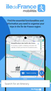
Île-de-France Mobilités is a maps and navigation app for public transport in the Paris region. Its main tools let you search for itineraries, buy tickets, and follow traffic information. That combination can be useful when you want to plan a journey and check transport updates from your phone, rather than treating route planning and ticket purchases as entirely separate tasks.
Is Île-de-France Mobilités suitable for visitors to Paris as well as local residents?
The app is intended for people navigating public transport in Île-de-France, so it may be useful both to regular passengers and to visitors exploring the region. It brings itinerary searches, ticket purchases, and traffic information together in one place. Visitors who prefer using a phone to organize their public transport journeys may find that combination convenient while getting around.
Does the app cover travel beyond central Paris?
Île-de-France Mobilités is focused on public transport in the Paris region, also known as Île-de-France. Its itinerary search and traffic information are intended to support journeys around that region, rather than serving as a general-purpose travel app for every destination. If your trips involve public transport in Île-de-France, its core features are relevant to the kind of journey planning you may need.
Can I use Île-de-France Mobilités without creating an account?
Île-de-France Mobilités brings ticket purchasing, itinerary searches, and traffic information into a single app. Whether you need to sign in can depend on the particular feature or purchase you want to use, so it is sensible to check the app’s prompts during setup and before completing a transaction. You can consider it primarily as a phone-based tool for organizing public transport trips around the Paris region.
Is the app meant only for buying tickets, or can it help during a journey too?
The app is not limited to ticket purchases. It also lets you search for itineraries and follow traffic information, making it useful both while preparing a trip and when checking transport conditions. Having these functions together can help you keep journey planning and ticket-related tasks in one place as you travel around the Paris region.
Pros
- User-friendly interface for easy navigation.
- Real-time updates on bus and train schedules.
- Multiple payment options for convenience.
- Comprehensive map coverage of the region.
- Customizable alerts for preferred routes.
Cons
- App occasionally crashes on older devices.
- Limited offline functionality.
- Some features require a stable internet connection.
- Can be slow during peak usage times.
- Not all transit lines are updated in real-time.

- Category
- Maps & Navigation
- Version
- Varies with device