GeoGuessr
- 1.04K
- 4.7
- Installs
- 5.00M
- Price
- Free

Screenshots
Analysis by Reviewed
I like geography games most when they make me look twice at places I thought I already understood. GeoGuessr builds that feeling around street-level views: I inspect a scene, notice small clues, then make a location guess. It is a trivia game, but it rewards observation as much as memorized facts, so a road marking or a change in landscape can matter more than knowing a capital city.
Small goals make the first rounds click
The appeal is easy to understand before you know any special geography tricks: look around, work out what the scene suggests, and decide where to put your pin. That gives each round a clear immediate goal without requiring a long tutorial or a store of country facts. I like that a beginner can start with broad questions—what kind of climate is this, which side of the road do people drive on, can I recognize the script?—and improve the guess by adding clues one at a time.
A useful first-session goal is not to chase a perfect score. Instead, choose one clue to focus on in each scene. In one round, pay attention to road signs; in another, compare vegetation and building styles. This keeps the task manageable and helps reveal which kinds of evidence you personally read well. It also makes a wrong answer useful: I can see whether I misread a sign, overtrusted the landscape, or simply guessed too narrowly.
The Thrill of the Unknown
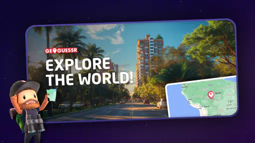
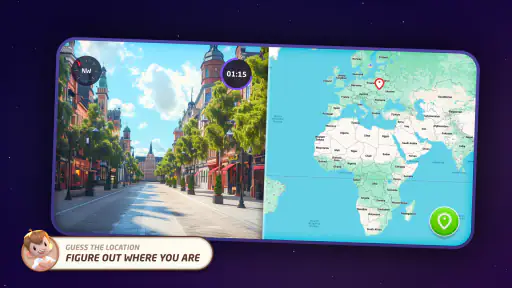
When you first launch GeoGuessr, you're greeted with a simple, yet exciting task: "Guess where you are!" The app places you in a random spot on Google Street View and gives you the freedom to explore your surroundings. You might find yourself in the bustling streets of Tokyo, the serene landscapes of rural France, or even a remote village in Africa. The possibilities are endless, and that's what makes it so addictive!
How It Works
Navigating through the app is a breeze. You can look around, zoom in and out, and even move down the streets to gather more clues. The key is to pay attention to details like road signs, language on billboards, and even the style of architecture. Once you feel confident about your guess, you drop a pin on the world map and see how close you were to the actual location. The closer you are, the more points you earn!
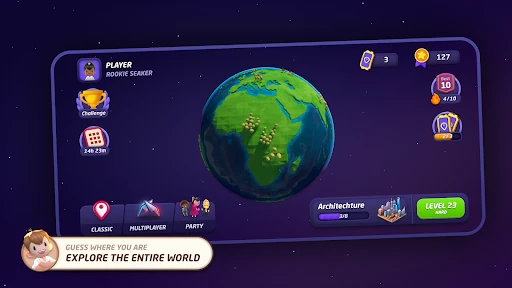
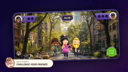
The game offers different modes to suit your mood. You can choose to play solo, challenge friends, or join a global game where you compete with players from all around the world. Each mode brings its own flavor of fun and excitement, keeping you hooked for hours.
Reading the Scene Before Guessing
My most useful habit is to pause before moving far along a road. First I scan for clues that can narrow down a region: which side traffic uses, the shape and color of signs, road lines, vegetation, and the way buildings are constructed. Then I look for more specific evidence, such as a readable place name or a language on a storefront. This order helps me avoid anchoring on one familiar-looking building and making an overconfident guess.
When the view seems sparse, I try to treat the absence of clues as information rather than keep wandering indefinitely. A broad landscape, road surface, and vegetation may suggest a climate or region, but they rarely identify a precise spot on their own. I make a defensible regional guess instead of pretending certainty. That approach is especially useful when a round offers few signs or recognizable landmarks, and it makes a miss feel like a lesson rather than a random failure.
Goals, Feedback, and the Learning Curve
The immediate goal is clear: use the scene to place a pin as close as possible. The score gives quick feedback on whether my reasoning worked, while repeated rounds help turn visual details into useful reference points. I find the learning loop more satisfying than simply memorizing country outlines; after a few sessions, I start noticing patterns in road furniture, landscape, and signage that I used to overlook.
The challenge can swing sharply from one location to another. A legible sign can make a round feel like a small puzzle with a satisfying answer, while a quiet stretch of road can leave me choosing between several plausible countries. I enjoy that uncertainty, but it also means a run can feel uneven. If you prefer every question to offer a clear clue and a predictable difficulty increase, this is not always that kind of trivia game.
Why You'll Love It
One of the most appealing aspects is its educational value. As you play, you're not just having fun; you're also learning about geography, cultures, and places you might never have discovered otherwise. It's a fantastic way to broaden your horizons without ever leaving your couch.
It works particularly well as a short shared activity. I can hand a friend the phone and ask what they would inspect first, then compare our guesses and reasoning. On an ordinary break, a single round can be a compact change of pace; with someone else, debating whether a road sign or the terrain is the stronger clue turns the same scene into a conversation. For a more focused session, I would keep notes on recurring clues I personally mix up, such as similar-looking road markings, rather than trying to memorize every country at once.
Compared with standard trivia apps, which often ask for a fixed fact with one direct answer, this game makes the surroundings the question. Compared with map quizzes, it asks me to infer a location from visual evidence instead of selecting a label from a list. That is its distinctive strength, though it also asks for more patience: exploring a scene and weighing uncertain clues takes longer than answering a quick multiple-choice prompt. If you mainly want rapid-fire facts, a conventional quiz is likely a better fit.
The game's design is user-friendly and visually appealing. The interface is clean, and the transition between locations is smooth, making for an enjoyable experience. The street-level format is also the main trade-off: the quality of a guess depends on what the scene reveals, and not every location provides equally readable evidence. I try not to spend too long searching for a perfect clue when a reasonable regional estimate is the best the view allows.
Who It Suits—and Who May Want Something Else
I would recommend it to curious travelers, map lovers, and anyone who enjoys solving a visual puzzle without needing specialist knowledge. It can also suit friends who want an easy game to discuss together, since even a wrong guess can lead to a useful exchange about what each person noticed. The developer is GeoGuessr, and the game has a 4.7 average from around 51,000 ratings, with over 5 million installs; that popularity is reassuring, though the appeal still depends on enjoying patient observation.
I would skip it if you dislike uncertainty, want a fast sequence of simple questions, or find street-view navigation more fiddly than fun. The free download makes it easy to try, but in-app purchases range from $0.49 to $35.90 per item, so I would check the purchase options before spending. It is rated for Everyone, runs on Android 8.1 or later, and version 8.2 is the current version. Those details make it approachable for a broad audience, but they do not change the central question: do you enjoy making a careful guess from a partial view?
Keeping the Challenge Enjoyable
The game’s retention comes less from a complicated progression system than from the urge to test whether the next landscape will be easier to read. I find it more rewarding to set a small personal goal—such as identifying the likely region before looking for a town name—than to treat every round as a demand for a perfect score. That keeps the focus on improving my deductions and makes difficult scenes less frustrating.
There is a balance to strike between exploration and overthinking. Moving through the scene can uncover a decisive sign, but wandering without a plan can consume attention without adding much evidence. I recommend checking a few distinct clue types, then placing a considered pin. The useful skill is not endless searching; it is knowing when the available evidence is good enough to commit.
A practical way to play in short sessions
For a quick break, I would decide in advance how much time I want to give a scene. I start by looking around from the initial position, then move only when a sign, junction, or change in the surroundings seems likely to add evidence. If I find a place name, I use it to narrow the map search; if I do not, I choose the broadest region I can justify and place the pin. This simple routine prevents one round from turning into aimless navigation.
That approach also helps when playing with another person. Rather than silently taking turns, each player can name a clue and explain what it suggests before anyone commits to a location. The discussion makes it easier to notice when one clue is weak or when two observations point in different directions. It is a low-pressure way to make the game social, and it keeps the focus on reasoning rather than who happens to know the most place names.
What the score teaches—and what it cannot
The score is a useful signal, but I would not treat a single result as a verdict on my geography skills. A close guess may come from a sound reading of the scene, while a lucky pin can land near the answer for the wrong reason. To make progress more meaningful, I try to remember the clue that shaped my decision, not just whether the result looked good. Over time, that makes the feedback more informative: I can distinguish a repeatable observation from a fortunate guess.
There is also a trade-off between learning a location and learning a visual pattern. A readable sign can solve the immediate round, but noticing road design, landscape, and architecture is what helps when the next scene has no clear text. I would use both kinds of evidence rather than relying on one favorite shortcut. In particular, a familiar language can tempt me to settle too early; checking whether the road markings and surroundings agree is a practical way to catch that mistake.
Choosing the right expectations
This is a better fit for someone who enjoys uncertainty than for someone who wants a tidy sequence of questions with one obvious clue each time. Its street-level scenes make geography feel tangible, but they can also be visually busy or unhelpfully sparse. I would not choose it when I want a purely factual quiz, a guaranteed learning path, or a game that asks for no interpretation. A traditional country-capital quiz is more direct for memorizing names; this one is more rewarding when I want to practise looking carefully and defending a judgment.
It is also worth setting expectations about improvement. I do not become better simply by playing more rounds quickly. Pausing to compare what I thought I saw with where I placed the pin is more useful than rushing through guesses. If I repeatedly confuse similar road signs or landscapes, I can make that the next session’s focus. That small self-directed goal provides a sense of progress without requiring me to turn a casual game into homework.
Final Thoughts
In a world where travel has become more challenging, it offers a delightful escape. It's a game that not only entertains but also educates, providing a unique blend of fun and learning. Whether you're a geography buff or just someone looking for a new way to pass the time, it is definitely worth a try. So, next time you find yourself with a few minutes to spare, why not take a trip around the world? You never know where you might end up!
GeoGuessr Frequently Asked Questions
Does GeoGuessr work well on a phone or tablet?
GeoGuessr is designed to bring its location-guessing challenge to mobile, where you explore a scene and make your guess on a map. The experience centers on looking closely at visual clues, so screen size and touch controls can affect how comfortable it feels. It is a trivia game for players who enjoy geography and observation, whether they play on a phone or tablet.
What kind of clues will I use while playing GeoGuessr?
The challenge is to work out where you are from what appears in the surrounding scene. Road signs, language, plants, buildings, and other environmental details can all help narrow down a location. Rather than relying on a single clue, it is useful to compare several observations before placing your guess. This makes each round a small exercise in noticing details as well as knowing geography.
Who makes GeoGuessr, and what should I know about its age rating?
GeoGuessr is developed by GeoGuessr and is listed as suitable for everyone. Its main activity is a geography-based guessing challenge, which can appeal to a broad range of ages. The game’s focus on recognizing places from visual details may also prompt players to learn about different parts of the world. Parents can still check the gameplay and online features to decide whether it is a good fit for their child.
What is GeoGuessr and how does it work?
GeoGuessr is a web-based geography game which uses random Google Street View locations. The objective is to guess your location in the world based solely on visual clues from the environment. Players can pan and zoom around the street view to gather hints before making a guess on the world map. It’s a fun way to enhance your geographical knowledge and explore different parts of the world virtually.
Is GeoGuessr suitable for children?
GeoGuessr is listed for everyone, making it a broadly accessible choice for players of different ages. Its central challenge is identifying places from visual clues and placing a guess on a map, so it can also encourage curiosity about geography. As with any location-based game, parents may want to check that the gameplay and online features suit their child before downloading.
Pros
- Wide variety of maps to explore
- Enhances geographical knowledge
- Multiplayer mode is engaging
- User-friendly interface
- Regular updates with new content
Cons
- Requires strong internet connection
- Limited free version features
- Can be challenging for beginners
- In-app purchases can be pricey
- Occasional server lag issues

- Category
- Trivia
- Version
- 8.2