Wavve Boating: Marine Boat GPS
- 536.00
- 4.5
- Installs
- 500.00K
- Price
- Free

Screenshots
Analysis by Reviewed
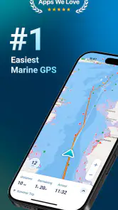
When I take a boat onto unfamiliar water, I want navigation information to be easy to read before I need it. That is the main appeal of Wavve Boating: Marine Boat GPS: it brings marine charts, route guidance, weather context, tide information, water details, depths, and GPS positioning into one mobile app instead of making me jump between several tools. It is a free Maps & Navigation app from Wavve Boating, rated for Everyone, and it has built a substantial audience with more than half a million installs and an average rating of 4.5 from roughly six thousand ratings.
I see it as a practical companion for recreational boaters, anglers, sailors, and anyone who spends time near the coast or on inland water. It is not a substitute for seamanship, local knowledge, or proper onboard equipment, but it can make planning a trip much less awkward. After using it as a planning and situational-awareness tool, my view is positive, with one important condition: you need to treat the phone as an aid rather than your only source of safety-critical navigation.
How the current version fits into a boating routine
The current version is 5.7.8, and the app’s identity is clear. It is built around the things boaters actually check before and during a trip: where they are, what lies beneath or around them, how conditions may change, and whether a planned route makes sense. That combination gives it more purpose than an ordinary road map placed on a boat.
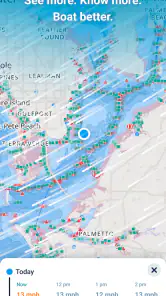
What I like most is the way the information belongs together. A general map application may show a shoreline and a destination, but it usually does not make marine depth, tides, or nautical chart context central to the experience. Wavve Boating starts from the opposite direction. The water is the primary environment, so the map feels more relevant when I am thinking about a launch point, a fishing area, a channel, or a return route.
The free entry point is helpful for someone who wants to understand the workflow before spending money. In-app purchases range from $0.99 to $69.99 per item, so the app can begin as a low-commitment experiment while still offering paid options for users who need more from it. I would not buy anything immediately. I would first test the map view in the areas where I normally boat, check whether the information suits my local waters, and decide whether the extra tools justify the cost.
That local test matters more here than it would with a typical city navigation app. A map can look impressive in screenshots and still be less useful for a particular harbor, lake, coastline, or cruising area. The practical question is not simply whether the app contains nautical information; it is whether the information is presented clearly enough for the places I actually visit.
What the boating-focused layout does well
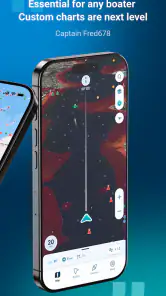
For me, the strongest part of the experience is the planning mindset. Before leaving, I can use the chart and map information to think through the shape of a trip instead of reacting to every turn once I am already moving. I can consider the route, nearby water features, depth information, and the broader weather and tide picture as parts of one decision.
More From Our News Desk

Clash of Clans Is Won Between the Battles

Android Auto Makes the Case for Quieter Car Software

MobiOffice: Transforming Mobile Productivity with Seamless Integration

EA SPORTS FC™ Mobile Soccer: Redefining Mobile Sports Gaming

How Microsoft OneDrive Became a Mobile Productivity Giant

How Google Translate Breaks Language Barriers Effortlessly
This is especially useful for short recreational outings. Imagine leaving after work for a few hours of fishing. I would check the route from the launch area, look at the surrounding water, review the tide situation, and note the conditions before deciding how far to go. If the weather changes or the return window becomes tighter, that preparation gives me a clearer basis for turning back early.
Another useful habit is to use the app before opening the boat’s engine. I can compare a planned route with the actual shape of the water, identify areas that deserve caution, and avoid wasting time searching for basic context once I am afloat. That is a small workflow change, but it makes a phone navigation app feel more like a boating tool than a map with a nautical theme.
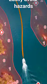
The depth information deserves careful attention. It can help me understand the character of an area and spot places that need closer inspection, but I would never interpret a charted depth as a guarantee of safe clearance at every moment. Tides, changing conditions, chart limitations, boat draft, and local hazards all matter. The app is valuable when it improves my awareness; it becomes risky only if I allow a screen to replace judgment.
How the latest version matters to existing users
Version 5.7.8 is the current reference point for anyone deciding whether to install or update. I would approach it as a mature release rather than assuming that a version number alone proves a dramatic redesign. The important question for an existing user is whether the app remains dependable in the situations where it is already part of a boating routine.
For someone upgrading from an older installation, I would check the app at home first, while connected to a reliable network and with the phone fully charged. Open the areas you use most, inspect the chart presentation, and make sure the controls still feel familiar before heading out. This is a sensible practice with any navigation software, but it is particularly important when the device may be used in bright sunlight, on a moving boat, or with wet hands.
The evolution visible in the current release should be judged by usability rather than by novelty. A navigation app earns its place when I can find the information I need quickly, understand what I am seeing, and return to the wider route without getting lost in menus. If an update makes those tasks smoother, that is more valuable to me than a flashy feature I would rarely use.
Existing users should also keep their own backup routine. I would not rely on a newly updated app as the only navigation method on the first trip after installing it. I would carry the usual safety equipment, retain whatever charts or instruments I normally trust, and use the phone as an additional layer. That is not a criticism of this particular product; it is simply the right attitude toward mobile navigation on water.
Where it is more useful than ordinary map apps
The comparison with familiar road-navigation apps is straightforward. Those apps are excellent for reaching a marina by car, finding a fuel stop on land, or navigating city streets, but they are not designed around marine depth, tides, or nautical chart reading. Wavve Boating makes more sense once the boat leaves the road and the shoreline becomes only one part of the problem.
I also prefer its boating focus when planning a route that is not a simple point-to-point journey. On land, the route usually follows visible roads. On water, I may need to think about channels, open stretches, shallow areas, changing conditions, and the safest way back. A marine-oriented interface encourages that broader view.
Dedicated chartplotters and professional marine systems still have clear advantages for serious or frequent boaters. They are generally designed for permanent onboard use, larger displays, and integration with other equipment. A phone is portable and affordable, but it is also more vulnerable to battery limits, glare, heat, water, notifications, and accidental handling. I would choose Wavve Boating as a convenient supplement or a strong planning tool, not automatically as the replacement for a full navigation setup.
Paper charts and local knowledge remain valuable too. A paper chart does not run out of battery, and an experienced local boater may know about conditions or hazards that no app can explain in the moment. The best approach is layered: use the app to prepare and cross-check, then combine it with proper equipment and sensible decisions.
Three practical techniques that improve the experience
First, I would separate route planning from route following. At home, use the larger amount of attention available to study the area and decide what the trip is meant to accomplish. On the water, keep the screen focused on immediate awareness rather than constantly redesigning the journey. This reduces distraction and makes the phone less likely to become the center of attention at the wrong time.
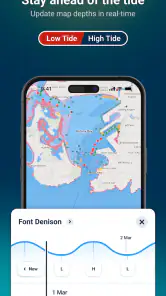
Second, I would use tide and weather information as decision filters, not as decoration. Before leaving, ask whether the conditions support the kind of outing planned. A short harbor trip, a fishing run, and a longer coastal journey have different tolerances. If the tide window or weather picture makes the return uncertain, the useful action may be shortening the route rather than trying to squeeze more value from the app.
Third, I would compare the chart view with what I can see around me. If the screen suggests one thing and the water, markers, shoreline, or local signs suggest another, I would slow down and investigate rather than assuming the phone is correct. That habit turns the app into a second set of eyes and helps prevent overconfidence in any digital chart.
A fourth technique is to prepare the phone physically. I would secure it where it can be seen without blocking essential controls, reduce unnecessary notifications, begin with a full battery, and avoid treating the device as waterproof simply because it is being used on a boat. These details are easy to overlook, yet they determine whether the app is genuinely helpful when conditions become busy.
Remaining gaps and situations where I would skip it
The biggest limitation is inherent to phone-based navigation: the device is not a complete marine safety system. Battery life, signal conditions, screen visibility, water exposure, and the quality of the underlying chart information all affect confidence. Even when the app is working perfectly, the person using it still needs to interpret the information correctly.
I would also hesitate to make it my primary tool for demanding offshore travel, night passages, or trips where a navigation failure could have serious consequences. In those situations, dedicated equipment, backup navigation, proper lighting, and stronger preparation deserve priority. The app may still be useful for planning, but the role should be narrower.
It may also be the wrong choice for someone who only wants road directions or a simple location pin. If my needs stop at driving to a boat ramp, a conventional map app is likely quicker and less specialized. Wavve Boating earns its space when I need marine context, not merely a way to get from one address to another.
There is also a learning curve for people unfamiliar with nautical charts. Depth shading, water features, tide information, and route decisions do not always read like a normal street map. I would spend time learning the visual language on land before trusting myself to interpret it while moving. That preparation is part of using the app responsibly, not an optional extra.
Who should consider the paid options
The free installation makes sense for curious boaters, occasional anglers, and people who want to evaluate the map experience before committing. I would begin there even if I expected to use the app regularly. The right paid purchase depends on whether the additional capability solves a problem I actually have, rather than whether it simply appears attractive in a menu.
A frequent boater who plans routes often may find more value in expanding the app’s capabilities than someone who takes one short trip every few months. Even then, I would compare the cost with the price of existing chart services, onboard equipment, and the value of reliable local information. The most expensive option is not automatically the best option for every boat.
Because individual items can cost anywhere from less than a dollar to nearly seventy dollars, I would be deliberate about purchases. Test the basic workflow, identify the exact limitation affecting your trips, and only then decide whether an upgrade addresses it. That approach avoids paying for features that remain unused and makes the app easier to judge on practical value.
What I would watch before depending on it
For future use, I would watch how consistently the app serves the waters I visit, how clearly it presents changing conditions, and whether updates preserve a fast, readable interface. Product evolution matters most when it improves trust and reduces friction. A new release should make it easier to prepare, check, and react without encouraging users to stare at the screen for too long.
I would also pay attention to how the current version behaves across different phones and real boating conditions. A comfortable experience at a desk is not enough. The app has to remain understandable in glare, movement, noise, and limited attention. Those are the circumstances that reveal whether a navigation tool is genuinely practical.
My final recommendation is therefore positive but measured. Wavve Boating combines marine GPS, nautical charts, map information, weather, tides, water details, and depths in a way that fits recreational boating far better than a standard road map. It is free to try, available to an Everyone audience, and developed by Wavve Boating with a strong current user base behind it.
I would recommend it to a boater who wants a mobile planning companion and understands the limits of phone navigation. I would not recommend using it as the sole safety system on a demanding trip, and I would not choose it for ordinary driving directions. Used in the right role, its real strength is not replacing every other tool; it is helping me prepare better, read the water with more context, and make calmer decisions before and during a day afloat.
My practical verdict: install it, test your local waters, learn the chart view on land, and treat the app as one layer in a responsible navigation routine. That is where Wavve Boating: Marine Boat GPS feels most useful and most trustworthy.
Wavve Boating: Marine Boat GPS Frequently Asked Questions
Can Wavve Boating help me plan a route before I leave shore?
Yes. Wavve Boating is designed to support trip planning as well as navigation on the water, with route planning and chart-based information among its tools. You can use it to think through a boating route and check relevant map details before departure. Preparing ahead is especially useful when you may lose cellular coverage, since any charts or navigation data needed offline should be downloaded in advance.
What kinds of marine information does Wavve Boating offer?
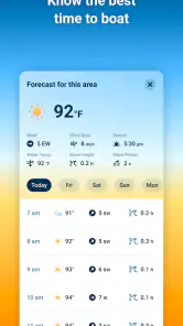
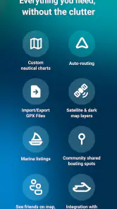
Wavve Boating brings together marine navigation features and information such as nautical charts, maps, weather, tides, water, and depths. These tools can help boaters get a broader picture of a planned trip than a basic road map would provide. The app is intended as a practical aid for time on the water, though users should still check conditions and use sound judgment rather than treating any single digital source as a complete safety plan.
What is Wavve Boating: Marine Boat GPS used for?
Wavve Boating is a marine navigation app designed to help boaters plan trips, follow routes, and understand their position on the water. It can provide chart-based navigation, GPS tracking, route planning, and information useful for coastal cruising. It is aimed at recreational boaters, sailors, and anglers who want digital navigation assistance on a phone or tablet rather than relying only on paper charts or a dedicated chartplotter.
Does Wavve Boating work without an internet connection?
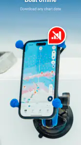
The app may support offline use when charts or relevant navigation data are downloaded in advance, which is especially important when sailing beyond reliable cellular coverage. However, users should prepare their maps, routes, and updates before leaving shore and confirm what features remain available offline. GPS positioning can often work without mobile data, but weather, online services, account features, and live information may require an internet connection.
Is Wavve Boating suitable for professional navigation or as a replacement for marine equipment?
Wavve Boating can be a convenient navigation aid for recreational use, but it should not automatically be treated as a replacement for certified marine electronics, official nautical charts, safety equipment, or local navigation knowledge. Conditions on the water can change quickly, and phone batteries, GPS accuracy, weather, and chart coverage all have limitations. Always use appropriate backup tools and follow local boating regulations.
Pros
- Detailed nautical charts help identify channels
- hazards
- and nearby facilities.
- Offline chart access is useful when sailing beyond reliable mobile coverage.
- Route planning tools support trip preparation before leaving the dock.
- Weather and marine information can improve awareness during changing conditions.
- Supports boating-focused navigation rather than general road directions.
Cons
- Some advanced charts or features may require a paid subscription.
- Chart coverage and detail can vary significantly by region.
- GPS accuracy may decrease near cliffs
- bridges
- or other obstructions.
- Continuous navigation use can drain the phone battery quickly.
- A large screen is preferable for safely reviewing routes while underway.
- Category
- Maps & Navigation
- Version
- 5.7.8











