Wasatch Backcountry Skiing Map
- 24.00
- 4.0
- Installs
- 1.00K
- Version
- Varies with device
Screenshots
Hey there, fellow adventurers! If you're a ski enthusiast like me, you know the thrill of carving through fresh powder in the backcountry. Today, I'm excited to share my thoughts on an app that's become essential for my winter escapades: the Wasatch Backcountry Skiing Map. This app is a game-changer for anyone looking to explore the beautiful Wasatch Range without getting lost or running into trouble.
Getting Started with the Wasatch Backcountry Skiing Map
First things first, let's talk about getting the app up and running. The Wasatch Backcountry Skiing Map is available for both Android and iOS, making it accessible for most smartphone users. Installation is a breeze, and once you open it, you're greeted with a user-friendly interface that's designed with skiers in mind.
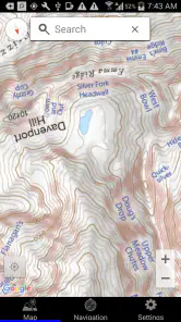
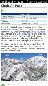
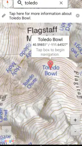
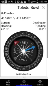
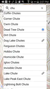
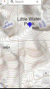
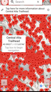
The primary feature of the app is, of course, the detailed map of the Wasatch Range. This isn't just any map; it's a comprehensive guide to the best skiing spots, complete with topographical details that help you plan your routes. The app shows you everything from trailheads to avalanche-prone areas, giving you the information you need to stay safe while chasing that perfect run.
Features That Make a Difference
One of the aspects I love most about this app is its real-time updates. The map is constantly refreshed with the latest snow conditions, weather forecasts, and even recent avalanche reports. This is crucial for planning your day out on the slopes. Trust me, there's nothing more reassuring than knowing the path you’re taking is safe and sound.
Another standout feature is the ability to track your progress. As you ski through the backcountry, the app logs your route, helping you to review your adventures and share them with friends. It’s like having a personal ski diary right on your phone!
Why It's a Must-Have
Now, you might be wondering why you need this app if you’re an experienced skier. Well, the Wasatch Backcountry Skiing Map isn't just about finding your way; it's about enhancing your entire skiing experience. The app helps you discover new trails you might not have found on your own and alerts you to potential hazards.
Moreover, the community aspect of the app is a fantastic bonus. You can connect with other backcountry skiers, share tips, and even plan group outings. Skiing is always more fun with friends, right?
In conclusion, the Wasatch Backcountry Skiing Map is more than just a navigation tool; it's an essential companion for any backcountry explorer. With its easy-to-use interface, detailed maps, and real-time updates, it's no wonder it's quickly becoming a favorite among skiing enthusiasts. So, if you're planning a trip to the Wasatch Range, make sure you have this app in your pocket. You won't regret it!
Pros
- Comprehensive trail coverage for accurate navigation
- Offline maps for areas with no cell service
- Regular updates with new trails and features
- User-friendly interface enhances usability
- Detailed topographic information available
Cons
- Only covers Wasatch region
- limiting use
- Requires storage space for offline maps
- Subscription needed for full feature access
- Interface may be cluttered for beginners
- No real-time weather updates included