TripShot
- 166.00
- 4.6
- Installs
- 100.00K
- Price
- Free

Screenshots
Analysis by Reviewed
Getting around is easy when every vehicle is on time, every stop is obvious, and your phone has a perfect connection. Real travel is rarely that tidy. I found TripShot most interesting in the less polished moments: checking a ride while moving between buildings, trying to understand whether a vehicle is still approaching, or deciding what to do when a signal drops at exactly the wrong time. As a free Maps & Navigation app from TripShot, it is built around a connected view of transportation rather than acting like a simple static map.
That distinction matters. A conventional map is excellent for planning a route across streets, rail lines, and walking paths. TripShot is more useful when the question is tied to a transportation service: what is available, where it is, and how the current trip fits into your day. I would not treat it as a universal replacement for every navigation tool, but I can see why a commuter, student, employee, or visitor using a supported transportation network might keep it installed.
How TripShot feels when your connection is doing the work
The app’s value depends heavily on fresh information. When I open a mobility app, I am not looking only for a map image; I want a current answer. Is the ride nearby? Is the next option practical? Am I looking at a live situation or an old plan? TripShot makes the most sense in that connected decision-making space, where the phone is acting as a window into transportation rather than merely displaying roads.
That also creates a clear trade-off. A connected experience can be much more useful than a timetable saved in a screenshot, but it is less reassuring when the network is weak. If the app needs to refresh transport information while I am standing outside, underground, inside a large building, or moving through a poor-coverage area, the experience can become uncertain. I would therefore open it before leaving a reliable connection, especially when the journey has a fixed arrival time.
My practical habit would be to check the app at three points: before leaving, shortly before reaching the pickup or boarding area, and again if the journey changes. That is more useful than repeatedly staring at the screen throughout a trip. It limits unnecessary data use and gives me a better chance of seeing a current update when I actually need one.
TripShot is not the kind of app I would judge only by how attractive its map looks. Its real test is whether it reduces hesitation. In a busy place, the difference between “I think this is the right vehicle” and “I understand what is happening” can save more time than a few seconds of route calculation. The app’s connected design is strongest when it turns transportation information into a decision I can make confidently.
Why a live connection changes the everyday experience
Imagine leaving work with a short window before an appointment. I would rather check the available transportation option while still inside the building than walk to a stop and discover that the situation has changed. If the app presents current service information, that early check can help me decide whether to leave immediately, wait a little, or choose another way to continue. The useful feature here is not simply seeing a route; it is being able to make the decision at the right moment.
More From Our News Desk

Clash of Clans Is Won Between the Battles

Android Auto Makes the Case for Quieter Car Software

MobiOffice: Transforming Mobile Productivity with Seamless Integration

EA SPORTS FC™ Mobile Soccer: Redefining Mobile Sports Gaming

How Microsoft OneDrive Became a Mobile Productivity Giant

How Google Translate Breaks Language Barriers Effortlessly
A second scenario is a large campus or organized workplace where several transportation choices may appear similar from the ground. In that setting, a phone-based service can reduce the need to guess from signs or ask another passenger. I would still verify the physical location and vehicle before boarding, but TripShot can serve as a practical bridge between the digital plan and what is happening outside.
There is a subtle limitation, though. Live information can encourage overconfidence. A screen may look precise while the surrounding reality remains complicated: a pickup point may be on the other side of a building, a crowded curb may make boarding difficult, or a temporary obstruction may change the easiest walking approach. I use the app as an aid, not as permission to stop paying attention to the street.
Using it while walking, waiting, and changing plans
Mobile context affects how helpful the app feels. At home, I can take time to compare choices and read carefully. On a sidewalk, I need short glances, clear priorities, and a plan that survives interruption. I would check TripShot before walking rather than trying to study the screen while crossing streets or navigating a crowded entrance.
For a first-time user, the best workflow is simple: open the app with a stable connection, identify the relevant transportation option, note the important location details, and only then start moving. Once outside, I would use landmarks and signs alongside the phone. This approach avoids a common mistake with navigation apps: following the display so closely that the user misses the actual entrance, curb, or boarding area.
The app also fits a “change of mind” situation better than a printed plan. If I finish an appointment earlier than expected, I can check again instead of relying on the departure I had in mind. That flexibility is one of the strongest reasons to use a connected mobility app. It is especially useful for people whose schedules shift during the day, although it also means the app should be treated as a current reference rather than a promise that every detail will remain unchanged.
I would be more cautious when my phone is nearly out of battery. A transportation app can be central to the journey, yet it shares the phone with calls, messages, location services, and other travel tools. Before a long day, I would charge the device and avoid unnecessary screen time. That is not a criticism unique to TripShot; it is simply part of relying on a phone for a moving trip.
What happens when the network or plan fails
The most important question for a connected app is not whether everything works in ideal conditions. It is what I can do when the connection becomes unreliable. TripShot is best used with a little preparation: check the journey while online, remember the main destination and boarding context, and keep enough battery for another look later. I would not begin an unfamiliar, time-sensitive trip assuming that a weak signal will never matter.
If a refresh takes longer than expected, I would first stop moving and give the app a moment rather than repeatedly tapping. Repeated attempts can waste battery and data without improving the answer. Next, I would compare what I see on the phone with physical signs, stop information, or staff guidance. If the digital view and the real-world situation disagree, the safe choice is to pause and verify instead of boarding based on a guess.
This is where TripShot differs from a traditional offline reference, at least in practical use. A static map or saved note can remain readable without a fresh connection, but it cannot reflect a new transportation situation. TripShot’s advantage is current context; its weakness is that current context is harder to obtain when connectivity is poor. I see that as the central trade-off, not a minor technical detail.
Recovery also means knowing when to leave the app’s comfort zone. If I cannot get a dependable update, I would use another available source for basic orientation, ask a transportation representative, or choose a simpler alternative if the delay threatens an important appointment. A good mobility tool should support judgment, not replace it. TripShot is useful when it helps me recover quickly, but no app can remove every uncertainty from a disrupted trip.
For that reason, I would avoid making a complicated connection my only plan when arriving late would have serious consequences. I might use the app to monitor the preferred option while keeping a second route in mind. That small amount of preparation makes the connected experience feel less fragile and prevents one stalled refresh from controlling the whole day.
Keeping mobile data use sensible
People often think about data use only when an app streams video or downloads large files. Navigation tools can also become wasteful when they are left open and refreshed without purpose. With TripShot, I would use a deliberate pattern: check for the information I need, close the app when I am no longer making a transportation decision, and reopen it when the situation genuinely changes.
That habit is useful for more than saving data. It reduces distraction, preserves battery, and keeps the screen from becoming a constant source of uncertainty. Watching every movement on a map can make a short trip feel more stressful, especially when small changes appear that do not require action. I prefer to check at meaningful milestones, such as leaving a building or reaching the pickup area.
On a limited mobile plan, I would perform the first route check over Wi-Fi when convenient, then use cellular access for targeted updates while traveling. I would also avoid opening the app simply to browse. The point is not to eliminate connected use; the point is to make each refresh answer a real question. That is a better fit for a transportation app than treating it like a map to inspect continuously.
Privacy and permissions are also worth considering before depending on any location-based service. I would read the operating system prompts carefully and choose settings that match how I intend to travel. If I only need occasional planning, I would not automatically grant broader access than necessary. If the service works best while I am actively navigating, I would make that decision knowingly rather than accepting every request without reading it.
These choices do not make TripShot an offline tool, and I would not plan around that assumption. They simply make a network-dependent workflow more manageable. The strongest routine is to prepare while connected, use live updates when they can change a decision, and keep a human-readable backup such as the destination, meeting point, or service name in mind.
Who will benefit most from TripShot?
I would recommend TripShot first to people who regularly use a transportation service connected to its ecosystem. For them, the app can become a practical daily checkpoint rather than another general-purpose map. Commuters may appreciate checking before leaving home; students and employees may find it useful around a campus or workplace; visitors may value having transportation details in one place when they are unfamiliar with the area.
It is also a reasonable choice for someone who dislikes guessing. If you often arrive early because you are unsure whether a ride is coming, or if you waste time walking toward the wrong pickup area, a connected mobility app may reduce that friction. The benefit is greatest when the transportation network is central to your routine and the phone can reliably reach the service.
I would be less enthusiastic for a person who mainly needs turn-by-turn driving directions, detailed hiking maps, or broad public-transit planning across unrelated cities. A general map application may be better for those jobs because it covers more kinds of movement in one familiar interface. TripShot is more focused: its appeal comes from its relationship with organized mobility, not from trying to be every navigation product at once.
I would also hesitate to recommend it as the sole tool for travelers who expect long periods without connectivity. The app’s connected nature is part of its usefulness, but it also makes preparation important. If your trip involves remote roads, underground travel, or a phone with unreliable service, carry a backup plan and do not assume that a live update will always be available at the exact moment you need it.
Where it sits beside familiar navigation alternatives
Compared with a standard map app, TripShot feels more like a transportation companion than a universal atlas. General map tools usually win when I need to compare driving, walking, cycling, and many public options over a broad area. They are also the natural choice when I am exploring an unfamiliar city without a specific mobility service in mind.
TripShot can be the better fit when the important question is tied to a particular organized transportation experience. Instead of starting with every possible road and route, I can focus on the service I am actually trying to use. That narrower purpose can make the app more relevant, provided the transportation network it serves matches my journey.
It also differs from a timetable or a saved screenshot. Those alternatives are easy to consult and may remain available when the phone is disconnected, but they become stale as soon as circumstances change. TripShot’s reason for being is stronger when current information matters. The trade-off is that I need to think about signal, battery, and sensible backup habits.
My advice is not to choose one navigation app for every situation. I would keep a general map tool for broad orientation and use TripShot when its transportation context is the one I need. That combination avoids forcing a specialized app to handle tasks it was not designed to replace while still taking advantage of its focused mobility experience.
Everyday usability and the details worth knowing
TripShot has been available since June 21, 2015, and its current version is 126. It is free, carries an Everyone age rating, and runs on Android 8.0 or later. Those details make it approachable for a wide range of Android users, including people who are not using the newest phone. I would still keep the app updated because connected transportation tools benefit from compatibility and service changes, even when I am not actively thinking about the version number.
The app has reached over one hundred thousand installs and holds a 4.6 average from around one thousand ratings, with more than one hundred written reviews. Those figures suggest that it has found a real audience, but I would interpret them in context: the experience can depend on whether TripShot is relevant to the transportation service in a user’s area. A strong rating cannot make an unsupported journey suddenly fit the app.
One useful way to test it is not during an emergency. Install it before a normal commute or low-pressure outing, open it on a reliable connection, and learn how the transportation information is presented. Then try the same routine when leaving a building or changing plans. This gives me a better sense of how quickly I can find the information I need and whether the service fits my habits before I depend on it for an important appointment.
I would also pay attention to how much of the journey requires active phone interaction. If I need to keep checking the screen every few minutes, the app may add stress rather than remove it. If one or two purposeful checks are enough to make a decision, it becomes much more valuable. That is a personal usability test, but it is one of the most honest ways to decide whether a mobility app belongs in a daily routine.
My connectivity verdict
After looking at TripShot through the lens of real mobile travel, I see a focused app with a clear strength: it can make organized transportation easier to understand when current information is available. I like the idea of checking before I leave, confirming the situation near the pickup point, and using the phone to adapt when my schedule changes. That is more practical than relying on a fixed plan that may no longer reflect the day.
Its main weakness is inseparable from that strength. A connected view is only as dependable as the moment in which it can refresh. Weak coverage, low battery, distraction, or an unclear physical pickup area can still create friction. I would prepare before leaving, avoid wasting data on constant checking, and keep a simple backup plan for journeys where being late is costly.
For Android users on version 8.0 or later, the free price and Everyone rating make it easy to try. I would recommend it to anyone whose daily transportation fits the service and who wants more confidence than a static schedule provides. I would skip it as a primary tool if my needs are mostly driving directions, broad city exploration, or travel in places where connectivity is consistently unreliable.
My bottom line: TripShot is most convincing when I treat it as a connected mobility assistant, not as an all-purpose map and not as a guarantee that travel will be trouble-free. Used with preparation and a little common sense, it can turn uncertain waiting and changing plans into clearer decisions. That is a modest promise, but for the right commuter or campus traveler, it is a genuinely useful one.
TripShot Frequently Asked Questions
What devices can run TripShot?
TripShot is a Maps & Navigation app for Android, with a minimum operating-system requirement of version 8.0. Before downloading, check that your device meets this requirement and has enough space for the app. The app is free to download, and its content rating is Everyone, so it is suitable for a general audience.
Who develops TripShot, and is it an established app?
TripShot is developed by TripShot and has been available since June 21, 2015. It has a 4.6 average rating from around 1.1 thousand ratings, with 166 reviews and over 100 thousand installs. Those figures suggest that many people have tried it, but your experience will still depend on whether your organization or transportation provider offers TripShot services.
What is TripShot and what can I use it for?
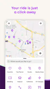
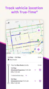
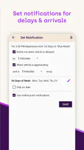
TripShot is a transportation management app designed to help organizations and communities plan, book, and track shared rides. Depending on the service provided in your area, it may let you view routes, reserve a seat, check pickup details, receive trip updates, and follow a vehicle’s location. Available features can differ between employers, schools, campuses, and transit operators.
Can anyone download and use TripShot, or do I need an invitation?
Although TripShot can generally be downloaded from the relevant app store, access to its transportation services is usually controlled by a participating organization or transit provider. You may need an invitation, an approved work or school account, an access code, or a registered email address. If your organization does not use TripShot, downloading the app alone may not provide access to rides or routes.
How do I book a ride or find my pickup information in TripShot?
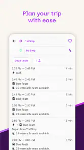
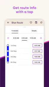
After signing in and selecting the transportation program available to you, TripShot typically displays eligible routes, stops, schedules, and booking options. You can choose a trip, review the pickup location and time, and confirm the reservation when required. Some services use fixed routes, while others may offer on-demand booking, so the exact process depends on the operator.
Pros
- Real-time vehicle tracking helps reduce uncertainty at pickup.
- Supports multiple transportation options in one app.
- Trip details and schedules are easy to review before departure.
- Useful service alerts can help passengers adjust plans quickly.
- Clean interface makes common booking actions straightforward.
Cons
- Availability depends on whether your organization offers TripShot service.
- Some routes or vehicles may not appear during off-peak hours.
- Location permissions are needed for the most accurate tracking.
- Service information can vary between different transportation providers.
- A stable internet connection is required for live updates and bookings.
- Category
- Maps & Navigation
- Version
- 126











