Street View Map and Navigation
- 114.00
- 3.4
- Installs
- 5.00M
- Price
- Free

Screenshots

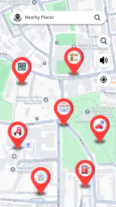
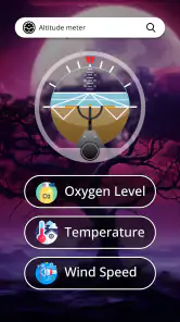
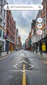
Analysis by Reviewed
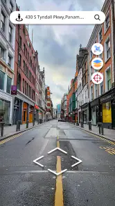
I find Street View Map and Navigation most appealing when I want a quick visual sense of a place, not just a route drawn between two points. Seeing a street before I arrive can make an unfamiliar destination feel less abstract, whether I’m planning a visit or simply curious about a neighborhood. That combination of map browsing and street-level imagery is the reason to try it; the more important question is whether it becomes useful after that first burst of exploration.
A useful first look, with limits
For a first visit to a café, office, or meeting spot, I’d use the map to locate the address and then check the surrounding streets visually. A nearby corner, distinctive building, or road layout can be easier to remember than a spoken turn instruction. This is especially handy when I’m walking the last few blocks and want to confirm I’m approaching the right entrance or side of a busy street.
I would treat that imagery as a planning aid rather than a live view of what is happening outside. A street image can help me recognize a location, but it cannot tell me whether a storefront is open, whether roadworks have appeared, or what traffic looks like at this moment. For time-sensitive decisions, I’d check current conditions separately and keep a familiar navigation option available as a fallback.
How it fits into a regular routine
The app is a free Maps & Navigation app from GPS Apps Box. It has a 3.4 average from around 5.9 thousand ratings, with more than 5 million installs, so it has attracted a sizeable audience without earning an especially strong overall score. I’d read that as a reason to try it for its particular visual angle, not as proof that it will replace a navigation tool I already trust.
In everyday use, the strongest recurring role is preparation: checking a destination before leaving, comparing nearby streets, or getting a visual landmark in mind for the final approach. That takes only a moment and can reduce the “am I in the right place?” feeling. If I commute along the same route daily, though, that benefit may fade quickly; a dedicated navigation app is usually more useful for repeated turn-by-turn guidance and routine travel.
What I’d check before relying on it
The app is rated for Everyone, and its current version is 1.7.3. It requires Android 8.0 or later, while in-app purchases range from $1.99 to $19.99 per item. I’d check the available options before paying for anything and decide whether the street-level view is solving a real problem for me. The free starting point makes casual exploration easy to test, but paid items mean it is worth being deliberate rather than assuming every useful extra is included.
My practical tip is to search and inspect a destination while you still have a stable connection, then note a clear landmark or cross street before setting off. That small habit makes the visual information easier to use when you’re outside, where attention should stay on your surroundings rather than on prolonged screen browsing. If you’re choosing between this and a conventional map app, use the conventional option for dependable everyday routing and keep this one for visual orientation when seeing the street matters.
More From Our News Desk

Clash of Clans Is Won Between the Battles

Android Auto Makes the Case for Quieter Car Software

MobiOffice: Transforming Mobile Productivity with Seamless Integration

EA SPORTS FC™ Mobile Soccer: Redefining Mobile Sports Gaming

How Microsoft OneDrive Became a Mobile Productivity Giant

How Google Translate Breaks Language Barriers Effortlessly
Exploring the World from Your Couch
One of the coolest features of the Street View Map and Navigation app is its ability to let you explore the world from your couch. Imagine strolling through the bustling streets of Tokyo or taking a leisurely walk along the Seine in Paris without ever leaving your home. The app offers high-quality street views that make you feel like you're actually there. It's perfect for planning trips or just satisfying your wanderlust when travel isn't an option.
Navigation Made Easy
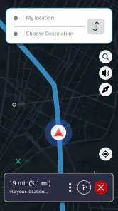
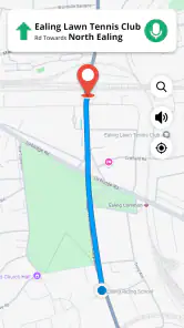
Let's talk about the navigation feature, which is a real lifesaver when you're on the go. Whether you're driving, biking, or walking, the app provides precise directions to get you to your destination with minimal hassle. It even offers real-time traffic updates, so you can avoid those dreaded traffic jams. Trust me, this feature alone is worth installing the app.
What really sets this app apart is its user-friendly interface. Even if you're not tech-savvy, you'll find it easy to navigate. The search function is straightforward, letting you find locations quickly. Plus, the app loads fast, which means you won't be left staring at a loading screen when you need directions ASAP.
Getting the Most Out of It
To get the most out of the app, make sure you take full advantage of the street view feature. It's not just for virtual sightseeing; it can also help you recognize landmarks and find your way around new places. Additionally, the app's offline mode is a game-changer. You can download maps and use them without an internet connection, which is incredibly handy when you're traveling in areas with spotty service.
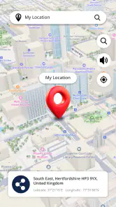
Now, let me share a little secret. The app has a hidden gem feature that lets you explore places in 3D. It's like Google Earth but more interactive. You can zoom in, tilt the view, and get a more detailed look at the locations you're interested in. It's a feature that adds a whole new dimension to virtual exploration.
Final Thoughts
Overall, Street View Map and Navigation is a must-have app for anyone who loves exploring new places or needs reliable navigation assistance. It's packed with features that make getting around easier and more enjoyable. The app is available for both Android and iOS, so download it today and start your virtual journey. You'll be amazed at the world that's waiting to be explored.
Does it earn a place beyond the novelty?
For me, the answer depends on how often I visit unfamiliar places. A traveler who likes previewing the approach to a hotel or checking the shape of a block before choosing a walking route may return to it regularly. Someone who mainly needs a dependable daily commute has less reason to keep opening a separate street-view app once the route is familiar. Its value is specific rather than universal: visual context is the draw, and it matters most when a destination is new.
A useful workflow is to look up the destination at home, identify a nearby landmark, then switch to the map while moving and use the landmark only as a cross-check. That avoids trying to study detailed imagery while crossing streets or driving. For a friend meeting me somewhere crowded, I might also share a simple description such as “the entrance near the corner,” based on what I saw in the preview, rather than expecting them to interpret a map while walking.
Where I’d be cautious
I wouldn’t make this my sole tool for an unfamiliar drive or a tight connection. Visual familiarity and route guidance are different jobs: a street preview can orient me, while a navigation app built around live routing may be the better choice when turns, changing conditions, or timing matter most. Likewise, if I need a detailed transit itinerary or a route tailored to accessibility needs, I’d check that those specifics are covered before depending on this app. The sensible choice is to use the tool that directly answers the question at hand.
There is also a small attention trade-off. Browsing streets can turn a quick check into aimless exploring, which is enjoyable at home but less helpful when I’m already late. I get more from it when I search with a purpose—confirming the block, noting a recognizable feature, or comparing two nearby approaches—and stop once I have that answer. That keeps the visual side useful instead of letting it become another screen to fiddle with on the way.
Keeping it useful over time
Street View Map and Navigation first appeared on May 17, 2021, and its current release is 1.7.3. Those details are useful context, but I’d judge its ongoing value by whether the imagery and map experience fit the places I actually go. Before an important trip, I would check the destination in advance and keep a backup way to navigate; for a casual virtual wander, I’d simply use it when curiosity strikes. That distinction helps avoid treating a visual preview as a guarantee of current street conditions.
So I’d recommend giving it a try if seeing a location before arriving genuinely reduces uncertainty for you. I’d skip making it a permanent fixture if your needs are already met by a standard map and you rarely explore unfamiliar streets. The best long-term use is occasional and intentional: preview a place, build a mental picture, then put the phone away and get on with the journey.
A small routine that makes previews more useful
I get the clearest benefit by deciding what question I’m trying to answer before opening the street imagery. Is the destination on a main road or a side street? Does the block have a noticeable corner or a recognizable approach? Am I likely to arrive from the north or the south? Framing the check this way keeps the map from becoming a substitute for planning and helps me leave with one useful visual cue rather than a vague impression.
For an appointment in an unfamiliar part of town, I’d check the address, then inspect the route from a nearby junction to the entrance. If the image gives me a helpful landmark, I can remember that and close the app. I would still confirm the address itself before setting out, because a familiar-looking building is not enough to distinguish two nearby destinations. The practical gain is confidence about the final stretch, not certainty about every detail of the trip.
Choosing between visual context and live directions
Compared with a standard navigation app, the main reason I’d open this one is the opportunity to orient myself visually before I arrive. Conventional map tools tend to be the better everyday choice when I want a route, traffic-aware decisions, or a familiar saved destination. A street-view-focused app makes more sense when a flat map leaves me unsure what the block will look like in person. I see them as complementary tools rather than interchangeable replacements.
That distinction matters most when traveling with limited time. I would use this app before leaving to picture the destination, then rely on whichever navigation option I trust for the actual journey. If the route changes or the arrival point is unusually complicated, I’d avoid trying to solve everything through a street preview. A visual snapshot can help me recognize where I am; it should not be treated as a promise about what the road will be like when I get there.
Who is likely to keep it installed?
I think it suits people who regularly visit new addresses, enjoy checking out neighborhoods, or feel more comfortable when they can picture a place in advance. It may also be handy for planning a meeting point: I can compare the surrounding streets and give someone a plain-language landmark to look for. The useful part is not endless virtual travel but reducing a small, familiar bit of uncertainty before a real outing.
I’d be less inclined to keep it on a phone used mainly for a daily commute, where routes are already familiar and a dedicated navigation app covers the recurring need. It is also not my first choice for someone who expects one app to handle every travel task, from changing traffic to specialized route planning. The decision is simple: if street-level context solves a question that comes up often, the app has a role; if not, its appeal may be mostly a first-week curiosity.
What to expect from a free starting point
Because the app is free to try but includes paid items, I’d explore the basic experience first and only consider a purchase if I can name the specific benefit I need. Before confirming an in-app purchase, I’d read its description carefully and check whether it applies to the way I use the app. That approach is more useful than assuming a paid option will make the map more current or turn a visual preview into live street information.
I would also avoid relying on an offline workflow just because it sounds convenient. The earlier advice to check a destination while connected is the safer habit: inspect what you need before traveling and keep another navigation option ready if connectivity becomes an issue. Whether the app fits your trip depends on the actual coverage and tools available for the place you’re visiting, so I’d test it on a familiar destination before making it part of a more demanding journey.
The long-term place I’d give it
My lasting verdict is more measured than the first impression. The visual angle can be genuinely useful, especially for a new address or a neighborhood I want to understand before walking around it. But the habit that keeps it valuable is occasional and purposeful: preview, remember a landmark, and move on. If I find myself opening it only to browse without a destination in mind, I’d treat that as entertainment rather than a reason to depend on it for travel.
For a friend deciding whether to install it, I’d say to try it when a street-level preview could answer a real question, while keeping a conventional map app for routine directions. The sizeable audience—more than 5 million installs—shows that the idea has broad appeal, but the 3.4 average is a useful reminder to keep expectations grounded. It is a free, specialized companion from GPS Apps Box, not an automatic replacement for the mapping tools already built into a daily routine.
Street View Map and Navigation Frequently Asked Questions
What does the app’s name and description suggest it is designed for?
Street View Map and Navigation is a Maps & Navigation app from GPS Apps Box. Its description focuses on viewing places with a live map, checking streets on a video map, and finding locations on a map. It may appeal to people who want to explore a destination visually as well as look up places while planning a journey.
What features does Street View Map and Navigation offer?
Street View Map and Navigation offers a wide range of features including real-time GPS navigation, street view imagery, traffic updates, and route planning. Users can explore cities worldwide with 360-degree panoramic views, find the fastest routes to their destinations, and receive timely traffic alerts. The app also supports voice-guided navigation, making it convenient for drivers.
Is Street View Map and Navigation available for both Android and iOS devices?
The app is listed for Android, with a minimum operating system requirement of Android 8.0. Its current version is 1.7.3, so it is worth checking that your device meets the requirement before downloading. If you are looking for it on iOS, check the relevant app store for availability on your device before proceeding.
Does Street View Map and Navigation require an internet connection?
Street View Map and Navigation primarily requires an internet connection to access live traffic updates, real-time navigation, and street view imagery. However, users can download maps for offline use, allowing them to navigate in areas with limited or no connectivity. This feature is particularly useful for travelers in remote locations.
How accurate is the navigation on Street View Map and Navigation?
The navigation accuracy of Street View Map and Navigation is highly reliable, utilizing advanced GPS technology and regularly updated maps. Users can expect precise directions and estimated arrival times. However, accuracy can vary based on factors such as GPS signal strength, environmental conditions, and the frequency of map updates.
Pros
- Detailed street-level imagery available.
- User-friendly interface for easy navigation.
- Supports real-time traffic updates.
- Offline maps feature for data saving.
- Integration with Google services.
Cons
- Requires significant storage space.
- High data consumption for live updates.
- Limited coverage in rural areas.
- Frequent app updates needed.
- Privacy concerns with location tracking.

- Category
- Maps & Navigation
- Version
- 1.7.3