Street View Earth Map Live GPS
- 1.05K
- 4.2
- Installs
- 1.00M
- Price
- Free
Screenshots
Analysis by Reviewed
I’d approach Street View Earth Map Live GPS as a map to explore visually, rather than as a replacement for a dedicated turn-by-turn navigation app. Its appeal is the chance to move between a map view and street-level imagery, so you can get a sense of what a place looks like before deciding where to go. That makes it useful for curiosity as well as practical planning, though it helps to keep those two jobs separate in your mind.
What to expect when you open it
This is a free maps and navigation app from BLYNX PTY LIMITED, with optional in-app purchases ranging from $0.49 to $9.99 per item. It’s rated for everyone, and its current version is 2.3.5, with Android 7.0 as the minimum operating system. I’d expect the most satisfying use to be looking up a place, checking the map, and exploring the available street imagery—not assuming every road or address will have the same level of visual coverage. A view that feels immersive in one area may be limited in another.
The app has a 4.2 average from around 104,000 ratings and more than a million installs, which suggests it has found a broad audience. Those figures are useful context, but they don’t guarantee that the coverage near your home or destination will match what you need. I’d test a familiar location first, then try the place you’re planning to visit.
Getting set up without overthinking it
After installing, start with a straightforward search or a location you already know. If you want to see where you are, use the GPS-oriented map view; if your goal is to preview a destination, search for it instead. This simple first check helps you learn how the map and imagery work together before you depend on them during a trip.
One practical tip: compare a landmark or nearby street with what you already recognize, rather than judging the whole app from a single unfamiliar result. Street-level images can help with visual orientation, but they’re snapshots, not a live camera feed. Treat them as a preview of an area, not proof of what is happening there right now.
Exploring the World from Your Sofa
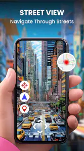
Imagine being able to stroll down the bustling streets of Tokyo, take a leisurely walk along the Seine in Paris, or even marvel at the architectural wonders of Rome—all without booking a single flight. That’s exactly what Street View Earth Map Live GPS offers. This app combines the power of live GPS and street view imagery to give you a virtual tour of the world. It's like having a global passport that lets you visit any corner of the earth right from your smartphone.
Features that Make It Stand Out
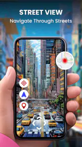
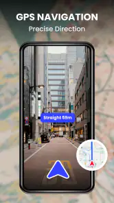
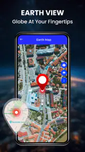
One of the coolest features of this app is its real-time GPS functionality. You can literally track your location on the map and switch to street view to get a ground-level perspective of your surroundings. It's perfect for armchair travelers who want to scout out future travel destinations or simply satisfy their wanderlust from home.
More From Our News Desk

Clash of Clans Is Won Between the Battles

Android Auto Makes the Case for Quieter Car Software

MobiOffice: Transforming Mobile Productivity with Seamless Integration

EA SPORTS FC™ Mobile Soccer: Redefining Mobile Sports Gaming

How Microsoft OneDrive Became a Mobile Productivity Giant

How Google Translate Breaks Language Barriers Effortlessly
Another highlight is the app’s user-friendly interface. Whether you’re tech-savvy or just a casual user, navigating through the app is a breeze. The intuitive design ensures that you can find your way around the digital globe without breaking a sweat.
Turning a visual preview into a useful plan
For a first-time user, the first meaningful success is modest: find a place you intend to visit and use its surroundings to build a clearer mental picture. If you’re meeting someone at a busy station, for example, check nearby streets and visible landmarks before leaving. That can make the final walk less stressful, even though you should still follow current directions once you’re on the move.
For a weekend trip, I’d use the imagery to compare the feel of two neighborhoods or see whether a landmark sits on a major road or a quieter street. It can also help when choosing a meeting point: a recognizable corner or building is easier to describe than a vague address. These are small planning wins, not a substitute for checking opening hours, access, or current conditions elsewhere.
A useful way to make that preview more actionable is to note one or two visual anchors rather than trying to memorize an entire route. Look for a distinctive building, a junction, or the side of a street where the entrance appears to be. Before the visit, compare those cues with the map view and your planned route. This gives you a simple recognition plan for arrival without pretending the imagery can guide every turn in real time.
For a first appointment in an unfamiliar area, I’d also check the last part of the journey separately from the drive or transit leg. A destination pin may get you close, while the street-level view can help you picture the final approach. If the address covers a large building or a complex block, use the preview to orient yourself, then confirm the exact entrance through the venue’s current directions. That division of jobs is more reliable than expecting one map screen to answer everything.
Where it fits among map apps
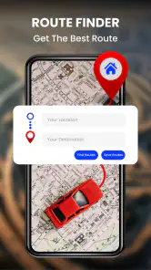
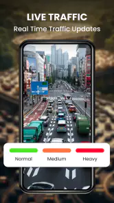
Compared with a conventional navigation app, this one is most compelling when the question is “What does this place look like?” rather than “What is the fastest route right now?” A dedicated navigation tool is the better choice for live traffic, precise route guidance, or a drive where missing a turn would matter. Here, visual exploration is the distinctive part; GPS helps connect that exploration to your location.
It’s also worth keeping expectations realistic when you travel. If street imagery is sparse or old in a particular area, the map may still help with general orientation, but it won’t answer every on-the-ground question. I’d use another current source for road closures or last-minute changes, and keep this app for previewing the layout and landmarks.
The comparison is less about choosing one map for every task and more about keeping a sensible pair of tools. I’d use this app before leaving to recognize the destination, then switch to a navigation service designed for live routing when I’m actually traveling. For a short walk in a familiar neighborhood, the map view may be enough to orient me; for a complicated drive, I wouldn’t rely on street imagery as my primary guide.
There is another trade-off for people who regularly travel through rural or less familiar regions: a visually rich preview in one town does not imply equal coverage on the next stretch of road. I’d check the key destination before building a plan around it. If the useful imagery stops short of the place you need, a standard map may still offer the route context, but this app’s main advantage becomes less important for that particular outing.
Why You’ll Love It
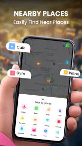
Now, let’s talk about why this app might just become your new favorite travel companion. For starters, it’s an excellent tool for planning your next adventure. You can explore potential travel routes, check out nearby attractions, and even discover hidden gems that aren’t on the usual tourist trail. Plus, it’s a great way to get a feel for places you’ve always wanted to visit but haven’t had the chance to yet.
Moreover, it also doubles as a fantastic educational tool. It’s perfect for students learning about geography or for anyone interested in understanding different cultures and landscapes. The app lets you immerse yourself in diverse environments, offering a virtual experience that’s almost as enriching as the real thing.
For a family planning a day out, I’d use it as a conversation starter rather than a definitive guide: let everyone look at the area around a museum, park, or meeting point, then decide what seems easy to reach. It can help younger users connect a place name to its surroundings, and it may make a future visit feel less abstract. I’d still check practical details such as current access and opening times separately, especially when a plan depends on them.
It can also be useful when deciding between two possible meeting spots. A café name alone may not tell a newcomer whether it is on a busy road or tucked into a quieter block. A visual preview can make that choice easier by giving people a shared landmark to describe. The catch is that imagery should support the decision, not settle time-sensitive questions such as whether a business is still there or which entrance is open.
A few useful limits to keep in mind
For families or students, browsing a location together can turn a geography lesson into a concrete activity: compare a city center with a coastal area, or trace how a road approaches a landmark. I’d treat it as a visual prompt for questions rather than a complete lesson, since imagery can’t explain local history or tell you what a place is like today.
There is a trade-off in relying on street-level views: the image may not reflect current construction, storefronts, or access arrangements. Before setting out, use the view to recognize surroundings, then verify time-sensitive details with a current source. That extra check matters most when accessibility, a tight appointment, or a complex interchange is involved.
If you mainly need reliable spoken directions while driving, prefer a navigation app built around that task. If you enjoy exploring places visually, planning a first visit, or showing a child how far-apart locations relate, this is a more natural fit. I’d also avoid trying to inspect imagery while moving; do your browsing before the journey or while safely stopped.
It is also worth deciding whether you need the optional purchases before spending anything. The app is free to start, and I’d first try the places and workflows that matter to me without assuming a paid item is necessary. If a prompt appears, read what it offers and whether it fits your use; there’s no reason to buy simply because you are exploring the app for the first time.
One common source of confusion is the word “live.” GPS can relate the map to your current position, but that does not make street-level imagery a live view of traffic, people, or changing conditions. I’d separate the two ideas: use the location view for orientation and the imagery as a visual reference. For a road closure, a newly changed entrance, or a busy event, check a current source instead.
Another practical question is whether it can serve as the only map on a trip. My answer would be no if the journey depends on turn-by-turn instructions, live road conditions, or dependable details at every stop. It can still be a useful companion for previewing places, but I’d keep a navigation option ready for the actual journey. If the destination is a remote address or a large site, checking the map and imagery in advance is especially worthwhile.
Of course, no app is without its quirks. While the street view imagery is generally high-quality, there are times when images might be a tad outdated. But hey, that’s a small price to pay for the sheer convenience and excitement this app brings to the table.
Who should try it—and who should skip it
I’d recommend it to someone who likes to inspect a destination before setting out, enjoys casual virtual exploration, or wants a visual aid for explaining where a place sits in relation to nearby streets. It is particularly handy when a map pin feels too abstract and seeing the surrounding area would make the plan easier to understand. A first-time visitor to a neighborhood can get value from even a quick look at the approach and nearby landmarks.
I’d skip it as a primary tool if your main need is precise driving guidance, current traffic, or confirmation that an entrance or business is open today. It is also a poor fit for anyone expecting uninterrupted street imagery across every location. The right choice depends on the question: for “What might I see when I arrive?” it can help; for “What is happening on the road right now?” I’d choose a live navigation service.
Before relying on it for an important outing, I’d run a small rehearsal: search for the destination at home, check whether the imagery covers the final approach, and identify a recognizable landmark. If that test gives a clear picture, keep the app as a planning aid. If it does not, use another source rather than trying to solve the gap while you are already on the way.
Final Thoughts
In a nutshell, Street View Earth Map Live GPS is a game-changer for anyone keen on exploring the world from the comfort of their home. It’s a fun, informative, and incredibly convenient way to quench your thirst for adventure without breaking the bank. So, if you’re ready to embark on a virtual journey around the globe, this app is definitely worth checking out. Bon voyage!
Street View Earth Map Live GPS Frequently Asked Questions
Is Street View Earth Map Live GPS suitable for planning a trip before I leave?
Yes. Street View Earth Map Live GPS combines maps, satellite views, and street-view imagery, so you can look around a destination and get a sense of nearby roads and places before setting out. Its store summary also describes GPS driving directions and navigation. Exploring an area in advance can help you feel more familiar with a route, though you should still pay attention to road signs and conditions while traveling.
Who develops Street View Earth Map Live GPS, and what should I know about its audience rating?
Street View Earth Map Live GPS is developed by BLYNX PTY LIMITED and is listed as suitable for everyone. It is a Maps & Navigation app with an average rating of 4.2 from around 104,000 ratings, giving prospective users a broad indication of how it has been received. Ratings are only one consideration, so it is also worth checking whether its map and navigation features suit the way you plan to use it.
What is Street View Earth Map Live GPS and how does it work?
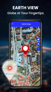
Street View Earth Map Live GPS is a navigation app that allows users to explore the world through high-quality street view imagery. By leveraging GPS technology, it provides real-time location tracking and detailed maps to aid in navigation, offering users the ability to virtually visit streets, landmarks, and places of interest globally. The app integrates satellite maps, 3D views, and live GPS navigation to enhance the user's experience.
Can I use Street View Earth Map Live GPS offline?
This app primarily relies on an active internet connection to fetch real-time street views and maps. While it offers some offline functionalities, such as previously downloaded maps and basic navigation, the full live street view experience requires a stable internet connection to access the latest satellite imagery and updates.
Is Street View Earth Map Live GPS free to use?
Street View Earth Map Live GPS is free to download and offers a free version with essential features, allowing users to explore maps and street views. In-app purchases range from $0.49 to $9.99 per item, so optional purchases may add to the cost if you choose them. Check the purchase details before confirming anything, especially if you only want to use the free features.
Pros
- High-quality satellite imagery
- Real-time GPS navigation
- User-friendly interface
- Detailed street views
- Frequent updates
Cons
- Requires internet connection
- Consumes significant data
- Limited offline access
- Ads can be intrusive
- Battery-intensive on some devices
- Category
- Maps & Navigation
- Version
- 2.3.5











