Satellite View:Live Earth Maps
- 85.00
- 3.2
- Installs
- 1.00M
- Version
- 2.0.0
Screenshots


Ever found yourself daydreaming about exploring the world without leaving your couch? Well, let me introduce you to Satellite View: Live Earth Maps, an app that turns that dream into reality. This nifty app brings the world to your fingertips, literally. From bustling cityscapes to serene natural wonders, it's all just a swipe away.
Exploring the World Virtually
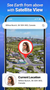
So, what's the deal with Satellite View: Live Earth Maps? Imagine having a bird's eye view of any location on the planet. This app provides high-resolution satellite images that let you zoom into any corner of the globe. Whether you're planning your next vacation or just curious about a place you've never been, this app has got you covered.
Features That Stand Out
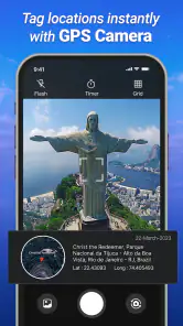
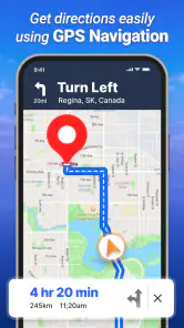
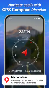
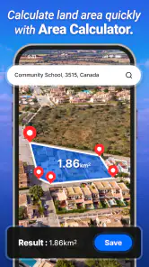
Let's talk features. One of the coolest things is the real-time traffic updates. If you're navigating through an unfamiliar city, this can be a real lifesaver. The app also offers 3D views of major landmarks, which is perfect for getting a feel for a place before you visit.
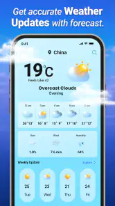
Another neat feature is the weather overlay. Knowing the weather conditions anywhere in the world can be incredibly useful, especially if you're planning outdoor activities. And if you're into stargazing, there's even an option to switch to an astronomical view!
User Experience
Now, let's get into the user experience. The interface is pretty intuitive. Even if you're not tech-savvy, you'll find it easy to navigate. The search function works like a charm, allowing you to find places quickly. Plus, the loading times for maps are impressively fast, so you won't be left waiting.
However, like any app, it's not without its quirks. Occasionally, the app may lag if you're viewing highly detailed maps or if your internet connection is on the slower side. But honestly, it's a small price to pay for such a comprehensive view of the world.
Why You Should Try It
At the end of the day, Satellite View: Live Earth Maps is more than just a tool; it's an experience. It's perfect for travel enthusiasts, geography buffs, or anyone with a curious mind. The app combines practicality with a sense of adventure, making it a must-have for your smartphone.
So, if you're ready to embark on a virtual journey around the globe, give this app a try. Who knows? You might discover somewhere new to add to your travel bucket list or just enjoy the thrill of exploring different locales from the comfort of your home.
Pros
- Provides real-time satellite imagery.
- Easy navigation with intuitive interface.
- Offers street
- terrain
- and hybrid views.
- Includes weather overlay for forecasts.
- Frequent updates with new data.
Cons
- High data usage on mobile networks.
- Limited offline map accessibility.
- Occasional lag in loading images.
- Some features require in-app purchases.
- May drain battery quickly.