RockHoundR: Rockhounding Map
- 8.00
- 4.4
- Installs
- 10.00K
- Price
- Free

Screenshots
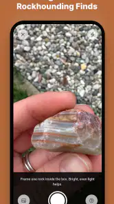
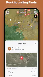
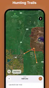
Analysis by Reviewed
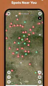
Rockhounding usually begins with a simple question: where should I look? RockHoundR approaches that question as a map-focused Android app for finding places connected with rocks, gems, and minerals. I found its appeal easy to understand. Instead of starting with a broad map and trying to guess which areas might be worthwhile, the app is designed to put rockhounding locations at the center of the experience.
That focus makes it more useful than a general navigation app for planning a collecting outing, but it also means I would not treat it as a complete field-safety or trip-planning replacement. Its value depends on how clearly a location is represented, how carefully I verify access before visiting, and whether my phone can display the map reliably when I need it. The best way to use it is as a discovery and planning tool, not as permission to enter land or collect whatever I find.
What RockHoundR is really useful for
The app belongs to the Maps & Navigation category and comes from Ruby Glint Technologies. Its central idea is narrow in a good way: help me explore a map for potential rockhounding destinations and learn what kinds of natural finds may be associated with them. That is a more practical starting point for a collector than searching ordinary map apps for vague terms such as “rocks nearby” or “gem location.”
I especially like the distinction between finding a promising area and deciding to visit it. A map can help me compare locations, estimate how far I want to travel, and build a shortlist for a weekend. It cannot, by itself, settle questions about land ownership, collecting rules, weather, road conditions, or whether a site is appropriate for children. Keeping that distinction in mind prevents the most common mistake: confusing a map marker with guaranteed access.
The app is free to install, carries an Everyone age classification, and has reached over ten thousand installs. Its average rating is 4.4 from roughly sixty ratings, with a smaller group of written reviews behind that score. Those figures suggest an early, focused product rather than a mature navigation platform with a huge community behind every location. I would read the rating as encouraging, but I would still inspect each destination carefully instead of assuming every mapped point has equal detail or current relevance.
Version 1.9.0 supports Android 7.0 and later, which gives it a reasonably broad range of compatible devices. That matters if I want to use an older phone as a dedicated field device. The app is free at the entry point, while optional in-app purchases range from about seven dollars to fifty dollars per item. Before paying for anything, I would first use the basic experience to decide whether the map presentation and location coverage match my own area.
Where people are likely to get stuck first
The first friction point is expectation. Someone who opens the app hoping for a turn-by-turn navigation system may find that a rockhounding map serves a different purpose. I would use it to identify and compare possible destinations, then rely on ordinary navigation tools for the drive itself if that produces clearer road guidance. This two-app workflow is not a failure; it is often the sensible division of labor.
More From Our News Desk
Weather by Xiaomi Review: Clear at a Glance, Less Clear Up Close

X Under Pressure: Can It Recover When Posting Goes Wrong?

Clash of Clans Is Won Between the Battles

Android Auto Makes the Case for Quieter Car Software

MobiOffice: Transforming Mobile Productivity with Seamless Integration

EA SPORTS FC™ Mobile Soccer: Redefining Mobile Sports Gaming
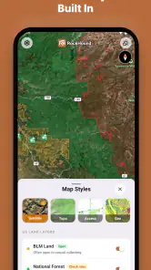
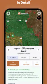
A second sticking point is interpreting a location too literally. A point on a map may represent a broad area, a known collecting region, or a place associated with a particular material. I would zoom in, read every available detail, and record the location separately before planning a trip. If the point sits near a road, trail, river, or boundary, I would not assume the marker shows the exact place where collecting is allowed.
The third issue is the difference between interest and preparation. Rockhounding involves more than reaching a coordinate. I still need suitable footwear, water, sun protection, containers, hand tools that are legal for the area, and a plan for leaving the site undisturbed except for permitted collecting. The app can narrow the search, but it does not replace those decisions.
There is also a practical screen problem. Maps are easy to browse at home, but a bright outdoor setting, gloves, poor reception, or a low battery can make any map app awkward. I would not wait until I am standing at a trailhead to learn how the app behaves on my phone. A short test at home can reveal whether the map is comfortable to read, whether markers are easy to select, and whether I can remember the important details without constantly staring at the screen.
Setup checks that save time later
My first setup step would be choosing a familiar nearby area rather than immediately searching for a distant destination. This gives me a low-risk way to understand how locations appear, how much information is attached to them, and how quickly I can move between a broad regional view and a more detailed view. It also makes it easier to notice whether a result is genuinely useful or simply interesting on a map.
I would then test the app in the exact conditions I expect to encounter. If I plan to use it while walking, I would check the map outdoors and with one hand. If I expect to use an older phone, I would test that phone rather than assuming performance will match a newer device. The minimum operating-system requirement is Android 7.0, but compatibility alone does not guarantee that every device will feel equally responsive.
Before leaving, I would make a small written or saved checklist for each candidate location: the name or identifying details shown in the app, the general area, the route I intend to use, and the questions I still need to answer elsewhere. This is one of the most useful habits because it turns browsing into a plan. It also protects me from losing context if I accidentally close the app, switch applications, or run into a weak connection.
I would separately verify access rules and current conditions. Public-looking land is not automatically open for collecting, and a location near a road is not automatically a safe parking place. Local agencies, land managers, official notices, and current weather information are better sources for those decisions. RockHoundR can help me decide where to investigate; it should not be the only source I consult before entering an area.
Another worthwhile check is purchase awareness. Since the app offers optional items at different prices, I would avoid buying anything during the first few minutes of exploration. I would first identify what the free version lets me do and whether that is enough for my normal trips. A paid option may be worthwhile for a committed user, but the right test is whether it solves a specific limitation in my workflow, not whether the existence of a purchase implies that I need it.
A better workflow for planning a collecting day
My preferred workflow starts several days before the outing. I open the map, scan a broad region, and select a few possibilities rather than committing to the first attractive point. I compare distance, surrounding roads, nearby communities, and the amount of information available for each place. This creates a backup plan, which is important because a promising location may turn out to be inaccessible, unsuitable for the group, or unproductive after closer research.
Next, I separate discovery from verification. RockHoundR is the discovery layer: it helps me notice candidate locations connected with rocks, gems, or minerals. Other sources then answer practical questions about boundaries, permissions, closures, hazards, and travel conditions. Treating these as separate stages makes the app more valuable because I am no longer asking one tool to provide information it was not designed to guarantee.
A useful, less obvious habit is to plan around material rather than just distance. If I am interested in a particular type of specimen, I would group possible locations by the kind of collecting experience I want, then choose the site whose access and conditions fit the day. A closer location is not automatically the better choice if it requires a difficult approach, while a farther destination may be sensible if I can combine it with other legitimate stops and prepare properly.
I would also keep a simple field note for every visit. I might record the date, general area, what I actually observed, and whether the location was practical for my equipment and experience. That personal record gives the map more value over time. Rather than repeatedly judging locations from the same first impression, I can build my own understanding of which kinds of places are realistic for me.
If the map seems to stop helping during a trip, I would switch to recovery mode instead of repeatedly tapping the same screen. I would return to the last location details I wrote down, confirm my route in a conventional navigation app, and use visible landmarks and safe stopping points. I would not pull over in an unsafe place just to force the map to load or attempt to handle the phone while driving.
Recovering from common map and location problems
When a location does not appear as expected, I would first check the simple things: whether I am looking at the correct region, whether the map is zoomed too far out or too far in, and whether I have accidentally moved away from the area I meant to inspect. Map browsing can create misleading impressions when I pan widely and forget where I started.
If the app feels slow, I would close unnecessary applications, restart the app, and try again in a stable environment before blaming the destination itself. I would also test a different area. If one region behaves normally and another does not, the issue may be related to the particular map content or connection rather than my phone. That comparison is more informative than repeatedly reopening a single screen.
If my position appears wrong, I would pause before acting on it. Phone location can be imprecise near trees, steep terrain, buildings, or other obstructions, and a moving position marker is not a substitute for careful orientation. I would compare the displayed position with roads, trails, and obvious landmarks, then use the safest available route. For a serious trip, I would carry a backup way to understand where I am instead of depending on one screen.
When a map location looks promising but the trip does not work out, I would preserve the useful part of the research. I would note why the plan failed: unclear access, unsuitable road, poor weather, lack of time, or simply a location that did not fit my group. That turns a disappointing outing into better future planning. The app is most helpful when it supports a repeatable process, not when I expect one tap to produce a perfect excursion.
I would also avoid assuming that a missing detail means a place is worthless. It may simply mean I need another source or a closer look. At the same time, I would not fill gaps with guesses. If I cannot establish that collecting is permitted or that the route is safe, I would choose another plan. That is a key trade-off with any specialized location database: focus can speed up discovery, but responsibility for final verification remains with me.
When the app is not the cause of the problem
Some frustrations blamed on a map are really trip-planning problems. A route can be difficult because of weather, road damage, seasonal conditions, or a vehicle that is not suited to the approach. A site can be disappointing because visible specimens are uncommon, collecting is restricted, or the area has already been heavily searched. None of those outcomes necessarily says anything about the quality of the app’s map experience.
There is a similar distinction with phone connectivity. If the map is difficult to use in a remote place, the problem may be the environment rather than the app. I would prepare by reviewing the area before departure, keeping key details available in another form, and avoiding a plan that depends on continuous screen access. This is especially important for first-time visitors who do not yet know the terrain.
Safety is another area where a specialized app should not be overextended. A marker cannot evaluate unstable ground, flash-flood risk, heat exposure, wildlife, or the skill level of everyone in my group. I would treat the map as one input into a broader decision. If a location requires equipment, experience, or access arrangements I do not have, selecting a simpler destination is the better choice even if the map makes the difficult one look exciting.
For casual sightseeing, a general map app may actually be enough. If my goal is only to find a scenic drive, a museum, a public park, or a nearby trail, ordinary navigation tools usually provide a broader set of information. RockHoundR becomes the stronger option when the central question is specifically related to rock, gem, or mineral collecting locations. Its specialization is its advantage, but also its boundary.
Who will get the most from it
I think the app suits beginners who need a focused way to start exploring the hobby, families planning an educational outing, and experienced collectors who want a faster first pass over unfamiliar regions. It can also help teachers, club organizers, and curious travelers brainstorm destinations before doing the more serious access and safety research.
Beginners should use it as a learning aid rather than a guarantee of success. I would choose an accessible, low-risk outing, study the surrounding area, and set modest expectations. The goal of a first trip should be learning how to read the map, understand local rules, and recognize what makes a location practical, not simply bringing home a large collection.
Experienced users may appreciate the focused search process, especially when comparing several regions. However, someone who already has a trusted collection of official maps, local geological references, and personal field notes may find that the app adds convenience rather than completely changing their method. Its benefit will depend heavily on whether its mapped coverage complements the areas they already know.
I would skip it if I want a full replacement for navigation, a guaranteed list of legal collecting sites, or detailed professional geological analysis. I would also hesitate if I rarely look for rocks, gems, or minerals, because the specialized focus may not justify adding another map tool to my routine. In those cases, a conventional navigation app or an official local resource may be a better fit.
My practical verdict after using it
RockHoundR makes sense because it starts with the question that ordinary maps handle poorly: where might a rockhound want to investigate? I like that focused purpose, and I can see myself using it at home to build a shortlist, compare areas, and prepare a realistic day trip. The app is most convincing when it helps me move from vague curiosity to a concrete research plan.
Its limitations are equally important. I would not rely on a map marker alone for permission, safety, road conditions, or exact field expectations. I would also test the app before traveling, keep backup notes, and use a second navigation source when driving or handling route details. Those extra steps are not unnecessary work; they are what make a specialized map dependable in real life.
At no cost to start, with support for Android devices from version 7.0 onward and an Everyone rating, it is approachable for a wide range of hobbyists. The optional purchases mean I would evaluate the free experience first and spend only if a particular addition clearly improves my own workflow. My overall recommendation is positive for anyone actively searching for rockhounding destinations, provided they understand that the app is a discovery companion rather than a complete field guide.
If I were recommending it to a friend, I would say: install it, test it around a familiar area, shortlist several locations, and verify every practical detail before leaving. Used that way, it can save time at the beginning of a search and make the hobby feel more organized. Just keep the final judgment in your hands, not on the map.
RockHoundR: Rockhounding Map Frequently Asked Questions
Is RockHoundR: Rockhounding Map free to download?
RockHoundR is free to download, with in-app purchases available. You can try its rockhounding map features without paying upfront, then decide whether any optional purchase suits your needs. Before completing a purchase, check the price shown in the app and make sure it matches what you intend to buy. The app is rated for Everyone, so it is broadly suitable for general audiences.
Which devices can run RockHoundR: Rockhounding Map?
RockHoundR is available for Android, and the listed minimum operating-system requirement is Android 7.0. Check your device’s software version and available storage before installing, since compatibility can depend on your device and its configuration. The app’s current version is 1.9.0, so keeping your device’s software and apps reasonably up to date can help with a smoother experience.
What is RockHoundR: Rockhounding Map used for?
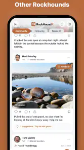
RockHoundR: Rockhounding Map is designed to help rockhounds, mineral collectors, fossil hunters, and geology enthusiasts discover potential collecting locations. It can be useful for planning trips, reviewing map information, and organizing places you may want to explore. However, the app should be treated as a planning and reference tool rather than a guarantee that specimens will be found at every listed location.
Does RockHoundR provide accurate and up-to-date collecting locations?
The app can be a helpful starting point for finding rockhounding areas, but map data may vary in accuracy, completeness, and freshness. Some locations may come from user contributions, public information, or other sources that can change over time. Before visiting, confirm access rules, land ownership, collecting restrictions, road conditions, and local regulations through official sources or land managers.
Can I use RockHoundR without an internet connection?
Offline availability depends on the app version and the specific mapping features provided on your device. Some map content may require an internet connection to load, search, or update, while saved information may remain accessible in limited form. If you are traveling to remote areas, prepare in advance by checking the location, saving important details when possible, and carrying a backup map or navigation method.
Pros
- Helps discover potential collecting areas with map-based location tools.
- Useful for planning rockhounding trips before visiting unfamiliar regions.
- Can make it easier to save and organize interesting locations.
- Encourages exploration of geology
- minerals
- and local landscapes.
- A practical companion for hobbyists who prefer digital trip planning.
Cons
- Map accuracy may vary depending on user-submitted information.
- Some locations may require permissions or have collecting restrictions.
- Remote areas can have limited signal or unreliable map access.
- The usefulness of listings may differ considerably by region.
- Frequent map use can drain battery during long outdoor trips.
- Category
- Maps & Navigation
- Version
- 1.9.0











