Organic Maps: Hike Bike Drive
- 365.00
- 4.4
- Installs
- 1.00M
- Price
- Free

Screenshots
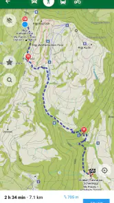
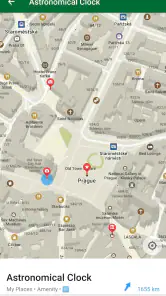
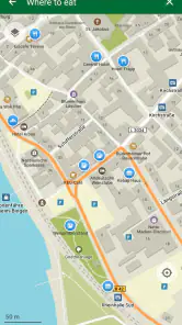
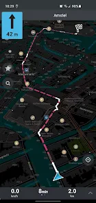
Analysis by Reviewed
I judge a navigation app not just by whether it gets me to a destination, but by how much trust and preparation it asks of me along the way. Organic Maps is built around offline use, which makes it especially appealing when I’d rather not depend on a steady mobile connection. That design can be useful on a trail or while travelling, but it also puts more responsibility on me to prepare before setting out.
Trust starts with practical expectations
Organic Maps is a free maps and navigation app from Organic Maps, with an Everyone age rating. It has a 4.4 average from around 15,000 ratings and over 1 million installs. Those figures suggest that it has found an audience, but I’d still assess it by whether its offline approach suits my own routes and habits. It first appeared in 2021, and the current version is 2025.11.26-5-Google; keeping the app updated is a sensible part of relying on it for navigation.
The privacy appeal needs a careful reading. I found the app’s open-source character and its emphasis on offline maps reassuring, especially compared with navigation tools that centre online services. But I wouldn’t treat a general privacy impression as a substitute for checking the choices and permission prompts on my own device. I pay particular attention to location access: it is central to live GPS navigation, while map browsing and route preparation are different activities. I grant only what I need for the task at hand.
Prepare first, then rely on the map
The main user choice that shapes the experience is downloading a region before travelling. I’d do that at home or somewhere with a dependable connection, then open the map once to make sure the area is available offline. This small check matters: offline navigation is only helpful if the map for the intended route is already on the phone. For a trip that crosses several regions, I’d plan downloads in advance rather than assume one map covers the whole journey.
That workflow also gives me more control over data-sensitive moments. Once I’m away from reliable service, downloaded maps can reduce my need to stay connected just to view the route. I still treat GPS as a separate choice, since using the phone to locate me is what turns a map into active navigation. If I’m only checking a place before leaving, I can browse first and enable location when I actually need it.
Discovering the Features
I was pretty excited to try out Organic Maps, given its reputation for being an open-source map app that doesn’t track your personal data. It’s quite refreshing in today’s digital age where privacy can sometimes feel like a luxury. The app offers offline maps, which means you can download maps for any region and use them without an internet connection. This is a lifesaver for those remote areas where signal is as rare as a unicorn.
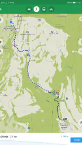
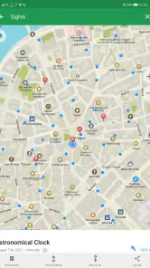
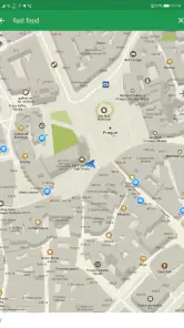
The app is incredibly easy to use. You don’t need a manual to figure out where to tap or swipe. The user interface is intuitive and clean, which is a big plus for someone like me who prefers simplicity over clutter. I was also impressed with the level of detail in the maps. You can find hiking trails, bike paths, and even some useful local spots like cafes and restrooms. It’s like having a local guide in your pocket!
More From Our News Desk

Clash of Clans Is Won Between the Battles

Android Auto Makes the Case for Quieter Car Software

MobiOffice: Transforming Mobile Productivity with Seamless Integration

EA SPORTS FC™ Mobile Soccer: Redefining Mobile Sports Gaming

How Microsoft OneDrive Became a Mobile Productivity Giant

How Google Translate Breaks Language Barriers Effortlessly
Performance and User Experience
When it comes to performance, Organic Maps doesn’t disappoint. The app runs smoothly without any hiccups, and the maps load quickly even when you’re offline. I took it for a test drive on a hiking trip, and it was rock solid. The GPS tracking was accurate and helped me stay on course without getting lost in the wilderness. What’s more, it didn’t drain my battery life as much as I expected, which is a big win in my book.
One of the standout features is the app’s commitment to privacy. There are no ads, no tracking, and everything is open-source. It feels good knowing that my location data isn’t being sold to the highest bidder. Plus, being open-source means that developers from all over the world can contribute to the app, constantly improving and updating it.
Where it fits into my routine
A practical example is a weekend ride that starts in town and follows paths beyond the edge of reliable coverage. I’d download the map beforehand, check the route while I still have a connection, and keep the phone accessible for occasional position checks rather than staring at it throughout the ride. That approach makes the offline map useful without turning every junction into a screen-watching exercise. I’d still carry a charged phone and use ordinary outdoor judgement; a navigation app is a guide, not a replacement for paying attention to signs, terrain, or changing conditions.
For a hike, the map detail can help me compare trail options and spot nearby facilities before I leave. A useful habit is to zoom in on the section where paths branch, rather than relying only on a broad overview. In unfamiliar terrain, I’d also note the intended return direction before starting. These checks don’t guarantee that every mapped path matches current ground conditions, but they make it easier to notice when my position and plan stop lining up.
Choosing it over a familiar alternative
Compared with mainstream navigation apps that are designed around live search, traffic, and a constant connection, Organic Maps makes more sense to me when the route is outdoors or the signal is uncertain. Its offline-first approach is the point, not an add-on I’d ignore. The trade-off is that people who depend on connected services for current traffic conditions, frequent business updates, or a highly guided city commute may prefer their usual online navigator. I’d happily keep both kinds of tool available: one for dependable offline orientation and another when live road information matters more.
It is also a good fit for someone who wants a straightforward map rather than a stream of prompts and extras. On the other hand, if I mainly need hands-free, turn-by-turn directions for busy urban driving, I would test my route before relying on it as my only option. A calm interface is welcome, but the right navigation tool depends on the journey: a walking path, a long drive, and a time-sensitive commute don’t ask for the same things.
Small decisions that make offline use safer
When I’m planning a trip, I’d leave room on the phone for the maps I need and check that the battery is healthy before heading out. GPS use can still consume power even when the map itself is offline, so I wouldn’t assume that downloading a region solves every practical issue. For a long day outdoors, a power bank or a paper backup can be a reasonable precaution. That is not a knock against the app; it is simply a sensible way to avoid making one phone the single point of failure.
If a route changes unexpectedly, I’d first check whether the new area is within the maps already saved on the device. That quick distinction helps separate a navigation problem from a coverage-preparation problem. Before leaving, I’d also decide whether I want location access active only while navigating or at other times, using the controls available on my device. These are small choices, but they make the app feel less like something I must trust blindly and more like a tool I can use on my terms.
What I’d check before depending on it
One question I’d ask before a trip is whether offline maps mean I can skip all preparation. I wouldn’t make that assumption. The useful distinction is between having a map available and having the exact coverage needed for the whole route. I’d inspect the start, destination, and any likely detours while connected, then check that the relevant areas have been downloaded. If plans change on the road, an offline map can still help with orientation, but it cannot make an unprepared region appear on the phone.
I’d also decide in advance how I want to use the screen. For a cycling route, I prefer checking the map before setting off and at safe stops, not trying to interpret it while moving. On foot, I can pause at a junction and zoom in to compare paths. This is a small but important trade-off: a map that leaves me in control still expects me to make sensible decisions about when and where to consult it.
A useful companion, not every driver’s default
For everyday errands, I’d reach for Organic Maps when I want to inspect an area or get around without relying on continuous service. A traveller can use it to prepare a neighbourhood walk before leaving accommodation, while a cyclist can keep a downloaded region ready for a ride that crosses patchy coverage. Those are different needs from finding the fastest route through rush-hour traffic. If live traffic and frequently refreshed business details are central to my trip, I’d choose a connected alternative for that journey rather than expect an offline-focused map to do the same job.
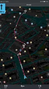
That doesn’t make it a niche tool only for wilderness trips. It can be handy in a city too, particularly when I value a clean map and want to reduce dependence on a connection. The deciding question is what I need the app to know right now. If the answer is my position and the surrounding mapped streets or paths, it makes sense. If the answer is current conditions that change minute by minute, another navigator may be more appropriate.
Performance and User Experience
When it comes to performance, Organic Maps doesn’t disappoint. The app runs smoothly without any hiccups, and the maps load quickly even when you’re offline. I took it for a test drive on a hiking trip, and it was rock solid. The GPS tracking was accurate and helped me stay on course without getting lost in the wilderness. What’s more, it didn’t drain my battery life as much as I expected, which is a big win in my book.
One of the standout features is the app’s commitment to privacy. There are no ads, no tracking, and everything is open-source. It feels good knowing that my location data isn’t being sold to the highest bidder. Plus, being open-source means that developers from all over the world can contribute to the app, constantly improving and updating it.
Final Thoughts
After spending some quality time with Organic Maps, I can confidently say it’s a must-have for anyone who loves the outdoors. Its offline capabilities, detailed maps, and commitment to privacy make it a standout choice in the crowded navigation app market. Whether you’re hiking, biking, or just exploring new places, this app is a reliable companion.
If you’re tired of apps that bombard you with ads and track your every move, give Organic Maps a try. It’s like a breath of fresh air in the app world, offering a blend of functionality and privacy that’s hard to beat. So go ahead, download it, and explore the world with confidence!
Organic Maps: Hike Bike Drive Frequently Asked Questions
Can Organic Maps guide me without mobile data or a Wi-Fi connection?
Yes. Organic Maps is built around offline maps, so you can download the areas you need before leaving a connection and use GPS navigation while you travel. This is useful on hikes, bike rides, and trips through places with weak coverage. Plan ahead and make sure the relevant maps are on your device before setting off.
Is Organic Maps free to download, and what devices can run it?
Organic Maps is free to download and is available for Android and iOS. On Android, it requires version 5.0 or later, so it can work on many older devices as well as newer ones. It is rated for Everyone. Before downloading, check that your device has enough storage for the offline maps you plan to use.
What is Organic Maps and how does it differ from other navigation apps?
Organic Maps is a free, open-source navigation app designed for hiking, biking, and driving. Unlike many other navigation apps, Organic Maps emphasizes privacy by not tracking users' location or behavior. It's particularly favored by outdoor enthusiasts for its detailed offline maps and user-friendly interface, making it stand out from other navigation solutions.
Can I use Organic Maps offline, and how reliable is it?
Yes, Organic Maps allows users to download maps for offline use, making it highly reliable when traveling in areas with poor internet connectivity. The app is regularly updated with the latest OpenStreetMap data, ensuring accurate and comprehensive map coverage even when offline. This feature is particularly useful for hikers and bikers venturing into remote locations.
Does Organic Maps support multiple languages?
Yes, Organic Maps supports multiple languages to cater to a diverse user base across the globe. This multilingual support enhances user experience by providing navigation instructions and app interface in a variety of languages, making it accessible and user-friendly for non-English speakers.
Pros
- Open-source and community-driven app.
- No ads or in-app purchases.
- Detailed offline maps available.
- Privacy-focused with no tracking.
- Supports multiple languages.
Cons
- Limited real-time traffic updates.
- No voice navigation feature.
- Offline maps require storage space.
- User interface is a bit outdated.
- Occasional map data inaccuracies.

- Category
- Maps & Navigation
- Version
- 2025.11.26-5-Google