Offender Locator
- 183.00
- 2.3
- Installs
- 100.00K
- Price
- Free

Screenshots
Analysis by Reviewed
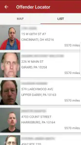
I approached Offender Locator as a practical safety-reference app rather than something I would open casually every day. Its purpose is straightforward: it lets me look for registered sex offenders around my current area or in a location I choose. That makes it potentially useful when I am moving to a new neighborhood, checking an address before visiting, or helping a family member understand the wider surroundings of a home.
The app comes from Offender Locator Inc. and sits in the Lifestyle category. It is free to install, carries an Everyone age rating, and has passed the point of being a minor experiment, with over 100 thousand installs. At the same time, its average rating is 2.3 from around 410 ratings, so I would not recommend approaching it with uncritical confidence. The central idea is useful, but the experience deserves careful checking and a realistic understanding of what a location-based public-record tool can and cannot do.
How the app feels to use in different situations
Readability and navigation
The strongest part of the concept is that it starts with a question most people can understand: who is registered near this place? I do not need to learn a complicated specialist vocabulary before understanding the reason for opening it. That direct purpose is helpful for someone who is already worried or trying to make a quick decision.
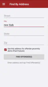
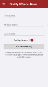
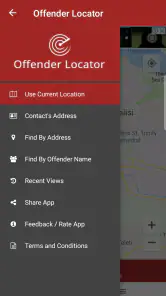
In a normal use case, I would begin with my present area, then change the search location when I wanted to examine another neighborhood. That second option matters more than it may seem. A person comparing apartments, planning a visit, or checking a relative’s new address needs more than a tool tied only to the phone’s current position. Being able to choose a location makes the app more useful for planning rather than just reacting.
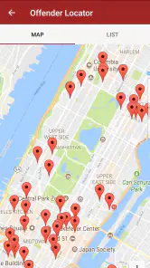
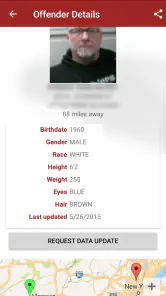
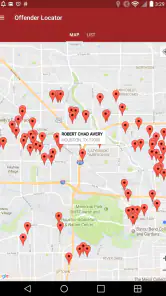
Still, an app dealing with sensitive information needs exceptionally clear navigation. A map marker or result should not be treated as self-explanatory. I would want to know whether I am looking at a precise address, a general area, or a record associated with a broader location. I would also take time to open each available detail instead of drawing conclusions from a pin alone. The app is most responsible when used as a starting point for understanding public information, not as a shortcut to judging everyone nearby.
For readability, the practical test is whether I can identify the search area, distinguish one result from another, and return to the previous view without losing my place. That matters for people with dyslexia, limited attention, or anxiety, because crowded screens and unclear labels increase the chance of misreading a result. I would use the phone’s normal display controls if text felt small, but I would not assume every part of the interface will scale perfectly. People who depend on very large text should test the current version, 13.0.1, on their own device before relying on it.
The app’s rating is also useful context when deciding how much patience to bring to the experience. A low average does not automatically mean the underlying purpose is worthless, but it does suggest that smoothness, clarity, or reliability may not meet everyone’s expectations. I would avoid opening it for the first time during an urgent moment. Exploring the search process calmly first is a better way to learn where controls and results appear.
More From Our News Desk

Clash of Clans Is Won Between the Battles

Android Auto Makes the Case for Quieter Car Software

MobiOffice: Transforming Mobile Productivity with Seamless Integration

EA SPORTS FC™ Mobile Soccer: Redefining Mobile Sports Gaming

How Microsoft OneDrive Became a Mobile Productivity Giant

How Google Translate Breaks Language Barriers Effortlessly
Motor and sensory considerations
For someone with limited dexterity, the main question is how much precise tapping the search process demands. Location tools can become frustrating when a user has to hit small map controls, select a narrow point, or repeatedly zoom and pan. I would prefer to search by a chosen place and then inspect results at a comfortable pace rather than trying to position a map perfectly with one finger.
That workflow also helps users who experience hand tremors or fatigue. Instead of treating the map like a navigation game, I would make one broad search, pause, and use the result list or detail view whenever possible. If several markers are close together, zooming in gradually is safer than tapping repeatedly and guessing which record opened. This is a small but important habit: it reduces accidental selections and makes the information easier to review.
People with low vision should be especially cautious with map-only interpretation. Pins, colors, and small labels can carry too much meaning when they are viewed quickly. I would look for textual details accompanying a location and enlarge the screen before making any decision. If the app presents information visually without an equally clear text route, it may be a poor fit for a user who relies on screen magnification or a screen reader.
For blind users, I would not assume that every map interaction is accessible. A location-based interface can be difficult when essential information is communicated through position, color, or touch gestures. The sensible approach is to test the app with the device’s preferred assistive technology and confirm that a search result can be reached and understood without depending entirely on the map. If that fails, an official public-record website with a more text-oriented layout may be the better option.
Hearing is less central to this app’s purpose than vision or touch, since the core task is reading and exploring location information. That does not make the experience automatically inclusive, though. Any spoken prompts or alerts should not be the only way to understand what happened after a search. I would want visible confirmation that a location was selected and that results have loaded. If I had to rely on sound to know whether an action worked, the app would quickly become inconvenient.
Sensory overload is another consideration. Searching sensitive records can already be emotionally difficult, especially for parents, survivors, or people moving into an unfamiliar area. I would use the app in a quiet setting, avoid rapidly jumping between many locations, and write down only the information I actually need. The benefit of checking an address can disappear if the interface encourages hurried scanning or leaves the user unsure which result is relevant.
Situational access beyond the current neighborhood
I see the most practical value when the phone is being used as a planning tool. Imagine that I am considering a rental in a different part of town. I could choose that location, examine the nearby registered records, and then compare what I find with information from official local sources. The app may save time during the first pass, but I would never make a housing decision from a single screen.
Another realistic situation is visiting family. If a relative has moved, I could search the area before arriving and use the result to decide what questions to ask or what additional sources to consult. This is particularly helpful for caregivers who need to think about children, vulnerable adults, or walking routes. The important distinction is that the app supports preparation; it does not replace a conversation with the people responsible for safety or a review of local guidance.
Travel is a more complicated case. A visitor may want to check an unfamiliar place, but location services and public records can vary by jurisdiction. I would treat any result as limited to the coverage and information available through the app, then verify important details with the relevant official authority. If I were offline, had weak reception, or needed certainty immediately, I would not depend on this app as my only source.
The ability to choose a location also creates a useful workflow for comparing several possible addresses. I would check one place, record the date of my review, then move to the next rather than continually dragging around a map. That makes the process less tiring for users with motor limitations and reduces confusion for anyone who has difficulty holding several visual layouts in memory. It also prevents a common mistake: assuming that the last visible results still represent the newly selected area.
Families should agree on how the information will be used before handing the phone to a child. The Everyone rating describes the app’s store age classification, but the subject matter is serious and may be upsetting. I would not present the results as entertainment or encourage children to investigate neighbors independently. An adult should explain that registration information is not the same thing as a complete measure of present danger and that personal confrontations are never an appropriate response.
What can get in the way
The biggest limitation is interpretive, not technical. A marker on a map can feel precise even when the surrounding context is more complicated. I would avoid sharing screenshots, naming individuals publicly, or treating a result as proof of what someone is doing now. The app can help me locate records, but it cannot provide a complete picture of a community or replace responsible judgment.
Accuracy and freshness are equally important in a tool like this. Public records can change, addresses can be updated, and jurisdictions may organize information differently. I would check the date and source of any detail shown, then confirm an important finding through an official local registry. This extra step is not needless caution; it is essential whenever the result could affect housing, employment, travel, or someone’s personal safety.
There is also a financial point to consider. The app is free to install, but in-app purchases range from about 20 dollars to 50 dollars per item. I would not pay for an upgrade until I understood exactly what it adds and whether the free experience already answers my question. For a person who only needs an occasional address check, a free official government search may offer better value. Someone who expects to use the app regularly should compare the purchase screen carefully before committing.
Privacy deserves attention as well. A user may be searching a home address, a workplace, or a family member’s location. I would avoid entering more personal information than necessary and would review the app’s current privacy details before using it for sensitive planning. I would also avoid searching while surrounded by people who could see the screen, especially when the results concern a private individual.
Users with cognitive disabilities may find the subject matter and map-based choices demanding. I would recommend a simple routine: choose one location, wait for the results, read one record at a time, and confirm the area before moving on. A trusted support person can help interpret unfamiliar terms, but should not make unsupported assumptions from a marker. This structured approach is more accessible than browsing without a clear question.
For people who use alternative input devices, the app may be less suitable if essential actions depend on dragging, pinching, or tapping small map targets. I would test those actions before paying for anything. If navigation becomes tiring or unpredictable, a text-based registry is likely a better alternative. The usual alternative, an official local website, may look less polished but can be easier to search with a keyboard, browser zoom, or assistive technology.
How it compares with ordinary alternatives
Compared with searching the web manually, Offender Locator offers a more focused starting point. I do not have to guess which search phrase will lead to the relevant registry, and choosing a location is more natural than opening several unrelated pages. That convenience is its clearest advantage for quick orientation.
Compared with an official government registry, however, the app should be treated as a convenience layer rather than the final authority. An official source may provide clearer jurisdictional context, update information, or explain the meaning of a record more fully. It may also be more accessible to users who need browser-based tools. My preferred workflow is to use the app to identify what deserves attention, then verify it through the appropriate official source.
Compared with general map applications, this tool is more relevant when the specific question concerns registered offenders. A normal map is better for walking routes, transport, landmarks, and street-level orientation. I would not expect this app to replace those tools. In practice, I would use a map app for the physical journey and this one only for the separate public-record question.
Its audience is therefore fairly specific. It may suit adults comparing neighborhoods, caregivers planning around a vulnerable person, or anyone who wants a quick location-based reference before doing deeper research. I would skip it if I wanted broad crime statistics, emergency alerts, neighborhood reviews, or a complete safety assessment. It is also not the right choice for anyone looking for entertainment, social interaction, or a substitute for contacting authorities in an emergency.
My inclusive verdict
After using the app as a location-reference tool, I see a useful idea surrounded by important cautions. The ability to inspect the current area or select another place makes it more practical than a simple static directory. It can help me prepare for a move, visit, or family discussion, especially when I use a deliberate search routine and verify meaningful findings elsewhere.
Accessibility is mixed from a practical standpoint. The purpose is easy to understand, and location choice can support several real-world situations, but map controls, visual markers, small text, and uncertain screen-reader behavior may create barriers. Users with low vision, limited dexterity, cognitive disabilities, or reliance on alternative input should test the complete search path before depending on it. A text-focused official registry may be more inclusive even if it feels less convenient.
I would also keep the low average rating in mind and avoid assuming that every search will feel polished. The free installation lowers the risk of trying it, but the paid items make it important to understand the value before spending anything. My recommendation is cautious: use it as a first-pass reference, never as the sole basis for a serious decision.
For me, the best version of the experience is calm, private, and cross-checked. I would search a specific location, read the result carefully, note any relevant context, and confirm it with an official source before acting. Used that way, Offender Locator can be a convenient addition to a broader safety routine. Used as a definitive judgment about people or places, it becomes far less reliable and much harder to justify.
Offender Locator Frequently Asked Questions
Is Offender Locator free to download, and are there optional purchases?
Offender Locator is a free lifestyle app, so you can download it without an upfront purchase. It also offers in-app purchases priced from around $20 to $50 per item, which may affect access to some features or services. Check the purchase details shown in the app before paying, and review your device’s purchase settings if you want to avoid accidental charges.
What devices can run Offender Locator, and is it suitable for all ages?
The app requires Android 8.0 or later, so check your device’s operating system before downloading. Its content rating is Everyone, though the subject matter—public offender registry information—may still be sensitive for some users and families. Offender Locator is developed by Offender Locator Inc. and was released in 2017; consider whether its purpose and content are appropriate for everyone who may use your device.
What is Offender Locator and what information does it provide?
Offender Locator is designed to help users search for publicly available offender and sex-offender registry information, usually by name, location, or map area. Depending on the jurisdiction and the data source, results may include an individual’s name, photograph, address or approximate location, offense details, and registration status. Information can vary significantly by region and should always be verified with the relevant official authority.
Is Offender Locator available everywhere, and does it cover all offenders?
Coverage depends on the country, state, or local authority supported by the app. Some areas may provide detailed records, while others may offer limited information or no searchable data at all. The app should not be assumed to contain every offender, every recent update, or records from every jurisdiction. Before relying on a result, check which databases the application uses and compare it with official registry websites.
How accurate and up to date is the information in Offender Locator?
Offender Locator generally depends on information supplied by public registries or third-party data services, so accuracy and update frequency can differ. Records may be delayed, incomplete, duplicated, or affected by changes in address and registration status. Treat the application as a convenient search tool rather than an authoritative legal source. For important safety, legal, or housing decisions, confirm details directly with the appropriate government agency.
Pros
- Quickly shows registered offender information near a searched location.
- Map-based browsing makes nearby records easier to understand.
- Useful address and identity details support personal safety planning.
- Search tools can help users check a new neighborhood before moving.
- Free access makes basic public-record information widely available.
Cons
- Coverage and update frequency depend on the available public records.
- Some listings may contain outdated addresses or incomplete information.
- Location data can be sensitive and may raise privacy concerns.
- The app is informational and cannot guarantee complete local coverage.
- Maps and searches may be less useful in areas with few records.
- Category
- Lifestyle
- Version
- 13.0.1