OCEARCH Shark Tracker™
- 1.00K
- 3.9
- Installs
- 1.00M
- Price
- Free

Screenshots
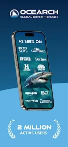


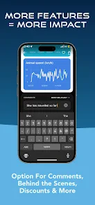
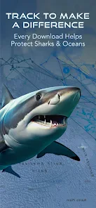

Analysis by Reviewed
I approach shark tracking as a way to learn about animal movement, not as a navigation tool or a live window into every moment at sea. That distinction matters: a map can make a tagged animal’s journey feel immediate, while the information is best treated as a series of observations to explore at your own pace. OCEARCH Shark Tracker™ is a free Maps & Navigation app from Ocearch.org, and its focus makes it most compelling for people who are curious about sharks rather than looking for turn-by-turn directions.
Trust starts with realistic expectations
With any app that displays location-related information, I prefer to separate what I can see from what I might assume. Here, the central experience is following tagged marine animals on a map; it is not a personal location-sharing tool or a dependable live alert for nearby wildlife. That distinction matters both for interpreting the map and for deciding how much attention to give the app.
I would not treat a moving map marker as proof of an animal’s exact current position, nor use it to decide whether a beach or boating area is safe. The useful question is what the observations can help me learn over time: where a tagged shark has been reported and how its broader route appears. That cautious reading makes the experience more informative and avoids turning an educational map into a safety instrument.
What the map can—and cannot—tell you
The tracker’s appeal is following an individual animal over time and seeing its reported position in a wider ocean context. I find that more rewarding than opening a conventional map and simply scanning coastlines: the animal’s route gives you a reason to look, compare locations, and ask questions. A useful habit is to treat each position as a snapshot, not a promise that the shark is still there when you check. That keeps the map interesting without encouraging assumptions about an animal’s exact present location.
It also helps to remember that this is a focused wildlife tracker, not a substitute for a general mapping app. If I’m planning a drive, checking a walking route, or trying to navigate somewhere, I’d use a regular maps service. This app is better for curiosity, classroom discussion, and returning to the same animal’s movements when I have a few minutes to spare.
Who will get the most from it
I can see it working well for a parent and child looking at an animal’s route together, or for a teacher using a map to start a conversation about migration and ocean habitats. For a more active learning session, I’d choose one shark, note where its map position appears, then revisit later and compare what has changed. That simple routine turns a quick look into a question about movement and the limits of tracking, without pretending that a map alone explains why an animal travelled.
It may be less satisfying if you want constant action, detailed trip planning, or a complete account of marine wildlife. The tracker has a narrow subject by design, so someone who prefers broad nature content may be happier with a general wildlife or documentary app. I’d also avoid using a shark’s displayed position to make decisions about swimming or boating; a tracking display is not a safety warning system.
More From Our News Desk

Clash of Clans Is Won Between the Battles

Android Auto Makes the Case for Quieter Car Software

MobiOffice: Transforming Mobile Productivity with Seamless Integration

EA SPORTS FC™ Mobile Soccer: Redefining Mobile Sports Gaming

How Microsoft OneDrive Became a Mobile Productivity Giant

How Google Translate Breaks Language Barriers Effortlessly
Getting to Know the Sharks
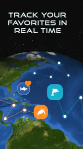
Diving into the OCEARCH Shark Tracker™ app, the first thing you'll notice is its user-friendly interface. It’s designed to make tracking sharks as easy as pie. You can view real-time data on the movements of these incredible creatures, thanks to the satellite tags attached to them. Imagine sitting at home and knowing exactly where your favorite shark is hanging out!
Features That Hook You In
One of the coolest features is the interactive map. You can zoom in and out to follow the sharks' journeys across the oceans. It’s fascinating to see how far these giants travel! The app also provides detailed information about each shark, including their names, sizes, and the date they were tagged. It’s like having a personal profile for each of these ocean dwellers. You can even receive notifications for your favorite sharks, so you never miss an update on their adventures.
What I love is how educational it is. The app includes a wealth of information about shark biology and conservation efforts. It’s not just about tracking; it’s about learning and appreciating these creatures' vital role in our ecosystem.
Small routines that make the map more useful
One helpful way to explore is to pick a single animal before zooming around the map. Starting with one profile gives the route a story to follow, while opening many markers at once can make the experience feel like a jumble of points. I’d note the broad area shown, then revisit the same animal later rather than trying to infer a complete journey from one quick glance. This is especially useful with children: it gives them a concrete comparison to make without implying that every gap in a route has an obvious explanation.
For a classroom or family activity, I’d ask learners to describe what the map actually shows before asking what they think it means. “The point is farther along the coast” is an observation; “the shark went there to find food” is a guess that needs evidence beyond a marker. That small distinction turns the app into a better prompt for critical thinking, not just a colorful map to browse.
Why You'll Love It Too
If you’re a parent or a teacher looking for a fun way to engage kids with marine science, this app is a fantastic tool. It turns learning into a thrilling exploration. Plus, the visuals are stunning. The high-quality images of sharks and the ocean are a treat for the eyes.
Everyday use and sensible expectations
In an ordinary day, I might open the map while making coffee, choose a shark that caught my attention, and look at its path with a child before school. Later, we could return to see whether the displayed information has changed and talk about what a tag can reveal—and what it cannot. That short, repeatable routine is a better fit than expecting a feed of constant events. Notifications can make following a favorite more convenient, but I’d use them selectively so the app stays an occasional learning prompt rather than another source of interruptions.
One practical trade-off is that the map is most useful when you give it a little context. Zooming way out can make a route feel dramatic but hard to interpret; zooming in can help place a point relative to a coast, while still not making it a precise local safety guide. I’d start with the animal profile, then use the map to trace the broader journey. If a child asks why a shark changed direction, I’d treat that as a research question rather than claiming the map explains the cause.
Trust, choices, and what to check
Because a tracking app can invite frequent checking, I think it is worth being deliberate about the choices you make inside it. If you enable notifications for a favorite shark, consider whether you actually want those updates throughout the day; turning off an alert you no longer find useful is a reasonable way to keep the experience on your terms. I would also review the device’s app-permission controls before granting access to anything, and only allow what seems necessary for the way I use it. Those settings are a better basis for a privacy decision than assuming that any app is automatically private or automatically intrusive.
I would make that permissions check before settling into a regular routine, then revisit it if the way I use the app changes. Device settings give me a visible place to manage what an app may access, while notification choices let me control how often it asks for my attention. I would not enable every prompt simply because it is offered: following one or two animals is usually enough to make a small learning habit feel personal without turning the tracker into a constant interruption.
The app is rated for Everyone, has a 3.9 average from around 4.1 thousand ratings, and has been installed over a million times. It is free to download, with optional in-app purchases ranging from $4.99 to $29.99 per item. I’d try the free experience first and decide whether any paid item is genuinely useful to me before spending. Its current version is 3.1.15, and it requires Android 7.0 or later, so checking compatibility before installing can save a needless attempt on an older device.
That makes the practical decision fairly simple: I’d begin with the free app, explore the map and animal profiles, and only consider a purchase if I can name what I want it to add to my own use. Someone downloading it for a child might also decide in advance whether the phone will be used together or independently; that keeps the app’s educational value in view and avoids treating an in-app option as necessary for the basic purpose of looking at shark movements.
How it compares with other map and wildlife apps
Compared with the usual alternatives in Maps & Navigation, this is not trying to replace road maps, route planners, or general-purpose location tools. Its value is the specific subject: tagged sharks and the stories their movements prompt. For a broad wildlife overview, another kind of nature resource may suit you better; for an animal-focused map to explore with family or students, this has a clearer purpose. I’d skip it if I needed dependable real-time location for travel or safety, but I’d keep it handy for an occasional, thoughtful look at marine movement.
The trade-off is depth in one direction rather than breadth in many. A conventional navigation app answers practical questions about where to go and how to get there; a documentary or broader nature app may offer a wider range of species and explanations. This tracker is more rewarding when the question is specifically about a tagged shark’s reported movements. If I wanted a map for a trip, I would switch apps; if I wanted a visual starting point for a conversation about one animal, I would stay here.
What I love is how educational it is
The app includes a wealth of information about shark biology and conservation efforts. It’s not just about tracking; it’s about learning and appreciating these creatures' vital role in our ecosystem.
Why You'll Love It Too
If you’re a parent or a teacher looking for a fun way to engage kids with marine science, this app is a fantastic tool. It turns learning into a thrilling exploration. Plus, the visuals are stunning. The high-quality images of sharks and the ocean are a treat for the eyes.
For those concerned about privacy and data usage, rest easy. The app is designed with user privacy in mind, ensuring that your data is secure. It runs smoothly without eating up your phone’s resources, which is always a plus.
The app isn’t just for shark enthusiasts. If you’re an adventure lover or someone who enjoys nature documentaries, this app will add a splash of excitement to your day. It gives you a glimpse into the secretive lives of sharks, making you feel like a part of their world.
My cautious verdict
I’d recommend it to someone who enjoys looking closely at animal movement and is happy to bring their own questions to the map. It can suit a parent, teacher, or curious learner who wants a short, hands-on way to discuss sharks, especially when they are comfortable distinguishing a reported position from a live guarantee. It is a weaker fit for anyone expecting route guidance, a comprehensive wildlife library, or a tool for making decisions about ocean safety.
In a nutshell, the OCEARCH Shark Tracker™ app is a must-have for anyone interested in marine life. Whether you’re following a particular shark or just browsing through the ocean’s vastness, it’s an exciting and educational experience that brings the ocean right to your fingertips. Dive in and see where the sharks take you!
OCEARCH Shark Tracker™ Frequently Asked Questions
Is OCEARCH Shark Tracker™ suitable for children and families?
The app has an Everyone content rating, making it suitable for a broad audience, including families who want to explore marine life together. Its map-based tracking and shark information can make ocean topics more engaging for younger users, while parents can use it as a starting point for conversations about wildlife and conservation. It is a tracking and learning app, rather than a shark-themed game.
What devices and operating systems can run OCEARCH Shark Tracker™?
OCEARCH Shark Tracker™ is available for Android and iOS, and the Android version requires at least Android 7.0. Before downloading, check that your device meets the relevant platform requirements and has enough space for the app. The app is in the Maps & Navigation category, so its experience is centered on exploring marine-animal tracking through maps.
What is the main purpose of the OCEARCH Shark Tracker™ app?
The OCEARCH Shark Tracker™ app is designed to provide users with real-time tracking of sharks that have been tagged by OCEARCH scientists. Users can follow the movements of these sharks as they navigate the oceans, learn about their migration patterns, and gain insights into marine life conservation efforts. It's an educational tool that raises awareness about shark behavior and marine ecology.
Is OCEARCH Shark Tracker™ app free to use, or are there any in-app purchases?
The OCEARCH Shark Tracker™ app is free to download and use. It provides access to a wealth of information about various tagged sharks and their movements at no cost. However, users should be aware that while the app itself is free, it may require an internet connection to access real-time data, which could incur data charges depending on your mobile plan. In-app purchases are also offered, with items priced from $4.99 to $29.99.
How accurate is the shark tracking data provided by the OCEARCH Shark Tracker™ app?
The data provided by the OCEARCH Shark Tracker™ app is sourced from real-time satellite tracking of tagged sharks. While the information is generally accurate, users should note that there can be occasional delays or gaps in data transmission due to satellite coverage or environmental conditions. The app is continually updated to ensure users receive the most current tracking information available.
Pros
- User-friendly interface for easy navigation
- Real-time tracking of sharks worldwide
- Educational content about shark conservation
- Customizable alerts for shark activity
- Supports oceanic research initiatives
Cons
- Requires internet connection for updates
- Limited to regions where sharks are tagged
- Notifications may drain battery quickly
- No offline mode available
- In-app ads can be intrusive

- Category
- Maps & Navigation
- Version
- 3.1.15