Mgrs & Utm Map Pro
- 123.00
- 4.8
- Installs
- 10.00K
- Price
- $19.99

Screenshots
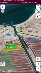
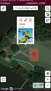
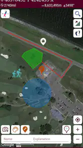
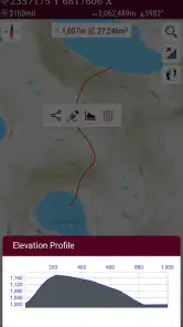
Analysis by Reviewed
I reach for a coordinate-focused map when a familiar street address is no help: on a remote trail, at a fieldwork site, or when someone gives me a grid reference instead of a place name. That is the niche Mgrs & Utm Map Pro is meant to fill. It is a paid navigation app from DakikTech, built around working with MGRS, UTM, and degrees-minutes-seconds coordinates. I see its main appeal not as replacing every map on my phone, but as making coordinate-based navigation more accessible when ordinary turn-by-turn directions are the wrong tool.
Where this coordinate map fits today
For everyday driving, I would still open a conventional navigation app. Those tools are designed to find an address, choose a route, and guide a driver through streets. This app addresses a different question: how do I read, use, and relate a position expressed in a grid or geographic coordinate format? That distinction matters. If you already work with MGRS or UTM, a map that puts those systems at the center can be more useful than a general-purpose map that treats coordinates as an occasional extra.
The app belongs to Maps & Navigation, and its broad audience includes hikers, land users, field teams, and people learning to handle coordinate references. Its Everyone age rating makes it suitable for general audiences, though the coordinate systems themselves may take some learning. The current release is version 7.8.0, and the app has been available since April 9, 2018. Those details tell me it is an established product with a current version, but they do not by themselves show what changed between releases or guarantee that every mapping workflow will suit every user.
What its long-running version history means in practice
A product that has continued to a later version can be easier to consider than a tool that appears abandoned, particularly when I plan to rely on it for trips beyond familiar streets. Still, I would treat the version number as context, not proof of a particular improvement. A version label cannot tell me whether a feature was added, whether a map source changed, or how the app behaves on a specific phone. I would check the current app details and test the exact workflow I intend to use before depending on it in a remote area.
That is especially important for coordinate work. A map can look clear while a user is still making a consequential format mistake. Before leaving, I would compare a known location against the coordinate system I expect to use, confirm that the displayed format matches the reference I was given, and make sure I can read the result without rushing. The useful habit is to test the complete handoff—from a coordinate in a message or field note to the point shown on the map—rather than simply opening the app and assuming the setup is right.
Who gets the most from it—and who may not
The strongest fit is someone who regularly receives or records MGRS, UTM, or DMS positions and wants a map-oriented way to work with them. A hiker navigating by a shared grid reference, a survey helper marking field locations, or a volunteer coordinating a search area may value that focus. Someone who only wants a simple route from home to a restaurant may find a standard navigation app faster and more familiar. The specialized focus is an advantage when coordinates are the task and unnecessary complexity when they are not.
Its price is $19.99, so I would think about how often I need coordinate tools before buying. The app has an average rating of 4.8 from around 1.9 thousand ratings, with roughly 123 written reviews and over 10 thousand installs. That is a positive reception, but ratings cannot tell me whether a particular map source, coordinate workflow, or device setup fits my needs. I would judge the purchase by the value of having these coordinate systems at hand, not by the score alone.
More From Our News Desk

Weather by Xiaomi Review: Clear at a Glance, Less Clear Up Close

X Under Pressure: Can It Recover When Posting Goes Wrong?

Clash of Clans Is Won Between the Battles

Android Auto Makes the Case for Quieter Car Software

MobiOffice: Transforming Mobile Productivity with Seamless Integration

EA SPORTS FC™ Mobile Soccer: Redefining Mobile Sports Gaming
A practical routine before heading out
Suppose a friend sends me a location in a grid format for a trail meeting point. Rather than waiting until I reach a place with weak reception, I would open the app at home, enter or locate the reference, and check that the marker makes sense against the route and surrounding terrain. I would then write down the coordinate in the format we agreed to use, along with a plain-language description of the meeting spot. That second description is a simple backup: it helps catch a typo or a mismatch before anyone is standing outside trying to resolve it.
For a group, I would also agree on one coordinate format before the trip. MGRS, UTM, and DMS are not interchangeable labels for the same-looking string; a recipient needs to know how to interpret the value. Sharing a point without stating its format can create avoidable confusion, even if both people are using mapping tools. My practical tip is to send the format with the coordinate and ask the other person to confirm the point on their own map before setting off.
How it compares with familiar navigation options
General map apps are usually better for searching businesses, estimating road journeys, and giving spoken turn-by-turn guidance. A paper map, meanwhile, needs no battery and can give a broad view that is difficult to appreciate on a phone screen. A dedicated GPS device may suit someone who wants a separate navigation tool rather than relying on a phone. This app’s reason to be is narrower: coordinate systems are central to its purpose. I would pair it with another navigation method when the trip involves road routing, broad route planning, or a need for a backup independent of my phone.
That pairing is not redundant. I might use a familiar map to plan how to reach a trailhead, then use a coordinate-oriented tool once the task becomes locating a specific point. On a field visit, I could keep a written record of the grid reference while using a broader map for context. The trade-off is carrying more than one source of information, but that can be sensible when each tool handles a different part of the job. No single map should be treated as a substitute for basic preparation or situational awareness.
Small checks that prevent big coordinate mistakes
One useful discipline is to read coordinates aloud in groups while another person checks the map. A hurried glance can miss a digit, confuse the order of values, or leave the coordinate system unstated. I would also keep the original reference unchanged in a note before making any conversion or sharing a reformatted version. That creates a way to retrace what was received if the marker appears in an unexpected place. These are not flashy tricks, but they make coordinate tools safer and more dependable in real use.
Another trade-off is screen scale. A phone map makes a precise point convenient to inspect, but a close view can hide the larger terrain or the route needed to reach it. I would zoom out periodically and compare the point with the broader area, then zoom in for the final approach. If the location seems implausible, I would stop and verify the coordinate rather than letting a confident-looking marker override common sense.
Limits worth considering before relying on it
Coordinate-centered navigation has a learning curve, especially for a newcomer who has never handled grid references. The app’s specialized purpose does not remove the need to understand what format a sender used or how to communicate a location clearly. Anyone expecting a familiar address search and automatic driving guidance should choose a general navigation option instead. I would also avoid treating any phone map as my only safety measure for a remote trip; a charged device, a backup plan, and an understanding of the route still matter.
The cost deserves a similar reality check. If I use coordinate references only once in a while, a general map or another method I already have may be enough. If I receive these references regularly, the focused workflow may justify paying for a dedicated app. The deciding question is not whether the app has a high rating, but whether it solves a recurring problem that my usual tools handle awkwardly.
Getting Started with Mgrs & Utm Map Pro
First things first, downloading Mgrs & Utm Map Pro was a breeze. Available on both Android and iOS, the app installs quickly and is ready for action. Upon opening it, you're greeted with a straightforward interface that's both user-friendly and packed with features. No overwhelming clutter—just what you need, where you need it.
Features That Stand Out
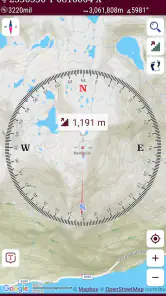
One of the standout features of this app is its ability to provide detailed maps using the Military Grid Reference System (MGRS) and the Universal Transverse Mercator (UTM) system. For those not in the know, these systems offer a more precise way of pinpointing locations compared to traditional GPS. I found this especially useful when I was out in the middle of nowhere, with no landmarks to guide me.
The app also allows for offline maps. This is a game-changer. There's nothing worse than being halfway up a mountain, only to lose your data connection and, consequently, your navigation. With Mgrs & Utm Map Pro's offline capabilities, you can download maps ahead of your adventure, ensuring you stay on track no matter where you are.
User Experience and Interface
I must say, using this app feels like having a personal cartographer in your pocket. The interface, while packed with features, remains intuitive. I could easily switch between different map views, set waypoints, and even measure distances without getting lost in a sea of buttons and options.
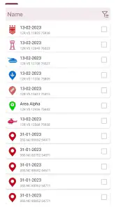
The app also includes a handy feature for saving and sharing your routes. After a successful trek, I enjoyed being able to share my journey with friends, complete with detailed map views and coordinates. It's a fantastic way to relive your adventures and plan future ones.
Performance and Reliability
In terms of performance, Mgrs & Utm Map Pro delivers. I experienced no lag or crashes, even when loading large map files or switching between different map types. The app is reliable, providing accurate and up-to-date information every time I used it.
Battery consumption is always a concern with mapping apps, but this app seems to have optimized its usage well. I managed to keep my phone running throughout a full day of hiking without any battery anxiety.
My recommendation after weighing the trade-offs
My recommendation is strongest for readers who already know why they need MGRS, UTM, or DMS, or who are willing to learn those formats before relying on them outdoors. A coordinate map can be a practical companion for finding a designated point, keeping field notes consistent, or checking whether a shared reference lands where expected. It is less compelling as a one-stop replacement for the familiar maps people use to search for shops, compare road routes, or follow spoken directions.
Before a first trip, I would spend a few minutes practicing at a place I can identify without help. I would enter or inspect a known position, check that the coordinate format is the one I intend to use, and rehearse sharing it with another person. Then I would prepare the map information I need while connected and keep a separate written backup for the key location. That routine turns a specialized tool into something useful without expecting it to solve every navigation problem.
What I would check as the app evolves
Version 7.8.0 is the current release, while the app’s April 9, 2018 launch gives it a longer history than a brand-new utility. I would watch future releases for changes that directly affect coordinate handling, map availability, and the ease of preparing for offline use. Those are the areas that matter most to someone choosing it for field navigation. Until a particular change is visible in the app, I would treat it as something to look for rather than assume it has arrived.
For existing users, the sensible approach is to keep a familiar workflow rather than changing habits just because a version number advances. After an update, I would verify a saved or frequently used location and confirm that the coordinate format still matches the way my group communicates. That quick check is useful with any navigation tool, but especially when the destination is expressed as a grid reference and a small misunderstanding can send people to different places.
In conclusion, Mgrs & Utm Map Pro is a robust tool for anyone who loves exploring the great outdoors. Whether you're a seasoned hiker, a professional needing precise location data, or just someone who loves a good map, this app is worth checking out. With its combination of powerful features and user-friendly design, it’s like having a trusty guide by your side. So, next time you're planning an adventure, make sure this app is part of your toolkit. Happy exploring!
Mgrs & Utm Map Pro Frequently Asked Questions
What coordinate systems does Mgrs & Utm Map Pro support?
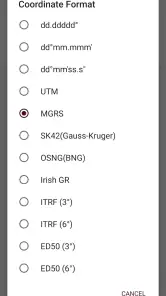
The app is a mapping and navigation tool focused on military GPS coordinate systems. Its name and description highlight MGRS and UTM, and it also includes DMS maps. That combination may be useful if you work with different ways of expressing a location, but it is worth checking that the formats you rely on fit your needs before downloading.
Who develops Mgrs & Utm Map Pro, and what does it cost?
Mgrs & Utm Map Pro is developed by DakikTech and costs $19.99. Since this is a paid app, consider whether its focus on military GPS coordinate systems and mapping matches the way you plan to use it. It is rated for Everyone, so its content rating is suitable for a broad audience.
What is Mgrs & Utm Map Pro and what are its main features?
Mgrs & Utm Map Pro is a sophisticated mapping application designed for professionals who require precise location tracking and mapping capabilities. It supports Military Grid Reference System (MGRS) and Universal Transverse Mercator (UTM) systems. Key features include offline maps, real-time location sharing, and the ability to import/export waypoints. It is ideal for military, search and rescue, hiking, and outdoor activities where GPS accuracy is crucial.
How does Mgrs & Utm Map Pro ensure accuracy and reliability in mapping?
The app ensures high accuracy and reliability by using advanced GPS technology and robust map data integration. It offers offline map capabilities, which means users can download maps and access them without an internet connection. The app also regularly updates its map data to ensure users have the most accurate information available, making it a reliable tool for professional use.
Is Mgrs & Utm Map Pro available for both Android and iOS devices?
Yes, Mgrs & Utm Map Pro is available on both Android and iOS platforms, making it accessible to a wide range of users. The app is designed to provide a seamless experience across different devices, with an intuitive interface that is easy to navigate. This cross-platform availability ensures that users can switch devices without losing functionality or data.
Pros
- Highly accurate GPS tracking.
- User-friendly interface.
- Offline maps available.
- Supports multiple coordinate systems.
- Regular updates enhance functionality.
Cons
- Requires in-app purchases for some features.
- Initial setup can be complex.
- Limited customer support.
- Battery consumption is high.
- Occasional bugs after updates.
- Category
- Maps & Navigation
- Version
- 7.8.0











