Magic Earth Navigation & Maps
- 860.00
- 3.4
- Installs
- 1.00M
- Price
- Free

Screenshots
Analysis by Reviewed
I find navigation apps most revealing when a trip gets messy: a turn comes up sooner than expected, mobile data drops, or the route looks different from what I pictured. Magic Earth Navigation & Maps is worth considering for those moments because it combines map guidance, offline use and traffic information in one free app. It is not a magic fix for every journey, though; a little preparation makes a real difference.
Who benefits most from planning ahead
I’d put this app on the shortlist for people who regularly drive beyond reliable mobile coverage, travel through unfamiliar areas, or want walking and cycling guidance alongside car navigation. The important distinction is that offline maps are useful only when the relevant area has been prepared in advance. If your usual journeys stay within dependable coverage and you never want to manage maps before leaving, an app that works entirely around a familiar connected routine may suit you better.
It can also work well as a second navigation option rather than an immediate replacement for the map app you already know. For example, you could test a short local drive, then compare its suggested route with your usual choice on a longer trip. That gives you a chance to learn how its map display and instructions feel without making your first experience a high-pressure journey.
Getting Started with Magic Earth
First things first, downloading and setting up Magic Earth Navigation & Maps is a breeze. Available for both Android and iOS, you can snag it from your usual app store haunt. From the get-go, it’s clear the developers have put a lot of thought into user experience. The interface is clean, intuitive, and, dare I say, kind of fun to use. You know that feeling when an app just ‘gets’ you? That’s the vibe here.
Where a route can get confusing
The part I would not leave until the last minute is getting ready for offline navigation. A map that has not been downloaded cannot help much when your connection disappears, so I would check the area you plan to visit while you still have dependable internet. For a trip across a border or through a rural stretch, I’d also make sure the selected map covers the whole route rather than just the destination. That small check is more useful than discovering a gap after setting off.
Magic Earth is a maps and navigation app from Magic Lane International B.V. Its core appeal is straightforward: use it for ordinary driving with traffic in mind, or prepare maps in advance for places where connectivity may be unreliable. It is free to start, rated for Everyone, and its current version is 1.0.0; optional in-app purchases are listed at $19.99 per item. The app has a 3.4 average from around 41,000 ratings, so I would treat it as an option to test on familiar roads before relying on it for an important, unfamiliar trip.
Setup checks that save time
Before leaving, I’d enter the destination and inspect the route while parked. Confirm that the map area is available offline if you expect to lose data, check that voice guidance is audible at a comfortable level, and choose the units you find easiest to read. These are simple checks, but they reduce the temptation to fiddle with the phone while moving. If you are using a cycling or walking route, verify that the selected travel mode matches the trip; a route suitable for a car is not automatically a sensible route on foot.
More From Our News Desk

Clash of Clans Is Won Between the Battles

Android Auto Makes the Case for Quieter Car Software

MobiOffice: Transforming Mobile Productivity with Seamless Integration

EA SPORTS FC™ Mobile Soccer: Redefining Mobile Sports Gaming

How Microsoft OneDrive Became a Mobile Productivity Giant

How Google Translate Breaks Language Barriers Effortlessly
One practical check is to think about the entire journey rather than the endpoint. If you are driving to a remote rental, for instance, the route may pass through areas with patchy coverage before you arrive. Preparing only the map around the rental would miss the stretch where you are most likely to need it. I’d also keep the phone powered and positioned safely for viewing, then make route changes only when stopped.
Features That Stand Out
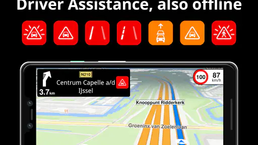
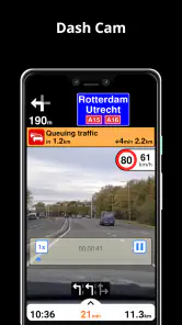
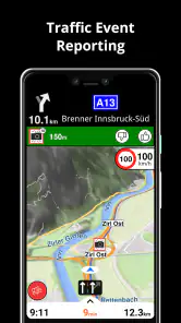
What really blew me away were the offline maps. Seriously, these are a game changer. You can download maps for entire countries and use them without a hint of internet, which is perfect for those trips where Wi-Fi is as rare as a unicorn. Plus, the app is jam-packed with useful features like real-time traffic updates and speed camera alerts, making it not just a map, but a full-blown travel companion.
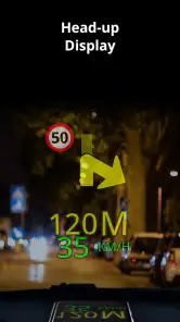
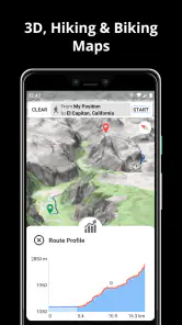
Let’s talk about the navigation. The turn-by-turn directions are as smooth as butter, and the voice guidance is clear enough that you’ll never miss a turn again. I especially love the 3D maps option; it’s like having a little piece of the world right in your hand. And for my fellow cyclists and pedestrians, the app offers specific routes that cater to non-drivers. It’s details like these that make the app feel inclusive and thoughtful.
A useful routine for everyday trips
Imagine leaving home for a weekend drive to a town you have never visited. I’d check the route over breakfast, save the relevant offline map before packing, and then let traffic information help me judge the trip while connected. If reception fades, the downloaded map can still make the route usable; once signal returns, connected traffic information can again be relevant. That distinction matters: offline mapping helps with the map and route, while live traffic depends on having a connection.
The same preparation is useful for a commute with a detour. I would compare the suggested route with the streets I already know before setting off, rather than treating every change as automatically better. The app’s traffic information can help explain a reroute, but local road conditions and signs still take priority. If I’m walking or cycling, I’d check the proposed path before moving, especially where a route crosses busy roads or unfamiliar areas.
For a more everyday example, picture meeting a friend in a part of town you rarely visit, then walking from a parking spot to the café. I’d set the destination before driving, park legally, and switch to checking the final walking leg only once I’m out of the car. That separates the driving decisions from the pedestrian ones and makes it easier to notice whether the last stretch actually looks comfortable on foot. A route line is a useful guide, not a substitute for reading crossings, signs and the street around you.
Safe and Secure
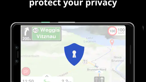
In today’s digital age, privacy is key. Magic Earth takes this seriously, offering a strong layer of security by ensuring no data is collected without your consent. It’s refreshing to use an app where you don’t feel like your personal data is being mined every second. This commitment to privacy is something I deeply appreciate and is a huge draw for anyone wary of big tech’s prying eyes.
When the app may not be the cause
If guidance seems unreliable, I would first separate a map problem from a phone or reception problem. Check that the destination is correct, the intended travel mode is selected, and the relevant offline area is ready if you are without data. If traffic details are missing, a weak connection may be the practical explanation rather than a broken route. And if the phone’s location appears off, pause somewhere safe and check its location settings before blaming the directions.
There is also a useful trade-off to remember when choosing between Magic Earth and the navigation app already on your phone. Familiar alternatives may feel easier if you depend on their established routines or connected services. Magic Earth makes more sense when offline maps, a privacy-conscious approach, or walking and cycling options matter to you. I would not switch in the middle of a critical journey; try it on a route you know, then decide whether its instructions and map presentation suit your habits.
If a route will not behave as expected, I’d recover in a calm order rather than repeatedly tapping around. First, stop somewhere safe and check the destination spelling and travel mode. Next, confirm that the map you expect to use offline actually covers the current location and the remaining route. If the route still seems unsuitable, compare it with road signs and your own understanding of the area before continuing. This approach is more useful than assuming every odd turn means the app has failed.
The Magic Touch
If you’re anything like me, you’ll appreciate the little touches that make an app feel special. Magic Earth offers a few personalized settings that allow you to tweak the app to your liking. Whether it’s customizing the map’s appearance or selecting your preferred units of measurement, it’s these little things that add up to a big difference.
One of my personal favorite features is the augmented reality navigation. It overlays directions onto a live view of your surroundings, making it easier to find your way through bustling city streets or quaint country lanes. It’s not just cool; it’s downright useful.
Making the choice practical
Those customization options are most valuable when they solve a small daily annoyance: choosing units you can read quickly, or a map appearance that stays clear in changing light. I would settle these preferences at home rather than adjusting them at a junction. Augmented reality can be helpful when the last part of a walk is hard to interpret, but it is not a reason to stare at a screen while crossing a street; stop somewhere safe, orient yourself, then continue.
With over a million installs, Magic Earth is clearly in use beyond a niche group, but popularity alone does not tell me whether it fits a particular driver. I’d recommend trying it if you want a free navigation option with offline preparation and routes beyond driving. I’d skip it as a sole travel tool if you need a system you already know intimately or do not want to prepare maps before losing coverage. Its minimum OS requirement is version 9, so it is also worth checking compatibility before planning around it.
The decision also depends on what you expect from a navigation app day to day. If your priority is a connected service whose surrounding features and routines you already use, staying with your current option may be more convenient. If the possibility of losing data is the main concern, Magic Earth’s advance map preparation has a clearer purpose. I would not judge it only by how many options appear on screen; the real test is whether its route is easy to follow in your own car, on your own device, and on roads you actually travel.
Wrapping Up
So, is Magic Earth perfect? Well, nothing’s perfect, but it’s pretty darn close. Whether you’re a frequent traveler or just looking for a reliable navigation app for your weekend road trips, Magic Earth Navigation & Maps has got the right mix of features and usability. It’s like having a trusty co-pilot who’s always got your back. Give it a go, and you might just find it’s the last navigation app you’ll ever need.
My practical verdict is more measured: I’d keep it as a strong candidate, especially for trips where downloading a map ahead of time is worth the effort. Try a familiar drive first, then test a planned offline area before depending on it somewhere remote. That gives you a fair sense of its routing and controls without putting an important journey at risk. For my needs, that balance of navigation choices and preparation makes it useful, even if it is not automatically the best fit for everyone.
Before making it your regular navigator
I would give it a gradual trial: first a familiar journey with a straightforward destination, then a planned trip where the offline map matters. Pay attention to the things that affect your own comfort—whether spoken directions arrive in time for you, whether the map remains easy to read, and whether the suggested route feels sensible. Those personal checks answer the question a rating cannot: does this particular navigation style work for the way you travel?
In short, I see it as a practical choice for someone willing to prepare and curious about an alternative to the default map app. It is less compelling for a person who wants to install nothing, make no settings decisions and rely on a single known workflow immediately. I’d keep a familiar backup available until I had tested the routes and offline preparation that matter to me. That is a sensible way to get the benefit without expecting any navigation app to replace attention, local signs or good judgment.
Magic Earth Navigation & Maps Frequently Asked Questions
Is Magic Earth Navigation & Maps free to download?
Magic Earth Navigation & Maps is free to download, and its store summary describes the app as entirely free. The app also lists in-app purchases priced at $19.99 per item, so it is worth checking the purchase details shown on your device before buying anything. You can consider its navigation and offline-map features first and decide whether they suit your needs.
Can Magic Earth Navigation & Maps help me plan a journey before I start driving?
Yes. Its navigation tools and crowd-sourced traffic information can help you plan a journey and consider traffic conditions along the way. Offline maps are also useful when you expect to travel somewhere with limited internet access. Together, these options make the app relevant to people who want to prepare a route before setting off, as well as those who need guidance while travelling.
Does Magic Earth Navigation & Maps provide crowd-sourced traffic information?
Yes. Magic Earth Navigation & Maps includes crowd-sourced traffic alongside GPS navigation and offline maps. This can help you take traffic conditions into account while planning a journey. The app is free to download, and it is designed for Maps & Navigation, so it may suit people looking for routing and traffic information in one place.
What features does Magic Earth Navigation & Maps offer for navigation?
Magic Earth Navigation & Maps provides a range of features for navigation, including offline maps, real-time traffic updates, and turn-by-turn voice guidance. The app supports multiple map views such as 2D, 3D, and satellite, and accommodates various transportation modes including driving, cycling, and walking. These features make it a versatile tool for travelers.
Can I use Magic Earth Navigation & Maps offline, and how do I download maps?
Yes, Magic Earth Navigation & Maps allows offline usage, which is ideal for areas with limited internet connectivity. To download maps, you simply select the regions or countries you need from within the app. Once downloaded, these maps can be accessed without an internet connection, ensuring seamless navigation at all times.
Pros
- Offline maps available for global navigation.
- Voice-guided navigation in multiple languages.
- Real-time traffic updates and route adjustments.
- Eco-friendly routes to save fuel and emissions.
- Detailed turn-by-turn navigation and lane guidance.
Cons
- Occasional inaccuracies in map data.
- Limited customization for map display.
- Heavy battery usage during prolonged use.
- Some features require in-app purchases.
- May have compatibility issues with older devices.
- Category
- Maps & Navigation
- Version
- 1.0.0











