Live Street View
- 12.00
- 3.5
- Installs
- 100.00K
- Price
- Free

Screenshots
Analysis by Reviewed
I spent time with Live Street View as a map and navigation app, focusing not only on what it shows, but also on how comfortably different people can use it. Its central idea is straightforward: explore places through street-level imagery, look around a three-dimensional globe, plan trips with AI assistance, and share locations. That combination makes it more of a visual discovery tool than a replacement for a dedicated turn-by-turn navigation service.
My first impression was that the app is easiest to understand when I use it for orientation before travelling. I can inspect the character of an area, check what a nearby road looks like, and use the globe view to get a broader sense of where a destination sits. The experience feels especially useful when a normal map leaves too many questions: Is the entrance likely to face a busy road? Does the neighbourhood look urban, rural, or spread out? Would a meeting point be easier to describe using a visible landmark?
That visual approach also shapes the app’s accessibility story. Some people understand places more easily from images than from abstract lines and pins, while others may find a busy visual interface tiring or difficult to interpret. In my experience, Live Street View can support several different ways of planning, but it works best when I treat it as an extra layer of understanding rather than the only navigation tool.
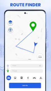
Seeing the route clearly before leaving home
Readability and navigation
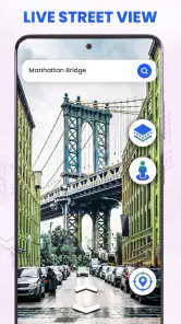
The street-view focus gives the app a practical advantage during preparation. Instead of relying only on a road name, I can look for visual clues that make a destination easier to recognise. This matters when I am visiting an unfamiliar building, arranging a pickup, or trying to explain a location to someone who does not know the area. A screenshot or shared location can be more immediately useful than a long written description.
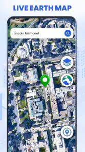
The three-dimensional globe view serves a different purpose. I found it better for understanding distance, direction, and the relationship between places than for detailed doorstep navigation. It creates a sense of geographic context that a flat map can sometimes hide. For students, travellers, and curious users, that broader view makes exploration enjoyable. For someone who simply needs the fastest route to work, however, it may feel like an extra step rather than a benefit.
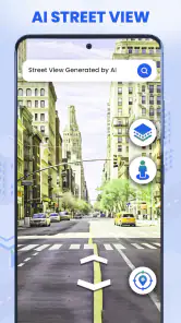
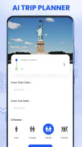
The AI trip planner is potentially the most convenient part for people who do not want to assemble a journey manually. I would use it at the beginning of a planning session, especially when a trip includes several places or when I am still deciding what order makes sense. My advice is to treat its suggestions as a draft. Before setting out, I would still check the proposed stops, travel assumptions, and practical details myself. AI can organise an idea quickly, but it should not replace personal judgement about accessibility, timing, safety, or local conditions.
For readability, the app’s usefulness depends heavily on how much visual information a person can comfortably process. Street imagery can make a location more concrete, but it can also contain signs, buildings, vehicles, and roads competing for attention. I found it easier to use when I had one clear question, such as identifying an entrance or comparing two nearby meeting points, rather than casually scanning without a goal.
More From Our News Desk

Clash of Clans Is Won Between the Battles

Android Auto Makes the Case for Quieter Car Software

MobiOffice: Transforming Mobile Productivity with Seamless Integration

EA SPORTS FC™ Mobile Soccer: Redefining Mobile Sports Gaming

How Microsoft OneDrive Became a Mobile Productivity Giant

How Google Translate Breaks Language Barriers Effortlessly
A helpful workflow is to begin with the broad globe view, narrow the search to the relevant area, and then switch to street-level exploration only after choosing a specific point. This reduces unnecessary movement around the map and makes the visual search less overwhelming. I also prefer sharing a precise location after checking it visually, because the recipient can then start from a clear reference instead of trying to interpret a vague description.
How it compares with ordinary map apps
Compared with a conventional map app, Live Street View feels more focused on “what will this place look like?” than “which instruction comes next?” Standard navigation tools remain the better choice when I need dependable route guidance, traffic-aware decisions, transit details, or a highly familiar interface. Their strength is getting me from one point to another with minimal distraction.
This app is more valuable before the journey or alongside another map. I can use a regular navigation service to calculate the route, then use Live Street View to understand the destination and nearby surroundings. That division of labour is one of the most sensible ways to use it. It prevents the visual exploration features from becoming a burden during a time-sensitive trip while still taking advantage of their strongest quality.
There is also a difference in how each tool supports memory. Written directions can be forgotten quickly, while a recognisable building or corner may stay in mind. For users who rely on visual landmarks, that can make an unfamiliar destination feel less intimidating. On the other hand, people who prefer text-based instructions may find a street image less efficient than a simple list of turns.
Motor and sensory considerations
From a motor perspective, the most comfortable use is deliberate rather than hurried. Exploring a globe or street scene naturally involves gestures and repeated adjustments, so someone with limited dexterity, tremors, or fatigue may prefer preparing a location in advance instead of navigating through imagery while moving. I would avoid trying to perform detailed exploration during a walk or while handling luggage. The app is better used when the phone can be held steadily or placed on a surface.
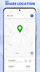
Sharing a location can reduce the amount of interaction required for another person. Rather than asking someone to search for an address and interpret several results, I can send the point after checking that it represents the intended place. This is useful for coordinating with a friend, arranging assistance, or giving a driver a clearer destination. The practical benefit is not just convenience; it can remove several rounds of verbal explanation.
For users with visual sensitivities, the strongest approach is to keep sessions short and purposeful. Rapidly moving through street imagery may be uncomfortable, and a globe view can involve a lot of visual change. I would pause between actions, zoom only as far as necessary, and avoid exploring while distracted. The app’s visual nature is central to its appeal, but that also means it may not suit someone who needs a low-stimulation navigation experience.
People with low vision may gain value from the ability to inspect a place visually, particularly when a large landmark is easy to recognise. Yet visual information is not automatically accessible information. A scene can be meaningful to one person and confusing to another, especially when the important detail is small, distant, or surrounded by similar buildings. I would pair the app with spoken directions, text labels, or help from another person when the destination is important.
For users who are deaf or hard of hearing, the visual emphasis may be a natural fit because the core experience does not depend on hearing a surrounding environment. It can help someone understand a meeting location without needing an audio description from another person. Still, I would not assume that every planning result or instruction is equally clear without checking the screen carefully. The app should support visual confirmation, not replace all other forms of communication.
Older users and people who are less comfortable with map technology may appreciate the familiar idea of looking at a real place, but the combination of globe exploration, street imagery, location sharing, and AI planning could still feel like a lot at once. I would introduce one task at a time: first locate a destination, then inspect it, then share it if needed. That approach is more approachable than presenting every feature as part of one complicated workflow.
Situational access in everyday life
A realistic example is meeting a friend at a large medical complex or public venue. A written address may bring both people to the same property but leave them searching for the correct entrance. I would use the street view to inspect the surrounding road, identify a visible landmark, and share the location that best matches the meeting point. The friend could then use a standard navigation app for the journey while keeping the shared visual reference in mind.
Another useful situation is planning a visit for someone who has limited energy. Before leaving, I could inspect the final approach and decide whether the destination looks easy to identify or whether a different drop-off point would be less stressful. The app cannot tell me everything about physical access, but it can help reduce uncertainty about the surroundings. That small amount of preparation may be valuable when an unexpected detour or confusing entrance would have a bigger impact.
For travellers, the globe view can help build a mental map before arrival. I like the idea of exploring the relationship between a hotel, a station, and a planned attraction before trying to move between them. This is not the same as confirming a route in real time, but it can make a new city feel less abstract. Someone with travel anxiety may benefit from knowing what the area looks like in advance, while someone who dislikes visual planning may find the process unnecessary.
The app can also help when language creates friction. A shared location and recognizable image may communicate more effectively than attempting to describe a street in unfamiliar terms. I would still verify the destination carefully, because a visual landmark can be similar to another one nearby. The best result comes from combining the image with a precise pin and a short written explanation.
For families, the location-sharing function may make coordination simpler when plans change. A parent can send a meeting point rather than asking a child to search for a complicated address. However, I would use this thoughtfully and avoid assuming that a shared pin alone explains where to stand, which entrance to use, or how to cross a busy road. Visual context helps, but basic safety instructions remain necessary.
Where access becomes less certain
The main limitation is that visual context is not the same as current, complete, or physically detailed access information. A street image may help me recognise a building, but it does not by itself answer every question about ramps, lifts, steps, surface quality, door width, seating, lighting, or indoor routes. If those details determine whether a journey is possible, I would contact the venue or use a specialist accessibility resource as well.
The AI trip planner introduces another point of caution. It may be convenient for turning a general idea into a proposed itinerary, but a plan can look sensible on screen while being unsuitable for a person’s actual needs. A route that is short may involve difficult terrain; a stop that appears nearby may have an inconvenient entrance; and a suggested sequence may not allow enough rest. I would use the planner to generate options, then adjust them according to the traveller’s abilities and preferences.
There is also a privacy and coordination consideration whenever locations are shared. Sending a point can be helpful, but I would check the recipient and the exact place before confirming. A location intended for a public meeting should not accidentally reveal a private address or a more precise position than necessary. This is a general habit worth keeping in mind because convenience can make people share faster than they normally would.
Performance and comfort can vary with the device and the amount of imagery being explored. On an older phone, extended visual browsing may feel less pleasant than checking a simple map. The app supports devices running Android 8.0 or later, which makes it available to many existing Android users, but compatibility alone does not guarantee that every phone will provide the same smooth experience. If the interface feels sluggish, I would prepare locations in shorter sessions rather than trying to explore an entire trip at once.
The app is free to install, although it includes optional purchases ranging from $1.49 to $34.99 per item. I would pay attention to which parts of my intended workflow require additional spending before relying on them for regular trip planning. For occasional street-level exploration, the free starting point may be enough. For frequent users, the value depends on whether the added options genuinely save time rather than simply adding more ways to browse.
Its public reception is mixed rather than uniformly enthusiastic: it holds a 3.5 average from around 381 ratings, with 12 written reviews, and has passed 100K installs. Those figures suggest a real user base but also a reason to approach it with realistic expectations. I would not choose it solely because it combines several fashionable features. I would choose it because the visual planning workflow matches a specific need I have.
Who should use it, and who should skip it?
I think Live Street View is a good match for people who want to preview unfamiliar surroundings, explain meeting points visually, explore geography, or sketch out a multi-stop outing with help from an AI planner. It is particularly appealing to visual learners and travellers who feel calmer after seeing a destination before arriving. The location-sharing feature also gives it a practical role in family coordination and group plans.
I would be more cautious recommending it as the only navigation app for commuters, drivers, or anyone who needs precise live guidance under pressure. A dedicated navigation service is usually a better primary tool for turn-by-turn movement and route decisions. I would also suggest skipping it if the main requirement is detailed accessibility information about buildings or transport infrastructure. Street imagery can support that research, but it cannot replace verified information from the destination itself.
The app comes from Cool IT Solutions and is listed for Everyone, which makes its intended audience broad. Its current version is 1.3.8, and it was released on February 22, 2024. I mention those details because they help set expectations: this is a relatively focused, modern mapping utility rather than a long-established all-purpose navigation standard. I would keep it updated and maintain a backup map option when travelling somewhere unfamiliar.
My inclusive verdict
After using it with accessibility and different situations in mind, I see Live Street View as a useful preparation companion. Its best contribution is reducing uncertainty through visual context. I can inspect a place, understand its surroundings, organise a trip idea, and share a clearer meeting point. Those actions can support people who process information visually, need extra preparation time, or find spoken location descriptions difficult.
Its limits are equally important. The app does not turn a street image into a complete accessibility assessment, and an AI-generated itinerary still needs human checking. Visual exploration can also demand more attention and hand movement than a simple map. I would therefore use it in a calm planning session, combine it with a conventional navigation service, and confirm critical access details through a more direct source.
My recommendation is to try it when seeing a place matters as much as reaching it. It is free, available to a broad Android audience, and offers a distinctive mix of street-level viewing, globe exploration, trip planning, and location sharing. I would not make it my only navigation tool, but for previewing destinations and communicating them more clearly, it earns a useful place alongside the usual map apps.
Live Street View Frequently Asked Questions
Is Live Street View available on both Android and iOS?
Live Street View is a Maps & Navigation app from Cool IT Solutions. Its minimum operating-system requirement is version 8.0, so check that your device meets the requirement before downloading. Availability and compatibility can vary by device and platform, and the app’s description focuses on exploring street views, a 3D globe, trip planning, and sharing locations.
What is Live Street View, and what can I use it for?
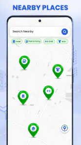
Live Street View is a map and location-exploration app designed to help you view streets, landmarks, roads, and places through map imagery. It can be useful when planning a trip, checking an address, exploring an unfamiliar neighborhood, or getting a visual impression of a destination before visiting. The app also describes features such as 3D globe views, an AI trip planner, and location sharing. The available imagery may vary by location.
Does Live Street View show real-time street images?
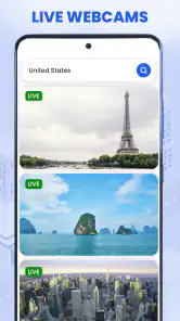
Despite its name, Live Street View generally does not provide a continuously updated live video feed of streets. Street imagery is usually captured previously by mapping providers and may be months or years old, depending on the area. Traffic, construction, weather, and buildings may therefore look different when you visit. Always treat the images as a reference rather than a real-time security or traffic-monitoring tool.
Does the app require an internet connection and access to my location?
An internet connection is normally required to load maps, search for places, and display street imagery. Location permission can improve the experience by showing your current position, but it may not be essential for basic searches if you enter an address manually. You can review and change location permissions in your Android or iOS settings. Mobile data usage may increase when browsing detailed maps or imagery.
Is Live Street View free to download and use?
Live Street View is free to download, though that does not mean every feature is free to use. In-app purchases are available, with prices ranging from $1.49 to $34.99 per item. Review the purchase details shown in the app store before buying, and check what a selected item includes so you can decide whether the free experience meets your needs.
Pros
- Explore panoramic street imagery from locations worldwide.
- Useful for planning trips and previewing unfamiliar neighborhoods.
- Simple map-based interface makes locations easy to find.
- Can help identify landmarks
- roads
- and nearby points of interest.
- Provides a convenient virtual sightseeing experience from your phone.
Cons
- Coverage and image quality vary greatly by location.
- Some imagery may be outdated or unavailable in certain regions.
- Loading panoramic views can use significant mobile data.
- Navigation may feel less smooth on older or lower-end devices.
- The app may include ads or in-app purchase prompts.
- Category
- Maps & Navigation
- Version
- 1.3.8











