Live Street view 360
- 39.00
- 2.9
- Installs
- 500.00K
- Price
- Free

Screenshots
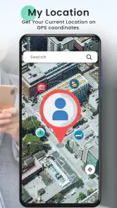
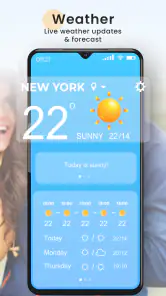
Analysis by Reviewed
I’d decide whether Live Street View 360 suits me by asking one simple question: do I want to preview places visually, or do I need dependable turn-by-turn guidance? Those are related but different jobs. This is a free maps and navigation app from Sharp Tech Studio, and its appeal is the chance to look around a location rather than rely only on a pin or a written address. I’d treat the street imagery as a way to get a feel for a destination, not as a guarantee that every corner will be available or current.
That distinction matters in ordinary planning. If I’m choosing between two nearby cafés, checking whether a street looks familiar, or giving a friend a visual idea of a meeting area, a map paired with a street-level view can answer questions that a route line cannot. For a long drive where timing, rerouting, and clear spoken directions matter most, I’d use a navigation-first app instead. The useful choice depends less on which app has the longest feature list and more on what I need to know before I leave.
Explore the World in 360 Degrees
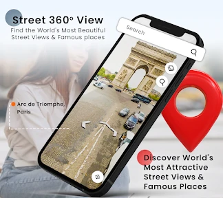
The first thing I noticed about Live Street View 360 is its sleek and intuitive interface. It’s really easy to navigate, even if you’re not exactly tech-savvy. Once you open the app, you’re greeted with a world map. You can literally drop a pin anywhere and instantly dive into a 360-degree view of that location. It’s like being there without the jet lag or lost luggage!
Features That Stand Out
What really sets this app apart are its interactive features. You can pan around, zoom in and out, and even switch between different viewing modes. One feature I found particularly cool is the ability to see the location in different timeframes. So, if you’ve ever wondered what Times Square looks like at midnight, you can check it out!
A practical way to use that kind of browsing is to inspect a destination before setting off, then keep the map open separately for the actual journey. I’d look for useful visual clues such as the character of the street or nearby landmarks, rather than assuming an image will show today’s exact conditions. For a visitor meeting someone in an unfamiliar area, exploring the approach beforehand can make the final walk less disorienting. It is a small preparation step, but one that can be more useful than repeatedly zooming a standard map.
A Few Quirks
Now, no app is perfect, right? While exploring, I did encounter a few blurry images here and there. Plus, some areas are just not covered yet, which can be a bit of a bummer if you're trying to visit more remote places. But honestly, these are minor hiccups in an otherwise smooth experience.
Another thing to note is that the app functions best with a strong internet connection. I tried using it while on a road trip with spotty service, and let’s just say it wasn’t the best idea. The images took forever to load, which kind of took away from the whole seamless experience.
More From Our News Desk

Clash of Clans Is Won Between the Battles

Android Auto Makes the Case for Quieter Car Software

MobiOffice: Transforming Mobile Productivity with Seamless Integration

EA SPORTS FC™ Mobile Soccer: Redefining Mobile Sports Gaming

How Microsoft OneDrive Became a Mobile Productivity Giant

How Google Translate Breaks Language Barriers Effortlessly
That makes the timing of a search part of the decision. I’d browse while planning at home or somewhere with reliable service, rather than wait until I’m standing at a junction trying to load an image. It’s also worth treating a panoramic scene as context, not as a live report: street imagery can help me recognize a building or understand the shape of a block, but it cannot tell me whether a shop is open, a road is blocked, or a meeting point has changed today.
Choosing It Over a Navigation-First App
Compared with the usual alternatives, the main trade-off is purpose: conventional navigation tools are the safer default when I need a route I can follow while moving, while this app is more appealing when I want to inspect a place visually. I wouldn’t use slow-loading street imagery as my only guide on an unfamiliar drive. A sensible workflow is to preview a destination while connected to reliable internet, note the address or area, and rely on a navigation tool for the route itself. That keeps the visual browsing useful without asking it to do a different job.
The comparison is not simply between this app and one other map. A standard road map is often faster when I only need to understand direction, distance, or which streets connect. A dedicated navigation app is the better choice when I’m already on the move and need clear route guidance. A street-view-focused tool earns its place when the question is visual: what might the approach look like, which side street seems familiar, or what kind of setting surrounds the destination? I’d choose based on that question, not try to make one category replace all the others.
For a realistic example, imagine I’m visiting a friend in a neighborhood I don’t know. Before leaving, I can explore the destination and nearby streets, then use a separate route app during the trip. If the imagery is unclear or the spot isn’t covered, I’d switch to a regular map rather than spend time hunting through views. This is also a good reason to check the actual address carefully: a visual match can help orient me, but it shouldn’t replace confirming where I’m going.
There’s a useful small habit here: start from the exact destination, then look outward only far enough to recognize the approach. Browsing an entire neighborhood can be entertaining, but it can also bury the one clue I need under too many images and pans. I’d note a landmark or the general appearance of the street, then stop. If I’m coordinating with someone else, I’d share the precise address through whatever method we already use rather than assume a screenshot or a visual description will be enough.
The app is a better fit for curious travelers, people planning a visit, and anyone who enjoys browsing places from home. It is less suitable for someone who wants a single, fully reliable tool for navigation, or who often travels through areas with weak connectivity. I’d also keep expectations measured when checking remote locations, since coverage can vary. On Android, it is rated for Everyone and supports devices running version 8.0 or later; the current release is 1.6.4.
For visitors with mobility or accessibility needs, I would use the imagery only as one part of preparation. A view may help me understand the visual character of an approach, but it is not a dependable substitute for checking current access details or asking the venue directly. Similarly, if I’m choosing a place because I need a quiet entrance or a particular facility, I would confirm that information elsewhere. The app is strongest when the question can be answered by seeing the surrounding street, not when the decision depends on details a picture cannot establish.
Cost, Ratings, and the Commitment to Try It
There’s little commitment to trying it because the app is free to download, although it offers in-app purchases ranging from $0.99 to $7.99 per item. I’d start with the free experience and decide whether any paid option is worthwhile only after seeing how often I use it. It has over 500,000 installs and an average rating of 2.9 from 844 ratings, so I would not take popularity as proof that it will suit my needs. The rating is a useful reminder to test the basics—coverage near places I care about and image loading on my connection—before relying on it.
My trial would be deliberately practical rather than a long tour around the world. I’d search one familiar place to see whether I can orient myself, then check a destination I expect to visit. If both searches are useful and the images load comfortably, I’d keep it as a planning companion. If I mainly need directions, or the places I care about are missing or hard to inspect, there is little reason to change my usual map routine. Because purchases are available, I’d also make sure I understand what an optional paid choice provides in the app before spending anything; the free download is enough to judge whether the basic idea fits my habits.
It was released on June 28, 2022, and has 39 written reviews. Those figures don’t tell me how well a particular street will appear, so my own quick check would be more useful: search one familiar destination, then a place I plan to visit, and see whether the imagery is clear enough to answer a real question. That simple trial also helps me judge whether the interface feels comfortable before I build it into a travel routine.
On the practical side, I’d avoid making a plan that depends on the app loading at the exact moment I need to act. Looking up a place before a trip reduces that pressure and makes the visual feature more worthwhile. If a view is blurry, incomplete, or simply not helpful, I can return to the address and map rather than repeatedly trying different angles. That is a sensible stopping point: the app should reduce uncertainty, not become another task to manage while travelling.
Why You Should Try It
If you’re a travel enthusiast or just someone who enjoys exploring new places, Live Street View 360 is definitely worth checking out. It’s also a nifty tool for planning trips, as you can virtually explore the area before you actually get there. Imagine being able to walk down a street in Paris or through a market in Tokyo without ever leaving your room!
I’d particularly recommend it to someone who likes to prepare visually before a first visit, or who enjoys casual armchair exploring without expecting a complete substitute for travel. It may also help when I’m trying to distinguish between two destinations with similar names or get a rough sense of the surroundings before arranging to meet. The key is to use it for orientation and curiosity, while checking important practical details through the appropriate source.
I would skip it as my main navigation choice if I need dependable guidance throughout a drive, regularly travel where the connection is unreliable, or expect every small or remote street to be represented clearly. Those needs call for a map or navigation option built around the route itself. I’d also pass if I rarely need visual previews: installing another app is not useful just because its central idea sounds appealing. A quick search of places I genuinely care about is a better test than browsing at random.
Overall, I’d say this app is a solid addition to your collection, especially if you love exploring new horizons. It’s fun, informative, and offers a little escape from the daily grind. So go ahead, give it a whirl, and start your own virtual journey today!
Live Street view 360 Frequently Asked Questions
What devices and operating systems can run Live Street View 360?
Live Street View 360 is an app in the Maps & Navigation category, developed by Sharp Tech Studio. Its minimum operating system requirement is Android 8.0, so check your device’s software version before downloading. The app is rated for Everyone, making it suitable for a broad audience. It is described as Live Street view 360.
What features does Live Street View 360 offer?
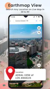
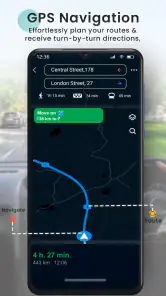
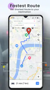
Live Street View 360 allows users to explore panoramic views of streets and locations worldwide, providing real-time navigation and 3D mapping. The app offers a user-friendly interface, street-level perspectives, and the ability to switch between various map types. Users can search for specific locations, save favorites, and even navigate using GPS for accurate directions.
Is Live Street View 360 available for both Android and iOS devices?
Yes, Live Street View 360 is available for download on both Android and iOS platforms. The app is designed to be compatible with a wide range of devices, ensuring that users can enjoy its features regardless of their preferred operating system. Always check the app store for the latest version compatible with your device.
Does Live Street View 360 require an internet connection to function?
Yes, Live Street View 360 requires a stable internet connection to load the maps and street views in real-time. The app uses online data to provide accurate and up-to-date images. Users should ensure they have a reliable data plan or Wi-Fi connection to enjoy uninterrupted service and fully explore its features.
Are there any costs associated with using Live Street View 360?
Live Street View 360 is free to download, but it includes in-app purchases ranging from $0.99 to $7.99 per item. Consider this if you prefer to avoid optional purchases. The app's core download does not require an upfront payment, so users can install it before deciding whether any paid extras are useful to them.
Pros
- High-quality 360-degree imagery
- User-friendly interface
- Real-time map updates
- Offline map access
- Accurate location search
Cons
- Consumes a lot of data
- Can be slow on older devices
- Limited offline features
- Requires constant updates
- Some areas not covered
- Category
- Maps & Navigation
- Version
- 1.6.4











