Live Earth Maps Satellite View
- 27.00
- 3.8
- Installs
- 100.00K
- Price
- Free
Screenshots

Analysis by Reviewed
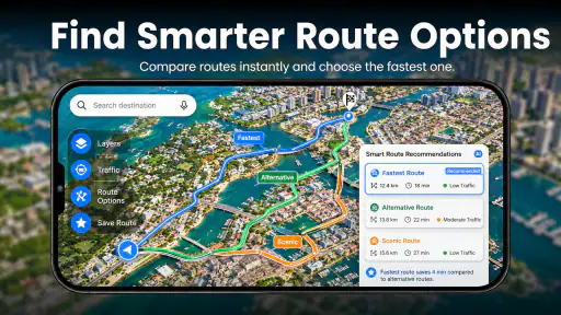
I approached Live Earth Maps Satellite View as a first-time user would: looking for a simple way to explore places, inspect streets, and get a feel for routes without opening a complicated navigation tool. It is a free maps and navigation app from Cybill Tech Mobile Apps, with a focus on live map exploration, GPS routes, nearby places, and well-known world wonders. My first impression was that it tries to bring several map-related activities into one approachable screen rather than concentrating only on turn-by-turn driving.
That broad approach is useful, but it also shapes the experience. This is not the kind of app I would automatically choose for every journey. It feels more suited to visual exploration, checking an unfamiliar area, browsing points of interest, and getting a general sense of where something is. For demanding navigation, I would still compare its route guidance with a more established everyday navigation service before setting off.
Getting from installation to a useful first map
What the app is really for
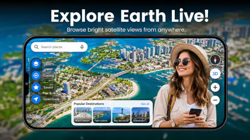
The store name suggests satellite viewing, while the wider experience is built around maps and navigation. In practice, I would think of it as a discovery-oriented map companion. You can use it to look around streets, examine an area from a map perspective, consider a GPS route, and search for nearby places or major attractions. That combination makes it appealing when the question is not simply “How do I drive there?” but “What is around this place, and how is the area laid out?”
That distinction matters for expectations. A person planning a holiday, checking a neighborhood before visiting, or exploring famous landmarks from home may find the app more interesting than someone who only wants the fastest commute. The visual side gives the map a sense of place, while the route element makes it more practical than a purely scenic globe or satellite viewer.
The app has an Everyone content rating, so it is presented as accessible for a broad audience. It has been available since October 8, 2017, and the current version is 1.9. It runs on Android 7.0 or later, which makes it viable on many older Android phones as well as newer devices. The listing shows more than one hundred thousand installs and an average rating of 3.8 from around eight thousand six hundred ratings. I read that as a sign of a useful but not universally polished experience: enough people have found value in it, while the score also suggests that expectations should remain realistic.
The first setup is deliberately uncomplicated
After installing it, I would begin with one small goal rather than trying every map option immediately. Search for a familiar place, such as a local shopping area, a public landmark, or a street you already know. This gives you a reference point for judging how clearly the map presents roads, nearby locations, and the surrounding layout. Using a familiar location is more helpful than starting with an unknown destination because you can quickly notice whether the view is easy to interpret.
When the app presents map information, take a moment to identify the difference between looking around and planning movement. A map can show a place attractively without being the best tool for precise driving decisions. I recommend treating the first session as orientation: find a location, inspect its surroundings, and then see how the route function changes the experience. This simple order avoids the common mistake of opening a route before understanding what the map is showing.
More From Our News Desk

Clash of Clans Is Won Between the Battles

Android Auto Makes the Case for Quieter Car Software

MobiOffice: Transforming Mobile Productivity with Seamless Integration

EA SPORTS FC™ Mobile Soccer: Redefining Mobile Sports Gaming

How Microsoft OneDrive Became a Mobile Productivity Giant

How Google Translate Breaks Language Barriers Effortlessly
The developer, Cybill Tech Mobile Apps, positions the product around accessible map exploration rather than a specialist professional workflow. That is reflected in the app’s general appeal. You do not need to be a frequent traveler or an advanced map user to get started. The learning curve is mostly about understanding which part of the interface is for viewing an area, which part is for searching, and which part is for following a route.
Your first meaningful success should be a nearby-place check
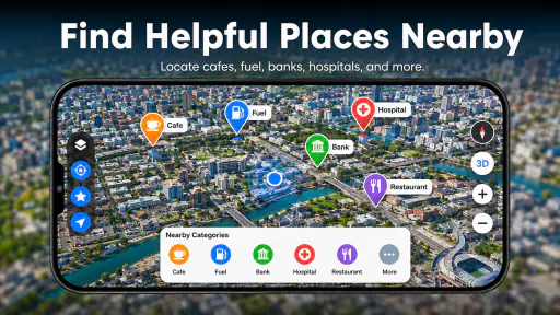
For a first useful action, I would search for a destination and then inspect what is nearby instead of immediately starting navigation. For example, if I were visiting an unfamiliar town, I might locate the hotel area, look for nearby food or services, and then examine the roads around it. This makes the app useful before I ever need active guidance. It also shows why the nearby-places element is more than decoration: it helps turn a blank map into a quick local orientation tool.
A realistic everyday scenario would be arriving in a new area for an appointment. Before leaving the station or parking area, I could use the app to locate the appointment address, check the surrounding streets, and see whether useful places are close by. If the destination is inside a large or unfamiliar district, the visual overview can reduce the initial uncertainty. I would then use the route function as a planning aid, while keeping another navigation option available if the journey involves complicated turns or time-sensitive travel.
Another good first-session workflow is to explore a world wonder or a prominent attraction, then move from the landmark to the surrounding streets and nearby places. This gives the app a more enjoyable use than simply entering an address. It also helps first-time users understand the difference between browsing a place and navigating to it. The strongest part of the experience is often that transition from curiosity to practical orientation.
How to read the map without getting lost in the interface
Map apps can feel confusing because several kinds of information appear to serve the same purpose. My advice is to keep asking one question: am I trying to see the area, find a place, or get from one place to another? If you are seeing the area, concentrate on the visual layout and nearby points. If you are finding a place, use a specific search term and verify the result against surrounding streets. If you are traveling, inspect the route before relying on it.
This habit is especially useful with a satellite-style view. A visual map can make buildings, open spaces, and road patterns easier to understand, but it may be less immediately readable than a clean standard map when you need to identify a turn quickly. I prefer the satellite perspective for recognizing a destination and the surrounding environment, then a simpler route view for deciding how to move through it. Switching mentally between those two purposes prevents the imagery from becoming a distraction.
I also recommend checking the destination name and the wider area before assuming that the first search result is the one you want. Similar names can appear in different neighborhoods or towns. The app is most helpful when you use its visual context as a second confirmation: look at nearby roads, landmarks, and the general shape of the area. That small verification step is more reliable than accepting a result just because the name looks familiar.
Where first-time users may feel friction
The broad feature set can create a mild sense of uncertainty at the beginning. Someone arriving for turn-by-turn directions may wonder whether the app is primarily a navigation tool, a satellite viewer, or a place-discovery app. My honest answer is that it combines all three ideas, but it does not replace the specialized strengths of each category. It is more comfortable as a flexible map companion than as a single-purpose navigation instrument.
There is also a practical trade-off between visual detail and immediate clarity. Satellite imagery can help you recognize a building or understand the shape of a location, yet a busy image may require more attention than a straightforward road map. When I am planning rather than sightseeing, I would avoid spending too long zooming around without a specific question. Decide whether you need to identify an entrance, compare nearby roads, locate a point of interest, or simply understand the district.
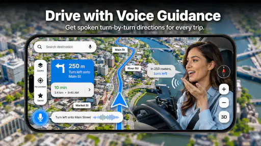
Users should also pay attention to the distinction between a route displayed on screen and a route they are ready to follow in real traffic. A route can be helpful for preparation, but conditions on the road, access restrictions, construction, and local changes can affect the real journey. For an important trip, I would cross-check the route with a familiar navigation service. That is not a criticism unique to this app; it is a sensible precaution whenever a map is being used for a journey where an error would be costly.
Using the app for travel planning rather than only driving
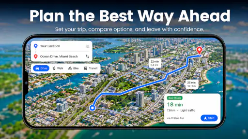
One of the less obvious strengths is its value before the actual day of travel. I can imagine using it to compare the feel of two neighborhoods, examine the surroundings of an attraction, or decide whether a destination appears close to other places I want to visit. Instead of treating the map as a button that starts a journey, use it as a planning surface. This is where the combination of nearby places, street views, and route awareness becomes more useful than a basic address lookup.
For a short outing, I would create a mental sequence: identify the main destination, inspect nearby places, then look at the route between the key points. This helps reveal whether a supposedly convenient stop is actually in a different part of the area. It also reduces backtracking. The app does not need to manage the whole itinerary to provide value; its role can simply be helping you understand the geography before you leave.
For world wonders and major landmarks, the exploration angle is even clearer. I would use the app to get a broad visual impression, examine the surrounding streets, and identify nearby points that might matter during a visit. This makes it suitable for casual learning, family exploration, or deciding what to investigate next. The Everyone rating supports that general accessibility, although younger users should still be guided by an adult when the app is being used to plan real-world travel.
Who will appreciate it most
I think the best audience is someone who wants more than a bare route line. Travelers checking an unfamiliar location, curious users exploring famous places, and people who like to inspect neighborhoods before visiting can all find a clear purpose here. It is also a reasonable option for an older Android device because the minimum operating-system requirement is Android 7.0, rather than a very recent platform release.
It may also suit users who prefer to begin with a visual overview. Some people understand a journey better after seeing how roads, buildings, and nearby destinations relate to one another. For them, the map exploration element can make a new place less abstract. I find that particularly useful when an address alone does not tell me whether the destination is near a main road, tucked inside a dense district, or surrounded by recognizable landmarks.
On the other hand, I would skip it as my only navigation solution if I needed a highly dependable daily driving assistant, detailed traffic decision-making, or a workflow built around constant commuting. A dedicated navigation service is usually the better choice for that job. I would also avoid relying on any map app without checking the route when traveling somewhere unfamiliar, especially if arriving late, carrying luggage, or working to a strict schedule.
Free access and the in-app purchase detail
The app is free to install, which makes it easy to test without committing money at the start. There are in-app purchases priced at $8.99 per item, so I would not assume that every possible enhancement or convenience is included in the free experience. Before purchasing anything, I would first use the basic map, search, nearby-place, and route workflows to decide whether the app’s style suits me.
This is an important practical point for first-time users: a free download is not automatically the same as a completely unrestricted experience. If you reach a purchase prompt, consider whether the feature solves a problem you actually have. For occasional exploration, the free entry point may be enough. For frequent use, compare the cost and benefit with the navigation tools already on your phone before spending money.
Small habits that make the experience better
My first tip is to search by a precise destination and then zoom out briefly. The close view helps identify the place, while the wider view shows whether the result sits in the correct district. This two-level check is more useful than repeatedly zooming in on a single building. It is a quick way to catch a mistaken location before planning around it.
My second tip is to use nearby places as a planning layer, not as a replacement for your destination. If you are meeting someone, locate the meeting point first and then inspect nearby landmarks that can help you recognize the area. A café, public building, or major street may be easier to spot than the exact address. This is especially helpful when you are explaining the meeting location to another person.
My third tip is to separate preparation from live travel. Explore the route while you have time, note the important turns or surrounding landmarks, and then decide whether this app alone gives you enough confidence for the journey. That approach uses the app’s visual strengths without pretending that a map preview can answer every on-the-road question.
A fourth useful habit is to return to the map after searching for an attraction instead of staying only on the result. The surrounding context may reveal other places worth visiting or show that the apparent distance is misleading. This turns a single search into a small discovery workflow and is one of the more enjoyable ways to use the app.
How it compares with familiar alternatives
Compared with a standard navigation app, Live Earth Maps Satellite View feels more exploratory. A mainstream navigation service is generally the stronger choice when the priority is dependable directions, routine commuting, and rapid route decisions. This app is more appealing when I want to understand a place visually, browse nearby destinations, or inspect a landmark and its surroundings before deciding what to do.
Compared with a basic satellite viewer, it offers a more practical connection to routes and nearby places. A pure imagery tool can be excellent for looking around, but it may not support the same sense of movement from one location to another. Here, the route element gives the exploration a purpose. The trade-off is that combining several map tasks can make the experience feel less focused than a specialist tool dedicated to only one of them.
Compared with a printed map or a simple address search, the app is more interactive and better suited to unfamiliar areas. I can move from a destination to its surroundings and then consider a route without changing mediums. Still, I would not treat it as a substitute for local knowledge or common-sense preparation. A visual map helps me plan; it does not remove the need to check the real-world situation.
My recommendation after using it
After working through the app as a first-time user, I see it as a useful free starting point for people who want to explore streets, landmarks, nearby places, and GPS routes in one place. Its strongest quality is flexibility: it can be a casual world-exploration tool one moment and a practical area-checking aid the next. The 3.8 average reflects my overall impression fairly well. There is real value here, but it is not a flawless replacement for every map service.
I would recommend installing it if your first question is “What does this place look like, and what is around it?” Start with a familiar location, test the search and nearby-place workflow, and then examine a route you already understand. That gives you a quick, low-risk way to learn how the app presents information. If the visual approach helps you orient yourself, it can become a handy companion for travel planning and local discovery.
I would be more cautious if your only requirement is highly dependable navigation during a demanding journey. In that situation, compare its route experience with a dedicated alternative and keep a backup plan. For everyone else, the sensible next step is simple: use the free version for a real task, such as checking an unfamiliar appointment area or exploring a landmark, before considering any $8.99 in-app item. The best reason to keep it is not the promise of a map; it is the practical confidence that comes from seeing how a place fits together before you go.
In short, Live Earth Maps Satellite View works best when I use it deliberately: search first, verify the surrounding area, inspect nearby places, and treat routes as preparation that deserves a final reality check. With those expectations, Cybill Tech Mobile Apps’ app becomes a pleasant and accessible addition to a phone’s maps and navigation toolkit rather than an overpromised all-purpose replacement.
Live Earth Maps Satellite View Frequently Asked Questions
Who develops Live Earth Maps Satellite View, and what kind of app is it?
Live Earth Maps Satellite View is a Maps & Navigation app developed by Cybill Tech Mobile Apps. It is aimed at people who want to explore places on a map, view satellite imagery, and look up routes or nearby locations. Its general focus is geographic browsing and navigation, so it may appeal to travelers and curious users alike.
What is Live Earth Maps Satellite View used for?
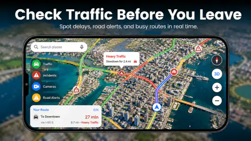
Live Earth Maps Satellite View is designed for exploring locations through satellite imagery, map layers, and geographic tools. During testing, it was useful for viewing cities, roads, landmarks, and natural areas from an overhead perspective. Depending on the version and device, it may also include standard map navigation, location search, directions, traffic information, or street-level imagery. Features can vary by platform and region.
Does Live Earth Maps Satellite View show real-time satellite images?
Despite the word “Live” in its name, the app should not be assumed to provide continuously updated, real-time satellite video. Most satellite and aerial imagery is collected periodically and may be days, months, or even years old. The exact update schedule depends on the map provider, location, and imagery source. Always treat the display as reference information rather than a live security or weather-monitoring feed.
Does the app require an internet connection or GPS access?
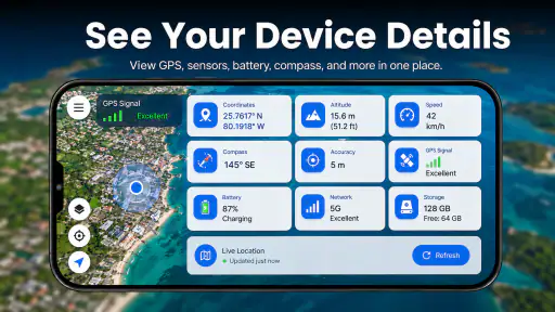
An internet connection is generally needed to load satellite tiles, map data, searches, and other online content. GPS or location permission may be requested if you want the app to identify your current position or provide navigation-related features. You can usually deny location access and browse manually, although some functions may not work correctly. Mobile data usage may increase when exploring detailed imagery.
What Android version is required to install the app?
The Android version requirement is 7.0 or later, so it is worth checking your device’s software version before downloading. If your phone or tablet meets that requirement, you can consider trying the app for map browsing and route exploration. The app is also marked for Everyone, making its stated content age category suitable for a broad audience.
Pros
- Detailed satellite imagery helps explore cities
- landmarks
- and natural areas.
- Live location tools make it easier to understand your position and surroundings.
- Map views are useful for trip planning and checking nearby places.
- Simple navigation suits users who want quick access to geographic information.
- Regular map updates can improve coverage and location accuracy.
Cons
- Some advanced map features may require a subscription or in-app purchase.
- Satellite imagery is not always live and may be several months old.
- High-resolution map data can consume considerable mobile data.
- Performance may slow down on older phones or weaker connections.
- Location features can raise privacy concerns if permissions are enabled.
- Category
- Maps & Navigation
- Version
- 1.9











