Live Earth Map: GPS Navigation
- 120.00
- 3.5
- Installs
- 10.00M
- Price
- Free

Screenshots

Analysis by Reviewed
When I decide whether to rely on a map app, I think about more than the directions: will the place I need load when I need it, and what can I do if my connection falters? Live Earth Map: GPS Navigation brings together practical location use and a broad, Earth-focused view, so connectivity shapes both its appeal and its limits. I’d approach it as a visual companion for exploring and preparing, then make a separate decision about whether it is the right tool for a time-sensitive journey.
Network-dependent moments
Map apps feel most dependable when the phone has a steady connection: information can load as you move, and searching is less of a stop-and-wait exercise. With an Earth-focused map, that matters even when I’m browsing from home. Zooming into a distant city or switching the area I’m looking at can make the experience feel more immediate when the network is cooperating; a weak signal can make exploration less fluid.
I’d plan around that difference rather than assume every view will be ready at any moment. Before leaving, I would look up the places I care about while connected, note their names or addresses somewhere accessible, and avoid making a last-second map search the only way to find a destination. That small habit is useful for any map app, but especially for one that encourages browsing across large areas.
Good fit for a second screen, not every journey
The app may suit someone who likes to inspect a destination visually before setting out, or who enjoys tracing a route across the map without needing a full travel-planning system. For a straightforward commute, however, I’d compare its directions with a familiar navigation app before relying on it. The practical question is not which map looks more impressive, but which one gives me the clearest route for the trip I’m taking.
For example, if I’m meeting a friend at an unfamiliar venue, I can explore the surrounding streets beforehand and get a sense of the area. I’d still save the venue’s exact address and keep a backup way to check it. That is a more sensible use than expecting a satellite-style view alone to answer every question about entrances, parking, or the best place to meet.
A small planning workflow that saves time
For a weekend visit, I’d use the app at home to inspect the destination, then write down the exact address and the name of the place I’m meeting. I’d also decide on a clear meeting point rather than relying on a broad map pin: a large public entrance or a named venue is easier to communicate than “somewhere near this corner.” This is especially useful when several people are travelling separately and their phones may not all have the same reception.
I’d keep the visual browsing separate from the actual route decision. The map can help me understand how a neighborhood sits in relation to nearby streets, but I’d confirm the address and route in the navigation tool I expect to use on the day. That two-step approach avoids a common trap: feeling familiar with a place after looking at it on screen, then discovering that the final approach or entrance is less obvious in person.
You May Like

Clash of Clans Is Won Between the Battles

Android Auto Makes the Case for Quieter Car Software

MobiOffice: Transforming Mobile Productivity with Seamless Integration

EA SPORTS FC™ Mobile Soccer: Redefining Mobile Sports Gaming

How Microsoft OneDrive Became a Mobile Productivity Giant

How Google Translate Breaks Language Barriers Effortlessly
Unveiling the World at Your Fingertips
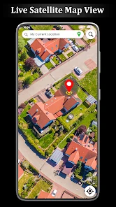
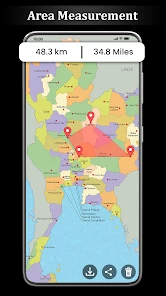
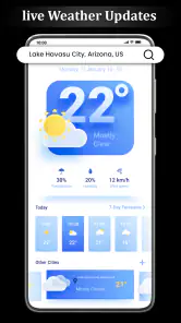
First off, let's talk about what Live Earth Map: GPS Navigation brings to the table. Imagine having access to real-time satellite imagery, global maps, and a GPS tracker all rolled into one neat package. It's like Google Earth, but with a personal touch. The app offers a seamless interface that lets you glide across continents with a simple swipe. And if you're anything like me, you’ll find yourself spending hours exploring cities you’ve never been to, all from the comfort of your couch. Live Earth Map doesn’t just stop at showing you maps; it goes a step further by providing a live feed of the current weather conditions. So, whether you're planning a road trip or just curious about the weather in Paris, this app has got you covered.
Features that Make a Difference
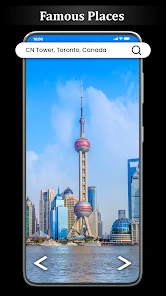
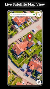
One of the standout features of this app is its GPS navigation. It’s incredibly precise and ensures you never take a wrong turn. The real-time voice navigation is perfect for those who prefer a hands-free experience, making it ideal for drivers. Plus, the 3D street view is a game-changer for anyone wanting to get a closer look at their destination. I was blown away by how detailed and clear the images were. Another nifty feature is the ability to bookmark your favorite spots. If you’re planning a trip, you can easily save all your must-see locations and access them with a single tap. No more scribbling down addresses or struggling to remember that cute café you wanted to visit.
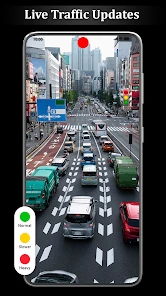
The app also offers different map styles, from satellite to terrain, making it versatile for different needs. Whether you’re a hiker needing topographical details or a driver looking for the quickest route, Live Earth Map has you sorted. The traffic updates are timely and accurate, saving you from unexpected delays, which is always a win in my book.
The User Experience
Installing the app is a breeze and navigating through it feels intuitive. The interface is clean and modern, ensuring you don’t get overwhelmed with too much information at once. It's also worth mentioning that Live Earth Map is light on your phone’s resources, which means it won’t slow down your device, a common gripe with many map apps out there.
One thing I particularly appreciate is the app's offline capabilities. You can download maps of specific areas and access them even when you’re off the grid. This feature is a lifesaver, especially if you’re traveling to remote areas with spotty internet coverage.
Costs, expectations, and who should choose it
The app is free to install and is rated for Everyone, so it can be a casual option for a household device as well as a personal phone. It has an average rating of 3.5 from around 13,000 ratings, with over 10 million installs. I read that as evidence of broad interest, not a guarantee that every feature will suit every person. The current version is 2.4.0, and it runs on Android 7.0 or later. Optional in-app purchases range from $2.49 to $6.99 per item, so I’d check what an offered purchase covers before paying rather than assume it is necessary for basic use.
That makes the app easiest to recommend to someone who enjoys visual exploration and wants a second way to inspect places. If your main need is turn-by-turn directions for work, frequent driving, or a time-sensitive appointment, your usual dedicated navigation app may be the safer primary choice. If you are comparing options, test the same familiar route in both before a trip; you can judge the clarity of the directions and the effort it takes to get started without taking a risk in an unfamiliar area.
A practical routine for planning and travel
When I’m preparing to visit a new neighborhood, I’d use the app in two passes. First, I’d browse the area to understand its layout and bookmark the locations I genuinely expect to visit. Then I’d check the route and address while I have a reliable connection, instead of saving a long list of vague map pins and sorting them out on the pavement. A bookmark is most useful when it represents a clear destination, not just a place that looked interesting during a scroll.
On the day, I’d keep the screen interaction simple, especially while walking or driving. Looking at a 3D view before setting off can help me recognize the surroundings, but it is not a substitute for watching traffic or checking signs. For a hike, terrain imagery can help with a broad sense of the landscape; I would still bring a suitable route plan and not treat a general map view as a complete safety tool. This distinction is easy to overlook when a map makes the world look comfortably close.
What to expect when the signal drops
Connectivity is the main practical consideration I’d keep in mind. A map that is loading new areas or information may be less useful when reception is unreliable, so I would not leave preparation until I’m already in a remote spot or underground. The app’s in-app purchase options are separate from that planning question: paying for an item should not be assumed to solve a weak-network problem. I’d confirm what I need while online and keep essential addresses in a form I can read without reopening a map.
If something fails to load, I’d first give the connection a moment, then try a simpler view or search for the destination again once service improves. If directions are unclear, I’d pause somewhere safe and compare the written address with another trusted source instead of repeatedly tapping while moving. These are modest recovery steps, but they can prevent a small loading delay from turning into a missed turn or a stressful arrival.
When another map is the better choice
For daily driving, the best alternative is often the navigation app I already know how to use without thinking. Familiar controls matter when I’m approaching a turn, dealing with traffic, or trying to hear instructions over road noise. A visually rich map can be more engaging for looking around, but that does not automatically make it the most efficient choice for a rushed trip. I’d test it on an easy route first and avoid making an unfamiliar interface part of a high-pressure journey.
For a walk through a new district, I’d use the app to build a mental picture, then rely on clear street names and the saved address as I go. If reception is patchy, the important question is not whether I can continue exploring endlessly, but whether I already know enough to get to the next useful landmark. Keeping just a few essential destinations in mind is more practical than depending on a long chain of fresh searches.
Data-conscious habits on the move
When I’m on mobile data, I’d browse with a purpose rather than repeatedly zooming in and out across distant places. I would look up the destination, inspect the immediate surroundings, and stop once I have the context I need. That makes the session more focused and may reduce unnecessary loading; it also helps avoid arriving with a screen full of pins that I no longer remember why I saved.
At home or on a dependable connection, I’d do the exploratory part of planning. On the move, I’d keep searches limited to essential checks and avoid assuming that a previously viewed area will remain ready in every circumstance. If data use or reception is a concern, writing down the address and keeping a meeting plan in a message or note gives me a simple fallback that does not depend on refreshing the map.
The Final Word
In conclusion, Live Earth Map: GPS Navigation is more than just a map app; it’s a window to the world. Whether you’re a frequent traveler, a geography enthusiast, or someone who just loves exploring new places, this app is sure to impress. With its array of features, user-friendly interface, and reliable performance, it’s a tool that makes exploring our planet easier and more enjoyable. So go ahead, download it, and let your adventures begin!
My own recommendation is more specific: use it when you want to explore a place visually, save a few meaningful destinations, or add context to a trip you are already planning. Keep a familiar navigation option for journeys where dependable turn-by-turn guidance matters most, and prepare important locations before you lose a stable connection. That balance lets the app’s broad map browsing shine without asking it to be the answer to every travel problem.
My connectivity verdict
I’d choose this app when the goal is to look around, get a sense of a destination, or make a short list of places worth visiting. I’d be more cautious if I needed directions to work smoothly through a commute or if I expected to travel somewhere with unreliable reception. In those cases, I would prepare the route in advance and keep a familiar navigation option ready rather than assume a new map will behave exactly as I need under pressure.
The most useful habit is simple: explore while connected, save only destinations I can identify later, and keep the address somewhere outside the map as well. That gives me the benefit of visual planning without making a live connection the single point of failure. For casual discovery, that trade-off feels reasonable; for essential navigation, I’d choose the tool I trust most on the route itself.
Live Earth Map: GPS Navigation Frequently Asked Questions
What devices and operating systems can run Live Earth Map: GPS Navigation?
Live Earth Map: GPS Navigation is a Maps & Navigation app developed by Seeda Lyara Apps. It requires Android 7.0 or later, so check your device’s operating system before downloading. The app is rated for Everyone. Its listed current version is 2.4.0, which can help you compare the version available on your device with the one described in the app store.
What are the main features of Live Earth Map: GPS Navigation?
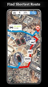
Live Earth Map: GPS Navigation offers a comprehensive set of features including real-time GPS navigation, street view, 3D maps, and satellite imagery. It allows users to explore the world from their mobile devices, providing accurate directions and location tracking. The app also offers features like traffic updates, route planning, and the ability to save favorite locations for easy access.
Is Live Earth Map: GPS Navigation free to use?
Yes, Live Earth Map: GPS Navigation is available for free. However, it may offer in-app purchases or ads to enhance user experience or unlock additional features. Users can use the basic functionalities without any cost, but premium features might require a purchase. Always check the app store listing for the latest information on pricing and available features. In-app purchases are listed from $2.49 to $6.99 per item.
How accurate is the GPS navigation in Live Earth Map?
The GPS navigation in Live Earth Map is designed to be highly accurate, utilizing advanced algorithms and real-time data to provide precise location information. It combines satellite imagery with GPS technology to ensure users receive the most reliable navigation routes. However, like any GPS service, its accuracy can be influenced by environmental factors such as weather conditions or signal obstructions.
Can I use Live Earth Map: GPS Navigation offline?
Currently, Live Earth Map: GPS Navigation primarily requires an internet connection to access real-time data and features such as live traffic updates and satellite imagery. However, users may have the option to download certain maps for offline use, which can be beneficial in areas with limited connectivity. Always check the app's settings or help section for offline map availability.
Pros
- Real-time GPS updates and navigation.
- High-quality satellite imagery.
- User-friendly interface.
- Offline map access available.
- Customizable map views.
Cons
- Requires constant internet for updates.
- Ads can be intrusive at times.
- Some features behind paywall.
- Occasional lag in real-time updates.
- Limited customization in navigation.

- Category
- Maps & Navigation
- Version
- 2.4.0











