GPS Satellite View: Live Maps
- 34.00
- 4.1
- Installs
- 5.00M
- Version
- 3.7.4
Screenshots


Have you ever found yourself lost in a new city or just curious about the world from a bird’s eye view? Enter GPS Satellite View: Live Maps, a handy app that’s like having a pocket-sized satellite in your hand. This app promises to bring the world closer to you by offering real-time satellite images and maps.
Exploring the World from Your Couch
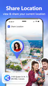
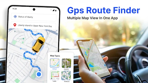
One of the coolest features of GPS Satellite View: Live Maps is its ability to offer live maps and satellite views. Imagine planning your next road trip or just satisfying your wanderlust without leaving your living room. The app provides high-resolution satellite images that seem to teleport you to any location around the globe. It’s like Google Earth on steroids! Whether you’re checking out famous landmarks or scouting a new hiking trail, this app has got you covered.
User-Friendly Interface
Let’s talk about the user interface. It’s sleek, intuitive, and easy to navigate. You don’t need to be a tech-savvy individual to get the hang of it. With just a few taps, you can zoom into any part of the world and explore it in detail. The search feature is particularly impressive, allowing you to find locations quickly and effortlessly. Plus, the app’s smooth performance ensures that you won’t be left waiting for images to load.
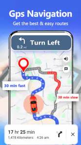
Real-Time Traffic Updates
Besides offering stunning satellite imagery, the app also provides real-time traffic updates. This feature is a lifesaver for daily commuters and road trip enthusiasts alike. By showing traffic conditions in real-time, you can plan your route more effectively and avoid getting stuck in traffic jams. It’s like having a personal traffic reporter in your pocket.
Immersive 3D Experience
For those who love a bit of depth in their maps, the 3D view is a game-changer. It lets you experience locations in a more immersive way, providing a closer look at buildings and landscapes. This feature is perfect for architecture buffs or anyone interested in urban planning. It adds a whole new dimension to virtual exploration.
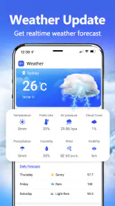
Staying Updated with Weather Conditions
Another nifty addition to the app is its weather overlay. Planning a picnic or an outdoor event? The app provides up-to-date weather forecasts that can help you plan your activities better. By integrating weather data with satellite maps, the app ensures you’re prepared for any changes in weather conditions.
In conclusion, GPS Satellite View: Live Maps is an impressive tool for anyone who loves to explore the world from the comfort of their smartphone. Its combination of stunning satellite imagery, real-time traffic updates, and weather information makes it an essential app for travelers and curious minds alike. Whether you're a frequent traveler or just someone who enjoys looking at the world from above, this app is definitely worth checking out. Happy exploring!
Pros
- High-resolution satellite imagery
- Real-time location tracking
- User-friendly interface
- Offline maps available
- Multiple map views
Cons
- Requires internet for live updates
- Ads can be intrusive
- Limited free features
- Battery consumption is high
- Occasional map loading issues