GPS Navigation:Street View Map
- 0.00
- 0.0
- Installs
- 10.00K
- Price
- Free
Screenshots
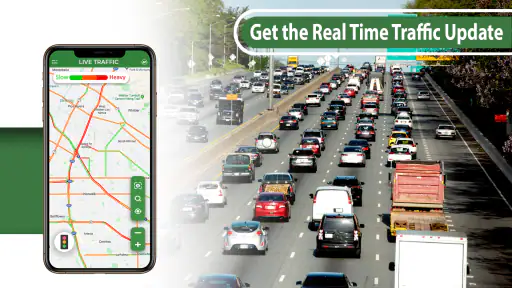
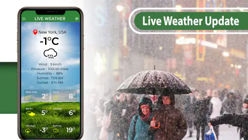
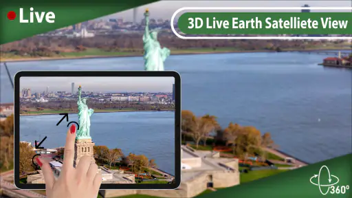
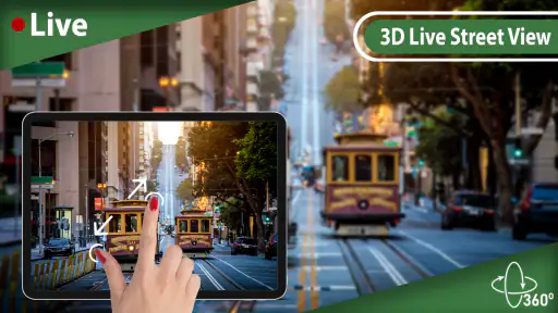

Analysis by Reviewed
I tested GPS Navigation:Street View Map as a practical travel companion rather than treating it like a simple map viewer. The app sits in the Maps & Navigation category and comes from Technest Apps, with a free entry point and optional in-app purchases priced from $2.99 to $49.99 per item. Its basic promise is straightforward: help me move from a starting point to a destination with GPS directions, map information, and street-view-style visual context.
That sounds familiar because most phones already include a navigation tool. What makes this app worth examining is the way it brings route guidance and visual orientation into one focused experience. I found it most useful when I already knew roughly where I wanted to go but needed help recognizing the surroundings, checking the approach to a location, or getting a quick sense of the streets before setting off.
The app is free to install, rated for Everyone, and supports devices running Android 9 or later. It has reached over ten thousand installs, and its current version is 2.7. Those details place it in the category of a lightweight, accessible navigation option rather than an established replacement for every specialized mapping service.
From a vague destination to a usable route
Starting with the real travel problem
My most realistic use case was not a dramatic road trip. It was the familiar situation of leaving for an unfamiliar appointment with only an address and limited time. I wanted three things: a route I could follow, enough context to understand the surrounding roads, and a way to reduce the uncertainty of the final approach.
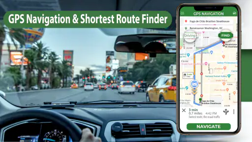
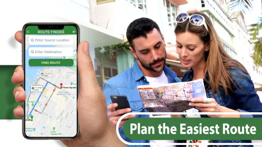
I began by entering the destination and then checking the map before moving. This first pause matters. A navigation app can produce directions quickly, but the first suggested route is not automatically the best choice for every traveler. I look at the general shape of the journey, nearby roads, and whether the destination appears to sit on a main street or inside a less obvious area. The map view is especially helpful at this stage because it lets me build a mental picture before I rely on turn-by-turn guidance.
For a driver, that preparation can prevent a common mistake: following instructions accurately while still arriving on the wrong side of a large building, complex, or block. For a pedestrian, the same check helps reveal whether the destination is near a visible road or tucked behind surrounding streets. The strongest part of the experience is using the map and visual view together before the journey begins.
Entering the destination without overcomplicating the task
The app is designed around a direct navigation purpose, so I would approach it with a specific destination rather than expecting a broad travel-planning suite. That makes the workflow easy to understand. I am not opening it to browse restaurant collections, organize a multi-stop holiday, or manage a detailed itinerary. I am opening it because I need help getting somewhere.
More From Our News Desk

Clash of Clans Is Won Between the Battles

Android Auto Makes the Case for Quieter Car Software

MobiOffice: Transforming Mobile Productivity with Seamless Integration

EA SPORTS FC™ Mobile Soccer: Redefining Mobile Sports Gaming

How Microsoft OneDrive Became a Mobile Productivity Giant

How Google Translate Breaks Language Barriers Effortlessly
That focused approach is useful when I am in a hurry. I can move from destination entry to route inspection without being distracted by unrelated travel tools. At the same time, it means users who want a complete travel ecosystem may find the experience narrower than the usual large mapping platforms. The app makes more sense as a navigation utility than as a full trip organizer.
Before starting, I would also verify the destination spelling and inspect the map pin. This is a small but important habit. Addresses can refer to a building entrance, a road segment, or a broad location, and visual confirmation is often more valuable than blindly accepting the first result. If I were meeting someone, I would send them the exact destination separately rather than assuming that a route screen alone communicates the best entrance.
Reading the route as a person, not just as a line
Once the route is displayed, I use it in two stages. First, I look at the entire path to understand the journey’s broad direction. Then I focus on the first few turns and the final approach. This is more reliable than staring only at the next instruction because it gives me a sense of how the route will develop.
The map is also useful for deciding when to stop and re-check my position. If I am walking, I can compare the route with visible streets and landmarks. If I am a passenger in a car, I can use the overview to help the driver anticipate a turn without trying to interpret every instruction at the last second. I would not operate the app while driving; the sensible workflow is to prepare before moving and let a passenger handle any necessary checks.
A practical tip is to inspect the destination before leaving, then return to the route view for the journey itself. The street-level perspective is most valuable when it answers a specific question: Does this entrance look familiar? Is the street likely to be easy to recognize? Does the surrounding layout match what I expected? Using it as a quick orientation tool is more efficient than wandering through visual imagery without a clear purpose.
Using visual context for the last few minutes
Many navigation problems happen after the main route is nearly complete. I may reach the correct neighborhood but still need to identify the right side street, building frontage, or approach. This is where the street-view element adds practical value. A conventional route line tells me where to go; a visual view can help me understand what I should expect to see.
That distinction matters in places with similar-looking roads. If several entrances sit close together, visual context can reduce the time spent circling. It can also help pedestrians recognize a destination from the outside, particularly when the address is technically correct but the doorway is not obvious from the main road.
I would treat this visual information as preparation rather than a guarantee of current conditions. Streets change, construction appears, businesses move, and temporary obstacles are not necessarily represented. The best workflow is to use the imagery to form an expectation, then stay alert to what is actually around me.
Handoffs between map, directions, and the user
The app’s usefulness depends on smooth handoffs. I move from entering a place, to reading the route, to checking visual context, and finally to navigating in the real world. Each handoff can either make the trip clearer or introduce confusion.
The first handoff is from search to route. I want the selected destination to remain obvious, because a wrong result can make every later instruction irrelevant. The second is from route overview to immediate directions. I need enough information to understand the whole journey without losing the next action. The third is from digital imagery to physical surroundings. This is where personal attention matters most: the screen can prepare me, but it cannot replace checking traffic, signage, road access, or pedestrian safety.
For an everyday appointment, I would prepare the route while stationary, inspect the final few streets, and then use the navigation view only as needed. That workflow reduces screen dependence and gives me a clearer fallback if I miss a turn. It also prevents the common habit of zooming and panning constantly while moving, which is distracting and rarely improves decision-making.
What the app does well in ordinary use
I like the app’s clear purpose. It does not require me to learn a complicated planning system before I can use it for a basic journey. The combination of GPS directions, map browsing, and street-view-style orientation gives it more practical depth than a route-only tool.
It is also approachable for people who are not confident with navigation apps. A family member who mainly needs to find an address can understand the basic sequence: choose a destination, inspect the route, check the surroundings, and begin. The Everyone content rating supports that broad accessibility, while the Android 9 minimum makes it available to many older devices still in everyday use.
The free installation is another advantage for occasional travelers. If I only need a secondary navigation option or want to test a map tool before committing to it, there is no initial purchase barrier. However, the presence of optional purchases means I would pay attention to what is included in the free experience before treating it as my only navigation solution.
Where it fits beside familiar alternatives
Compared with the default map application many people already have on a phone, this app’s appeal is its focused combination of route guidance and visual street context. It may feel less overwhelming for someone who wants a straightforward navigation screen rather than a large platform filled with business information, reviews, saved places, and other services.
The trade-off is that established alternatives often have deeper surrounding ecosystems. A user who depends on extensive place information, complex trip planning, transit details, or a mature collection of location-based tools may prefer a more comprehensive mapping service. I would also compare the app’s route experience with the navigation tool already installed on my phone before making it my primary option.
In my view, GPS Navigation:Street View Map works best as a practical second opinion or a simple destination-focused navigator. It is particularly appealing when visual familiarity matters. It is less compelling for someone who wants one application to handle every part of travel, from researching places to coordinating several stops and managing a detailed itinerary.
Useful habits that improve the workflow
My first recommendation is to separate planning from movement. Enter the destination and inspect the complete route before walking or driving. This makes it easier to notice an awkward approach and reduces the temptation to make last-second decisions at an intersection.
My second recommendation is to use street-view imagery selectively. Check the final approach, a confusing junction, or an unfamiliar entrance rather than spending time inspecting every part of the route. The feature has the most value when it answers a concrete orientation question.
My third recommendation is to keep a human fallback in mind. If the route becomes unclear, stop somewhere safe and reassess. A navigation app can guide me, but it cannot judge every temporary road closure, crowded sidewalk, unsafe crossing, or misleading entrance. Treating the app as an aid rather than an authority produces a safer and less frustrating experience.
A fourth useful habit is to prepare for handoffs when traveling with someone else. I can inspect the route and destination imagery before leaving, then explain the overall plan to the driver or walking companion. That is better than passing a phone back and forth while the journey is already underway.
Where the flow breaks down
The workflow becomes less comfortable when I expect the app to solve every navigation problem automatically. A route screen is only as useful as the destination selected and the information available around it. If I need extensive local research, multiple planned stops, or a highly specialized travel mode, a broader mapping platform may be a better fit.
The visual component also has a natural limitation: it represents a view that may not match the exact moment of travel. I would never use an image to assume that a road is currently open, that parking is available, or that an entrance remains unchanged. The imagery helps with recognition, but real-world observation still decides what I should do.
There is also a cost consideration. The app is free to start, but optional purchases ranging from $2.99 to $49.99 per item mean that I would review the purchase prompts carefully. A casual user may be satisfied without spending anything, while someone seeking a more complete experience should understand which functions require payment before depending on them regularly.
Users should skip this app if they want a fully featured travel planner, extensive place discovery, or a navigation system chosen primarily for a long history of advanced routing tools. They may also prefer another option if their trips depend on features beyond the app’s central map-and-directions workflow. On the other hand, people who want a simple free starting point with visual location awareness have a reasonable reason to try it.
My outcome after using it
For the everyday appointment scenario, the app helped me turn an unfamiliar address into a more understandable journey. The route gave me the broad path, while the map and street-view-style perspective helped with the part that often causes the most hesitation: recognizing where the destination actually sits in its surroundings.
I would not describe it as a universal replacement for every navigation service. Its value is more specific. It gives me a direct way to prepare a route and add visual context without requiring a complicated planning routine. That makes it useful for occasional trips, unfamiliar neighborhoods, and users who prefer a focused interface.
Technest Apps has kept the concept accessible: a free Maps & Navigation app for a wide audience, with version 2.7 available for Android 9 and newer devices. I appreciate that the core idea is easy to grasp, but I would still test it on the journeys I actually make before relying on it exclusively.
My final recommendation is simple: try GPS Navigation:Street View Map if your main need is getting from a known starting point to a destination while gaining extra visual familiarity with the route. Choose it for preparation and orientation, not as a substitute for attention, judgment, or a complete travel-planning ecosystem. For that focused job, it can be a useful companion; for more demanding navigation habits, compare it carefully with the tools already on your phone.
GPS Navigation:Street View Map Frequently Asked Questions
Who develops GPS Navigation: Street View Map, and what devices can run it?
GPS Navigation: Street View Map is a Maps & Navigation app developed by Technest Apps. It is available for devices running Android 9 or later, so checking your device’s operating system before downloading is a sensible first step. The app is rated for Everyone, making its stated age rating suitable for a broad audience.
What is GPS Navigation: Street View Map used for?
GPS Navigation: Street View Map is designed to help users plan routes, find locations, and explore places through map-based navigation and street-view imagery. During testing, it was most useful for checking an unfamiliar area before traveling, viewing nearby roads, and getting general orientation. It should be treated as a navigation and exploration tool rather than a replacement for careful driving or official local directions.
Does GPS Navigation: Street View Map provide turn-by-turn navigation?
The app is intended to support route planning and location guidance, but the exact navigation features may depend on the device, operating system, selected map service, and current app version. Before relying on it for a journey, users should test the route options and confirm whether spoken directions, live traffic information, or offline guidance are available. Always follow road signs and local traffic regulations while driving.
Does the app require an internet connection or GPS access?
Yes, users will generally need to allow location access for the app to identify their position and provide relevant navigation results. An internet connection may also be required to load maps, street-view content, search results, and updated route information. Performance can vary in areas with weak mobile coverage. It is a good idea to check the route before leaving and keep an alternative navigation option available.
Is GPS Navigation: Street View Map free to download and use?
The application is free to download, but it offers in-app purchases priced from $2.99 to $49.99 per item. Users should review the purchase details before confirming a payment, especially if considering optional features or content. Some map, imagery, or advanced navigation features can be limited depending on the version installed. Carefully read any pricing and purchase terms shown in the app.
Pros
- Clear turn-by-turn directions for everyday driving
- Street View helps preview unfamiliar places before visiting
- Useful map search for addresses
- businesses
- and landmarks
- Location sharing can make meeting friends easier
- Simple interface suitable for casual navigation needs
Cons
- Some features may require a stable internet connection
- Street imagery can be outdated in certain locations
- GPS accuracy may drop indoors or in dense urban areas
- Battery usage can increase during long navigation sessions
- Advertising or in-app purchases may affect the experience
- Category
- Maps & Navigation
- Version
- 2.7











