GPS Maps Navigation GPS Camera
- 40.00
- 4.1
- Installs
- 100.00K
- Price
- Free
Screenshots
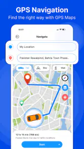
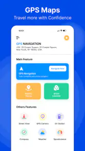
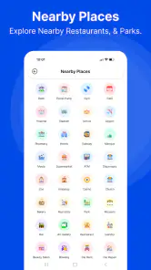
Analysis by Reviewed
GPS Maps Navigation GPS Camera is a straightforward driving companion from Galaxy Apps Center, and my overall impression is that it aims for convenience rather than trying to replace every feature found in the biggest navigation platforms. It belongs to the Maps & Navigation category, is free to install, and combines GPS route guidance with an after-call feature that can be useful when a journey is interrupted by a phone conversation. That combination gives it a practical angle, especially for drivers who want navigation and call-related convenience in one place.
After spending time with it, I see the app as a sensible option for everyday trips, short commutes, and drivers who prefer a less complicated navigation experience. Its current version is 1.54, it works on Android 10 or later, and it is rated for Everyone. The app has reached over 100 thousand installs, with an average rating of 4.1 from nearly 300 ratings. Those figures suggest a reasonably positive early reception, although I would still treat it as a focused tool rather than a fully proven replacement for long-established navigation services.
What the navigation experience does well
The main appeal is easy to understand: open the app, use GPS-based maps, and get driving directions without paying an upfront purchase price. I like that positioning because it keeps the first decision simple. You are not committing money before finding out whether the interface suits your habits, and the free starting point makes it practical for occasional drivers, visitors using a secondary phone, or anyone testing an alternative to their usual map app.
In normal use, the most important quality is not visual polish but whether the route guidance stays understandable while I am driving. A navigation app should reduce decisions, not create more of them. GPS Maps Navigation GPS Camera is best approached with that expectation: set up the route before moving, check that the destination is correct, and then let the map guidance support the trip rather than repeatedly adjusting it while behind the wheel.
The GPS focus also makes it useful when I want a dedicated navigation screen instead of mixing directions with unrelated map searches. For a quick trip across town, that can feel more direct than opening a broader map service filled with business listings, reviews, saved places, and other information I may not need at that moment. The narrower purpose is a strength for people who want to get from one place to another with fewer distractions.
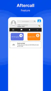
One of the more interesting parts is the after-call feature mentioned in the app’s store summary. In a realistic situation, I might start a route on the way to an appointment, receive a call, and then need to return my attention to navigation once the call ends. Having an after-call function connected to the driving experience can make that transition more convenient than manually reopening the navigation app and checking whether the route is still active.
That feature is especially relevant to people who use their phone for work while travelling between locations. A delivery worker, property agent, technician, or freelancer may receive short calls during a trip. The value is not that it eliminates the need for safe phone habits; it is that it addresses the awkward moment after a call, when I need to confirm where I am going next without losing time searching through recent apps.
More From Our News Desk

Clash of Clans Is Won Between the Battles

Android Auto Makes the Case for Quieter Car Software

MobiOffice: Transforming Mobile Productivity with Seamless Integration

EA SPORTS FC™ Mobile Soccer: Redefining Mobile Sports Gaming

How Microsoft OneDrive Became a Mobile Productivity Giant

How Google Translate Breaks Language Barriers Effortlessly
A practical workflow for daily driving
My preferred workflow with an app like this would be to enter the destination before leaving, verify the route while parked, and place the phone where the screen can be seen without blocking the road. If a call comes in, I would handle it only when safe and then use the after-call function as a prompt to return to the route. This is a small change in routine, but it prevents the common problem of assuming navigation has resumed when the phone is still showing the call screen.
Another useful habit is to treat the app as a route assistant rather than an automatic decision-maker. If road signs, temporary closures, or local instructions disagree with what appears on the screen, I would follow the real-world situation and pull over before changing the destination. GPS guidance can be helpful, but no navigation app should encourage last-second turns or phone handling in traffic.
For a family member who is not comfortable with feature-heavy map apps, I could see this being easier to introduce. The free access removes a financial barrier, and the focus on driving directions gives the app a clear purpose. I would still spend a few minutes showing that person how to enter a destination, start guidance, and return to the route after a call. That short preparation is more useful than assuming the app will be self-explanatory in the middle of a journey.
Where it fits beside familiar alternatives
The usual alternatives in this category often do more than navigation. Large map platforms commonly combine directions with extensive place information, traffic details, public transit tools, saved locations, business profiles, and broad search functions. That makes them stronger when I am planning a complicated trip or choosing a restaurant, fuel stop, parking area, or unfamiliar destination.
GPS Maps Navigation GPS Camera makes more sense when I value a dedicated driving purpose over a large ecosystem. I would choose it for a simple point-to-point journey, particularly if the after-call feature matters to me. I would lean toward a larger mapping service when I need rich place discovery, detailed local information, or a long-established account-based map history.
This is not necessarily a disadvantage. A smaller app can be preferable when I do not want every navigation session to feel like a full search experience. The trade-off is that a focused app must earn trust through clarity and reliability, because it may not offer the same depth of supporting information as the best-known alternatives. For me, the decision depends on whether the trip is mainly about following directions or about researching the destination along the way.
Questions I would settle before a longer drive
A useful first check is whether the destination search understands the exact place I have in mind. I would enter a full street address rather than relying on a business name alone, then compare the pin or route endpoint with what I expect. This matters most for destinations with multiple entrances or similarly named locations. A few seconds spent checking the endpoint while parked can prevent a confusing arrival.
I would also decide what I need if mobile data becomes unreliable. Before a trip through unfamiliar areas, I would check whether the route remains usable in the conditions I expect, rather than assuming every GPS navigation app behaves the same way offline. If continuous access to maps or live road information is essential for the journey, I would keep a familiar alternative ready until I had tested this one in a low-stakes setting.
For everyday use, the best test is not a dramatic road trip but a route I already know. I can judge whether instructions are easy to follow, whether the screen is readable in its mounted position, and whether the after-call transition fits my habits without the pressure of being late. If anything feels unclear, I can stop safely and compare the route with road signs or another navigation option.
The limitations I would consider before relying on it
The biggest limitation is that a store summary cannot tell me how the app will perform in every driving environment, and I would not make it my only navigation option for an important unfamiliar journey without testing it first. A route tool can seem perfectly adequate on familiar roads but feel less reassuring when I need complex lane decisions, detailed traffic awareness, or information about a changing road situation.
That matters because navigation is one of those categories where a small weakness can become frustrating at exactly the wrong time. If the map presentation, rerouting behaviour, or destination search does not match my expectations, I may need to stop and sort it out. I would therefore test the app on ordinary local trips before using it for an airport run, a long-distance drive, or a time-sensitive appointment.
The after-call feature is useful in concept, but it should not be treated as permission to manage calls while driving. Its practical benefit is the return to navigation after a conversation, not the removal of driver responsibility. I would keep the phone mounted, avoid typing while moving, and make any changes only after parking safely. Users who want a completely hands-free driving setup may find that a system-integrated navigation option works more naturally with their vehicle.
There is also a financial detail worth noticing. The app is free, but it includes in-app purchases ranging from $1.99 to $8.99 per item. That does not make the initial download expensive, yet I would check what any optional purchase unlocks before confirming it. Free navigation apps can differ significantly in which conveniences are included at no cost, so a user who wants a completely free experience should pay attention to the purchase prompts rather than assuming every function will remain free.
I would also be cautious about installing it on an older phone. The minimum operating system is Android 10, so devices running an earlier Android release are not suitable. For supported phones, I would update the operating system and the app when possible, then try a short route before depending on it. This is particularly important for anyone using an older handset as a spare navigation device.
Who will get the most from it
I think the strongest audience is drivers who want a free, focused GPS navigation app for regular road trips and who like the idea of an after-call workflow. It could suit someone who drives to several appointments in a day, a commuter who wants a separate navigation tool, or a user who finds large mapping platforms too busy for basic directions.
It may also work well as a backup navigation app. Keeping a second option available can be sensible when I am travelling with a spare phone or testing which interface feels clearest. I would not install it only because it is free; I would install it if its driving-focused approach and after-call feature solve a problem I actually have.
I would recommend a different option to someone who depends heavily on detailed place discovery, extensive traffic context, public transport planning, or a deeply established map history. A broad mapping platform will likely be more convenient for those tasks. Likewise, drivers who require advanced vehicle integration or who expect navigation to handle every aspect of a long journey should compare the app carefully with the tools already built into their phone and car.
For a first-time user, I would begin with a familiar destination. Enter it while stationary, follow the route for a short drive, and deliberately test what happens when a call interrupts the session. That gives a much better sense of whether the after-call behaviour fits personal habits than reading a feature list. It also reveals whether the map view is comfortable to read from the chosen phone position.
Making the switch without adding hassle
I would not replace a trusted navigation setup on the morning of an important drive. Instead, I would keep this app alongside my usual map option for a few ordinary trips. That makes comparison practical: I can check whether entering a destination feels quicker, whether I understand the route prompts, and whether returning after a call is genuinely easier. If I find myself switching back repeatedly for a specific task, that is a useful sign about which app belongs in my routine.
It also helps to separate navigation from trip planning. I might use a broad map service beforehand to research a destination or identify a convenient stop, then open this app for the straightforward drive itself. That two-app workflow is not ideal for everyone, but it lets the focused interface serve its purpose without asking it to replace tools I rely on for other parts of a trip.
For a short daily commute, the decision may be simpler: try the same route at a quiet time, then see whether the instructions are comfortable to follow in normal traffic. If the route changes unexpectedly, I would pull over before investigating why. A navigation app earns a place through calm, repeatable use, not by being installed as a backup and forgotten until a stressful journey.
My final assessment
GPS Maps Navigation GPS Camera has a clear and useful idea: provide GPS driving directions while adding a practical after-call element for people whose journeys are interrupted by phone conversations. I appreciate the focused approach, free entry point, and suitability for ordinary trips. The app does not need to imitate every major map platform to be worthwhile; it needs to be dependable and easy to return to when driving resumes.
My recommendation is therefore specific rather than universal. If you want a simple navigation companion on a supported Android phone, and the after-call feature matches your routine, GPS Maps Navigation GPS Camera is worth trying on local journeys first. Its 4.1 average rating and growing install base make it an interesting option, but I would still build confidence gradually instead of relying on it immediately for a critical trip.
The clearest way to judge it is to use it in the situation it is designed for: start a short route, keep the phone safely positioned, let a call interrupt the session when appropriate, and see how smoothly you can return to the directions. Its real strength is focused convenience, not an oversized collection of map services. For drivers who value that simplicity, it can become a handy everyday tool; for users seeking a complete travel-planning ecosystem, a more established alternative may remain the better fit.
GPS Maps Navigation GPS Camera Frequently Asked Questions
Is GPS Maps Navigation GPS Camera free to download, and are there in-app purchases?
The app is free to download and is rated for Everyone. It also offers optional in-app purchases, with items priced from $1.99 to $8.99. You can start with the free app and consider purchases only if they suit your needs. Check the purchase details shown in the app before confirming anything, especially if you share your device or payment method with others.
Who develops GPS Maps Navigation GPS Camera, and what should I know about its store presence?
GPS Maps Navigation GPS Camera is developed by Galaxy Apps Center and is listed in the Maps & Navigation category. It has an average rating of 4.1 from around 300 ratings, with about 40 written reviews, and has been installed over 100,000 times. These figures offer a quick sense of its store presence, though your experience will depend on your device and how you use its features.
What is GPS Maps Navigation GPS Camera used for?
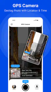
GPS Maps Navigation GPS Camera combines route planning, turn-by-turn navigation, location tracking, and camera features in one app. It can help you find places, follow driving directions, and record photos or videos with location information. The exact tools available may depend on your device, installed version, permissions, and whether the app requires an internet connection for maps or navigation data.
Does GPS Maps Navigation GPS Camera work without an internet connection?
The app may use your phone’s GPS sensor to determine your position, but navigation and map details can still require mobile data or Wi-Fi. Some versions may support downloaded or cached maps, while others depend on an active connection for searching locations, calculating routes, traffic information, or updating map content. Check the app’s settings and description before relying on it in areas with weak coverage.
Is GPS Maps Navigation GPS Camera accurate for driving directions?
Accuracy depends on several factors, including your phone’s GPS quality, visibility of satellites, network availability, map data, and how frequently the app updates your position. It can be useful for everyday navigation, but users should still follow road signs, local traffic laws, and safe-driving practices. Avoid interacting with the app while driving, and verify important routes before starting your journey.
Pros
- Shows your current location and direction using GPS.
- Useful for recording trips with location-tagged photos.
- Simple interface suitable for quick outdoor navigation.
- Can help identify nearby places while traveling.
- Supports visual route planning with map and camera features.
Cons
- GPS accuracy may decrease indoors or in dense urban areas.
- Continuous location use can drain your phone battery quickly.
- Some features may require an internet connection or map data.
- Camera overlays may be less reliable in poor lighting.
- Privacy concerns may arise from storing location-tagged photos.
- Category
- Maps & Navigation
- Version
- 1.54











